
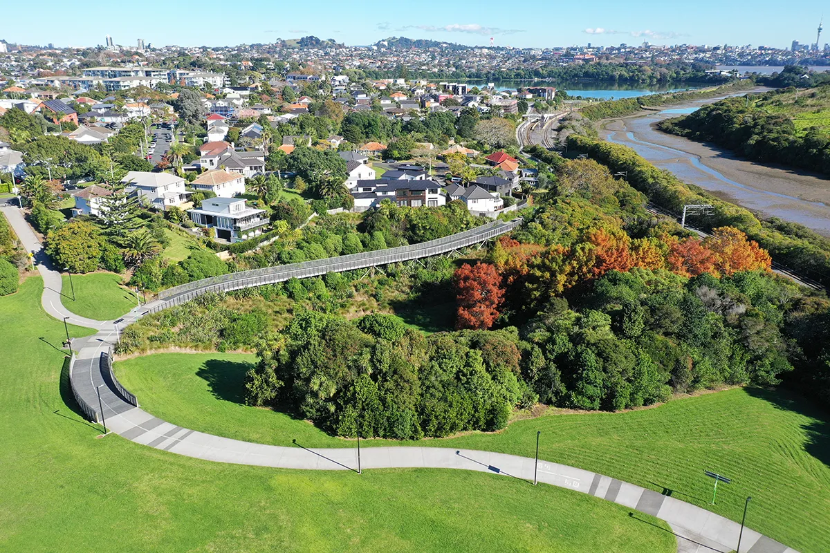
Te Ara Ki Uta Ki Tai | Glen Innes to Tāmaki Drive Shared Path is a successful piece of active transport infrastructure, but real significance lies in how the project rethinks the relationship between movement, landscape and public value. The 8-kilometre route connects Glen Innes town centre with Tāmaki Drive and Auckland’s wider cycle network; Section 2 (2.65 kilometres) traverses the Pourewa Valley between Meadowbank and Ōrākei to St John’s and Kohimarama through land shaped by the Eastern Transport Corridor designation and the North Island Main Trunk rail corridor.
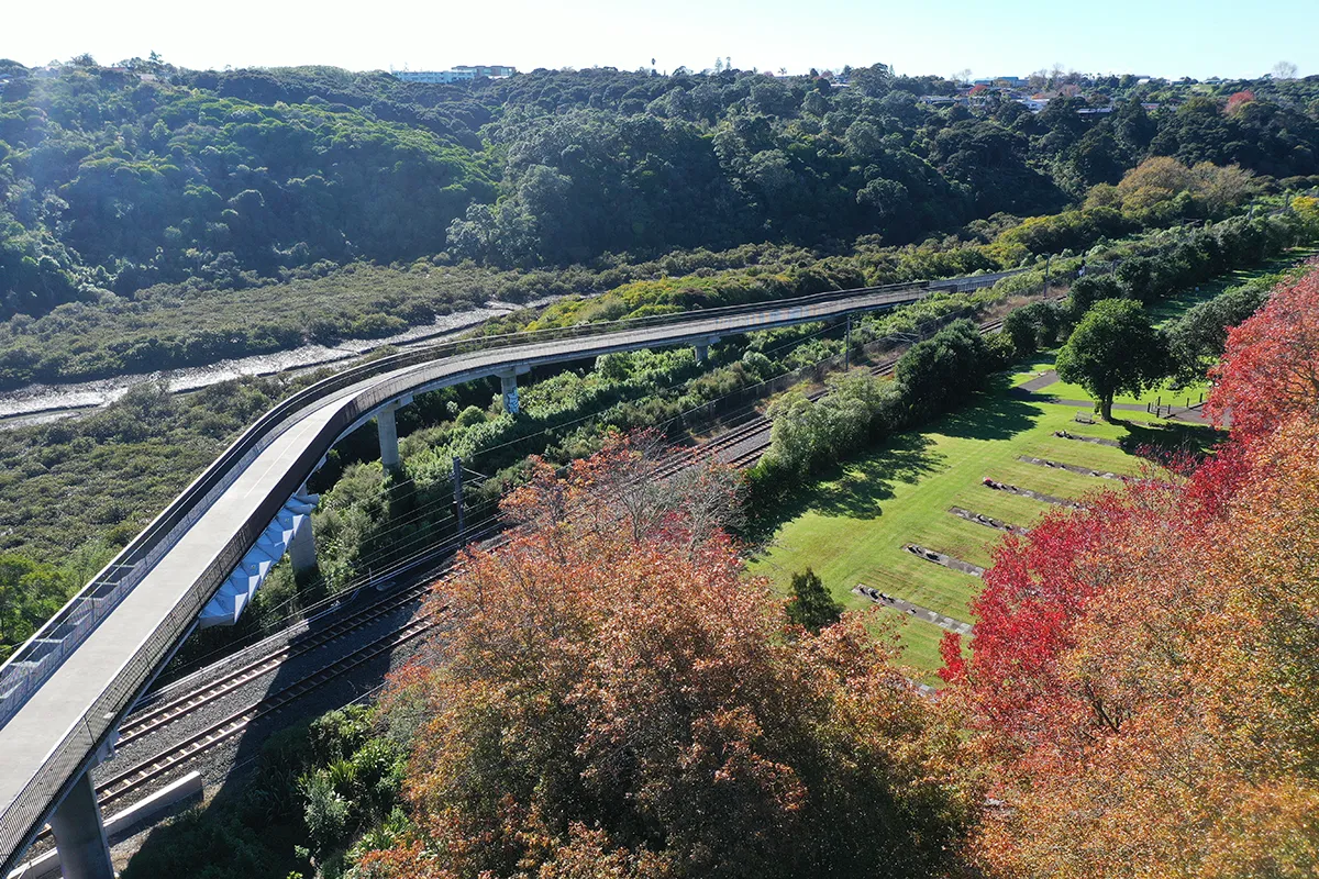
For decades, the corridor operated as a zone of severance. It was physically difficult to cross, visually under-activated, and disconnected from the surrounding communities despite its remarkable ecological and landscape qualities. Te Ara Ki Uta Ki Tai accomplishes more than simply inserting a path through this condition. It transforms residual infrastructural land into a legible public landscape that supports commuting and recreation while revealing an urban valley that had been largely inaccessible except to restoration volunteers and informal users.
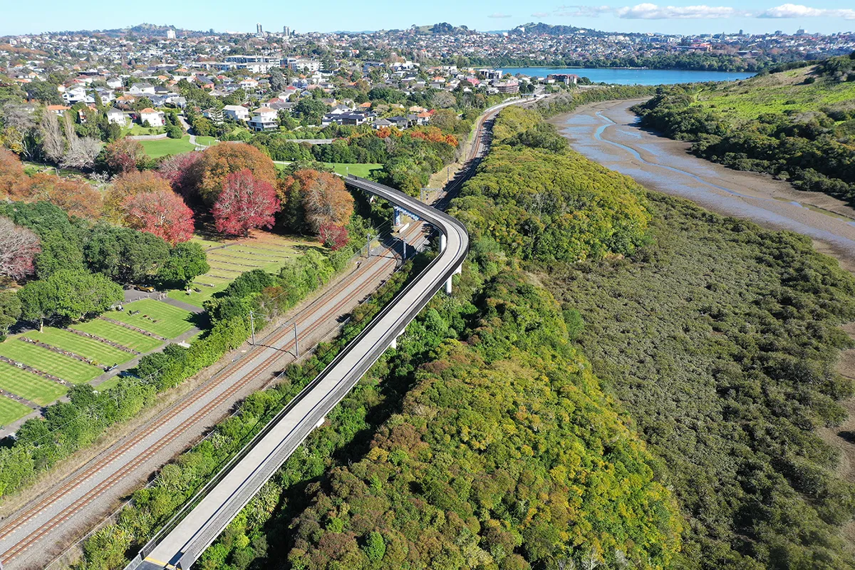
Boffa Miskell contributed to the development of the planned route and worked with the project team and mana whenua to prepare a Cultural Landscape Framework that embedded Te Aranga principles into the project’s planning and design approach. From 2019, Boffa Miskell led the integration of landscape architecture, urban design, ecological thinking and cultural values into Section 2, shaping the corridor’s appearance and its underlying spatial and technical logic.
Design integration is one of the project’s strongest qualities. Too often, landscape inputs are applied to transport infrastructure after the core engineering decisions have already been made. Here, Boffa Miskell and the wider team embedded landscape and ecology into the iterative development of horizontal and vertical geometry, reducing cut and fill, minimising retaining structures and barriers, and producing more comfortable path gradients. The result is a route that reads less as infrastructural compliance and more as a carefully edited landscape sequence. Accessibility is handled in similarly thoughtful terms: rather than a checklist exercise, the project incorporates wider path dimensions, rest areas and platforms within bridges and steeper sections to make the route genuinely usable for a broad range of people. The wider route now records more than 1,300 average daily users for both commuter and recreational infrastructure.
Section 2 moves users through pastoral, riparian, bush and rail-adjacent environments via elevated boardwalks and bridges that lift the path above gullies and embankments, creating long views over the Pourewa Valley and giving the journey a strong sense of revelation. The restraint of the material palette is critical. Slender structural members, timber top rails, micro-mesh surfaces, muted tones and integrated lighting all allow the landform and vegetation to remain primary. This reflects the design team’s understanding of the risk of over-articulating infrastructure in a setting where the landscape itself should remain the dominant experience.
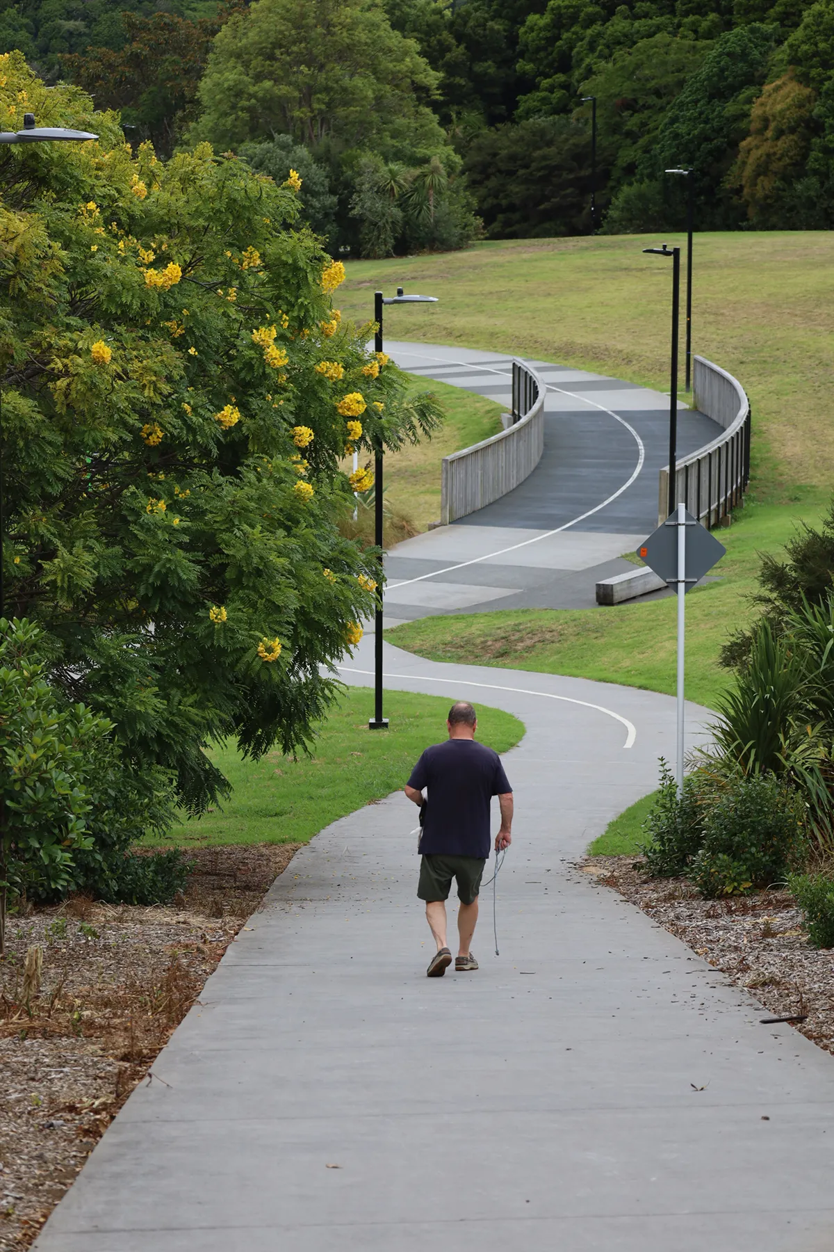
Te Ara Ki Uta Ki Tai | Glen Innes to Tāmaki Drive Shared Path is an exemplar of transport investment delivering environmental repair. Boffa Miskell ecologists authored the Ecological Restoration Plan as a companion document to the Urban Design and Landscape Management Plan, ensuring restoration was embedded in delivery rather than treated as an afterthought. Section 2 includes approximately 5.2 hectares of planting, more than 40,000 native plants, and 368 specimen trees intended to restore representative canopy, wetland and riparian communities within a significant ecological area.
Planting was eco-sourced from the Tāmaki Ecological District, with stock sourced where possible from the adjacent Ngāti Whātua nursery. Weed control emphasised manual and cut-and-paint methods in sensitive areas. Steeper slopes were addressed with biodegradable erosion-control fabric and ponga logs to retain mulch, while replacement planting was calibrated to stabilise wetland and riparian edges. The detailed landscape-ecology methodology is shaped by site conditions, construction constraints and longer-term stewardship goals. Ecological design was also informed by tangata whenua collaboration: species were selected in part to express maramataka harvest times, particularly in relation to kai moana. That move extends the restoration strategy beyond ecological performance alone, reconnecting the corridor to mātauranga Māori and ongoing kaitiakitanga.
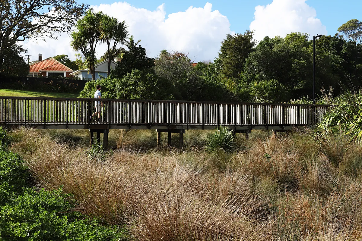
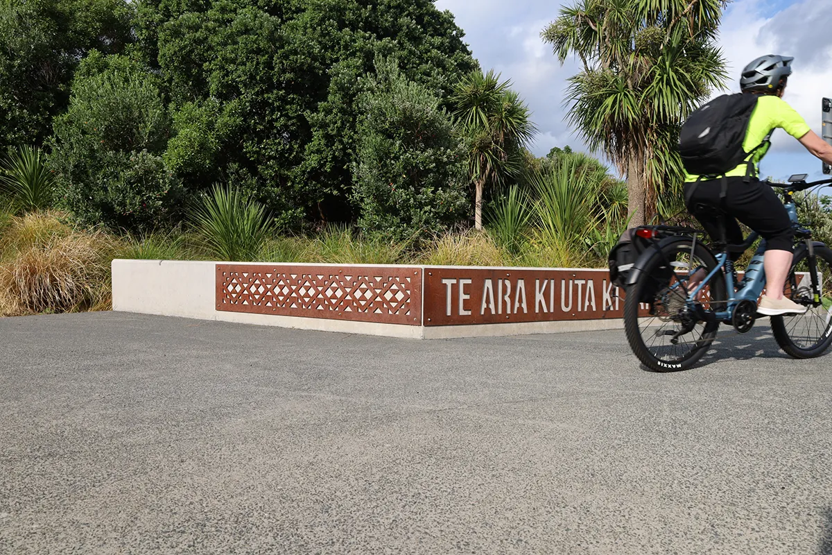
Boffa Miskell also worked closely with mana whenua through hikoi, hui and ongoing design collaboration so that the narrative of Te Ara ki Uta ki Tai — “From the Land to the Sea” — became an organising framework for the route’s thresholds, wayfinding and moments of pause. Iwi artists and tikanga advisors contributed directly to the placement and form of key interventions, including pou, carved and engraved bridge elements, waypoint markers, naming walls and sculptural details at transition points.
The Urban Design and Landscape Management Plan operated as a cross-disciplinary integration tool for the project. Boffa Miskell landscape architects undertook monitoring and sign-off at designated hold points, protecting design intent through construction in a corridor shaped by rail operations, environmental constraints, archaeology, hydrology and multiple asset-owner requirements.
Te Ara Ki Uta Ki Tai demonstrates what can happen when landscape architecture is the foundation of infrastructure, rather than an applied layer to soften its impacts. The input of landscape architects helped turn a corridor of residual transport land into a civic landscape where access, ecology, cultural identity and spatial experience are resolved together rather than traded off against one another.
Te Ara Ki Uta Ki Tai
Location: Auckland, Aotearoa New Zealand
Client: Waka Kotahi / New Zealand Transport Agency and Auckland Transport
Design Firm: Boffa Miskell
Boffa Miskell Project team: Mark Lewis, Hanna O’Donoghue, Kieran Dove, Sandeep Gangar, Stuart Houghton, Sofia Fourman
Collaborators:
CLL Service and Solutions
VSL Landscapes
Stantec
Monk Mackenzie
Eliga
Roadlab
Mana whenua artists: Graham Tipene, Hana Maihi, Ted Ngataki, Katz Maihi, Tessa Harris.
Engagement with: Ōrākei local Board, Bike Auckland, Heritage New Zealand, Kiwirail, Watercare, Purewa Cemetery, Meadowbank Pony Club, Auckland Council.
Image Credit: Boffa Miskell
Images are taken along the pathway for illustrative purposes.
Text: Boffa Miskell