Chinese traditional settlements are determined by the characteristics of their living environment. Based on the long-term social form of history and culture, they form the law of geographical spatial distribution in the specific topography, which is also a special form of human settlement presented by people’s use and transformation of nature. At present, with the intensification of China’s social transformation, especially the impact of tourism development, traditional settlements are facing the crisis of cultural diversity and the disappearance of regional cultural characteristics. This study aims to explore the possibility of the protection and development of the diversity of traditional settlements in Southwest China by revealing the generation principle of traditional settlements.
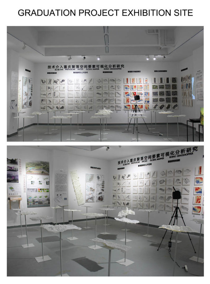
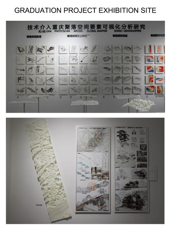
Through the use of UAV technology to investigate more than 20 different types of rural settlements in Southwest China, the author initially establishes the digital point cloud Library of rural settlements in Southwest China, and systematically collects, processes and analyzes the spatial data of traditional settlements through the digital point cloud library This is also the first attempt of UAV technology in settlement research. The digital point cloud library includes the following contents:
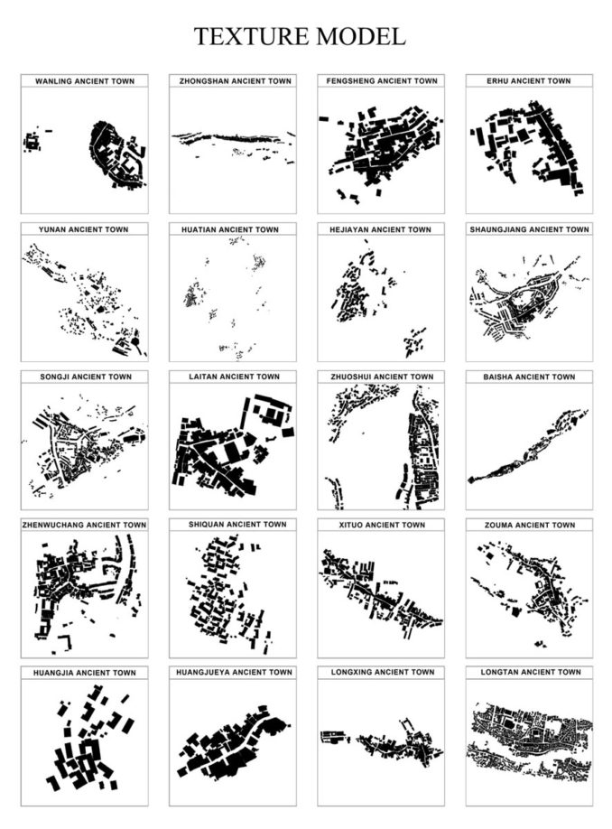
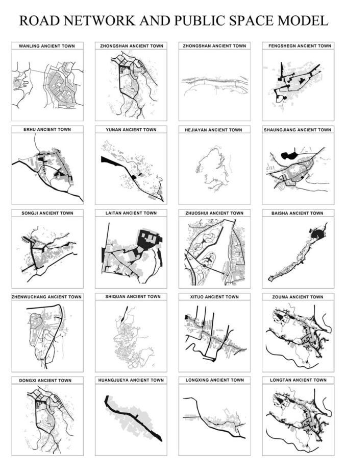
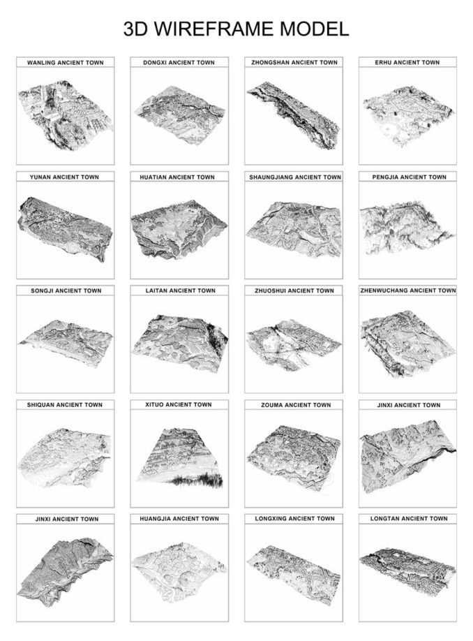
1. The visualization of rural settlements is studied through UAV data acquisition, data processing of aerial triangulation, parametric data analysis, and finally displayed through typology exhibition, mainly including settlement texture, settlement road network and public space, settlement orthophoto, settlement 3D wireframe model, settlement surface digital model, etc, We can perceive the differences and uniqueness of traditional settlements in Southwest China from these five aspects.
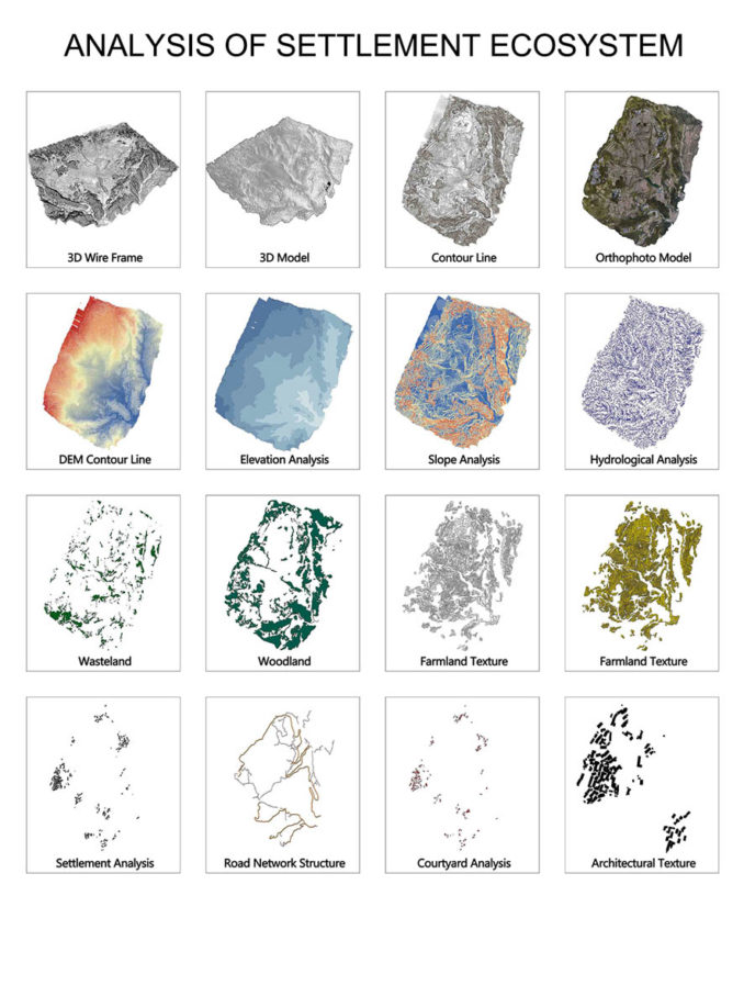
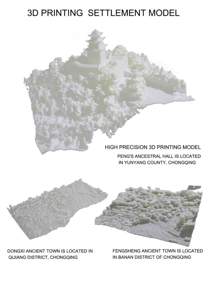
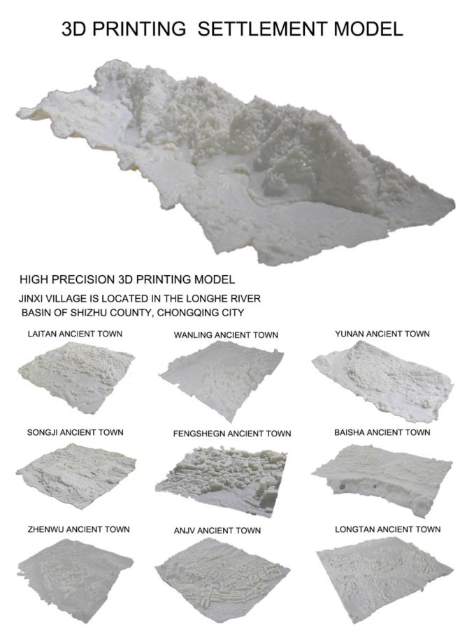
2. Three dimensional real space construction of 20 different settlements. The settlement data of different areas are collected by the tilt photography technology of UAV. The data is encrypted by the photoscan UAV data processing software to generate high-precision three-dimensional real model and a series of geographic information models. The three-dimensional real space construction of settlements is realized by 3D printing, This is of great significance to the protection planning and design of traditional settlements
-678x918.jpg)
3. Through the detailed data visualization analysis of Hejiayan village, Huatian Township, Wuling mountain area, Chongqing, the multi-dimensional visualization analysis system of rural settlements is realized through the point cloud model. The data model obtained from the analysis is projected into the 3D printing real space to realize the all-round visualization research of human landscape interactive settlements
-678x918.jpg)
4. The establishment of the digital point cloud Library of rural settlements is an epoch-making breakthrough in the design practice of rural settlements and the application of the renewal design of the protection of traditional rural settlements’ cultural heritage, which makes the artistic scientific research based on more rigorous scientific data, which is of great help to the revitalization of rural China
The establishment of the digital point cloud Library of rural settlements is a change from the two-dimensional thinking mode of traditional rural settlements research 2.0 to the multi-dimensional mode of 3.0. It is a multi-dimensional, all-round and three-dimensional analysis of rural settlements, and a major breakthrough in the research of rural settlements
The 20 villages in this study are the first step to study the point cloud of traditional villages in China as a whole. In the next year, 110 traditional villages in Chongqing will be studied, and 1875 traditional villages in Southwest China will be established in 3-5 years, which will greatly promote the research of traditional settlement heritage protection in Southwest China
Rural Settlement 2.0-Rural Settlement 3.0
Image Credits:Fanjin Meng & Luling Qu
Student: Fanjin Meng & Luling Qu, Sichuan Fine Arts Institute