
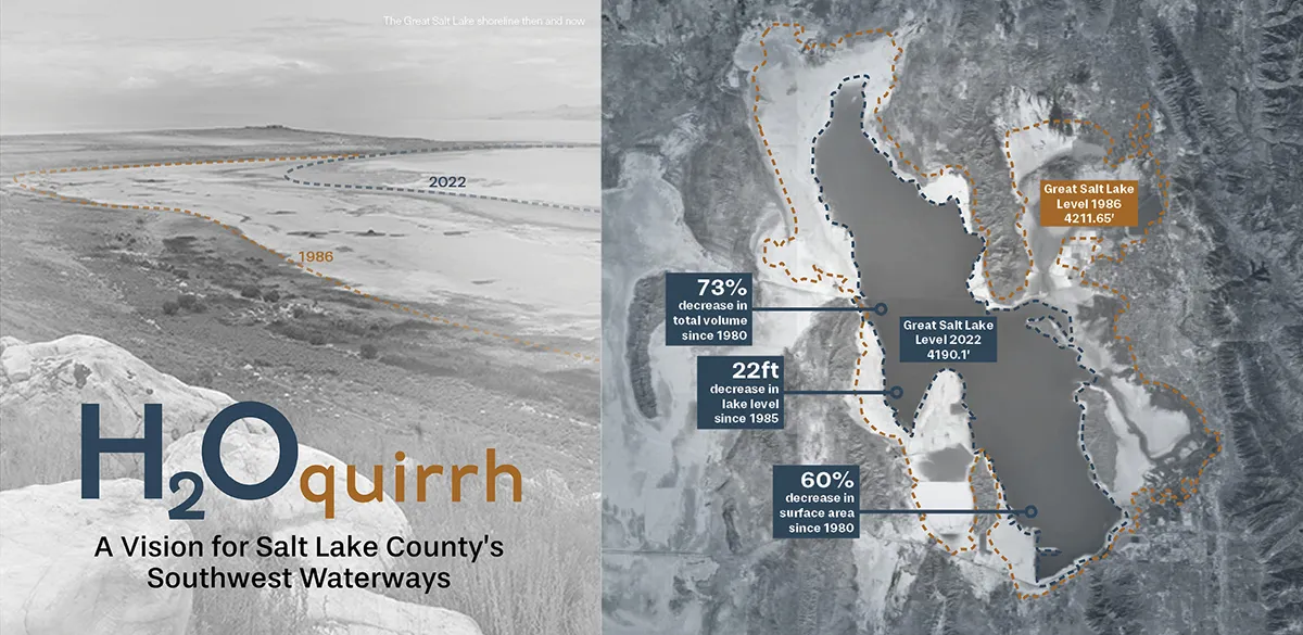
For much of the year, the creeks and washes descending from Utah’s Oquirrh Mountains appear dry. The washes separate agricultural fields, overlooked as vacant land assumed to be waiting for another purpose. The creeks that intermittently convey mountain snowmelt and stormwater transition into new neighborhoods as narrowed ribbons that for most of the year are disregarded as prickly corridors of weeds. Yet these waterways have historically performed some of the region’s most important work. On the surface, they are open-space habitats that support ecosystems, and their vegetation and pervious soils are essential for infiltrating water underground to recharge deep aquifers. Although largely invisible, these hidden processes have shaped the Salt Lake Valley for thousands of years.
As drought, rapid growth, and a shrinking Great Salt Lake place increasing pressure on water resources across the West, these overlooked landscapes have taken on new significance. Rather than treating stormwater as a nuisance, moving water off valuable real estate through pipes and channels, the H2Oquirrh Vision Plan reimagines the relationship between development and the natural water cycle that happens unseen, below ground.
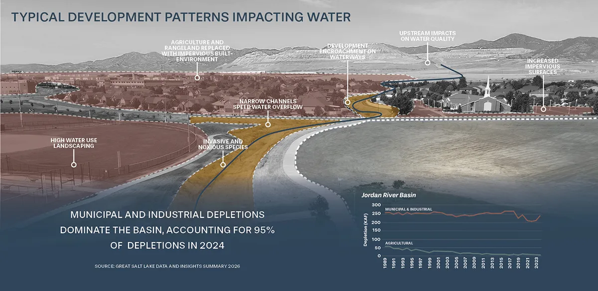
“This project identifies a profound flaw with landscape design that only looks at one snapshot in time when stormwater is idealistically flowing through a property,” says Anna Laybourn, FAICP, Principal at Design Workshop. “This vision extends the view to a regional scale and the time horizon to decades of water management. It asks the question: what if we disturbed as little of the water cycle as possible with our land use choices and waited patiently for the return on our water investment?”
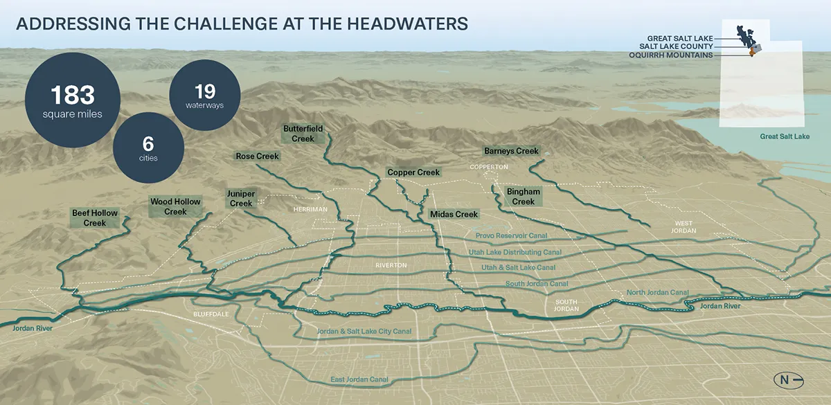
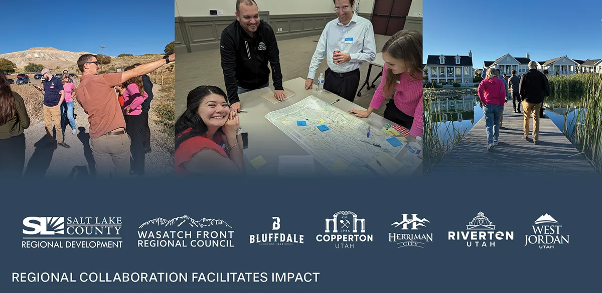
That philosophy became the foundation of a regional vision developed through a partnership between the cities of Bluffdale, Copperton, Herriman, Riverton, West Jordan, Salt Lake County, the Wasatch Front Regional Council, landscape architects, water engineers, community planners, land managers, and environmental scientists. Together, they looked beyond jurisdictional boundaries to understand nine creeks and washes as interconnected natural infrastructure, recognizing that every land use decision influences the movement, quality, and long-term availability of water across the watershed.
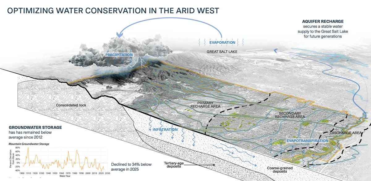
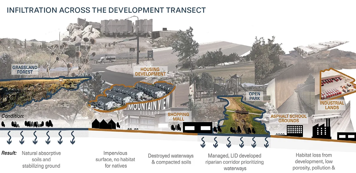
H2Oquirrh recognizes that some of the landscape’s greatest value lies in its ability to slow stormwater down, absorb it before it evaporates, and percolate water down to subterranean aquifers. Water that disappears beneath the surface is not lost. It is stored, filtered, and slowly rebuilds the groundwater supply that supports the watershed over time. This groundwater supplies an estimated 10% to 12% of the water entering the Great Salt Lake. It was believed to be only about 3% until recent geophysical modeling revealed more about its importance.
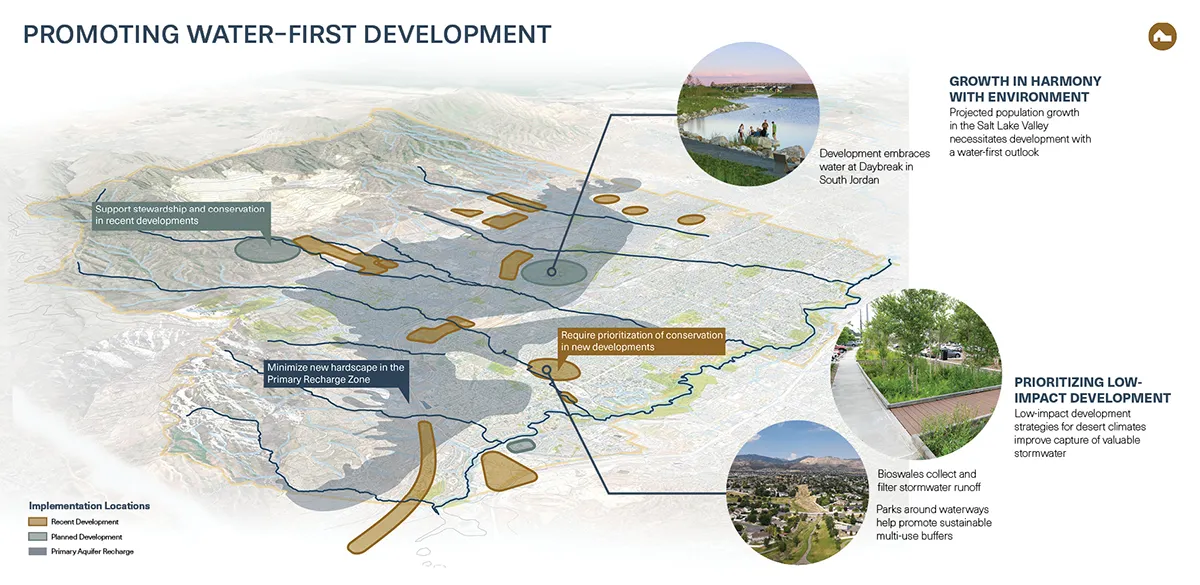
This understanding radically changed the perspective of waterway design and regional land use planning. A watershed scale analysis of hydrology, soils, land cover, and future development patterns identified opportunities to enhance stream corridors, conserve lands in critical groundwater recharge areas, expand green stormwater infrastructure, and guide development in ways that reinforce the natural movement of water. Rather than proposing isolated projects, the vision establishes a regional framework where land use planning and water management become inseparable. The result is a water first approach that recognizes healthy landscapes as the foundation of long-term resilience.
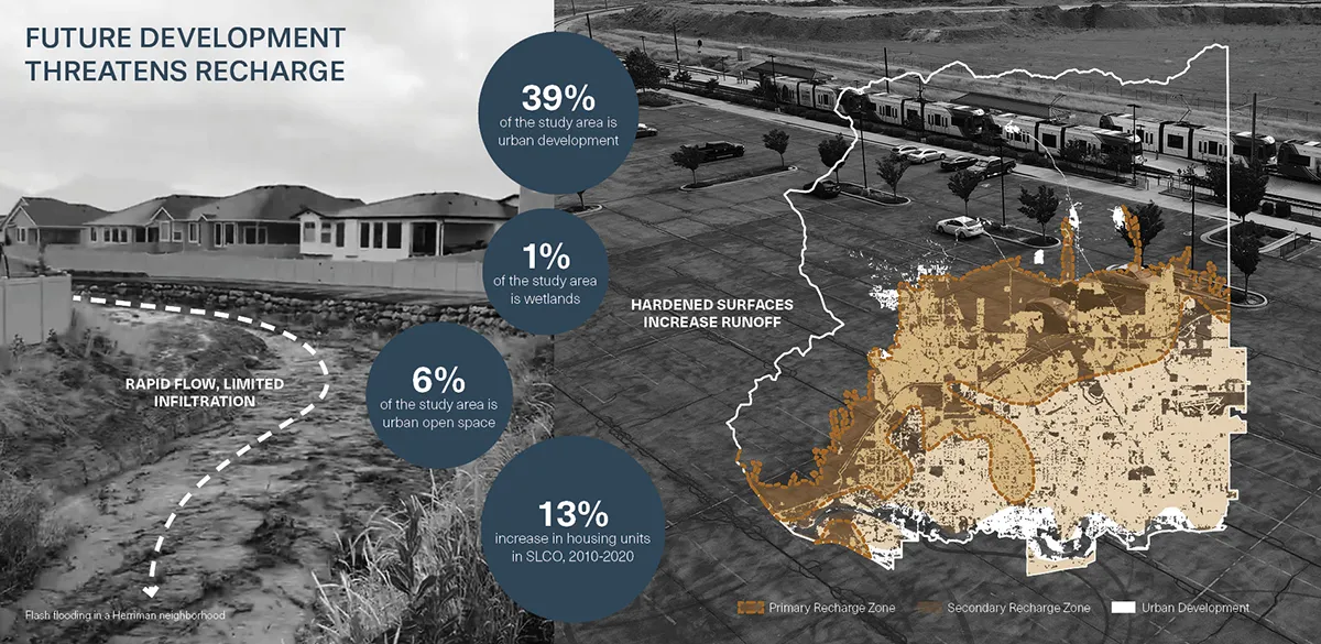
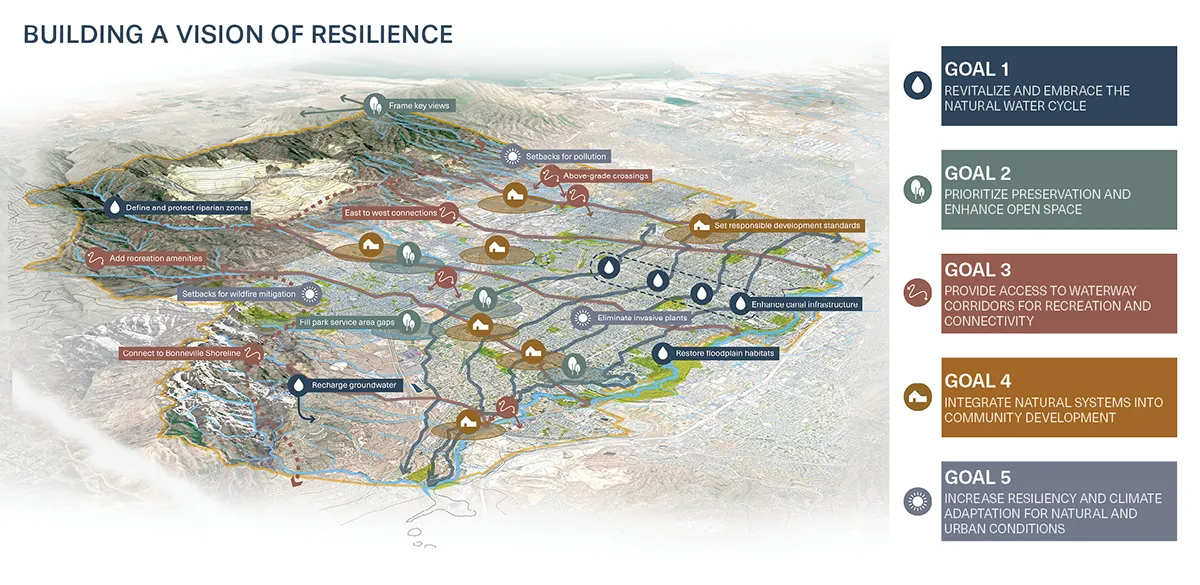
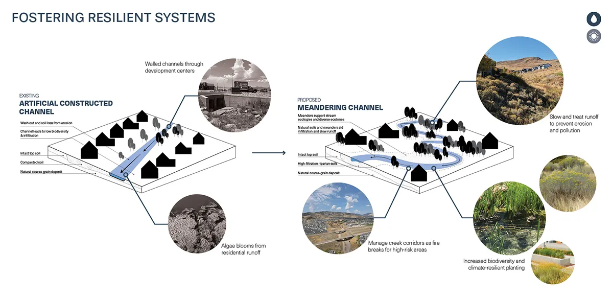
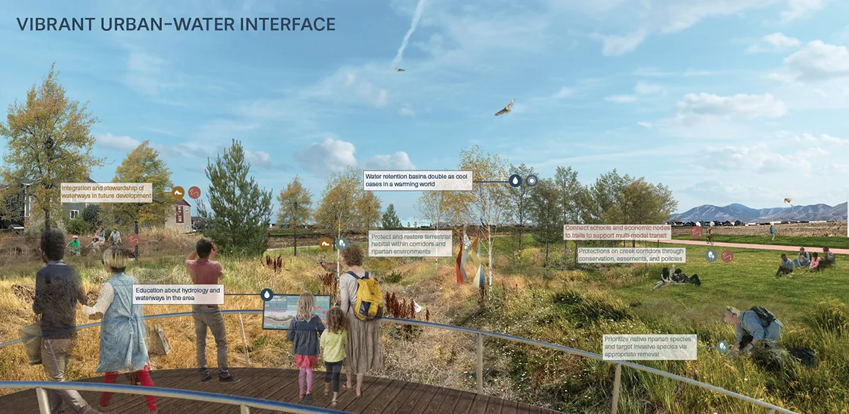
The benefits extend well beyond water. It addresses intersecting climate impacts that cross jurisdictional boundaries: heat, wildfire, erosion, invasive species, air quality, and flooding. Conserved washes and creek corridors strengthening ecological connectivity and expanding opportunities for recreation trail corridors. Development strategies recognizing waterways as assets that contribute to environmental safety, public health, and quality of life.
Equally important was changing how people understand these invisible systems. Groundwater recharge is difficult to appreciate because it happens beneath the surface and unfolds over years rather than days. Through maps, visualizations, and illustrations of the regional water cycle, the planning process translated hydrologic science into stories that residents, elected officials, developers, and public agencies could readily understand. Dry washes that once appeared ripe for development became recognizable as living infrastructure supporting the health of an entire region. The potential role of landscape design and actions required to improve natural system functions became better understood.
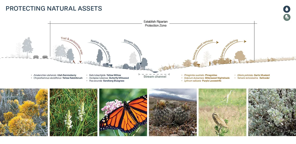
“I surmise this approach to land planning and development is uncommon not because the water science is too complex, but because it requires a regional sharing of water resources,” says Laybourn. “Once stormwater disappears from sight underground and slowly flows with no regard for property ownership, the ability to control and monetize changes from a right to a collective responsibility.”
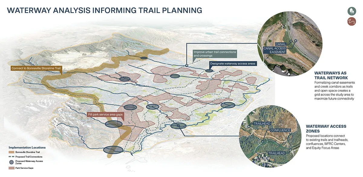
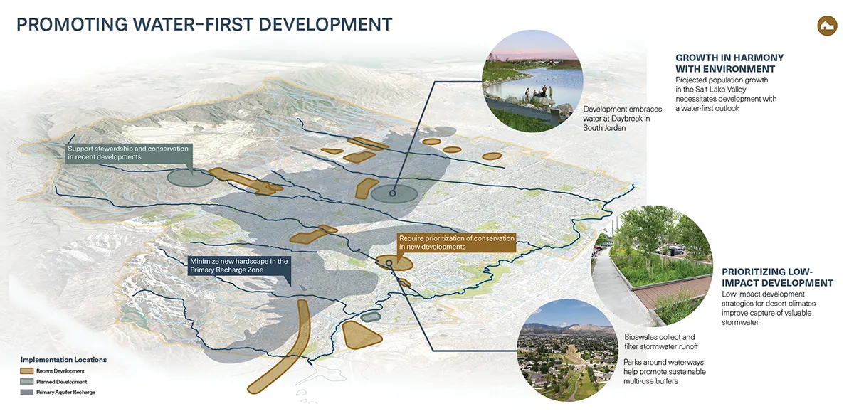
That perspective may be H2Oquirrh’s greatest contribution. Water does not recognize city boundaries, property lines, or political jurisdictions. A healthy watershed depends on shared stewardship, making regional collaboration just as important as technical innovation. By bringing together multiple municipalities around a shared vision, the plan demonstrates that protecting groundwater cannot be achieved through individual projects alone. It requires communities to understand their role within a larger hydrologic system and to make land use decisions that strengthen, rather than interrupt, the natural water cycle.
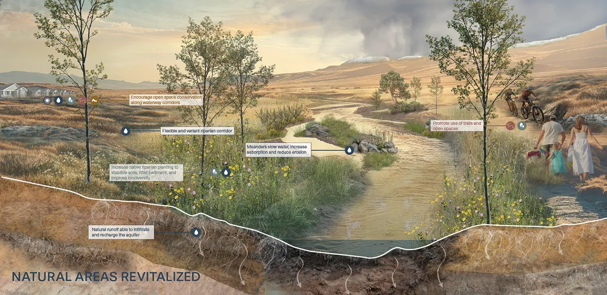
Although developed for one of the nation’s fastest-growing metropolitan regions, the principles behind H2Oquirrh extend well beyond Utah. Communities throughout the Interior West face many of the same challenges as prolonged drought, declining snowpack, rapid development, and increasing flood risk reshape the future of water management. The dry creeks and washes found across these landscapes are often overlooked, yet they quietly perform the same essential work of slowing, filtering, and recharging water beneath the surface. H2Oquirrh offers a framework for recognizing these systems not as leftover spaces, but as critical infrastructure for long term water security.
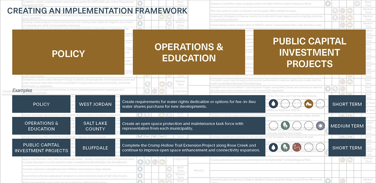
The future of the Great Salt Lake will not be determined by a single restoration project or conservation initiative. It will be shaped by thousands of decisions made across the watershed, many miles from the lake itself. H2Oquirrh reminds us that every creek, every wash, and every acre of healthy landscape contributes to that future. By designing for the water we cannot see, landscape architecture can help communities build resilience from the land surface down, creating places where decisions about community growth strengthen the water cycle rather than diminish it.
H2Oquirrh
Landscape Architect: Design Workshop
Principal: Anna Laybourn – FAICP
PM: Dylan Bagnasco – PLA, and Mary Oliver
PLAs: Helen Lea, Kevin Corrigan, Addison Martin, Clare Kavanagh, Marina Daniels
Consultants
LimnoTech
Other Contributors
Wasatch Front Regional Council
Salt Lake County
City of Bluffdale
Town of Copperton
Herriman City
Riverton City
City of West Jordan
Images & Text Credit: Design Workshop