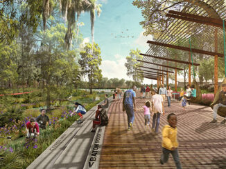
In one of Aotearoa New Zealand’s fastest-growing and most climate-exposed districts, the Queenstown Lakes Blue Green Network Plan reframes landscape as essential infrastructure. Developed for Queenstown Lakes District Council (QLDC), with Boffa Miskell as the lead consultant, the Plan establishes a long-term, landscape-led framework for integrating waterways, wetlands, ecological corridors, parks, trails, civic spaces, and streets into the future planning of urban areas and settlements across the Whakatipu and Upper Clutha Basins.
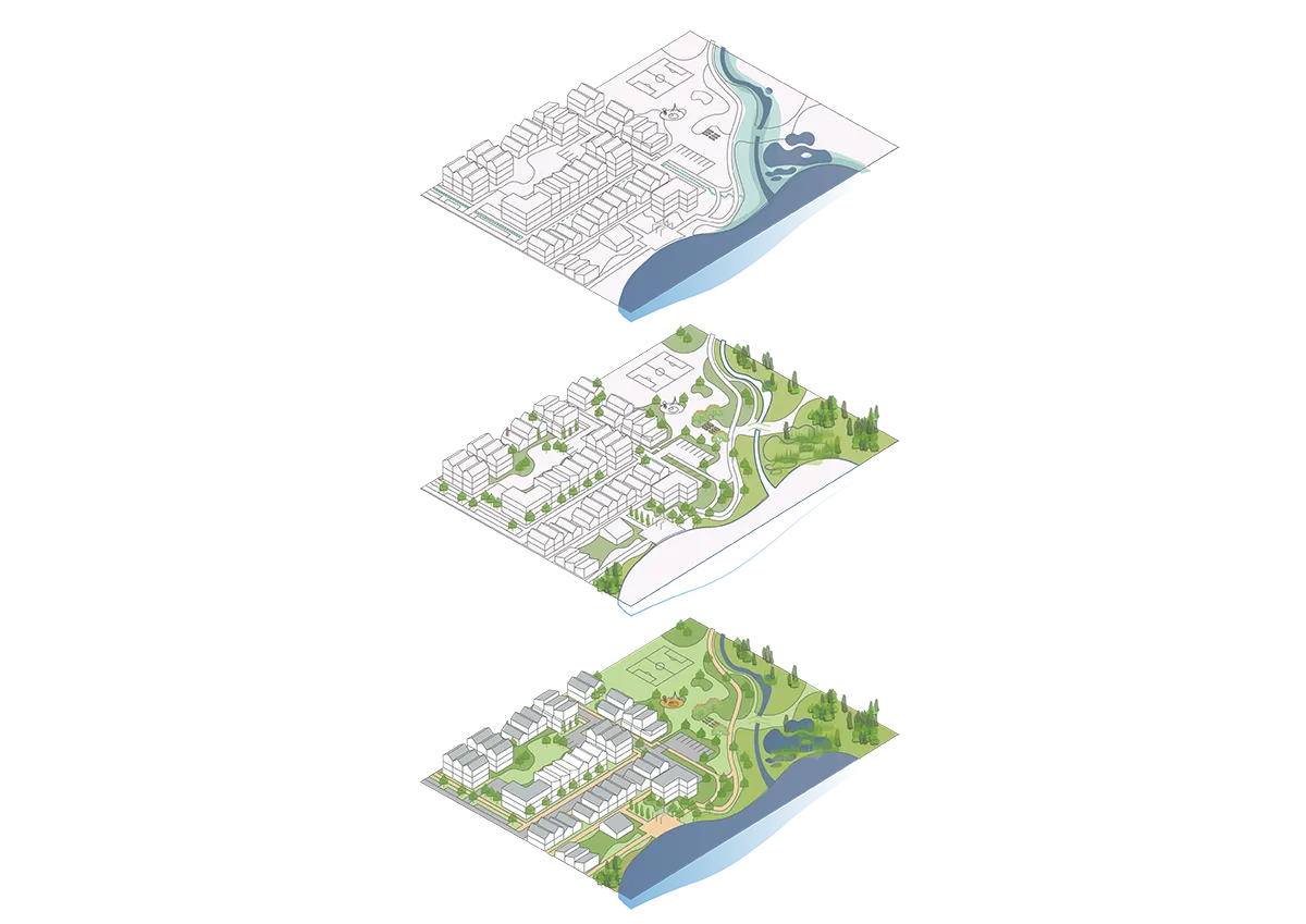
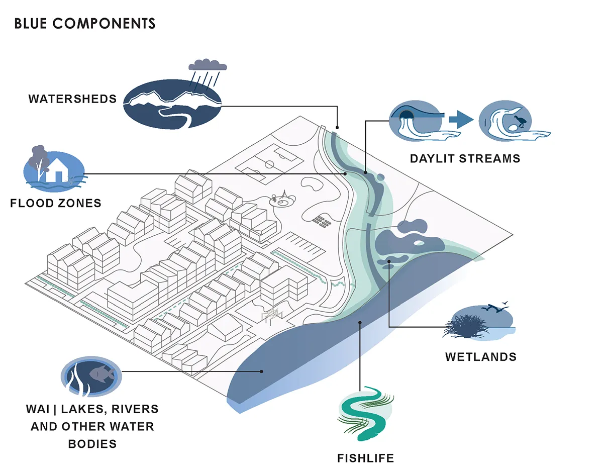
Rather than treating open space as an amenity to be added after development, the Plan positions blue-green infrastructure as the primary structuring system for growth. The Blue Network includes lakes, foreshores, rivers, streams, wetlands and green stormwater infrastructure; the Green Network comprises reserves, ecological corridors and vegetation patterns; and these are overlain with the Community Network of parks, trails, streets and civic spaces. Together, these systems are intended to improve water quality, support biodiversity, manage stormwater, enable active movement and provide daily access to nature as urban density increases.
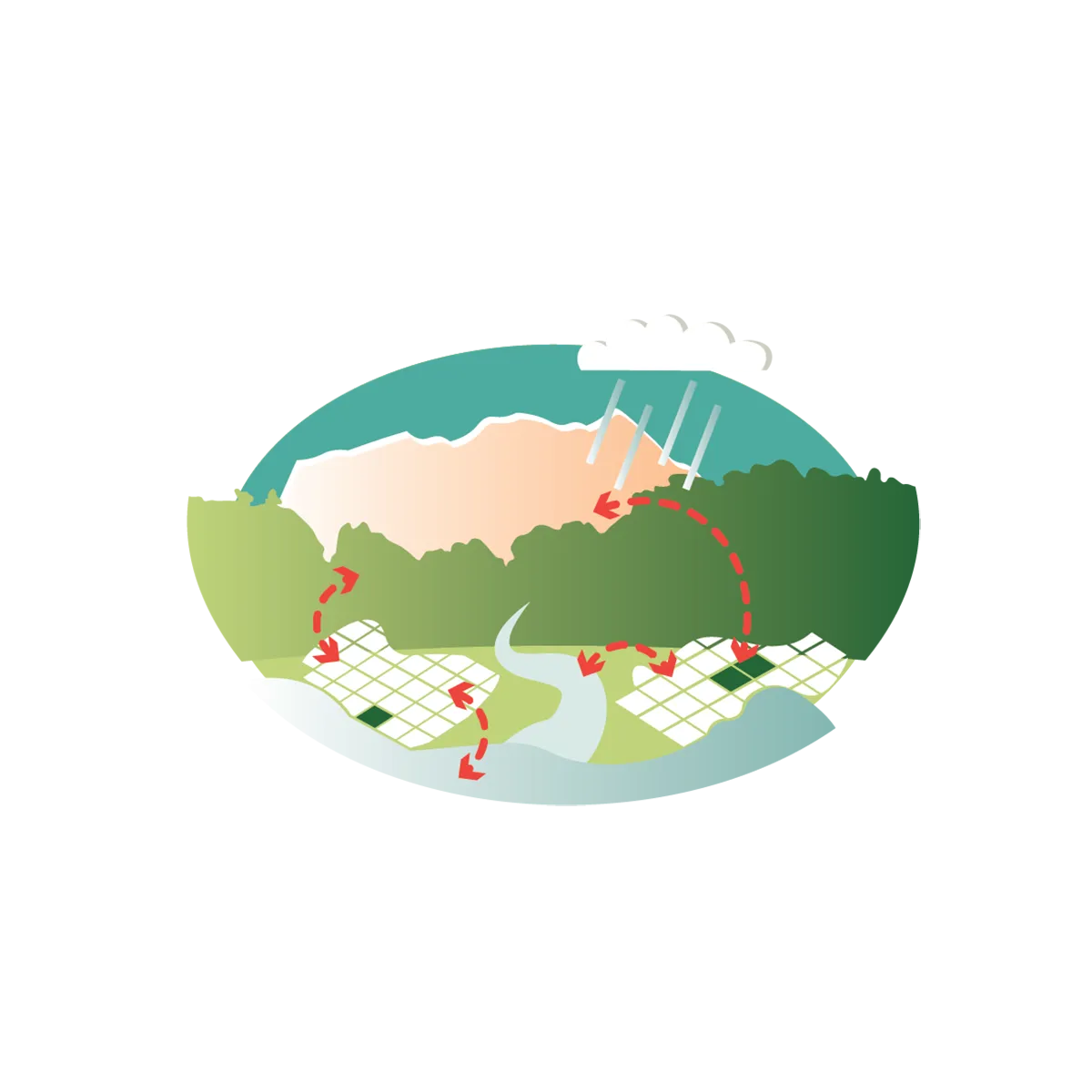
The Plan is grounded in Ki Uta Ki Tai, the Kāi Tahu philosophy that recognises the interconnection of mountains, waterways, lakes, land and people. The Plan integrates Māori values with contemporary landscape and urban design practice. Basin scale analysis of geomorphology, hydrology, historic vegetation, ecological networks, growth projections, and climate modelling informs spatially explicit design responses that shape urban form, guide infrastructure placement, and protect natural systems over time. This catchment-based view informs the Plan’s emphasis on Mana o te Wai, making space for water, restoring mauri, supporting mahinga kai, and protecting waterways and wetlands as living cultural and ecological systems. Kāi Tahu values are embedded through the project’s principles, spatial structure and future implementation actions, rather than being applied as a symbolic layer.
At its core, the Plan establishes a clear and disciplined framework of principles Mana o te Wai, Ki Uta Ki Tai, coexistence of nature and people, and connected networks that guide decision making across land use, infrastructure, and investment.
The Blue Green Network Plan is built on five key principles:


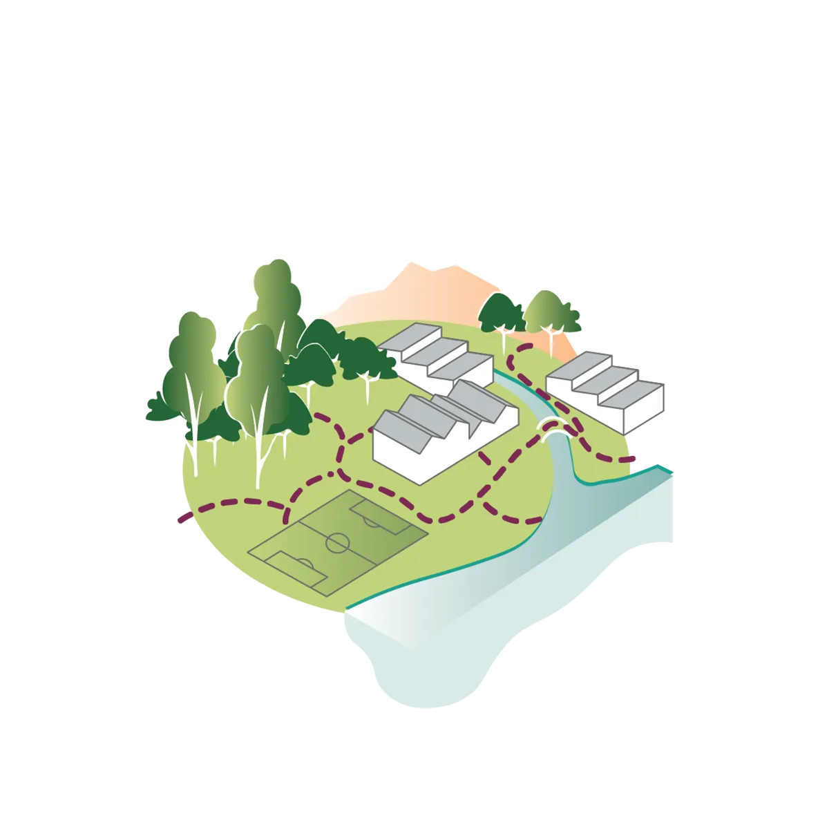
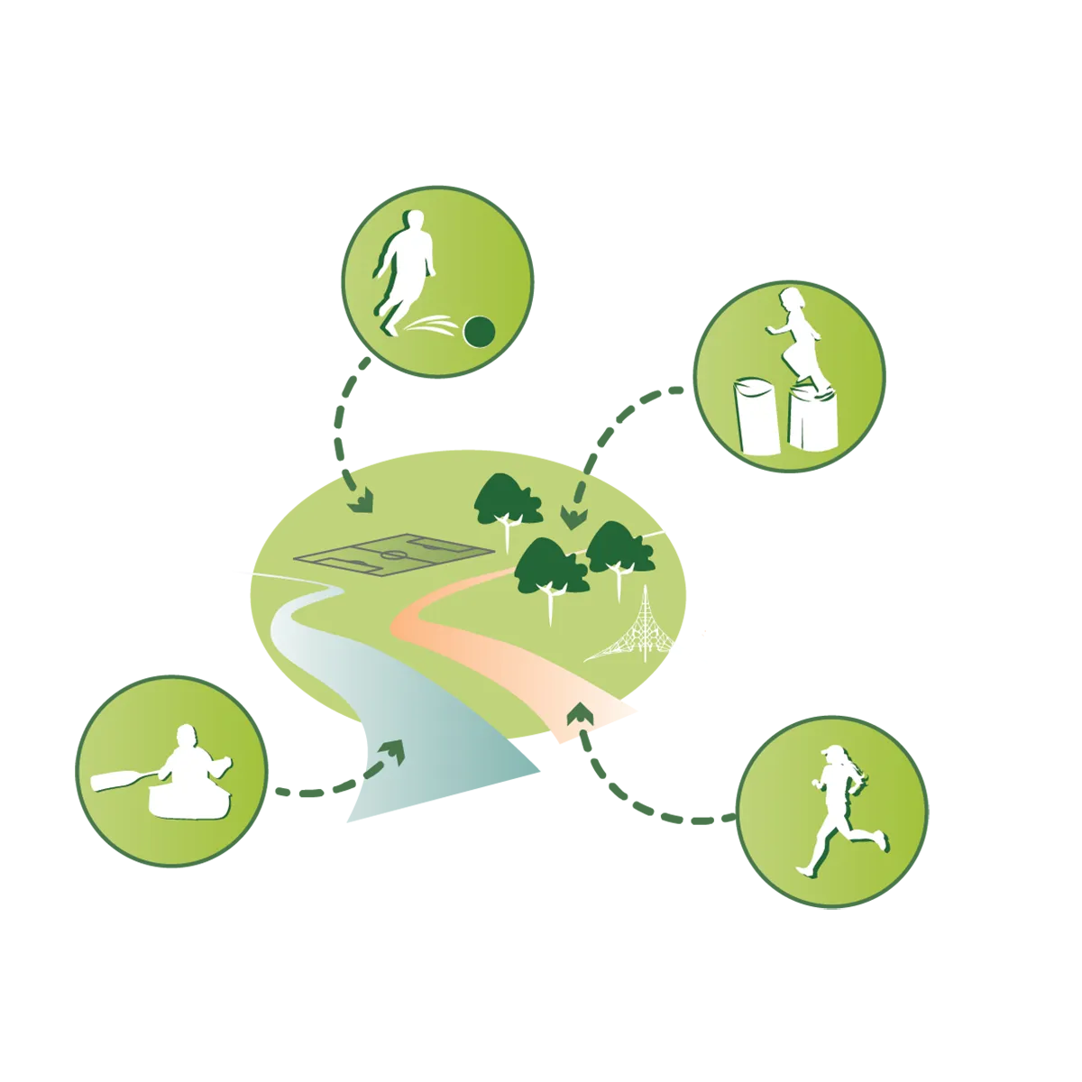
The scale of the work is significant. The Plan is articulated through 21 Local Blue-Green Plans covering Priority Development Areas and settlements including Tāhuna | Queenstown, Te Kirikiri | Frankton, Te Tapuae | Southern Corridor, Kā Muriwai | Arrowtown, Wānaka, Albert Town, Luggate, Lake Hāwea, Cardrona and Makarora. Each local plan identifies projects and opportunities across six components: water, ecology, parks, trails, destinations, and arrival nodes. These range from riparian planting and wetland restoration to daylighting streams, improving fish passage, creating new parks, extending trail networks and strengthening active travel connections.
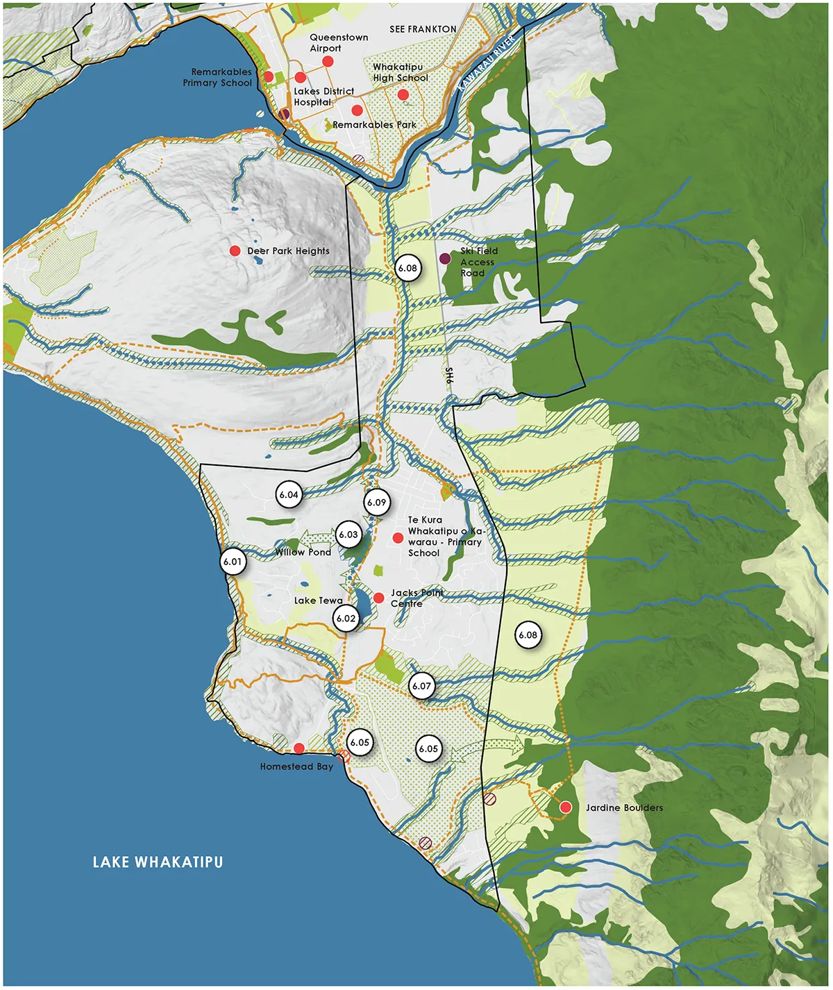
The Plan responds directly to the pressures shaping Queenstown Lakes: rapid population growth, visitor demand, intensification, high land values, fragmented habitats and increasing climate risk. Under a high-emissions climate scenario, the district is projected to experience warmer temperatures, fewer frost days, more hot days, reduced snow cover, more intense rainfall in some areas and increased wildfire risk. The Plan treats these risks as urban design drivers, using floodplains, wetlands, riparian corridors and adaptable parks to slow, store and filter water while enhancing public amenity and ecological resilience.
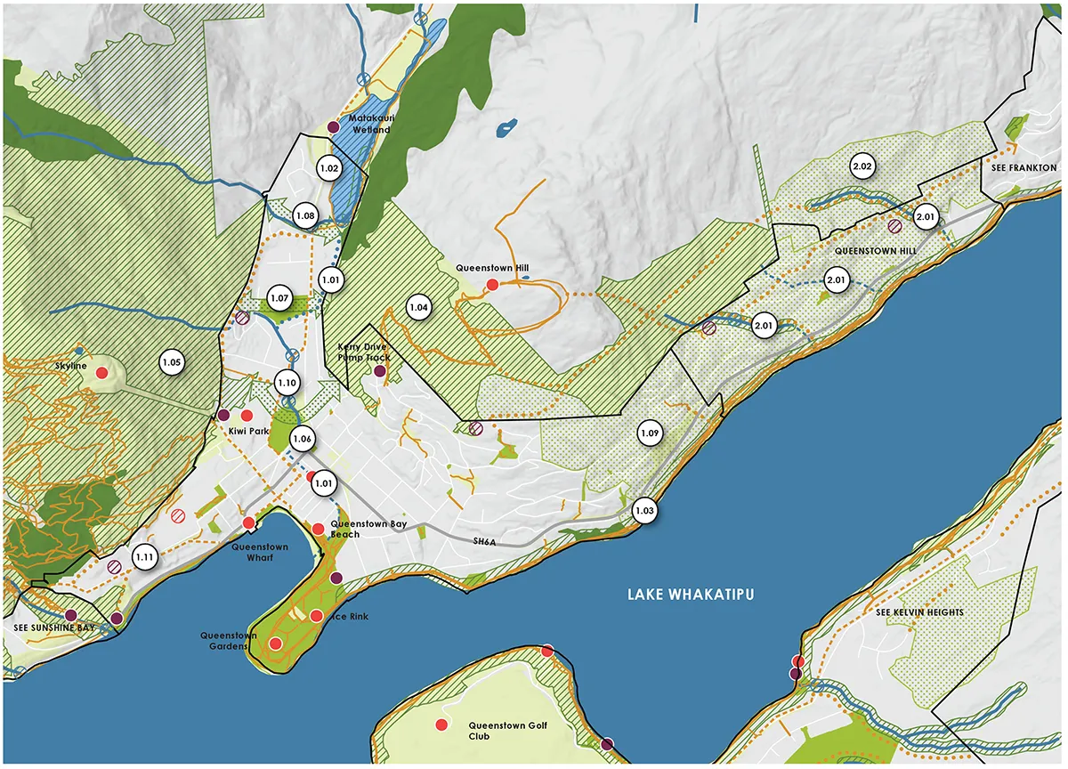
Boffa Miskell’s role was to help translate this complexity into a clear, spatially explicit and implementable planning framework. The team led technical analysis, GIS-based mapping, spatial gap identification, stakeholder engagement, project identification and the integration of landscape, ecology, planning and urban design expertise. Basin-scale analysis of geomorphology, hydrology, historic vegetation patterns, ecological networks, growth projections and climate modelling informed local responses that are specific to each settlement’s landscape character and development pressures
A key innovation is the Digital Blue Green Network, a GIS-based tool held by QLDC that documents the combined Local Blue-Green Plans and their data attributes. This enables the Plan to operate not only as a strategic document, but as an evolving spatial platform for structure planning, development assessment, infrastructure coordination and capital investment. It allows council officers, mana whenua, developers and infrastructure providers to understand how individual sites and projects can contribute to the wider network.
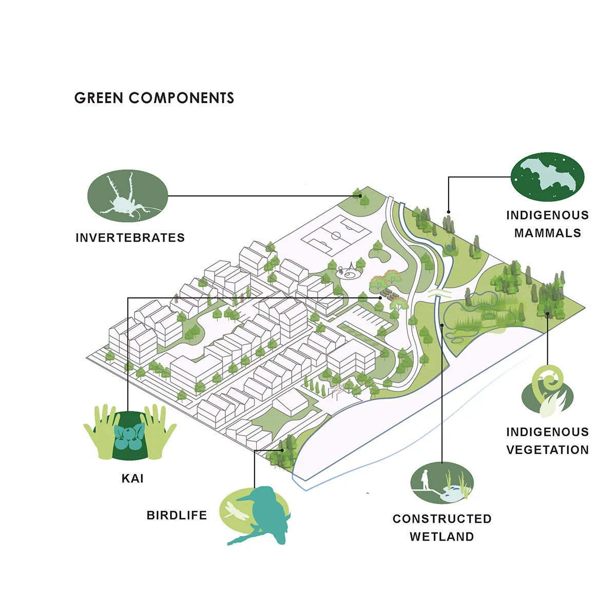
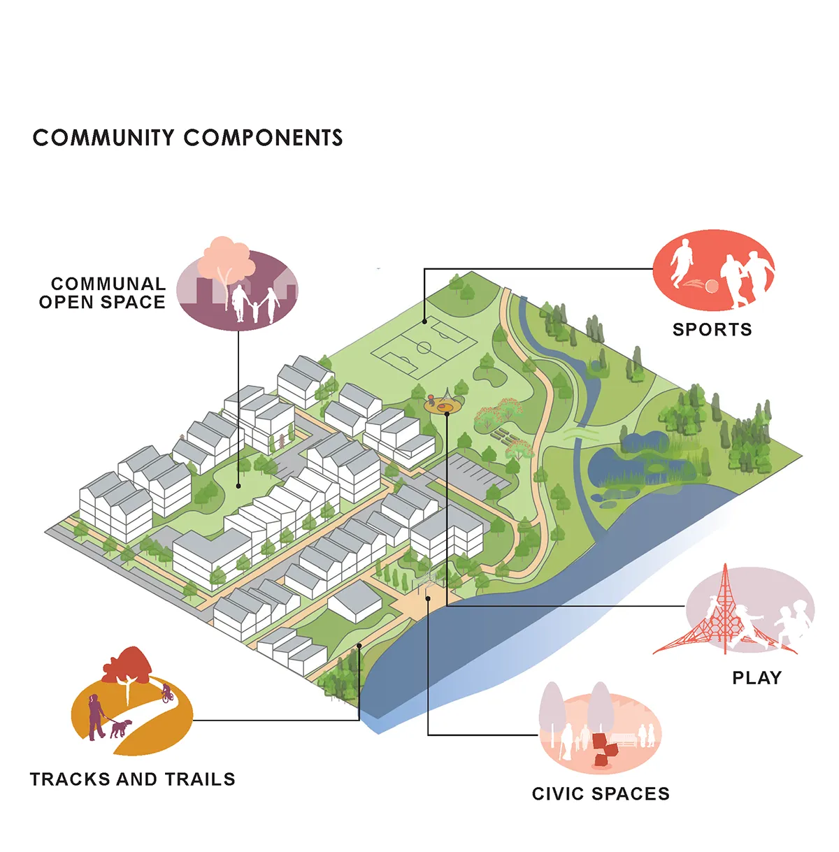
Implementation is central to the Plan’s value. The Local Blue-Green Plans are intended to inform QLDC spending on parks, open space and social infrastructure, while a separate Action Plan will identify priorities, timeframes, responsibilities and funding pathways. The Plan is also designed to integrate with the Queenstown Lakes Spatial Plan, Future Development Strategy, structure plans, development contributions, parks and open space strategies, community facilities planning, transport planning and long-term council investment.
Through the lens of landscape architecture, the Queenstown Lakes Blue Green Network Plan offers a compelling model for climate-responsive urbanism. It demonstrates how landscape systems can shape urban form, how nature-based solutions can replace or complement hard infrastructure, and how cultural values, ecological processes and public space planning can be brought together into an operational framework. In doing so, it positions blue-green infrastructure not as a background condition, but as the foundation for more resilient, connected and place-specific growth.
See the project on Queenstown Lakes District Council Website: Blue Green Network Plan | Let’s Talk Queenstown Lakes District Council
Design Firm: Boffa Miskell
Images & Text: Boffa Miskell