A landscape-led active transport corridor reconnecting ecology, culture and community in Sydney’s Inner West
The Cooks to Cove GreenWay is a significant ecological and active transport corridor linking Iron Cove and the Parramatta River in the north to the Cooks River between Dulwich Hill and Earlwood in the south. Extending six kilometres in total, the corridor traces the Hawthorne Canal before aligning with the Inner West Light Rail corridor.
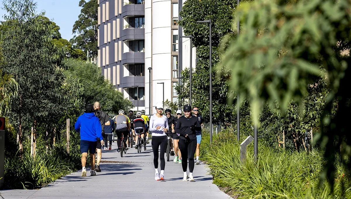
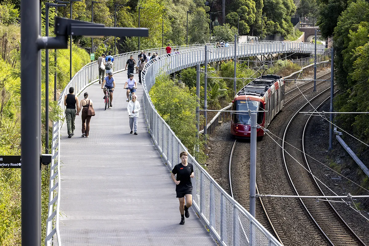
The GreenWay establishes a continuous, accessible shared path while transforming underutilised and previously inaccessible spaces into a connected linear park. It demonstrates a collaborative model between designer and contractor, navigating complex infrastructure, heritage rail conditions and stakeholder interfaces to deliver a multi-functional corridor for movement, recreation and learning.
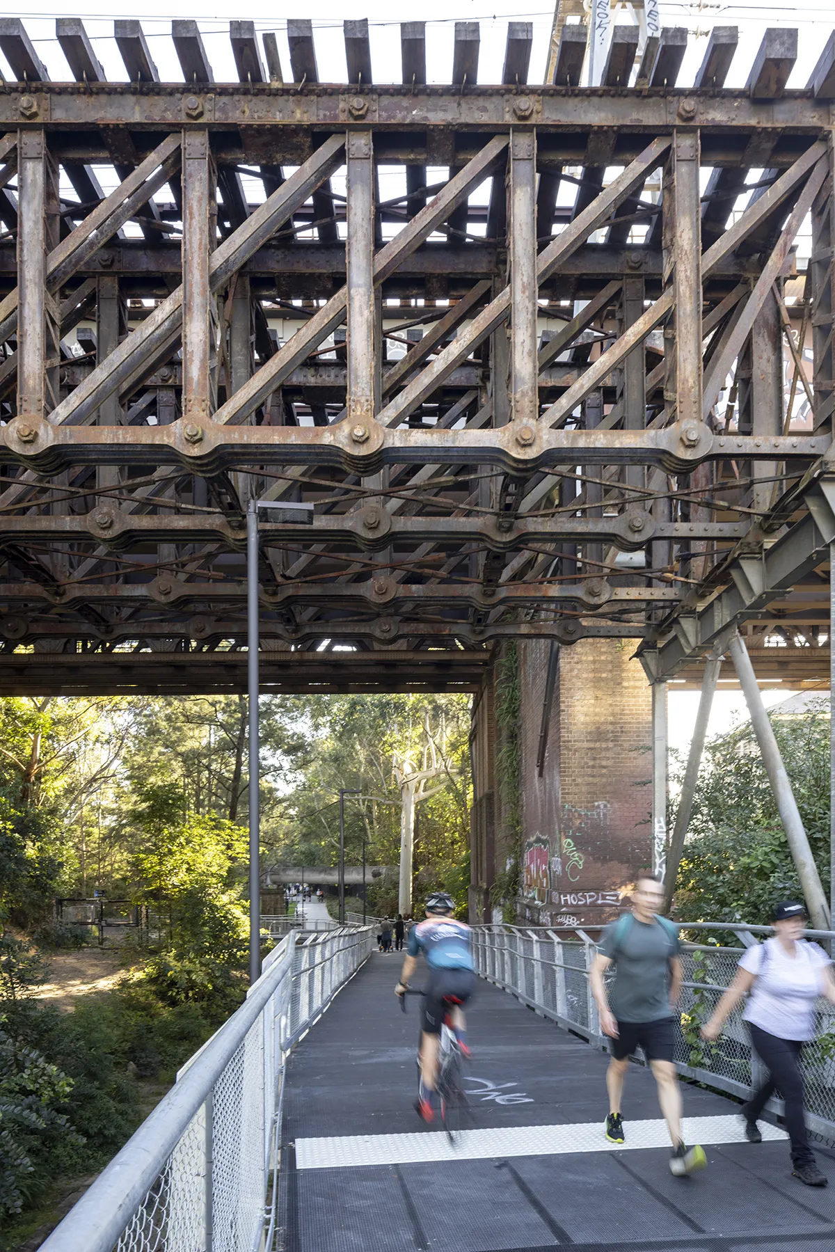
ASPECT Studios with Gartner Rose undertook the most challenging two-kilometre stretch that weaves over canals (including a cantilevered steel platform over Hawthorne Canal and under Parramatta Road), under bridges, pierces through abutments and skirts the existing Light Rail corridor.
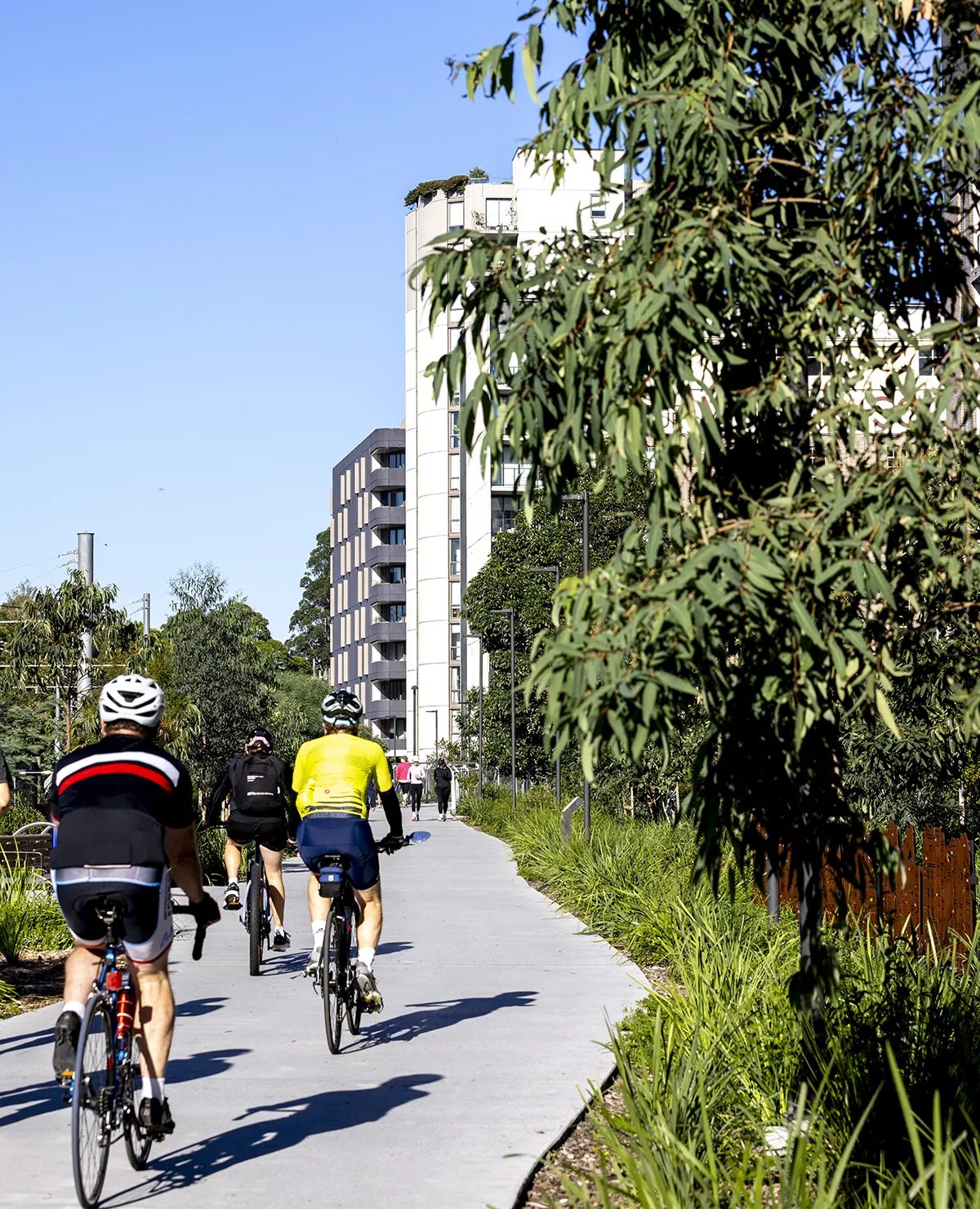
At its core, the project enhances the everyday landscape of Sydney’s Inner West – prioritising pedestrians, supporting walking, cycling, play, fitness, and moments of respite – while expanding public access to open space and strengthening links between existing parks, transport nodes and neighbourhoods.
A New Linear Landscape for Sydney
The GreenWay represents a significant shift in how infrastructure corridors are understood – moving beyond singular transport functions to become multifunctional public landscapes.
By stitching together fragmented spaces, the project delivers a continuous, accessible and ecologically rich corridor that supports both movement and pause. It strengthens connections between people, place and Country, while setting a benchmark for integrated landscape and infrastructure design in metropolitan contexts.
Landscape Vision
The project completes critical ‘missing links’ within the GreenWay through two key sections:
- Central Link: Parramatta Road to Old Canterbury Road
- Southern Link: Waratah Mills to Dulwich Hill
The design is guided by a clear ambition:
A unique, landscape-led active transport corridor between the Cooks River and Iron Cove – a place for exploring, learning and playing, where Country is regenerated and ecological systems are reconnected, revealing layers of cultural, industrial and geological heritage.
Connecting Landscape and Infrastructure
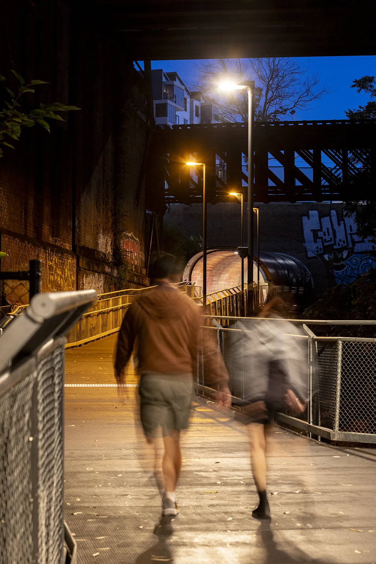
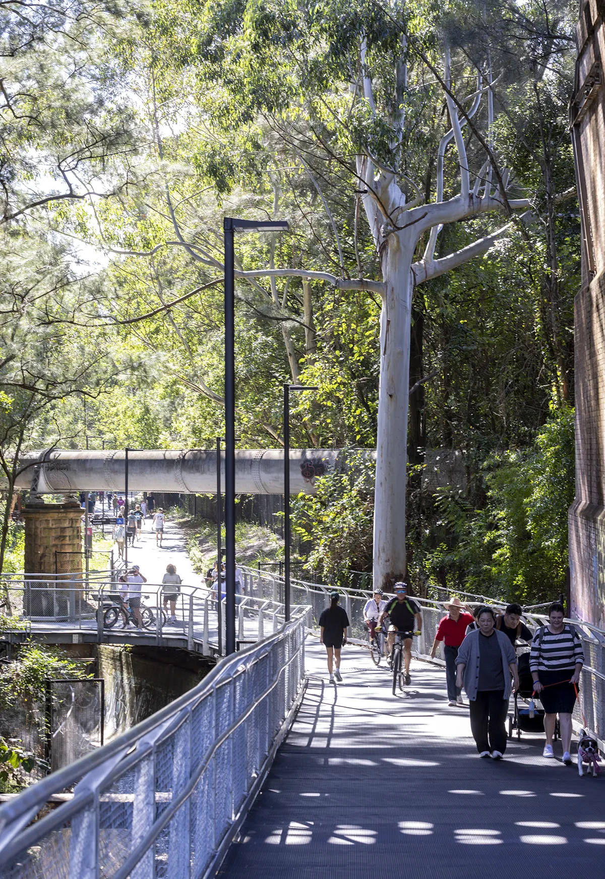
A continuous 3.5-metre-wide shared path establishes a legible and accessible route for all users. Along its length, a consistent ‘kit of parts’ – including seating, lighting, wayfinding, bicycle parking and drinking fountains – creates moments for pause while responding to the specific character of each location.
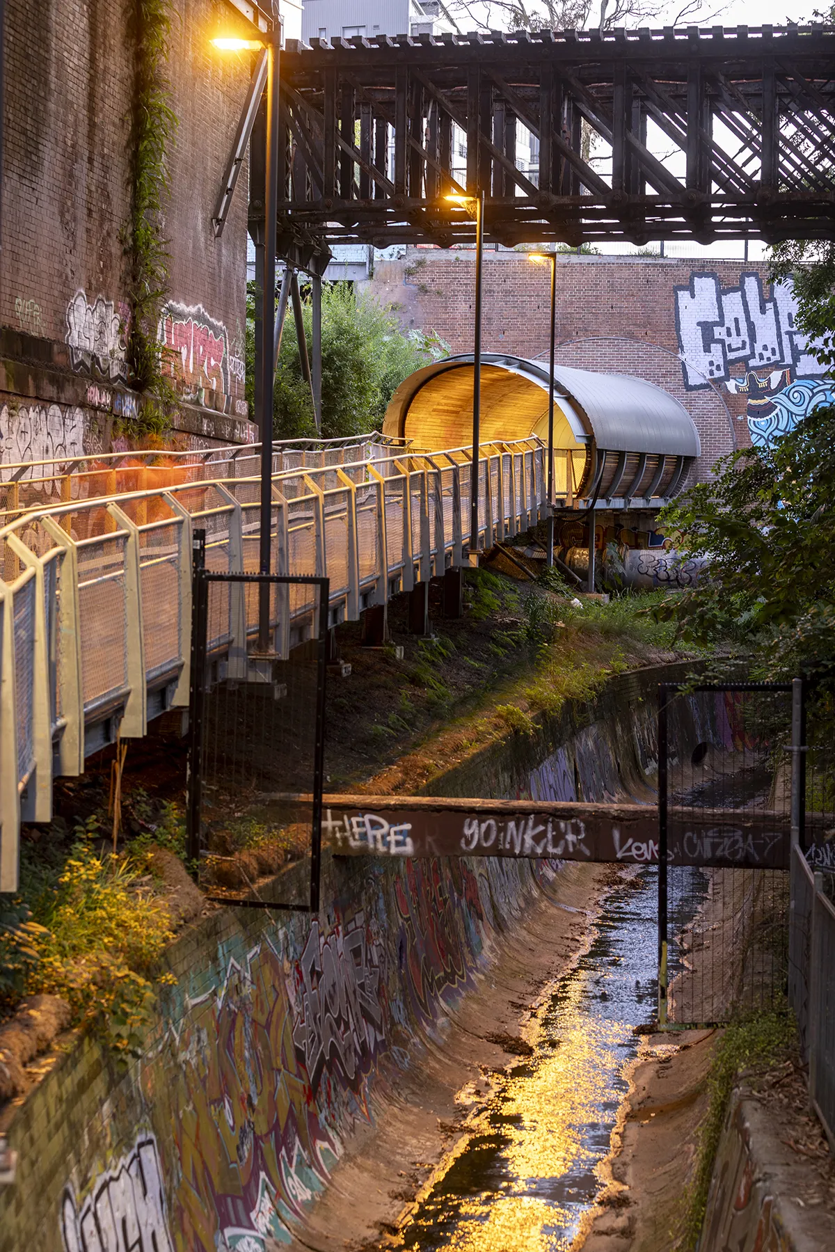
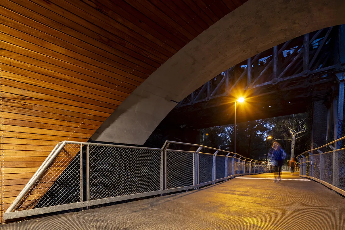
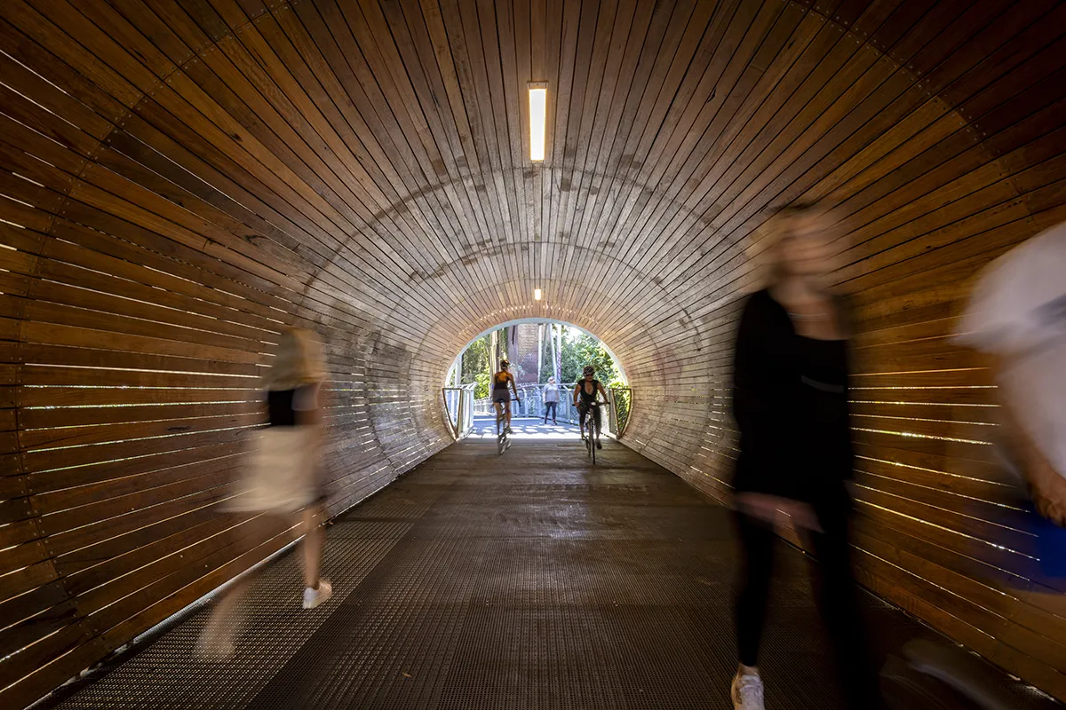
The project carefully negotiates complex infrastructure through four tunnels and two underpasses. These interventions weave through rail corridors, road crossings and existing vegetation, balancing engineering requirements with a cohesive architectural language.
Tunnel portals reinterpret the area’s industrial vernacular, drawing on the historic ‘hoods’ of rail tunnels. Tapered arch forms, light apertures and public art introduce moments of intrigue, while recessed wing walls and planting soften edges and integrate the structures into the landscape.
Reclaiming and Expanding Public Space
A central achievement of the GreenWay is the reclamation of previously inaccessible land, particularly within the rail corridor, effectively increasing the area of public open space in the Inner West.
Key moves include:
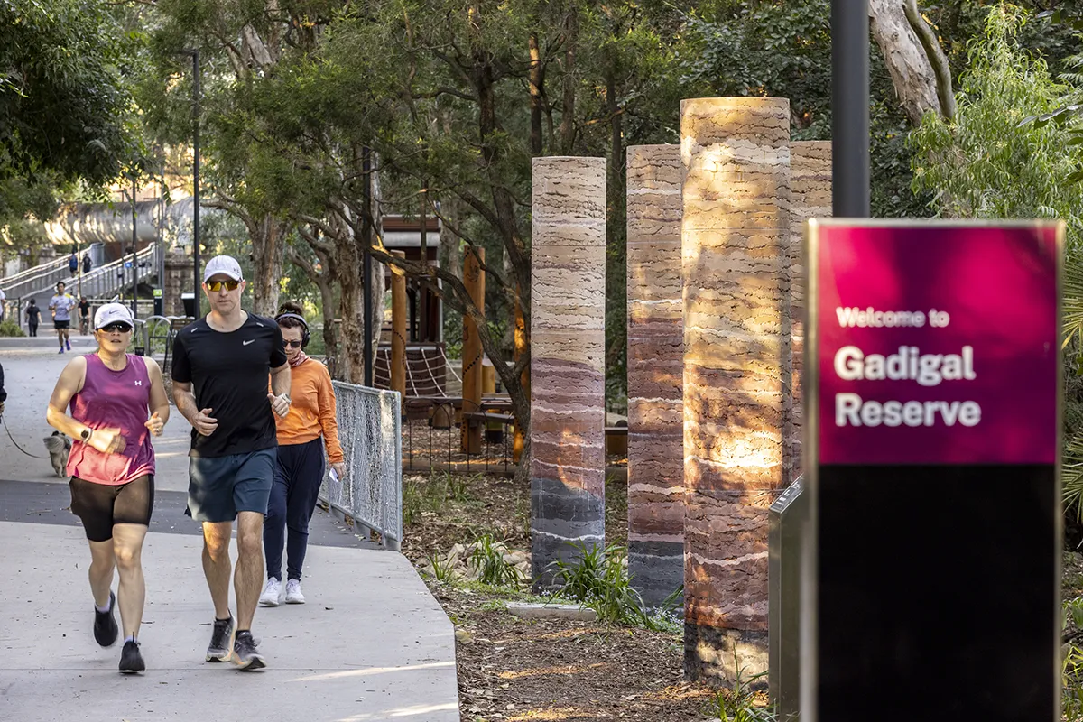
- New and upgraded parklands, including Gadigal Reserve and Hercules Street Parklands
- Improved connections to existing parks and recreation facilities
- A seamless interface with public transport, including light rail and bus networks
- Creation of quiet, nature-based spaces alongside active movement corridors
Play, Community and Cultural Connection
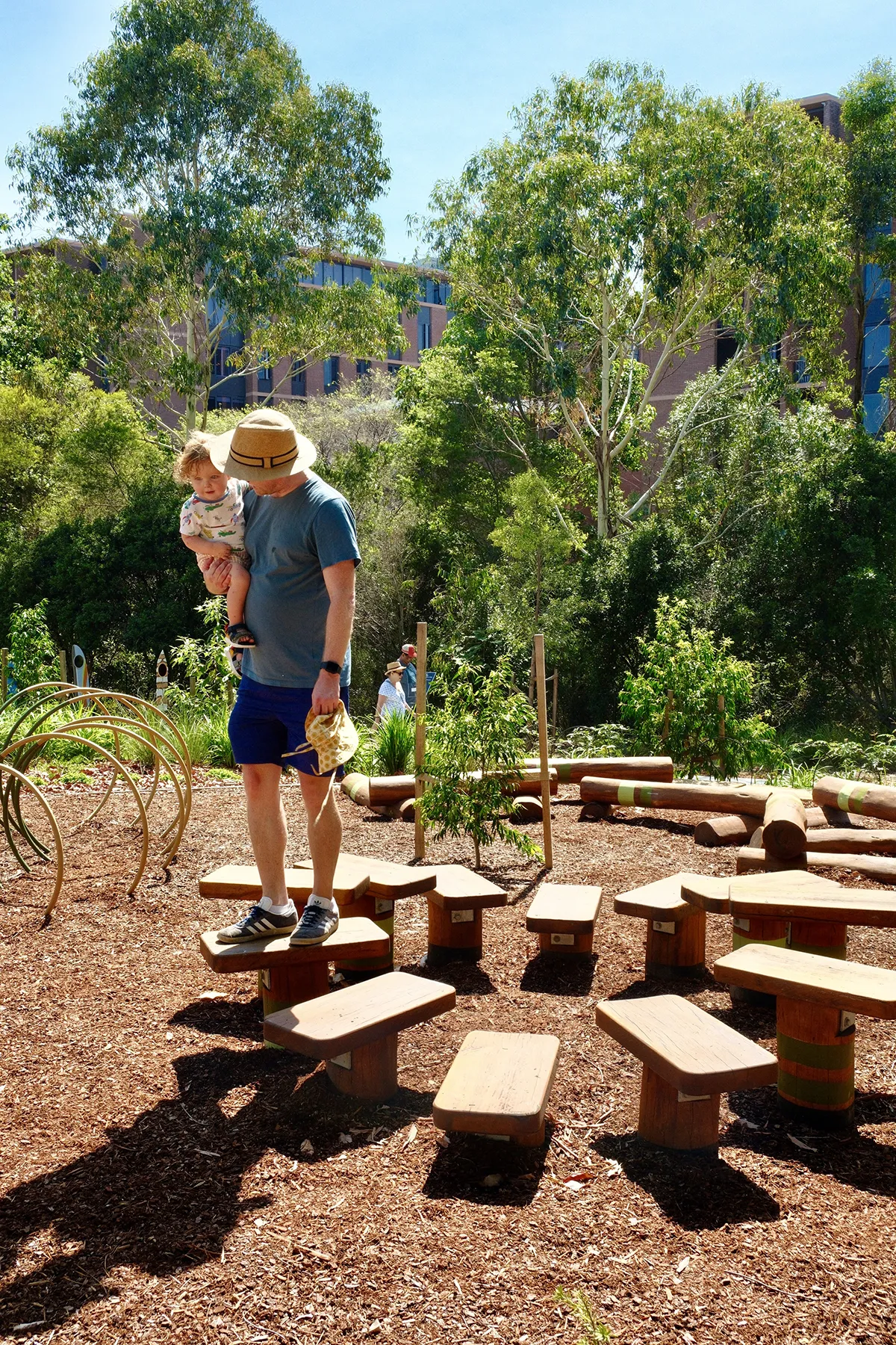
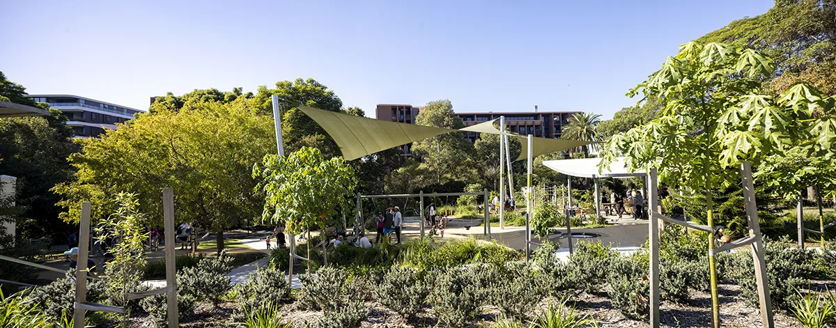
Gadigal Reserve Nature Play
A nature-based play space sits within a canopy of mature trees, offering both social and quiet play opportunities. The space is anchored by Ngaraora, a sculptural playspace by First Nations artist Jasmin Sarin (a proud Kam-il-a-roi and Jerrin-ja woman from New South Wales) that references the Glossy Black Cockatoo.
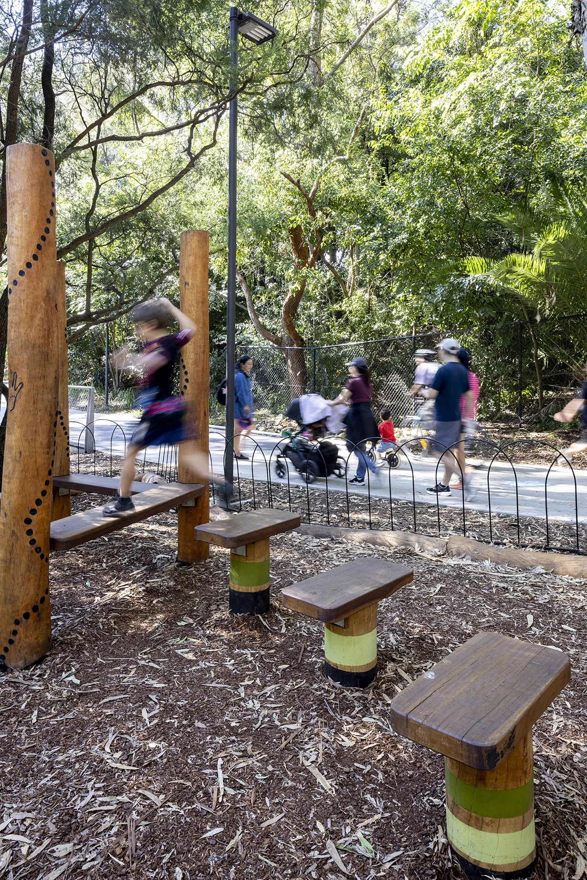
The integration of art and play fosters cultural connection and invites younger generations to engage with local knowledge and ecology.
Off-Leash Dog Park
Located in Lewisham West, the dog park transforms former residual land into a layered recreational space. Terraced forms support varied use, while separate zones accommodate different activity levels and users.
Johnson Park
The upgrade of Johnson Park is embedded within the broader Cooks to Cove GreenWay. Positioned at a key junction between the light rail, the GreenWay shared path, and the Dulwich Hill neighbourhood, the project recalibrates an existing park to accommodate new movement patterns while reinforcing its role as a local recreation ground.
Rather than reconfigure the park’s program, the design refines and intensifies existing uses. Upgraded paths, lighting, multi-use courts, and a renewed playground improve legibility, accessibility and safety, aligning with the GreenWay’s emphasis on walking and cycling connectivity. Movement through the park is intuitive and largely on-grade, with circulation stitched to established desire lines and new entries from the shared path network.
The project balances activation with ecological restraint. Existing trees and bushcare areas are retained, reinforced by revegetation and understorey planting that extend habitat connections along the corridor. Recreational upgrades: play, exercise, and informal gathering spaces are integrated with this landscape framework, supporting everyday activities from sport and fitness to rest and social exchange.
The park adopts a cohesive and playful language, drawing on the site’s distinctive character while introducing robust, contemporary elements. The result is a connected civic landscape: one that accommodates regional movement infrastructure while sustaining the local, social and ecological life of Johnson Park.
Hercules Street Parklands
Hercules Street Parklands introduces a new linear open space for Dulwich Hill. The park includes native species with a focus on endemic planting, contributing to the Connecting with Country approach. The design balances movement with stillness – providing opportunities for gathering, reflection and immersion in the landscape, alongside the active GreenWay corridor.
Ecological Regeneration
The GreenWay is a critical ecological corridor, underpinned by a diverse and site-responsive planting strategy. The design supports habitat creation and strengthens biodiversity through:
- Sydney Turpentine-Ironbark Forest restoration
- Sydney Sandstone Forest and Woodland communities
- Wetlands and biofiltration systems
- Bush food species and endemic planting
These layered planting systems enhance ecological resilience while reinforcing the corridor’s identity.
Tunnel and underpass
Along the GreenWay extent there are 3 new tunnels and 2 new underpasses. Each tunnel or underpass delicately navigates in, around, over, and under existing heritage infrastructure, carriageways, light rail corridors, services, and existing trees and ecological habitats. The design team worked together to provide both feasible and optimal engineering solutions, while ensuring a consistent design character unique to the GreenWay and its context.
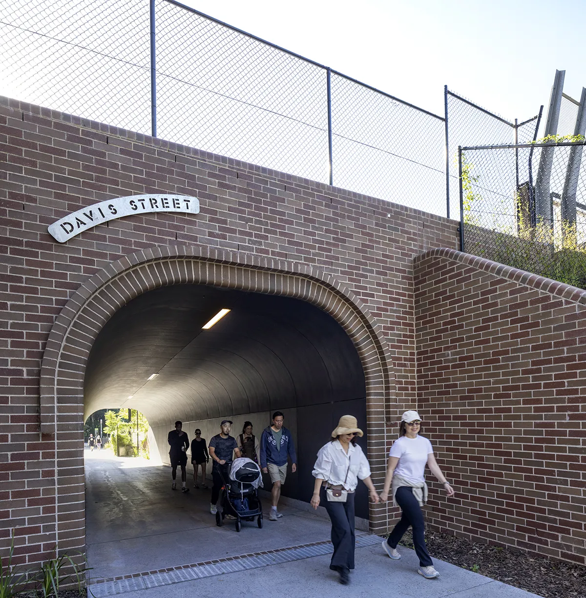
The architectural design for the tunnels – including the wing walls and portal entries – draws upon an appreciation and understanding of the rich suburban and industrial landscape adjacent. Set back from road abutments, the new tunnel entries are enriched by crafted brick details, bespoke signage, and integrated art.
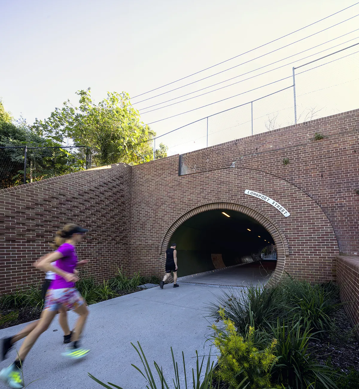
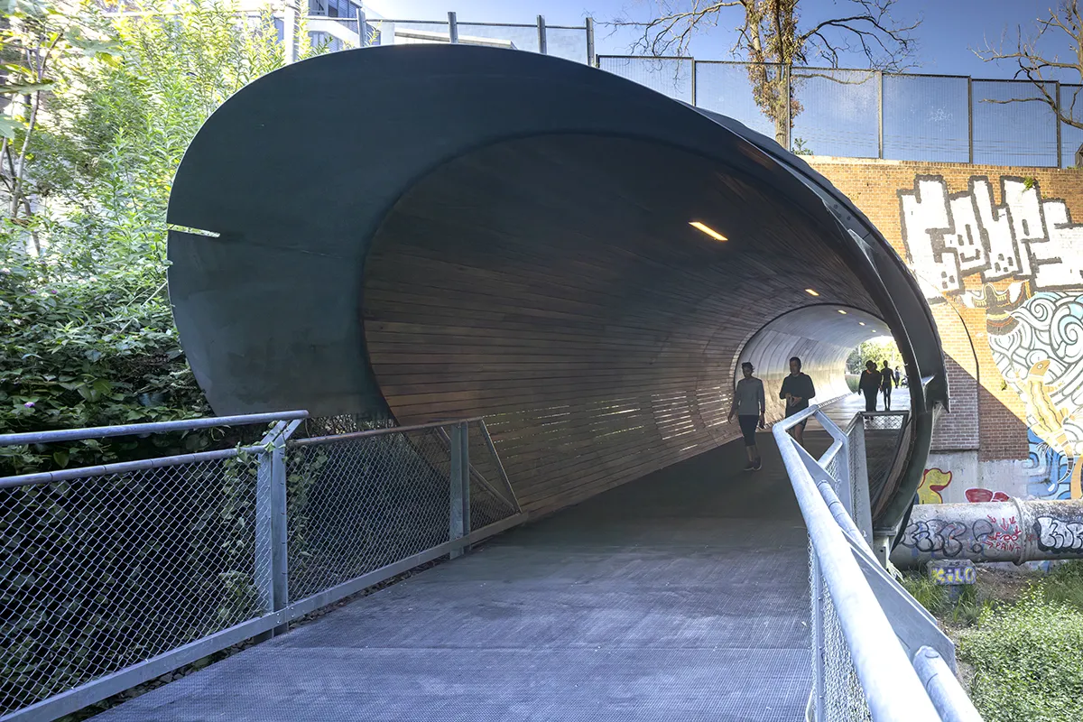
This is especially apparent in Longport Tunnel, which is located in a wilder landscape where remnant industrial architecture presents almost cathedral-like in a richly planted setting. Here, the tunnel extends with a hardwood timber hood fondly known as the ‘bat screen ‘, which frames the entry and protects the adjacent micro bat colony from light spill.
Brick-clad ‘wing walls’ retain and protect the existing adjacent light rail walls and roadway structure, and serve to frame the tunnel portal with small shrubs, ground covers and cascading plants.
All tunnels use the same materiality and elemental palette in slightly varying arrangements. These differences are in response to the unique existing conditions of light, grading, and easements at each location
GreenWay Heritage
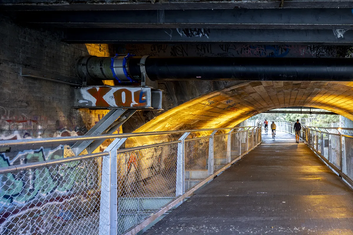
The Parramatta Road underpass carries the GreenWay beneath one of Sydney’s busiest historic corridors, maintaining continuity of movement while preserving and revealing significant heritage fabric. The path alignment is defined by the existing overpass structure, allowing the walkway to be suspended from and coexist with it, thereby reinforcing the layered history of transport across the corridor.
As the path passes below the carriageway, users encounter the site’s rich cultural and industrial heritage. Exposed sandstone headwalls frame the tunnel portals, expressing early construction techniques characteristic of colonial infrastructure. Beneath the overpass, the remnant Battle Bridge, listed on the New South Wales Heritage Register, is carefully conserved and celebrated. Its original stone arches, once forming a key crossing along the Parramatta route, are revealed and enhanced through feature lighting, creating a focal point that interprets the site’s role as a historic connection between Sydney and Parramatta.
These elements are both protected and made legible, positioning the GreenWay as an open-air narrative of the area’s evolution from Aboriginal Country to colonial route and industrial corridor. New interventions, including stairs on the southern side of Parramatta Road, are sensitively integrated to improve access while minimising impacts on existing infrastructure.
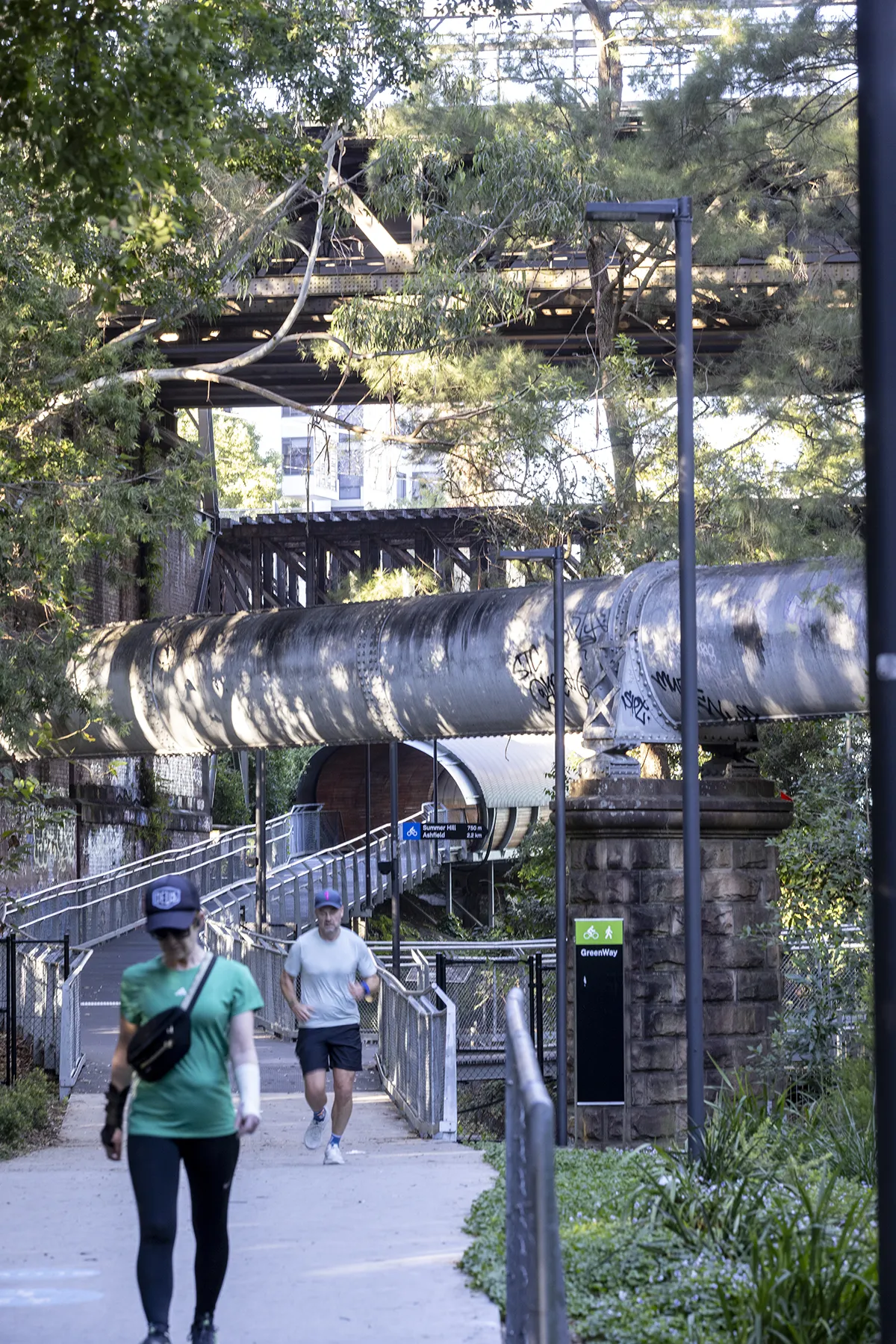
The Longport Tunnel continues this approach. Emerging from the tunnel, users enter a landscape shaped by historic infrastructure, adjacent to the 19th-century Hawthorne Canal and beneath the heritage Whipple Truss bridge sections. Nearby, the heritage-listed cast iron sewer pipeline at Gadigal Reserve spans the canal. Built in the 1890s, it remains a prominent reminder of early sewerage systems and the industrialisation of the Inner West.
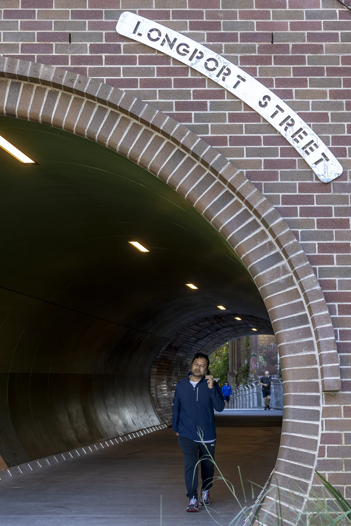
A timber-clad bat screen and angled steel portal introduce contemporary elements that respond to environmental needs while referencing the corridor’s industrial character. Together, these features establish the GreenWay as a living heritage corridor that preserves, reveals and interprets its layered past.
Wayfinding & Interpretation Strategy
ASPECT Studios developed a comprehensive Wayfinding & Interpretation Strategy, establishing updated guidelines across the GreenWay and surrounding precincts. Aligned with the Council’s refreshed brand identity, the signage suite incorporates bespoke mapping that highlights key user information, including accessibility, dog regulations, and transport connections.
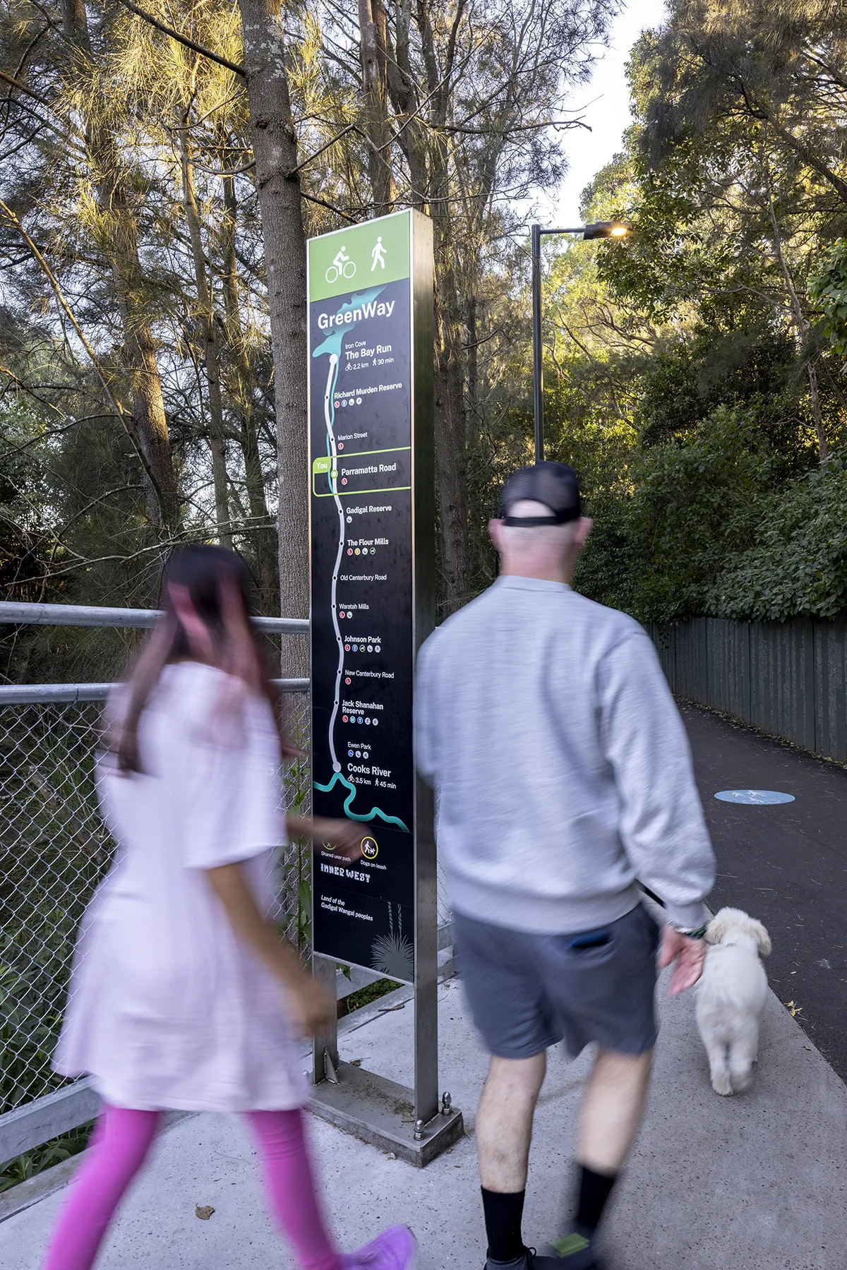
As a key walking and cycling corridor, the GreenWay required signage responses carefully tailored to its linear geography and informed by community feedback. A custom-designed linear mapping system was introduced to support intuitive navigation and create a cohesive user experience along the trail.
Our team also delivered an interpretive signage strategy, culminating in a bespoke suite of interpretive signage supporting the Council’s artwork trail. Integrated QR codes enable an adaptable digital layer that supports the trail’s ongoing evolution while enriching the corridor’s cultural and experiential qualities.
The GreenWay: Iron Cove to Cooks River
Traditional Custodians: Gadigal and Wangal peoples
Client: Inner West Council
Design Team:
Landscape Architect: ASPECT Studios
Wayfinding and Interpretation: ASPECT Studios
Project Lead and Head Contractor: Gartner Rose
Engineers: TTW
Geotechnical Engineers: JK Geotechnics
GreenWay Public Artists:
Birds of a Feather – Carla Gottgens
Sedimentary Earth Core – Benjamin Muir
Connected Histories – James Gulliver Hancock
Dance of the Ghost Fungus – Floria Tosca
Hourglass Tree – Mark O’Ryan
Goods Stuff – James Voller
Photography: Brett Boardman (unless otherwise captioned)