
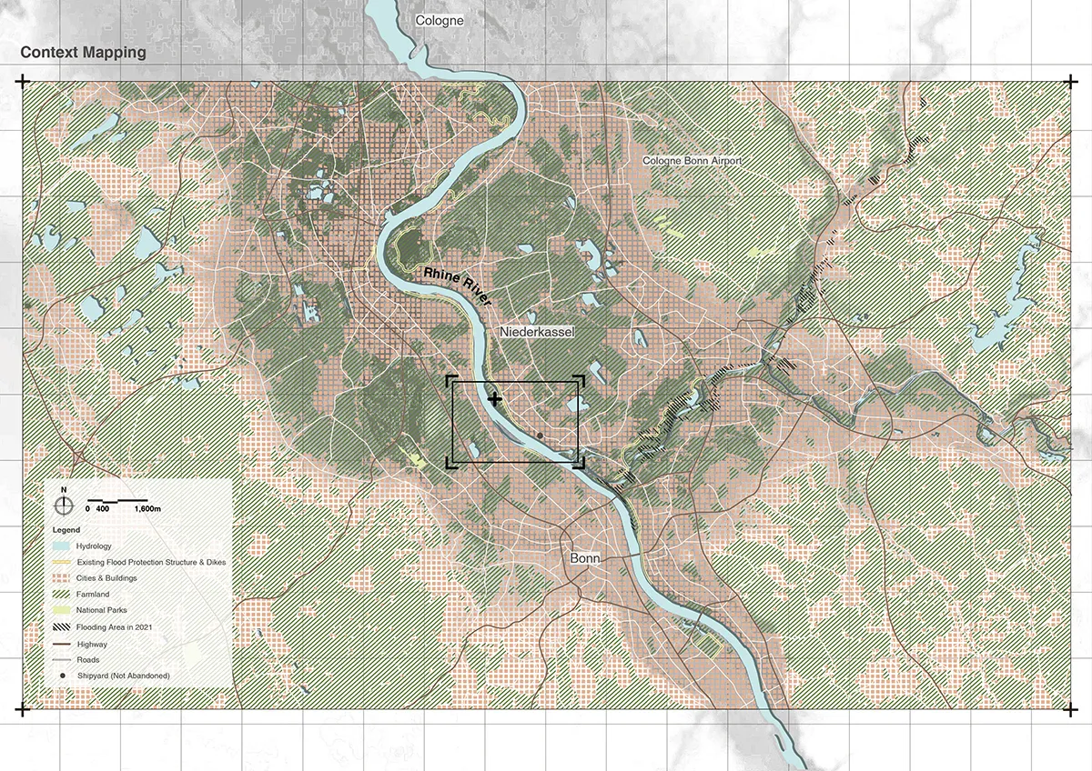
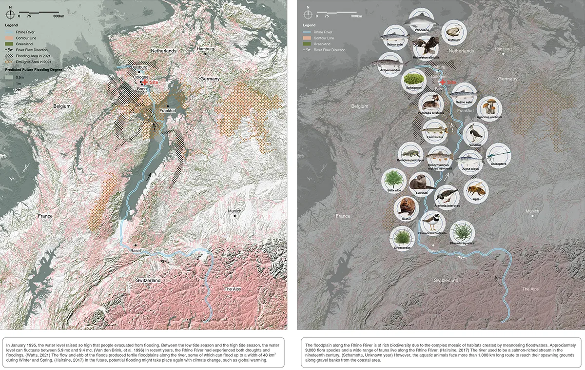
Spongy Connection Between Land and River explores how landscape architecture can transform a vulnerable industrial river edge into a resilient, productive and publicly accessible landscape. Located along the Rhine in Niederkassel, between Cologne and Bonn, Germany, the project responds to the increasing pressure of flooding, ecological fragmentation and the separation between urban development and river ecosystems.
Rather than treating flooding solely as a threat to be controlled, the proposal considers water as an active landscape process. The design introduces a “spongy” river-edge system capable of absorbing, retaining, filtering and gradually releasing water while creating a mosaic of habitats that can adapt to changing hydrological conditions. Flooding becomes not simply a constraint, but a productive force that shapes the character and seasonal transformation of the landscape.
The existing industrial and shipyard context provides an important starting point. Instead of erasing this infrastructure, the project works with the existing spatial structure and gradually introduces ecological systems into the fragmented river edge. A sequence of wetland, riparian and terrestrial habitats creates a gradient between river and land, strengthening ecological connectivity while allowing the landscape to accommodate different levels of inundation.
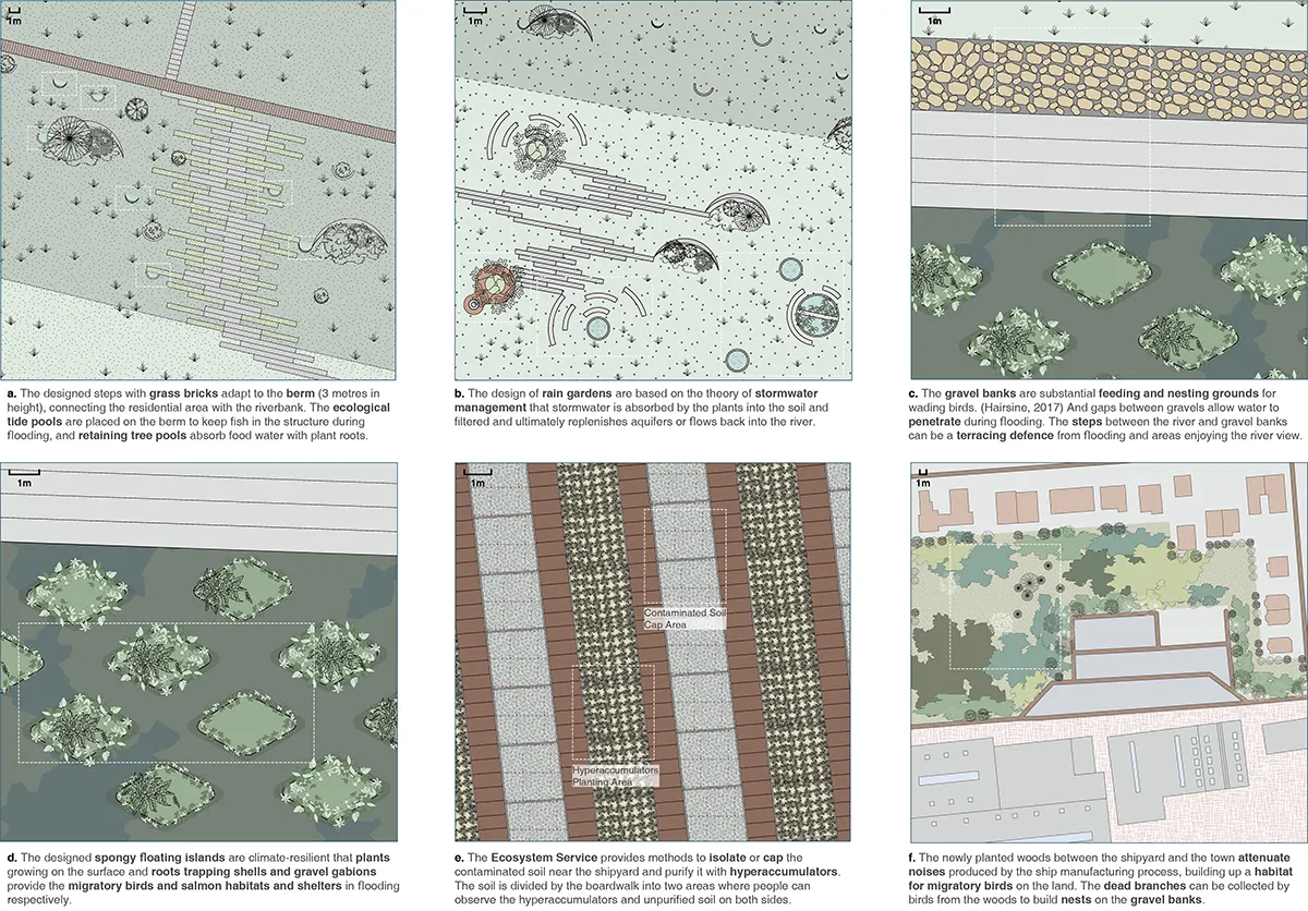
Water management is therefore integrated with habitat creation. Depressions, wetlands, and planted areas provide opportunities for water retention and infiltration, while changes in topography create distinct ecological niches. These interconnected landscape systems form a resilient spatial framework that responds to fluctuating water levels and supports greater biodiversity.
Public access is carefully integrated within this ecological structure. Paths, platforms and elevated routes allow people to move through the landscape without interrupting its hydrological processes. Rather than creating a conventional riverside park separated from ecological functions, the proposal allows public experience and environmental processes to coexist. Visitors encounter changing water levels, vegetation communities and habitats as part of an evolving landscape.
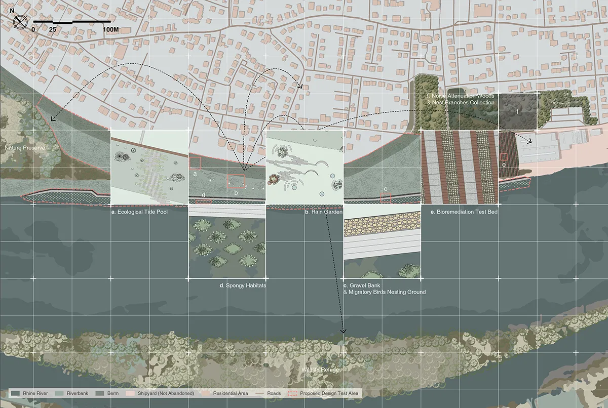
Spongy Riverbank also proposes the riverbank as a place for environmental learning. Viewing points and moments of interaction enable visitors to understand the relationships among water, soil, vegetation, and seasonal change. The landscape consequently operates at multiple scales: as flood infrastructure, an ecological corridor, a public realm, and an educational environment.
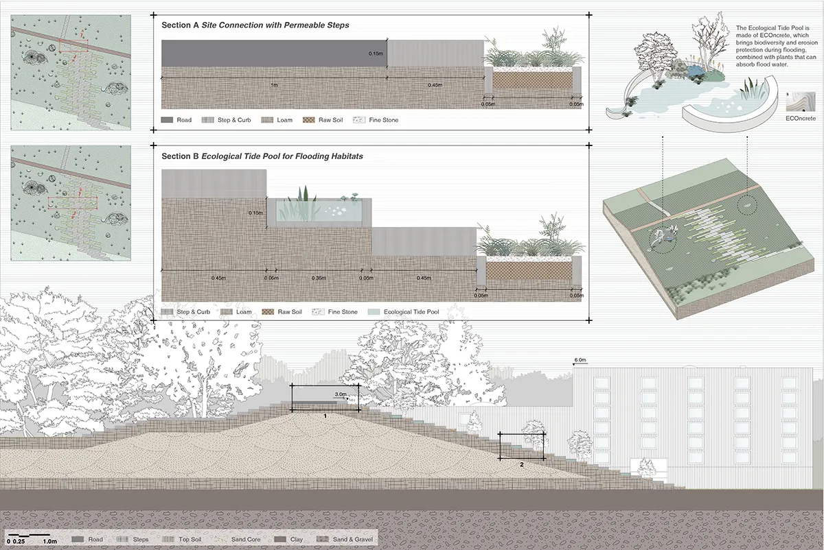
At the broader scale, the proposal reconnects fragmented habitats along the river and establishes a stronger relationship between the Rhine and its surrounding landscape. It suggests that flood-resilient design can move beyond defensive infrastructure towards a more adaptive approach, in which ecological restoration, climate resilience and public space are considered as interconnected systems.
Spongy Connection Between Land and River ultimately asks how a landscape can live with water rather than simply resist it. Through the integration of hydrological processes, habitat creation, and public access, the project proposes a river edge that is not fixed but continuously adapts to environmental change.
Technical Information
The proposal develops a flood-resilient landscape system by manipulating topography, planting, and water movement. A series of depressions, wetland zones and riparian habitats creates a gradient between the Rhine and higher terrestrial ground, allowing the landscape to accommodate different degrees and durations of inundation.
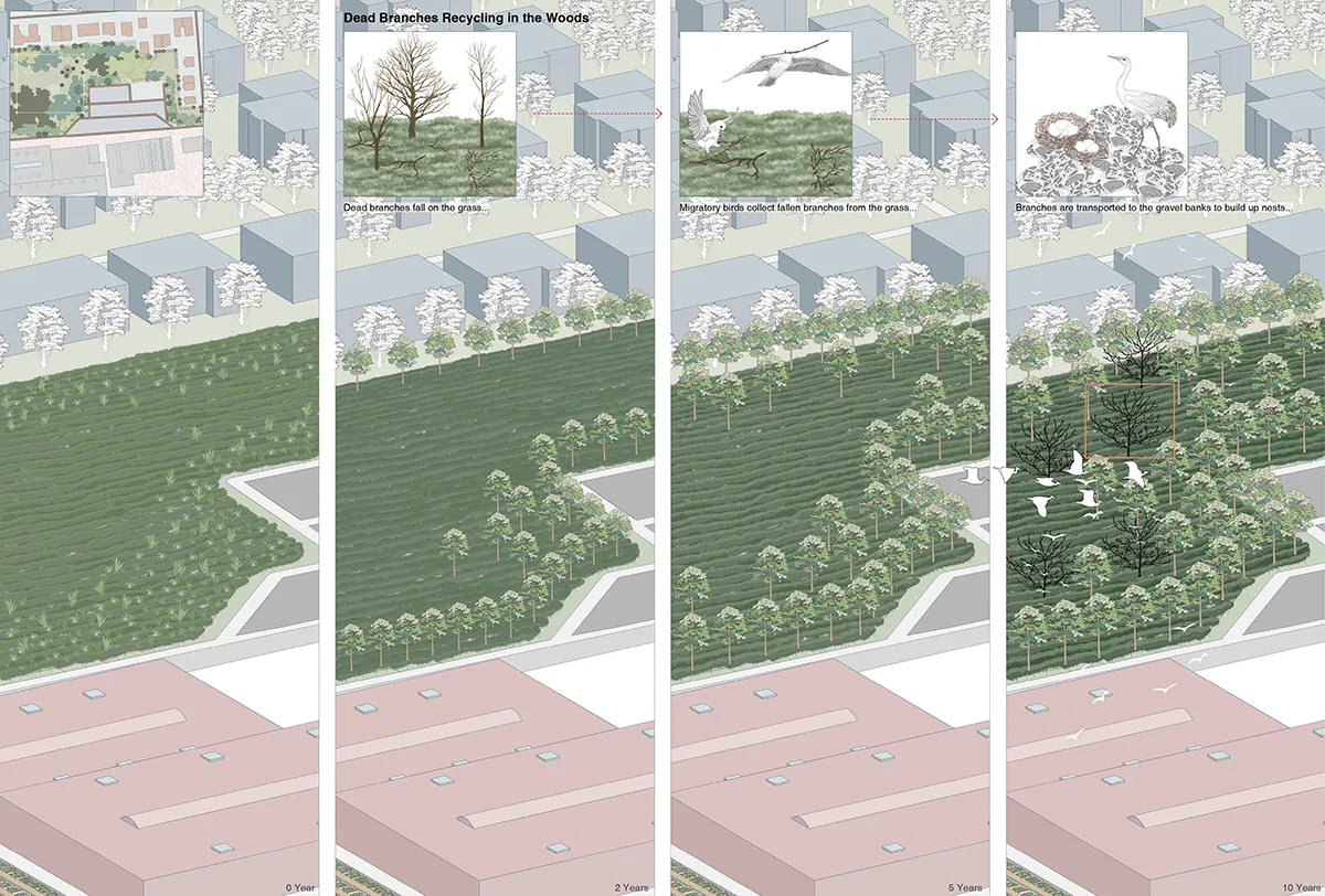
The “spongy” system slows and retains surface water while supporting infiltration and ecological processes. Lower areas are designed to tolerate periodic flooding, while transitional planting communities occupy intermediate elevations. More stable terrestrial habitats are positioned on higher ground, creating a sequence of ecological conditions across the site.
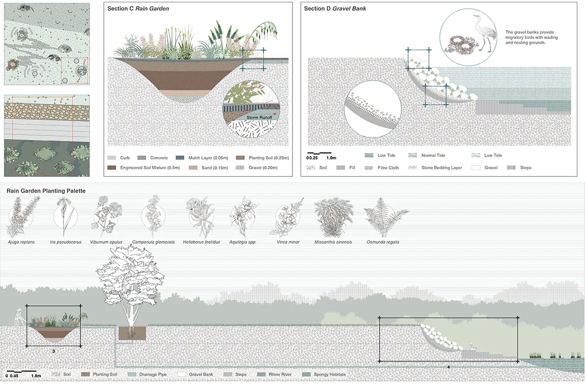
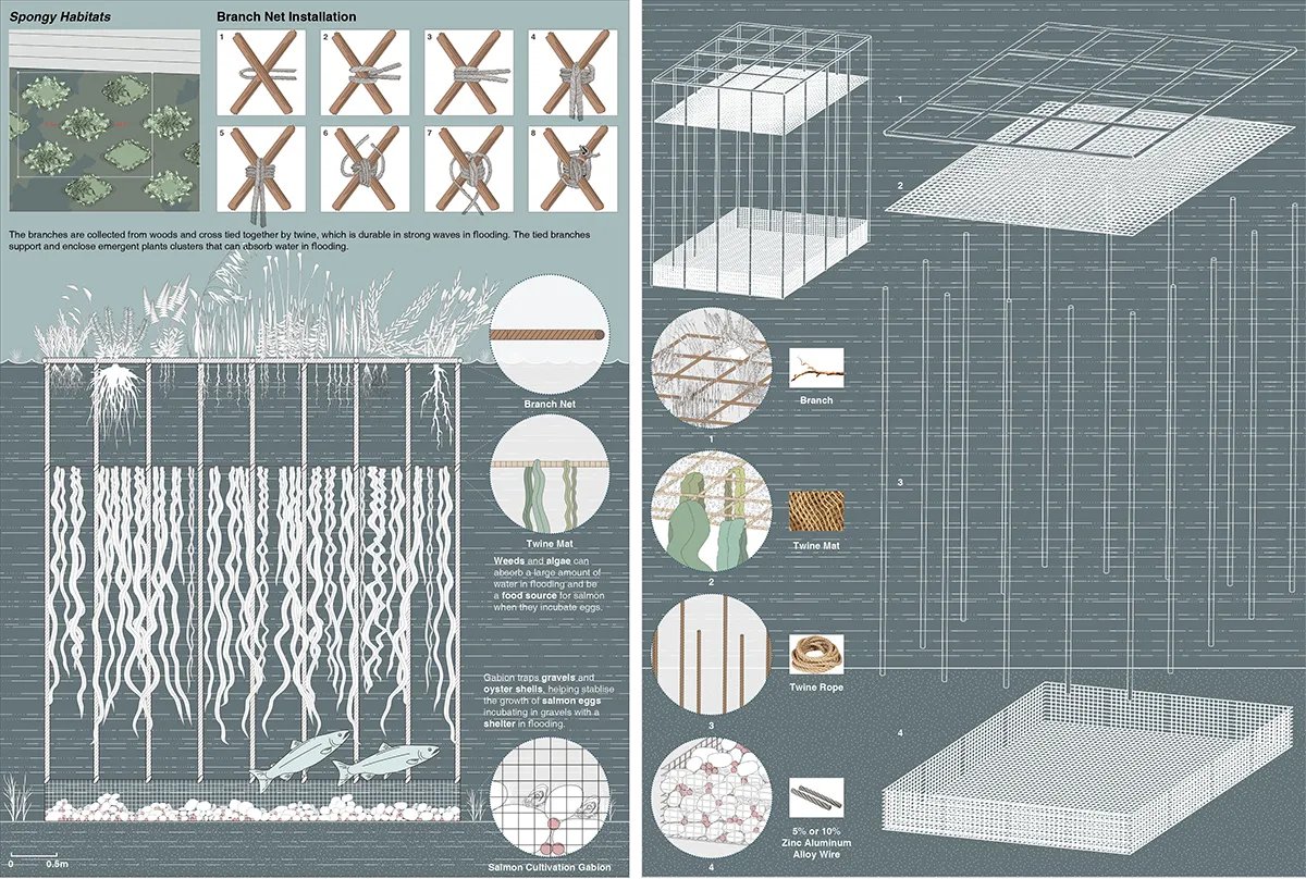
Existing industrial structures and spatial traces are retained where appropriate and incorporated into the new landscape framework. Rather than replacing the existing site entirely, the intervention uses ecological succession and strategic planting to progressively reconnect fragmented habitats.
Public circulation is organised through a combination of ground-level paths and elevated routes. These provide access while reducing disturbance to wetland and habitat areas during periods of high water. Platforms and viewing points create opportunities for environmental observation and learning.
The planting strategy combines wetland, riparian and terrestrial species to establish diverse habitat conditions and improve ecological connectivity. Seasonal variation is considered an integral part of the landscape character, allowing changing water levels and vegetation communities to make environmental processes visible.
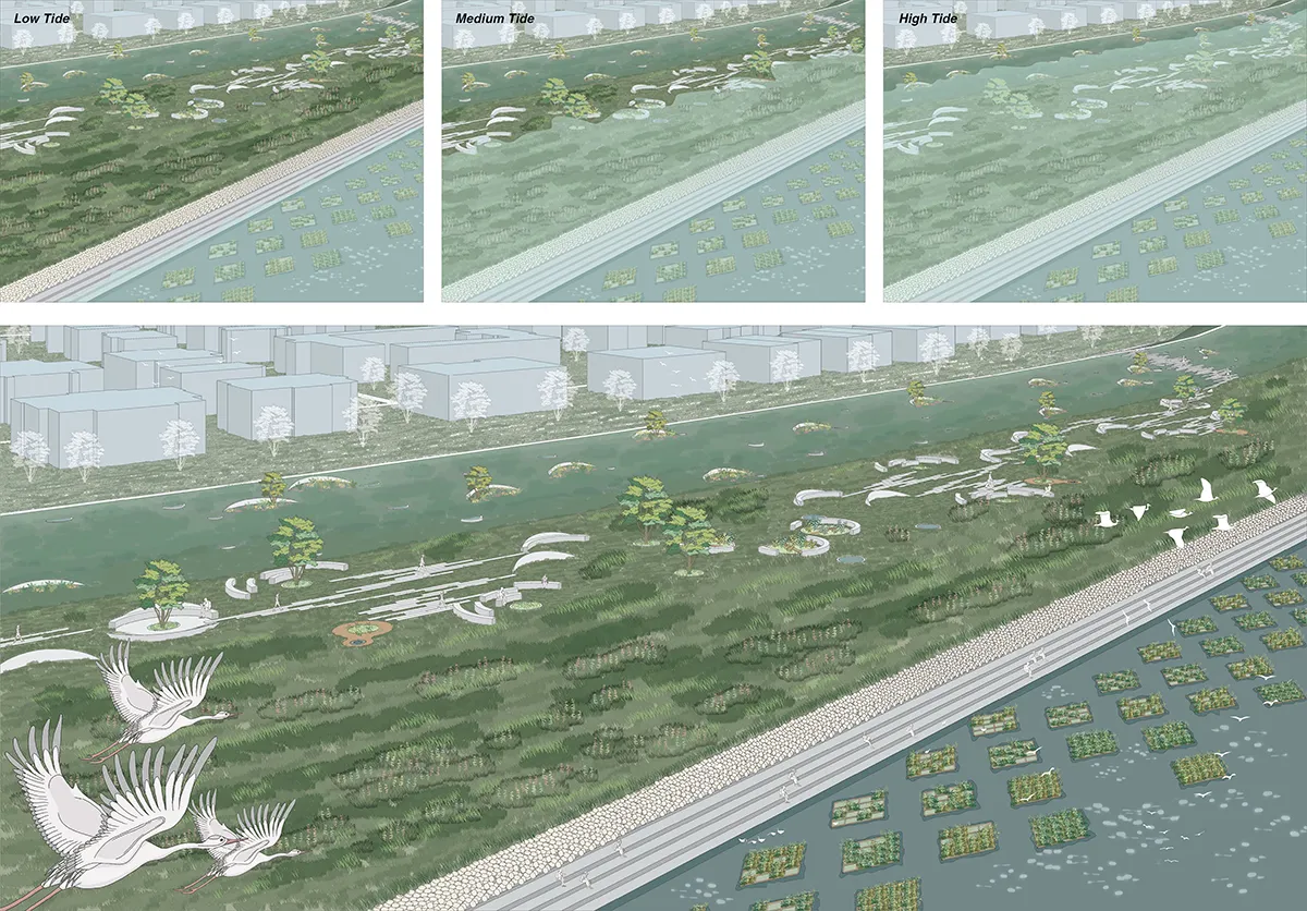
Together, these interventions create a multifunctional river-edge landscape in which flood management, ecological restoration and public access operate as a connected system.
Spongy Riverbank: Flood-Resilient Landscape in Niederkassel
Location: Niederkassel, Germany
Designer: Fengyi Wu
Image Credit: Fengyi Wu
Text Credit: Fengyi Wu