Winner of an Honourable Mention Awards in the 2025 WLA Awards – Concept Analysis & Planning
Context for an Ecological Corridor in a Car-Centric City
The metropolis of Shenzhen, located on the northern edge of Shenzhen Bay on the eastern side of the Pearl River estuary, is an essential cultural and economic link between Hong Kong and Mainland China. Since 1980, Shenzhen has been one of the world’s fastest-growing cities. In its former, more natural state, Shenzhen was defined by a contiguous topographic and ecological gradient rising from the resource-rich Pearl River to the mountainous region along the city’s northern boundary. The surface continuity from low to high as part of the larger regional morphology resulted in a series of robust transitional ecosystems moving from Mountain to Bay: a multi-layered, overlapping, resilient, and diverse ecological network.
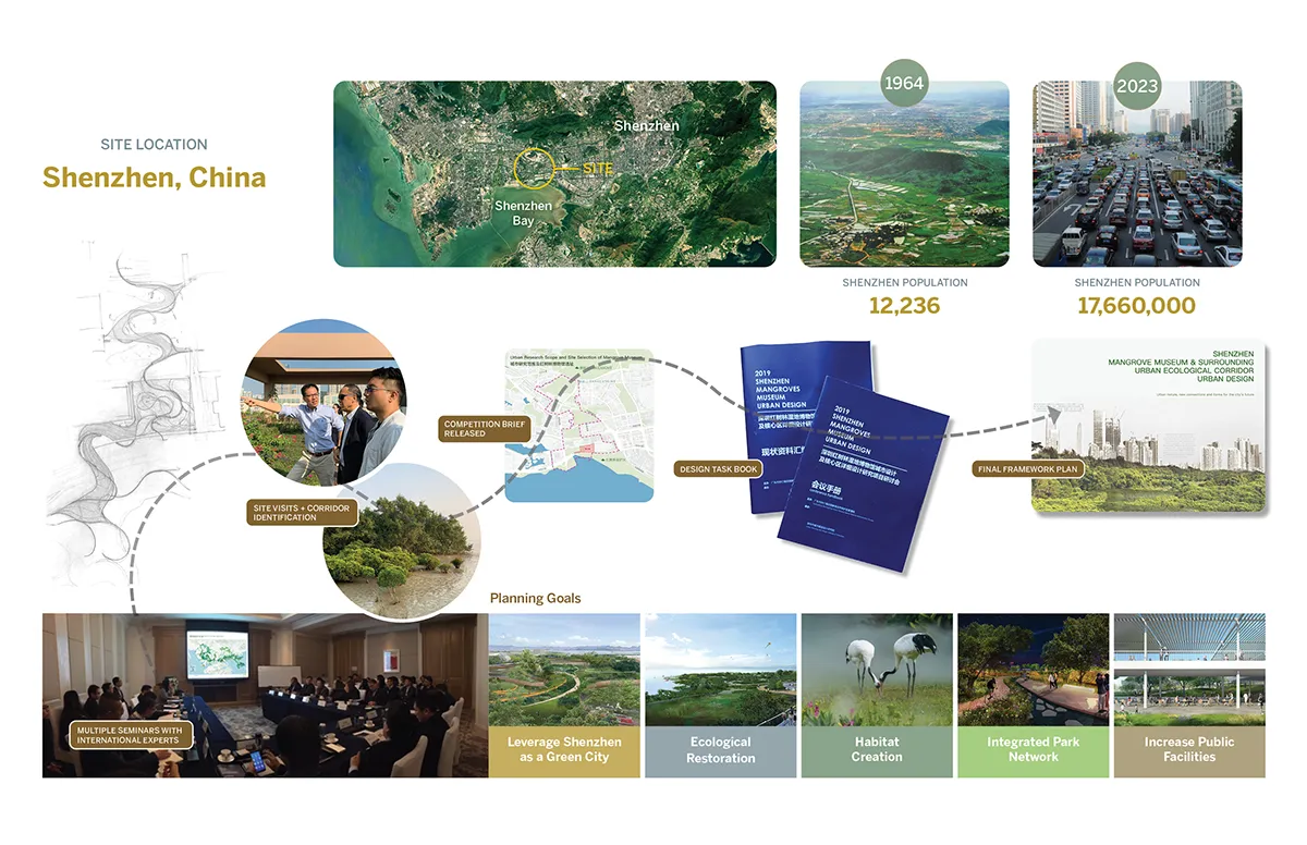
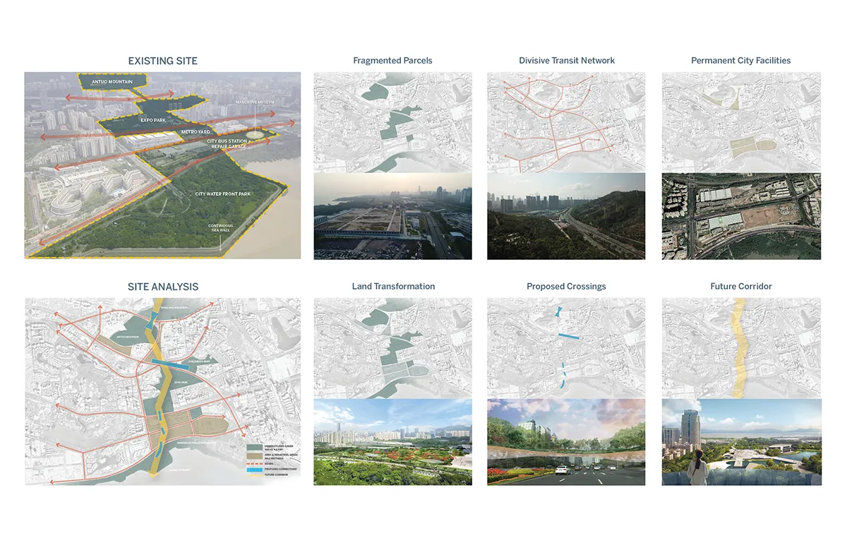
In response to rapid urbanization, 20th-century planning efforts primarily addressed transportation needs. This focus led to the development of thoroughfares, highways, and rail lines that connected the city’s neighborhoods. These roadways facilitated urban connectivity but also fragmented the once-vibrant, interconnected ecology. As a result, the remaining ecological patches have become disconnected and isolated, struggling to survive the harmful aspects of urbanization.
Creating a Scalable Framework
Mountain to Bay is a framework plan that pursues to mitigate the negative impacts of past urbanisation strategies and does so by establishing an environmentally principled overlay that seeks to reunify ecological systems.
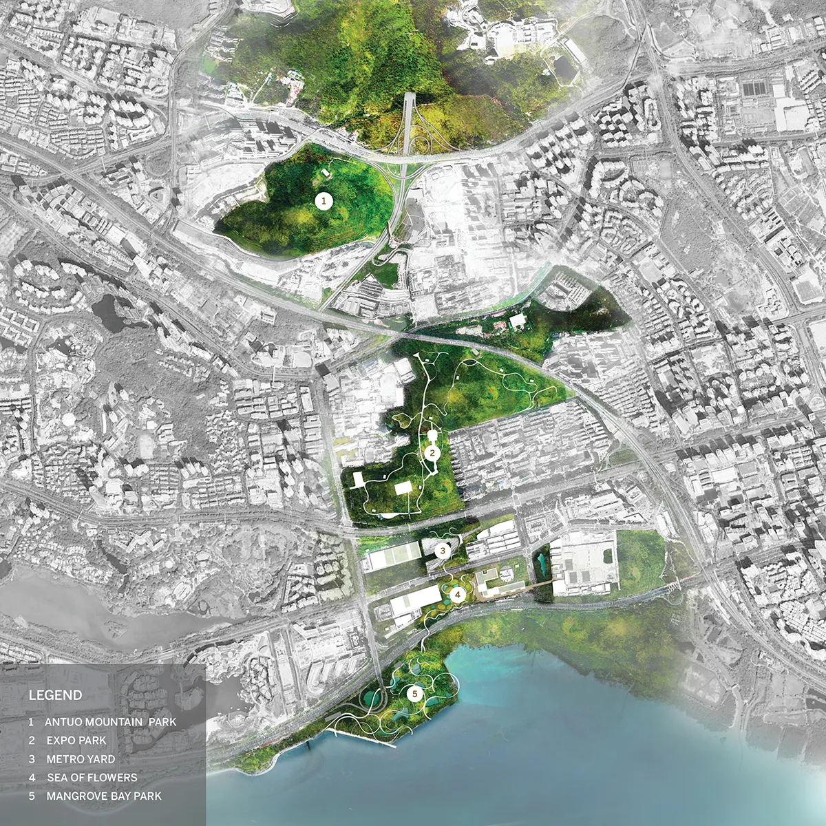
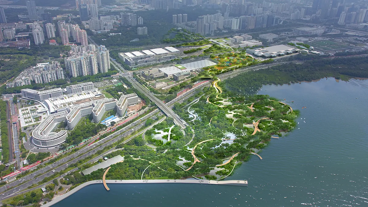
Therefore, the primary goal of the project is twofold: first, to identify the various remnant eco-zones between Antou Mountain and Shenzhen Bay, and second, to develop a precise methodology for overlapping and combining these disparate zones into a cohesive, dynamic whole. Ecology plays a central role, guiding the flow of movement from the mountains, through the urban landscape, and down to the Bay.
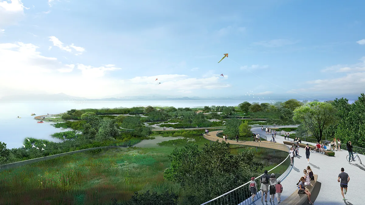
A Vertical Journey Across Five Biomes
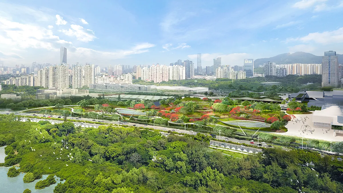
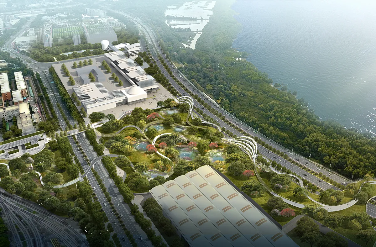
The first zone, Mangrove Park, deals with eliminating invasive species and re-introducing mangroves to restore the ecosystems damaged by industrialization and to create an ecological storm buffer. The second zone is the Sea of Flowers, a landscape built on a platform above a massive bus station and repair facility, creating hills and valleys for local flora and fauna to emerge. The Metro Yard is also a new landscape built on a platform that extends over an existing railyard, which will develop into an urban forest with nesting walls for migrating birds. The fourth zone is the Expo Park, a restored landscape showcasing traditional Chinese gardens. The corridor then arrives at the mountain foothills, the planned site of a new Cultural Center. The final land bridge extends from the foothills up to Antuo Mountain Park.
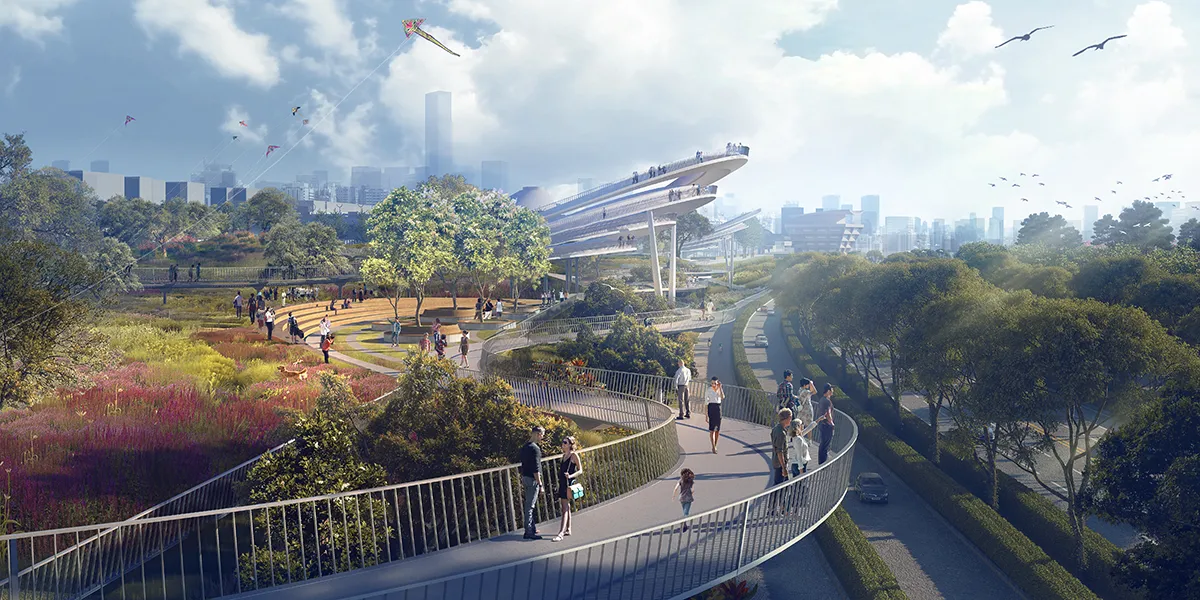
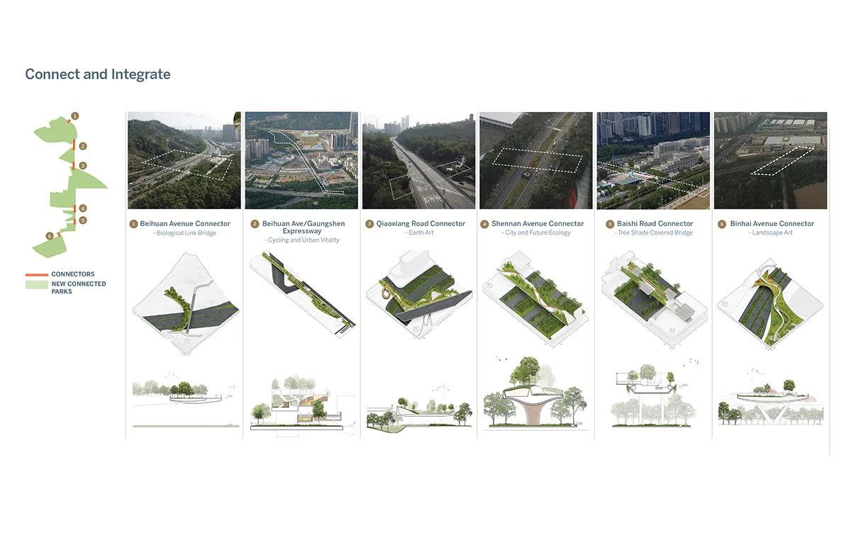
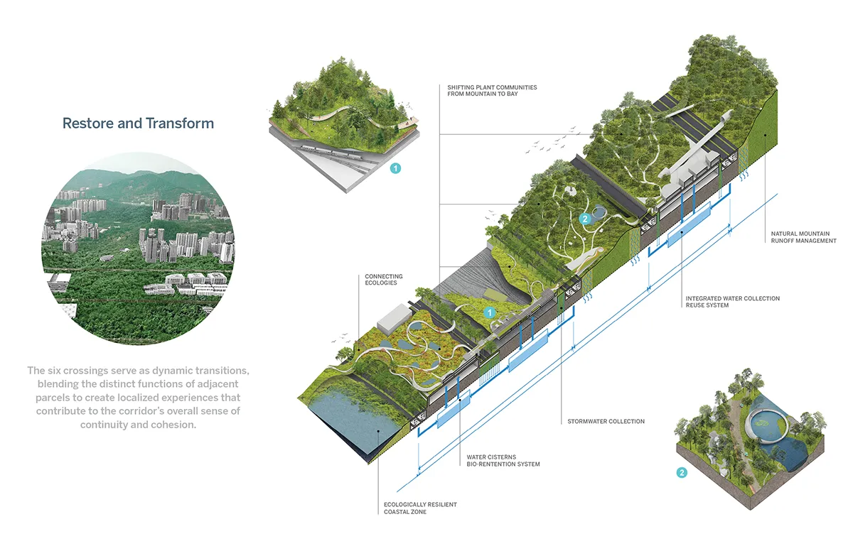
Following the recommendations developed in the work on patch dynamics by acclaimed landscape ecologist Richard Forman, the design team created linkages between zones to connect and enhance continuity within landscape transition zones. These connectors were established to provide elongated ecological experiences and greater biodiversity. Adjacent zones overlap so that proper thickening of local, adaptive ecologies over time ensures a more sturdy and resilient transition across the entire transect. The transitional zones between ecosystems, interpreted as vegetated, earthen bridges spanning the highways, foster more beneficial physical connections, enabling the passage of small mammals and people alike. These connections contribute to the continuity of the tree canopy, further enhancing habitat for local and migratory birds.
From Mountain to Bay: A New Ecological Corridor for the Metropolis of Shenzhen
Location: Shenzhen, China
Design Team
Landworks Studio, Inc.
Principal in Charge: Michael Blier
Design Team: Andrea Varutti, Jenny Chiu, Cissy Yang, Xianzi Lai, Yue Wu, Keting Zhou
Adele Santos and Associates
Architects in Charge: Adele Santos, Yao Zhang
Design Team: Yi Liu, Boliang Du, Giovanni Bellotti, Taeseop Shin. Yang Huang
The Urban Planning & Design Institute of Shenzhen (UPDIS)
Planners in Charge: Wei Chen (Deputy Director of Urban Design Department 3, UPDIS), Huang Weidong (Deputy President, UPDIS)
Design Team: Kong Xiangwei, Yuan Tian, Shen Rui, Chen Jiapeng
Seminar Participants
Sun Yimin, School of Architecture, South China University of Technology\Executive Vice President, Professor; Zhang Yuxing, UABB Academic Committee\Director; Li Baozhang, L&A Design\Founding Principal, Chairman & Principal ; Tam Fung yee Nora, Department Of Chemistry, City University of Hong Kong / Emeritus Professor; Liu Xiaodu, URBANUS Architecture & Design\Founding Partner, Chief Architect ; Wang Weiren, School of Architecture, the University of Hong Kong\ Professor; Zhu Tao, School of Architecture, the University of Hong Kong\ Professor; Wu Wenyuan, Shenzhen Apecland Design Co.,Ltd\ General Manager; Yang Xiaochun, School of Architecture & Urban Planning, Shenzhen University\Director; Rafi Segal, MIT School of Architecture and Planning, Associate Professor of Architecture and Urbanism; Ron Henderson, FASLA, Professor and Director of the Master of Landscape Architecture + Urbanism Program at Illinois Institute of Technology (IIT); Ole Bouman, historian, writer, curator in urbanism design and architecture, Founding director of Design Society, Shenzhen
Client Group
Guangdong Neilingding Futian National Nature Reserve Management Bureau, Planning and, Natural Resource Bureau of Shenzhen Municipality, Urban Management Bureau of Shenzhen Municipality, Shenzhen Municipal People’s Government
Image Credits: Landworks Studio, Inc.; Adele Santos and Associates;