
Article by Sandy Rompotiyoke, Shabnam Lotfian, Resham Mehta – Arup
As landscape practitioners, we are entering a more consequential digital phase; the opportunity is not simply to accelerate workflows, but to expand the profession’s ability to make better ecological decisions, strengthen relationships with place and steward living systems over time. Used well, digital tools can help us understand where intervention will matter most, who benefits, what risks remain and how today’s decisions may perform across generations. This also changes the skill set required of landscape architects: moving beyond software proficiency towards the critical judgement needed to combine ecological literacy, data fluency and long-term stewardship.
From Digital Efficiency to Landscape Intelligence
Geospatial analysis, environmental modelling, artificial intelligence, digital twins and shared information environments are becoming integral to landscape design, planning and delivery. They enhance analysis and coordination, but their greater contribution lies in making relationships, trade-offs, and long-term consequences legible before critical decisions become fixed.
Landscape architects have long recognised the importance of designing with nature. What remains important is demonstrating the scale, distribution and durability of those benefits. How much risk is reduced, who benefits, what ecological functions are strengthened, and whether predicted outcomes persist after construction? Digital practice can connect baseline evidence, design decisions, delivery information, and post-occupancy monitoring, showing how performance changes throughout a project’s life cycle.
This is where digital tools need to move beyond efficiency: using evidence not only to predict performance, but to guide how landscapes are cared for and adapted as conditions change. Regenerative design is not a higher-performing version of conventional mitigation. The critical question is whether an intervention increases a place’s capacity to renew ecological processes, support people in shaping and caring for their environment, and respond to change. In this context, landscape intelligence is not simply computational capacity. It is the ability to integrate ecological evidence, spatial understanding, local knowledge, and long-term responsibility into a single decision-making process.
Digital tools should help teams understand landscapes across scales, identify leverage points, test the distribution of benefits and risks, connect short-term interventions to longer-term trajectories, and make uncertainty explicit. For practitioners, this requires a shift from treating digital analysis as a specialist output to using it as a shared language for questioning assumptions, testing alternatives and learning collectively across a range of integrated disciplines.
Integrating Data with Place-Based Knowledge
Across the world, designers are being asked to respond to increasingly complex environmental risks, yet many decisions affecting outdoor comfort and resilience are still made without clearly measurable outcomes. Digital decision-support tools can make environmental consequences clearer while there is still scope to influence planning, design and investment priorities. In regions such as Queensland, where high ultraviolet exposure poses a significant public health concern, this means treating shade not as an amenity or incidental benefit of planting but as an essential factor in healthier public environments.
CanopyCast Pro demonstrates how this translation from research [1] to decision-making can work. Developed by Arup for Queensland Health, the free web application converts research on tree canopy, shade and UV exposure into actionable insight for landscape design and planning. Users can compare existing and proposed conditions, explore different tree forms, sizes and spacing, test performance at different times of day and year, and examine the combined contribution of trees, buildings, awnings and shade structures. Results can also be exported in GIS- and CAD-compatible formats for mapping and reporting.
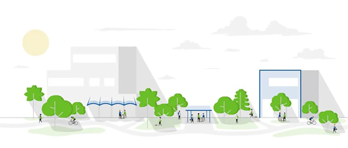
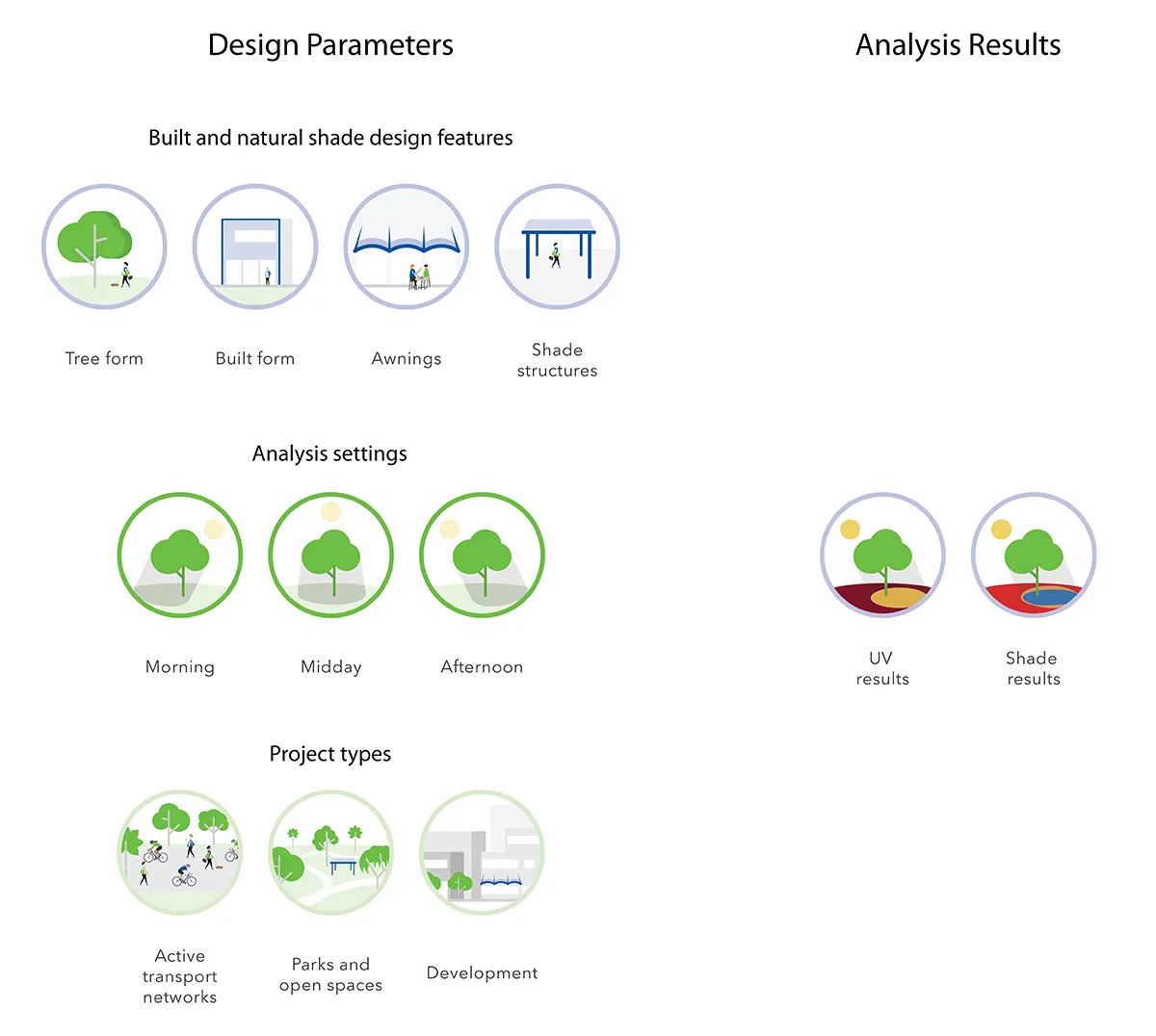
The significance of tools such as CanopyCast Pro is not simply technical efficiency. It is their potential to change what clients, designers and communities can expect from design decisions. The consequences of removing mature trees, changing planting arrangements or providing insufficient shade can be made more explicit and measurable. In one urban pedestrian-network study, mature trees provided approximately 36 per cent shade coverage, while modelling their replacement with smaller or juvenile trees reduced coverage to around 15 per cent. The comparison made the long-term value of the established canopy explicit, providing a robust basis for discussions about retention, investment, and the integration of natural and built shade.
However, quantitative analysis is only one form of knowledge. A model can indicate where shade falls, but on its own it cannot define how space is used, what a tree means to a community, or which ecological relationships are locally significant. Place-based intelligence emerges when spatial data and modelling are combined with lived experience, maintenance knowledge, cultural understanding and field observation. This is where transdisciplinary practice becomes essential. Different forms of expertise do more than contribute separate inputs. They jointly frame the problem, interpret the findings and determine appropriate action. If tools such as CanopyCast Pro show how evidence can strengthen early design decisions, major infrastructure projects demonstrate why that evidence must also survive the pressures of coordination and delivery.
Safeguarding Design Intent through Delivery
While digital tools can bring environmental intelligence into early design decisions, their value also depends on how effectively those decisions are carried through coordination and delivery. On major infrastructure projects, shared digital environments allow the project team to resolve competing requirements while keeping the intent of the landscape and public realm clearly represented.
Initiated in 2019, the Brisbane Metro project brought together more than 50 disciplines and subconsultants within a fully coordinated BIM environment implemented in line with ISO 19650, with Arup pioneering this approach across the project. This allowed landscape works, including trees, planting, shade and other public-realm elements, to be resolved within a clash-free federated model under highly constrained infrastructure conditions. Three-dimensional information enabled landscape requirements to be discussed through the same spatial information used for engineering decisions.

This strengthened the landscape architect’s ability to advocate for outcomes that might otherwise have been lost through clearance assumptions or late-stage coordination. At the Cultural Centre, digital coordination supported agreement to plant approximately 350 millimetres from an existing asset, rather than applying a three-to-four-metre separation. This contributed to the objective of increasing tree-canopy cover by 60 per cent. Digital assessments of shade, urban heat, and dwell time also informed discussions of the planting strategy, while the Heritage Management Plan guided interventions regarding protected views, the historic Gibson Grid, and the material character of the precinct.
The real benefit lies not only in the coordinated model itself, but the stronger voice it gives landscape architects throughout the project lifecycle. When landscape information carries the same precision and authority as engineering information, public-realm ambitions become legible, negotiable and more likely to survive into delivery.
Stewarding Living Systems
The most important digital shift may occur only after practical completion. Landscapes need to be observed over seasons and years, with management adapted as conditions change. Post-occupancy monitoring should not be viewed as a final audit, but as the mechanism through which design becomes long-term stewardship.
The Pasig River Rejuvenation Project in Manila illustrates this transition, where restoring and maintaining water quality became as important as the physical interventions. The Pasig River Plastic Waste Digital Twin supported the work by identifying pollution sources, mapping waste pathways and informing targeted action at source. Similar initiatives, including the Point Conception Environmental Digital Twin developed by The Nature Conservancy with Esri in California, and the European Biodiversity Digital Twin led by CSC-IT, show how data, sensors, artificial intelligence and predictive modelling can support environmental stewardship.
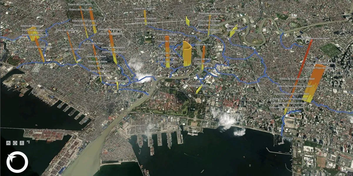
These platforms treat landscapes as dynamic systems whose condition and response can be monitored across seasons, uses and environmental pressures. Flood resilience, water quality, biodiversity recovery, habitat health, thermal comfort and carbon performance can be compared against design assumptions. Across Arup, Terrain Suite, Digital EIA, Biodiversity Net Gain digital services, digital ecology tools, and sensor-based monitoring frameworks help connect geospatial analytics, remote sensing, environmental modelling, and field data throughout the project lifecycle.
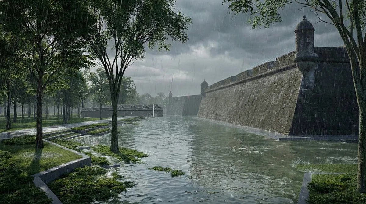
Image Credit: Asian Development Bank (ADB), Urban Resilience Trust Fund and UK International Development
What matters most is the feedback loop between design intent, observed performance and management action. Monitoring should not merely confirm whether a target was met. It should inform maintenance, trigger corrective action and generate transferable learning for future projects. This also demands care. More data does not automatically produce better stewardship. Teams need clear indicators, reliable baselines, proportionate monitoring, transparent governance and defined responsibility for responding to observed conditions. Without these, a digital twin risks becoming a sophisticated representation of decline rather than a mechanism for changing it.
Future Skills for Landscape Practitioners
Technology enables landscape architects to quantify outcomes, test alternatives, coordinate delivery and monitor performance with better clarity. Its greater contribution, however, is to connect design with stewardship. As a result, the profession increasingly requires practitioners who are as comfortable interpreting data, observation and analysis as they are facilitating collaboration and designing physical space. By translating ecological knowledge, spatial thinking and community priorities into a shared basis for decisions, landscape architects can help shape how policy, planning and investment contribute to healthier, more resilient and more biodiverse environments.
There are still important limits to acknowledge. Environmental datasets are uneven in quality and coverage. Models can obscure assumptions or create false precision. Digital capability is unevenly distributed across organisations and geographic regions. Interoperability remains difficult, while data ownership, long-term maintenance and the environmental cost of digital infrastructure require greater scrutiny. Measurement can also privilege what is easiest to quantify, marginalising cultural meaning, tacit knowledge and slow ecological change. The profession therefore needs methods that link project-level metrics to wider regional outcomes, while making assumptions, uncertainty and measurement limits explicit.
Digital practice is also changing how landscape architects learn. Future practitioners will need to move confidently between ecological understanding, spatial design, data interpretation and collaborative decision-making. The most valuable skill may not be mastering specialist software, but the ability to synthesise different forms of knowledge into coherent, place-based responses. Digital practice proves its worth when it helps landscapes function better ecologically, deepens people’s connection to place, and allows decisions to adapt as conditions and understanding evolve. Above all, human judgement, care and imagination remain indispensable. Ultimately, it should be judged by what it enables: better decisions, stronger relationships with place, and landscapes that can keep adapting long after the design team has moved on.
Article by Sandy Rompotiyoke, Shabnam Lotfian, Resham Mehta – Arup
Image Credits: Refer to captions
[1] Comparing the annualised dynamic shade characteristics of twenty-one tree canopies across twenty-six municipalities in a high ambient UV climate, Queensland – Australia” Nathan J. Downs, Louise Baldwin, Alfio V. Parisi, Harry J. Butler, Jennifer Vanos, Melanie Beckman