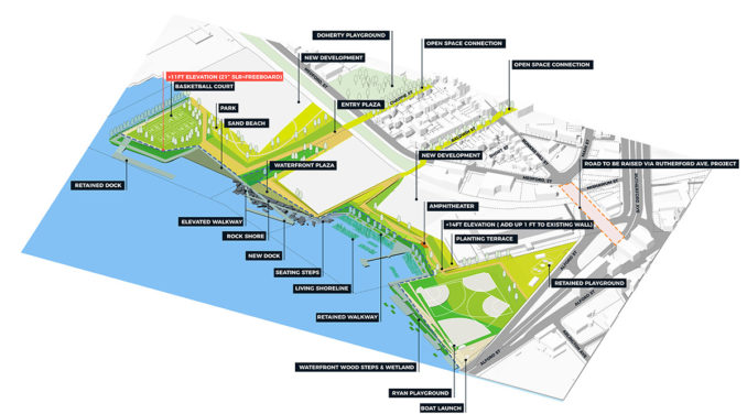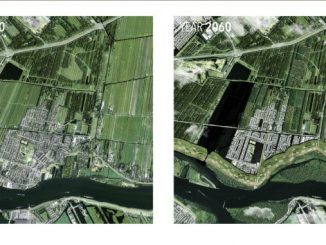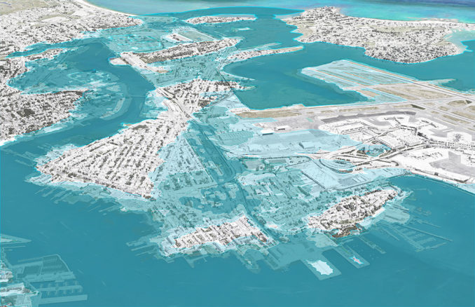
Coastal Resilience Solutions for East Boston and Charles-town outlines near- and long-term strategies to protect neighborhoods from flooding – in two of Boston’s most disadvantaged areas. It is the first neighborhood-specific application of the Climate Ready Boston framework, the City of Boston’s ongoing initiative to adapt to climate change.
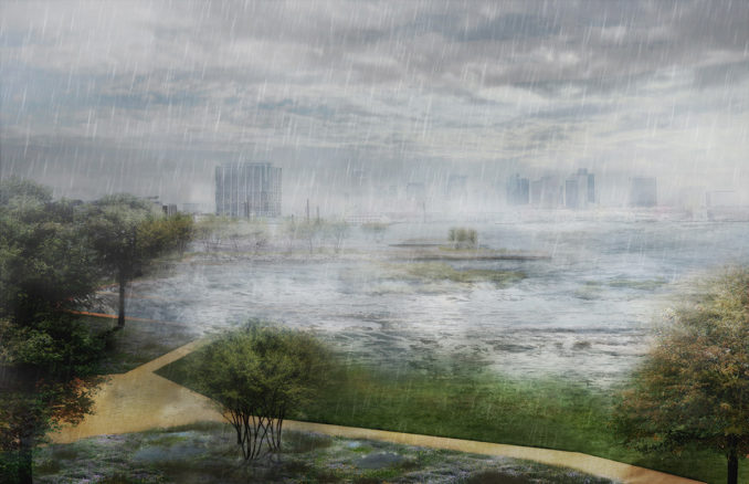
The Climate Resilience Solutions project is a direct response to recommendations in the Climate Ready Boston report (2016) that the City ‘prioritize and study the feasibility of district-scale flood protection’ and ‘develop local climate resilience plans in vulnerable areas to support district-scale climate adaptation’. The City of Boston chose to address these areas first because they are currently at risk from the 1% annual chance coastal flooding and have high concentrations of vulnerable residents and critical infrastructure.
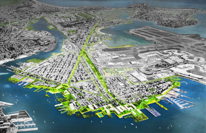
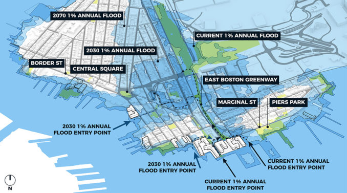
The design team, in coordination with partners at all levels of government, community members and the private sector, developed a resiliency strategy that included a set of evaluation criteria, recommendations for near-term and long-term actions, order-of-magnitude costs and an implementation roadmap to guide the City as it begins to move from planning, into implementation phases.
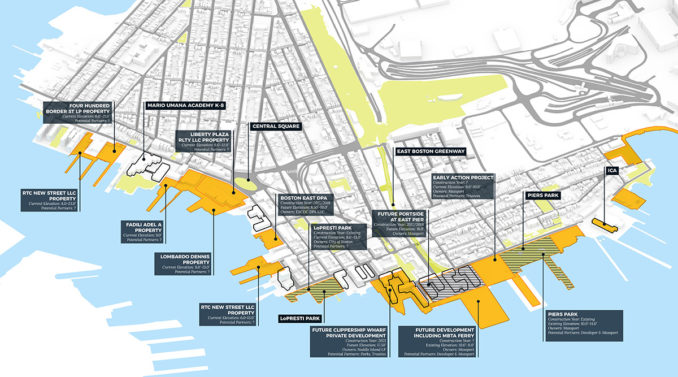
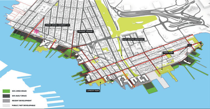
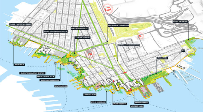
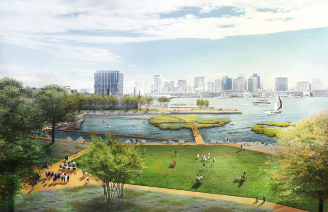
The resiliency strategy embraces layered flood control and integrated green infrastructure measures that mitigate the effect of climate change, and create social, environmental, and economic benefits and value to the people of East Boston and Charlestown and to all who share in the health of the city and the harbor. These measures include waterfront open spaces with strategic elevated areas at key points of entry for coastal flooding such as the Greenway in East Boston and at Schrafft’s Center in Charlestown. Additional measures include enhanced Harborwalks, improved connections to the waterfront, natural wetland buffers and ‘living shorelines,’ stepped hardscapes, temporary flood barriers, and increased planting of shade trees to combat higher temperatures. Together, these measures will provide flood protection, waterfront access, recreation, and mobility, and dramatically increase waterfront open space and public access to one of Boston’s greatest natural resources.
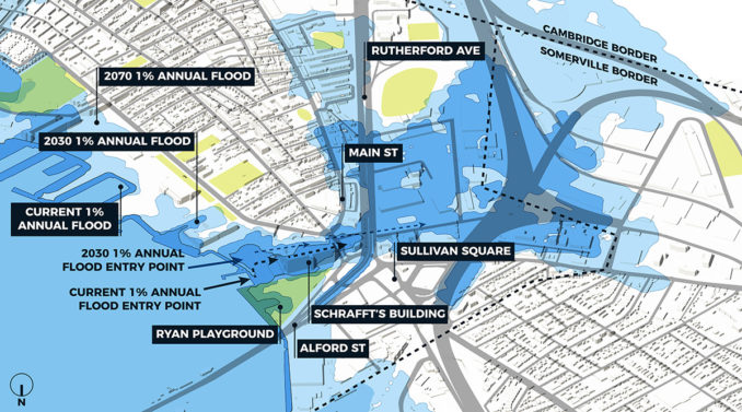
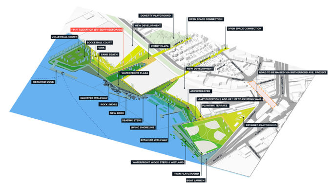
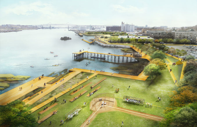
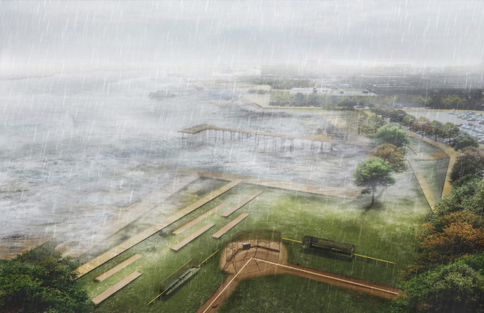
Together the measures outlined will provide flood protection, waterfront access, recreation, mobility and protect over 11,000 residents, at least 300 businesses, as well as critical highway and transit infrastructure.
Overall Project Credits
PROJECT TEAM (City of Boston)
Austin Blackmon, Chief of Environment, Energy and Open Space
Carl Spector, Commissioner of Environment
Alison Brizius, Director of Climate and Environmental Planning, Environment Department
Mia G. Mansfield, Climate Ready Boston Program Manager, Environment Department
Richard McGuinness, Deputy Director for Climate Change and Environmental Planning, BPDA
Chris Busch, Senior Waterfront Planner, BPDA
Lisa Berry Engler, Boston Harbor Regional Coordinator, MA Office of Coastal Zone Management
Bud Ris, Senior Advisor, Barr Foundation
CONSULTANT TEAM
Stoss Landscape Urbanism
Amy Whitesides, Project Co-Manager, Design and Engagement Lead
Chris Reed, Design Director and Principal Landscape Architect
Alex Marchinski, Landscape Designer
Difei Ma, Landscape Designer
Kleinfelder
Nasser Brahim, Project Manager and Technical Lead
Andre Martecchini, Principal Engineer
Robin Seidel, Designer
ONE Architecture
Matthijs Bouw, Principal Urban Designer and Architect
Travis Bunt, Senior Urban Planner
Dalia Munenzon, Urban Designer
Mat Staudt, Urban Designer
Woods Hole Group
Kirk Bosma, Senior Coastal Engineer and Flood Risk Modeler
ACKNOWLEDGEMENTS
STEERING COMMITTEE
Boston Environment Department, Boston Planning and Development Agency, Boston Parks and Recreation Department, Boston Public Works Department, Boston Transportation Department, Imagine Boston 2030, Mayor’s Office of Neighborhood Services, Mayor’s Office of Resilience and Racial Equity, Boston Water and Sewer Commission, MA Office of Coastal Zone Management, Massachusetts Department of Transportation, Massachusetts Port Authority, Massachusetts Bay Transit Authority, City of Cambridge, City of Somerville, Green Ribbon Commission, UMass Boston School of the Environment, Neighborhood of Affordable Housing;
STAKEHOLDER ENGAGEMENT COMMITTEES
»
Neighborhood of Affordable Housing, Green Ribbon Commission, Boston Harbor NOW, Harborkeepers, The John Flatley Company, East Boston Harborwalk Group, Greenway Council, Friends of the Charlestown Navy Yard,
Harbor View Neighborhood Association, Eagle Hill Neighborhood Association, Orient Heights Neighborhood Association, Jeffries Point Neighborhood Association
Images – As credited
Coastal Resilience Solutions for East Boston and Charles-town won a 2018 WLA Awards – Award of Excellence in the Conceptual Design category

