Australia is taking a strong and responsible commitment to climate change expecting to reduce carbon by 50% from 2005 to 2030. Therefore, renewable energy especially wind energy is in demand worldwide. Victoria, the second largest populated state in Australia, is in action aiming at carbon net zero in 2050. Although there are a number of wind farms in Victoria and it is controversial from stakeholders and local communities regarding their impact on local flora and fauna as well as the ground. The proposed research project has identified the gap between top-down policy-driven wind farm development and bottom-up ecological site condition. This project sets up Multi-Criteria-Decision- Making (MCDM) model and generates the geospatial suitability map of future wind-farm development. The result is a balance of practicality of project, urbanization and most importantly the environmental impact especially the local vegetation health and fauna habitat. The research is taken from the perspective of post Anthropocene and looks deeply into urbanization, Ecology by analysing the correlation between various layers of geo-spatial data.
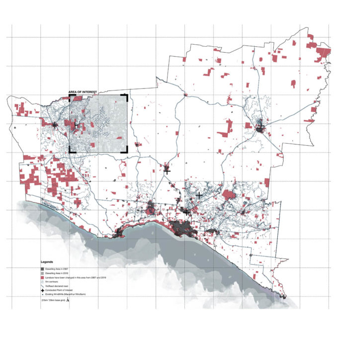
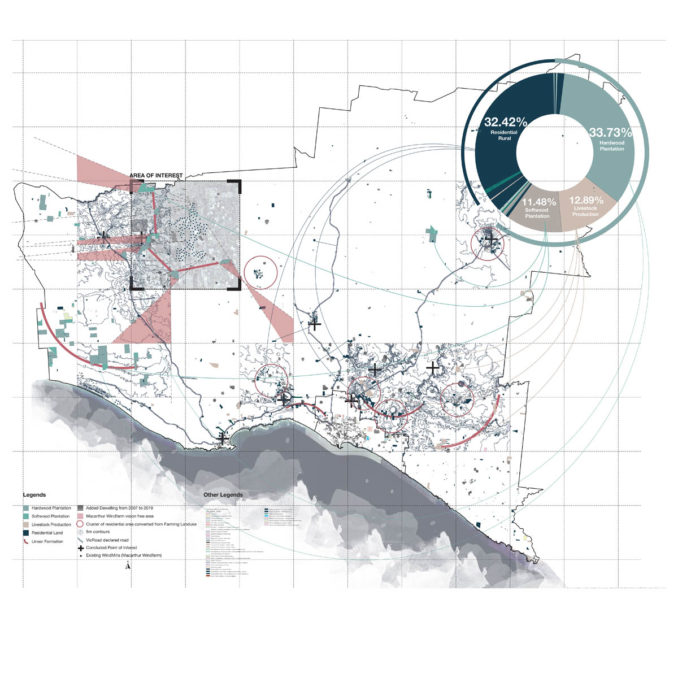
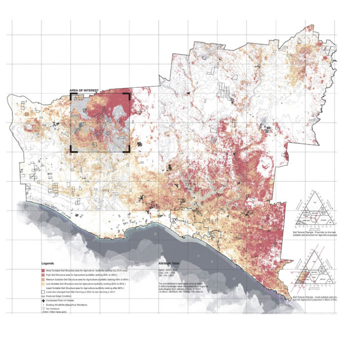
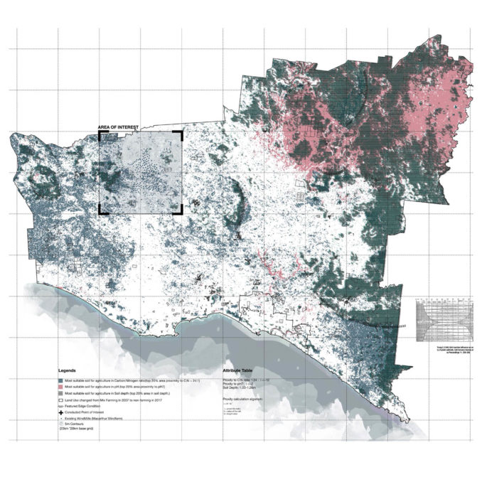
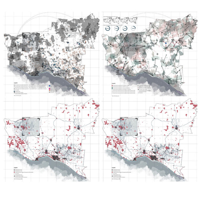
The research is delivered in different phrases and various methods have been used to deliver the outcome. Mapping is an effective device to reveal the hidden correlation between layers of information. By having access to the remote sensing technology and Geographical Information System, the map has the ability to find not just qualitative but also quantitative hidden correlations between layers. Consequently, the research has been conducted through the process of data collection, data clean up and processing, spatial analysis, calculation, modelling as well as data visualization.
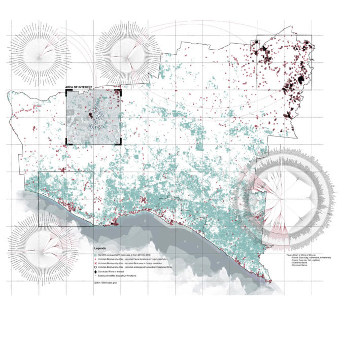
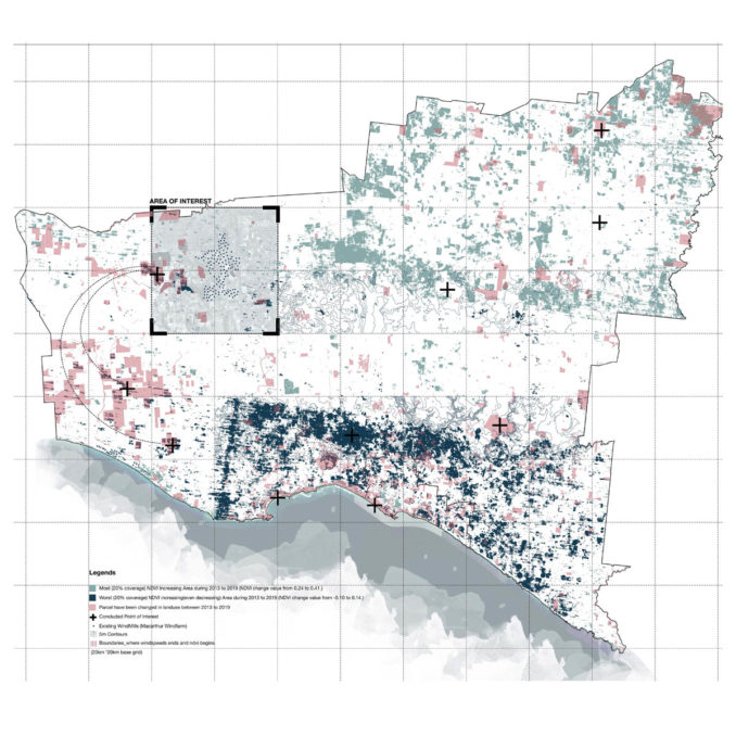
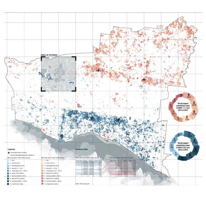
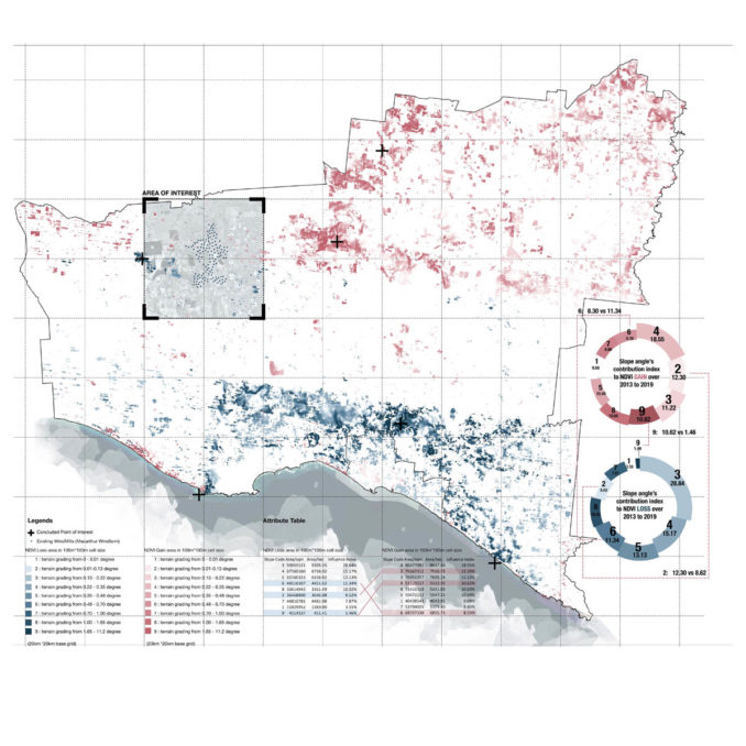
There are two distinctive highlights of this methodology:
Firstly, it focused less on the data visualization, but dived into revealing hidden relationships by visualizing the result of quantitative data processing, so there is statics evidence and algorithm backup behind the mapping.
Secondly, this atlas of mapping reveals how landscape layers change over time and represent in a flattened plane. The Multi-Criteria Decision Making (MCDM) Model generates data-driven suitability planning which is based on the observation and calculation from the atlas.
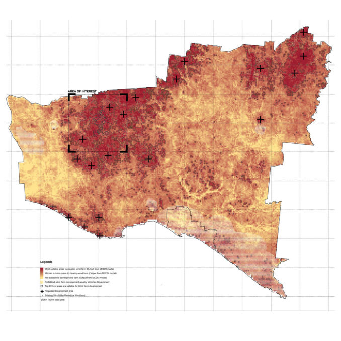
There are 11 input parameters into the model:
1. Proximity to built up area: <2km, <4km, <8km, <12km, <16km; Weight 1)
2. Proximity to Existing power transmission line: 5km, 10km,15km,20km,20km+ ; Weight 1
3. Proximity to terrain ridge line: <200m, <600m, <1000m, <1400km, <1800km+ ; Weight1
4. Wind speed: Score rank: <7.65m/s <7.84m/s, <7.98m/s, <8.18m/s <9.55m/s; Weight 5
5. Soil pH proximity to 7 index: <2, <2.6, <3, <3.4, <5.8 ; Weight 1
6. Soil Structure: Scoring Milestone according to proximity to1:24 index: <2, <2.6, <3 <3.4, <5.8; Weight 1
7. Soi Depth: The correlation between soil depth and suitability is negative correlation <0.91, <0.96, <0.99, <1.02, <1.26; Weight 1
8. Distance to Biodiversity (Particularly fauna) value: <300m, <600m, <900m, <1200m, >1200m; Weight 1
9. Vegetation Performance area (NDVI): <0.163, <0.180, <0.193, <0.207, >0.207 ; Weight 2
10. Terrain Aspect: Wind farm development need to stay away from Northwest, north and southwest, but more suitable in Southeast , northeast and east facing. Weight 1
11.Terrain Grading: Wind farm development need to stay away from slope angle 0.01 to 0.13 and 1.65 to 11.2 but more suitable at 0.48 to 0.7 degree. Weight 1
Shire of Wind Power
Student: Zhuocheng (Jackie) Gu, RMIT University, Australia
Course: Design Research Seminar, Master of Landscape Architecture
Image credits: Zhuocheng(Jackie) Gu


