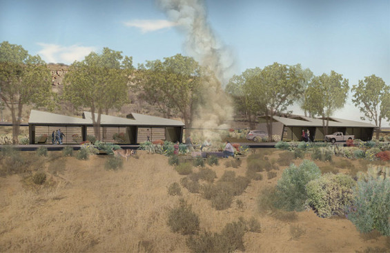
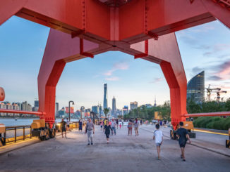
This is a conceptual graduate student project that was undertaken as part of a studio led by Laurie Olin at the University of Pennsylvania in the spring semester of 2014. It focused on revitalizing Crownpoint, New Mexico, USA, a small town on the Navajo Reservation, in one of the poorest counties in the United States. The design creates a new cultural route to promote Navajo heritage and to provide a new source of income for the community. A swale along the route collects storm water and uses it to irrigate community gardens at the center of the city. Both the route and the swale work with the existing topography to minimize the cost of regrading, since their budget is limited.
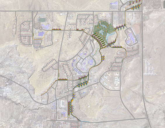
By creating one road through the town, which is easily accessible from the highway, tourists can experience the Navajo culture at different shops, cultural centers, and demonstration areas built along the route. The Navajo have a strong tradition of craft making, especially textiles, pottery, basketry, and jewelry. Since Crownpoint is the closest city on the Navajo Reservation to Albuquerque, it would be an ideal location. The community would not only profit economically from this tourism, but they would also promote an understanding of their culture.
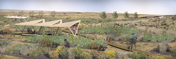
This route can help unify the entire town as well. Currently there is no central gathering place or main street in Crownpoint. The elementary school, the high school, the college, hospital, and the chapter house are all in different parts of the town. Furthermore, the neighborhoods are completely disconnected from one another. Currently people walk on the streets since there are no sidewalks. Both the new cultural route and gravel pedestrian paths help fill in the gaps of connectivity within the city.
Inevitably, the tourism that this cultural route creates, will increase the number of parking spaces needed. The design has gravel parking zones integrated between the commercial buildings. The water from the surrounding mesas are diverted around the buildings and into these areas, which double as initial filtration zones before the water enters the swale along the road.
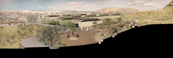
On average, Crownpoint, New Mexico only receives 12 inches of rainfall per year, however much of it comes during one time of the year. This has resulted in flooding, since many of the buildings are where water collects. This can be mitigated by creating a swale along the cultural route to capture the water and filter it before it reaches these low points. The water can then be used to irrigate the plants around the buildings and the community gardens at the center of the city.
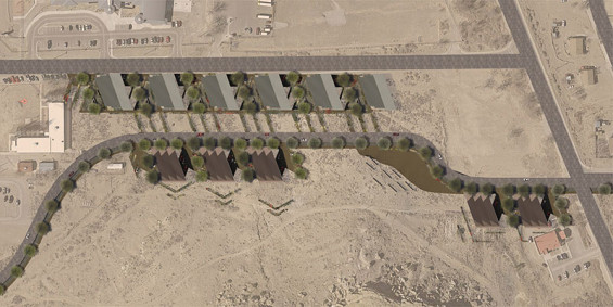
The traditional Navajo people had a remarkable amount of knowledge about different local plants and their uses. Unfortunately it has almost entirely been forgotten by the currant generation since they are no longer living off the land. Fortunately, in 1943, Elmore Francis preserved their native knowledge by publishing his research in his book the “Ethnobotany of the Navajo”. It chronicles all the different uses the Navajo had for plants. The plant selection adjacent to the route is based on this research. Traditionally the Navajo had to wander the vast landscape to gather these plants. In this design, there are no expensive mass plantings. Instead, the most useful plants are located only along the pedestrian paths and around the buildings for easy access. They can be used to create traditional crafts, food, and medicine.
Rethinking the Rez | Jeff M. Jones
This project was designed by Jeff M. Jones in the spring semester of 2014 at the University of Pennsylvania in partnership with his studio critics Laurie Olin, Tony Atkin, Abdallah Tabet, and Gavin Riggall. The project is located on the Navajo Reservation in Crownpoint, New Mexico, USA.
FUTURE CALL FOR SUBMISSIONS
WLA Magazine will be putting out the call for submissions from students, universities and firms for the next edition in early July – the theme of next edition (WLA21) will be Research & Policy.

