Late last month, the Pier 42 masterplan received approval from a Community Board 3 subcommittee and is currently awaiting final approval by the Public Design Commission of the City of New York and the full board of Community Board 3 to move ahead. Recently WLA asked Mathews Nielsen (the landscape architect) what was unique about this project,
“Pier 42 uses a combination of newly created soft shoreline edge and an inboard ridge to dissipate wave action and protect against both flooding and future sea level rise. The park will place mechanical systems and small park buildings above the new 100 year flood line and seeks to use solar-powered lighting to eliminate any electrical conduit from vulnerability. All plant material and hardscape finishes within the flood zone will be tolerant of period inundation.” – Signe Nielsen, Principal, Mathews Nielsen
From the designer:
Design Intent
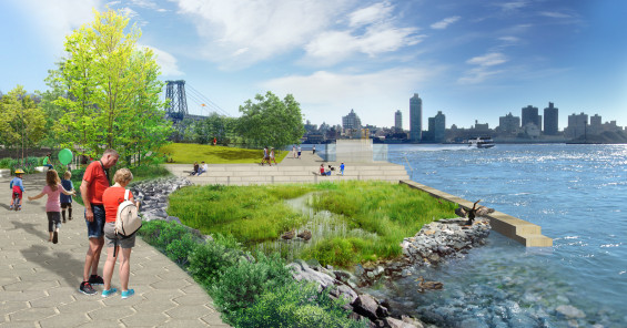
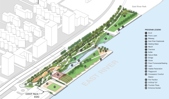
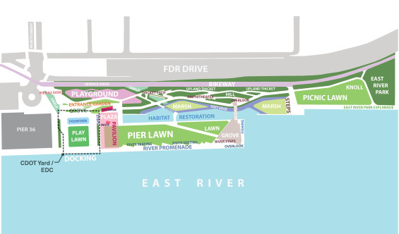
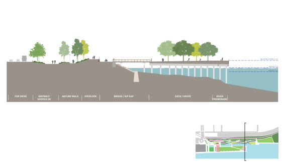
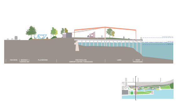
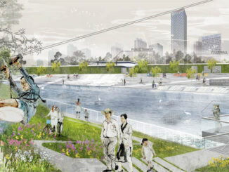
The Pier 42 project will transform an 8.1 acre former industrial maritime site on the East River into waterfront parklant that will create a new soft edge on the East River of Manhattan. Design and planning principles for the project are design as follows:
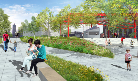
- Respond to community input requesting passive park space with environmental attributes.
- Reimagine the shoreline with a soft edge that adds ecological value and unique experiential opportunities for park visitors.
- Provide a variety of open spaces that creates a sequential experience as one traverses the park connecting East River Park to the East River Waterfront Esplanade.
- Incorporate site history by expressing the pier structure and retaining a portion of the steel frame from the former newsprint terminal building.
- Create unique destination for residents of the Lower East Side Community that brings residents closer to the water.
- Configure park spaces to frame urban vistas.
Sustainability Objectives
Pier 42 has several strategies that provide for environmental benefit. These strategies are integral to the experience of the park and drive the overall design.
- Remove 166,0000 square feet of pier deck to provide daylight to the East River creating additional marine habitat.
- Retain existing piles at removed deck to be retrofitted as marine habitat
- Deconstruct 500 feet of bulkhead and create a soft edge with the use of rip-rap to make the waterfront more resilient.
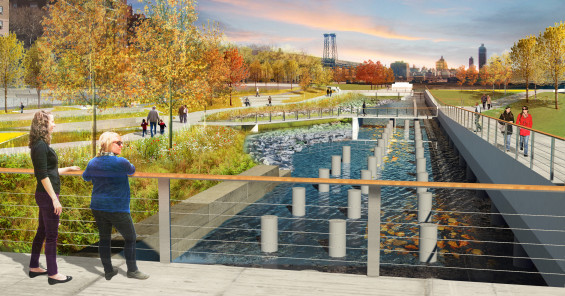
- Integrate two marsh areas with adjacent pedestrian viewing and seating areas for tidal ecosystem learning opportunities.
- Create an upland nature walk with robust planting that utilizes native species and buffers the park from the FDR Drive.
- Utilize Solar lighting on the deck portion of the project to reduce energy demand and help harden the park against future storm surges.
- Allow storm drainage to naturally infiltrate with the use of bioswales.
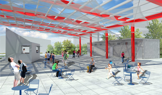
- Re-use a portion of the existing shed frame as a pavilion structure.
- Repurpose the deconstructed granite bulkhead stone as landscape features in the park.
Phase One Sustainability Objectives
Phase One will consist of temporary landscape of lawns, shrubs, trees and pathways that will replace the existing expanse of asphalt with the upland portion of the site. This will provide the following significant environmental benefits:
- Reduced impermeable surface will permit natural rainwater infiltration. Secondary pathways will use permeable pavement.
- Reduced pavement area will decrease the urban heat island effect.
- Planting will consist of native and adapted species that will require no irrigation or use of potable water. No mow turf will be used where appropriate.
Existing Conditions: 33,300 s.f. Permeable Area – 9% of total site area
Proposed Conditions: 154,000 s.f. Permeable Area – 43% of total site area.
Community/Neighborhood Context
Pier 42 is located on the Lower East Side Neighborhood on the East River between the Manhattan and Williamsburg Bridges. It is situated at the southern end of East River Park and the northern extent of the East River Waterfront Esplanade South (under construction) making it a critical link in the creation of continuous parkland ringing Manhattan.
The site is poorly integrated with the Lower East Side Neighborhood as the FDR Drive defines the northern edge of the park creating a relatively impermeable barrier for most of this length. One major point of community access is available at the terminus of Montgomery Street whet the FDR Drive is elevated. At the eastern end of the park, access is limited as the FDR is at grade and the pedestrians must enter from East River Park. Approximately 305′ from the Pier 42 project site is a pedestrian bridge connecting East River Park to Corlears Hook Park opposite FDR Drive or from a proposed seasonal access walkway along the water at Pier 36.
The immediate neighborhood opposite the FDR Drive consists predominantly NYCHA housing including Vladeck, La Guardia, Rutgers, Smith and Two Bridge Houses. Further to the north is the Seward Park Coop among many low rise commercial and residential buildings. Within a 10 minute walk from Pier 42 are two parks and seven playgrounds. Many public schools are location within walking distance of Pier 42.
Transit access to the park is available from the East Broadway F train stop, a 10 minute wal, or the number 22 bus stop at Montgomery Street is a 5 minute walk.
IMAGES & TEXT | Mathews Nielsen
Comments are closed.