How to connect the city center of Creil to the edge of the Oise, to a district positioned on a plateau while crossing a remarkable landscape on a vertical of 40 m?
It was the challenge of this project led with determination by the team of the agency Espace Libre, landscapers and urban planners, with the support of the city of Creil.

“The originality of this operation is due to a determined mastery of work that decided to connect an isolated district of the city center by the inscription of an urban ramp through a wooded hillside,” says Maxime Saïsse, landscape architect founder of the Espace Libre workshop.
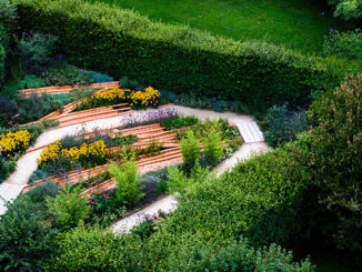
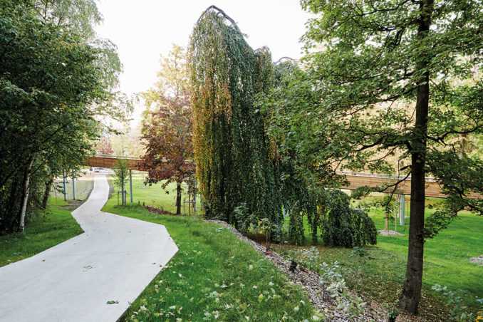
What could have been a banal development operation turned into a real project featuring the landscape, ecosystems, views. The sensitive layout of pathways and observation platforms is part of a natural process rather than the setting up of new uses of the site.
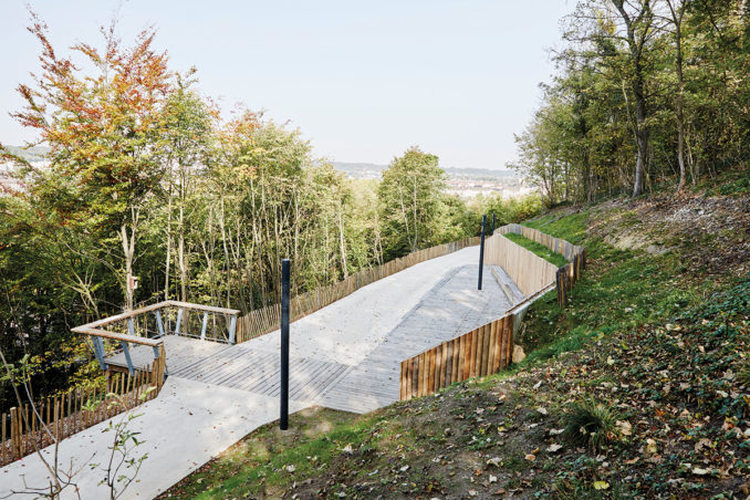
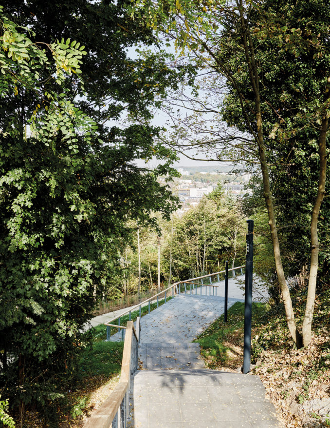
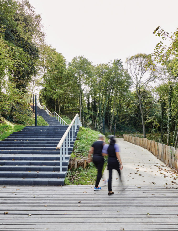
Located north of Paris, Creil is a city that developed strongly in the post-war period by the emergence of neighborhoods characteristic of this period. A dense urban neighborhood has developed on the heights of Creil forty meters higher than the city center, cut by a wooded hillside. This spatial configuration resulted in an urban break that never allowed the inhabitants to connect the city center otherwise than by a monumental staircase.
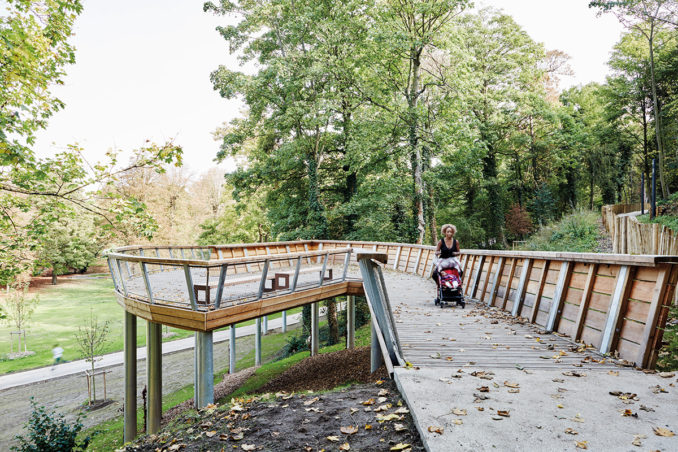
The will to gently connect the neighborhood to the city center with the new standards related to the handicap was the opportunity to think about a global project that went through the ecological restoration of the site, the hydrographic network and endemic plant species. by a careful study of the site; an inventory of its potentialities, as well as a detailed study of the nature of the soil were conducted in order to minimize the environmental damage.
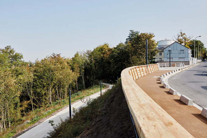
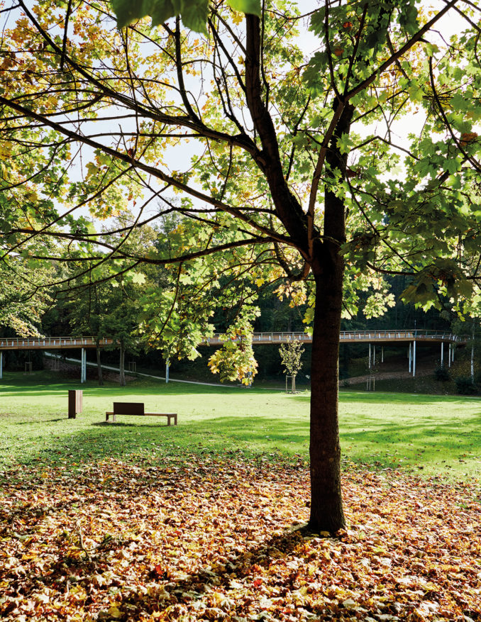
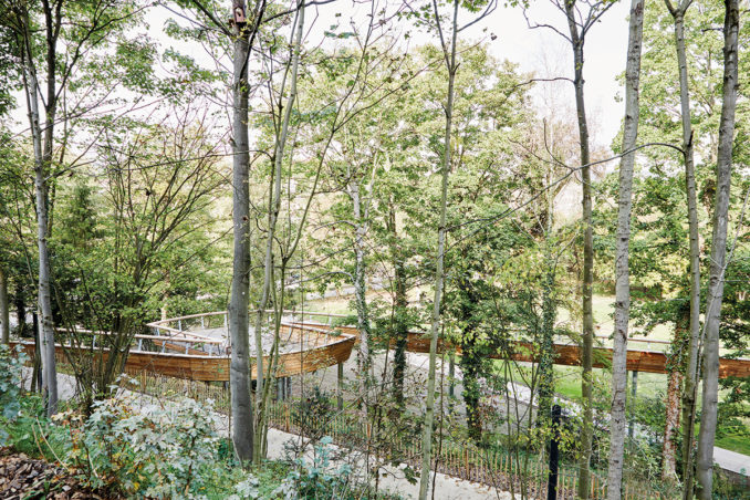
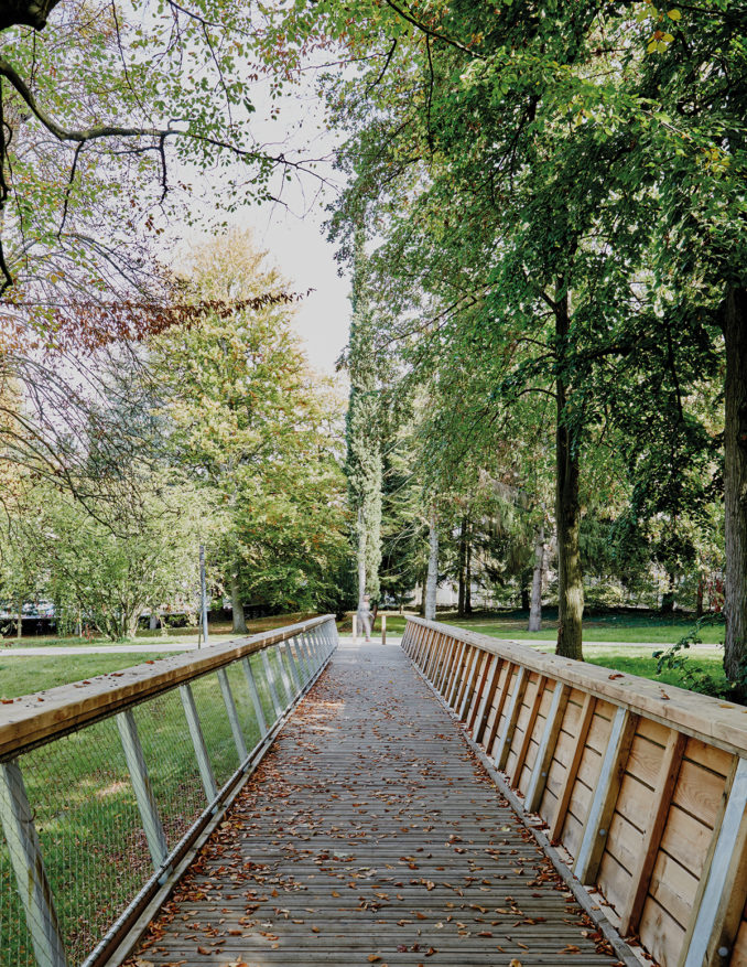
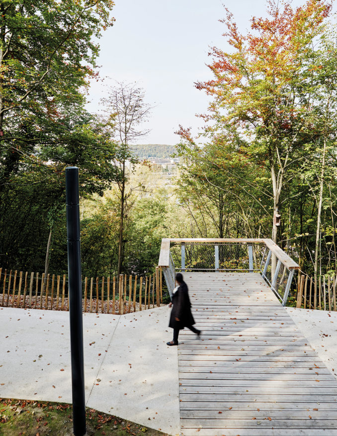
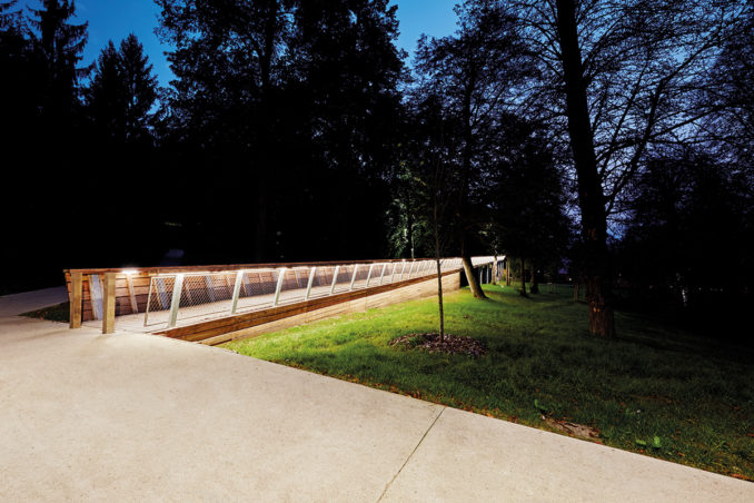
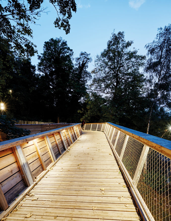
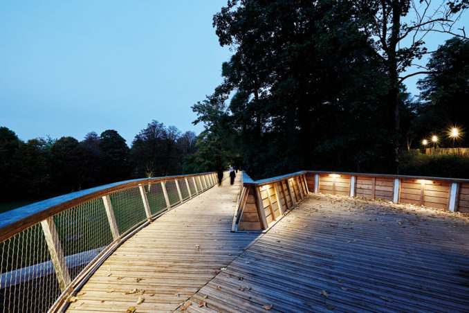
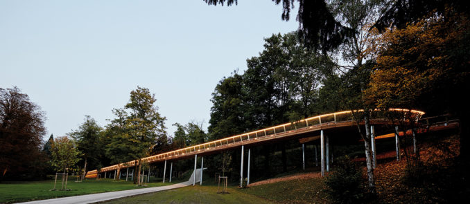
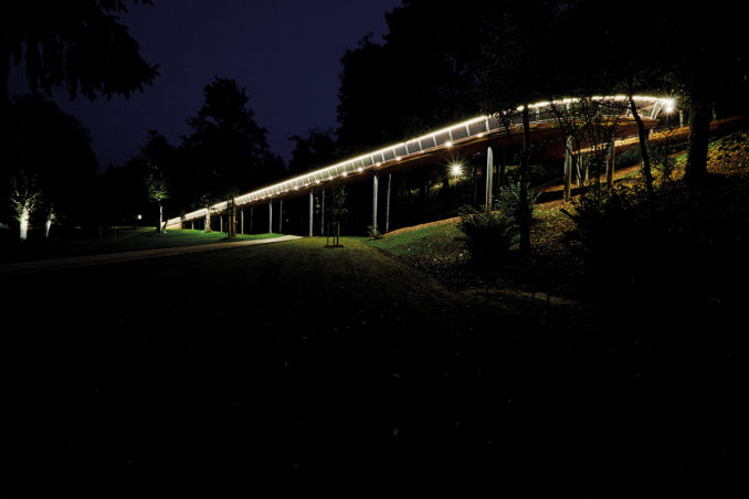
The inscription of the route should thus allow its most discreet inscription while revealing the characteristics of a remarkable landscape. This set of constraints accentuated the strength of the project, in particular by the inclusion of a footbridge at the bottom of the path, making it possible to catch up with a level coastline essential for the regulation of people with reduced mobility.
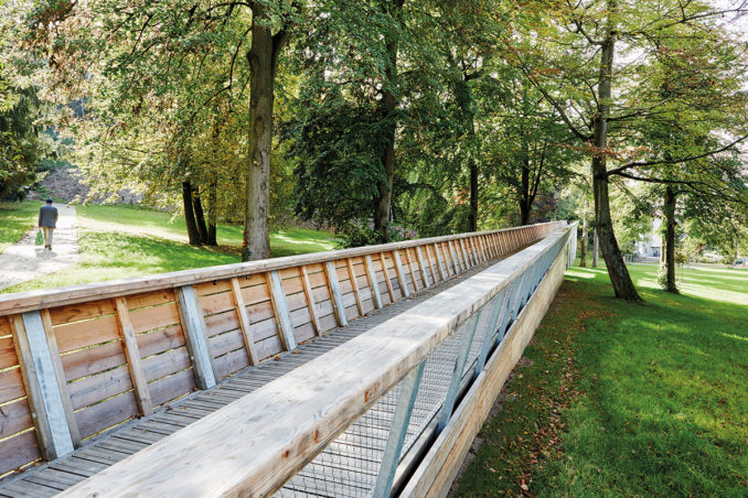
This majestic bridge is more than a hundred meters long and rises through the treetops through an English park. The
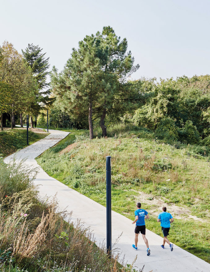
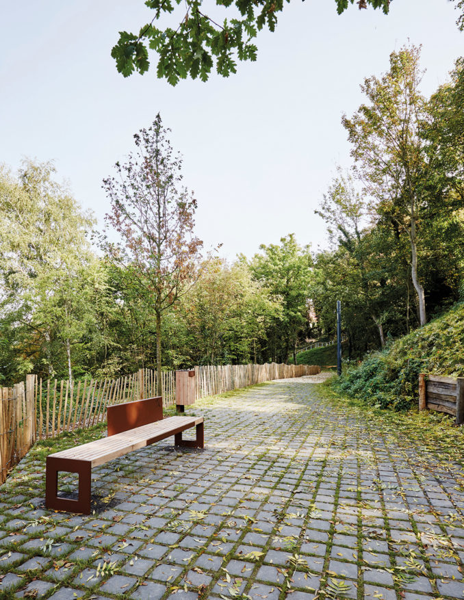
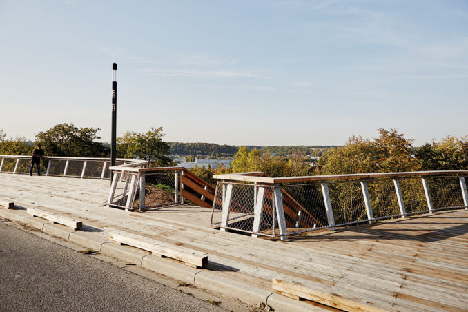
The 1.2 kilometers of the path are marked with places of breaks, meetings and observations:
- the belvedere
haut - the Laversine glades
- the
belvedere of the crossroads - the crossroads
- the hiker’s plaza
- the ramp
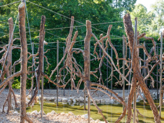
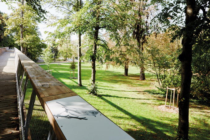
In these spaces, a signage highlights the endangered species. Their treatment favors sensitivity and sobriety, the images appear in black and white and are very enlarged to immerse themselves in the “faces” often unknown to these living species in our same ecosystem.
Client | CITY OF CREIL
Project Management Team
FREE SPACE LANDSCAPE AND URBANISM WITH EGIS, EUROVIA, LOISELEUR, MARCANTERA, EIFFAGE ENERGY