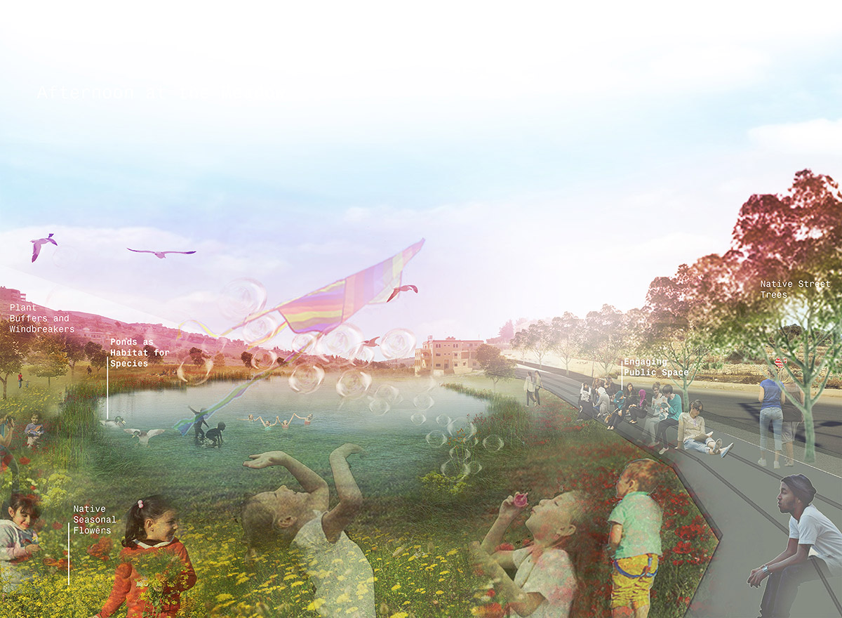
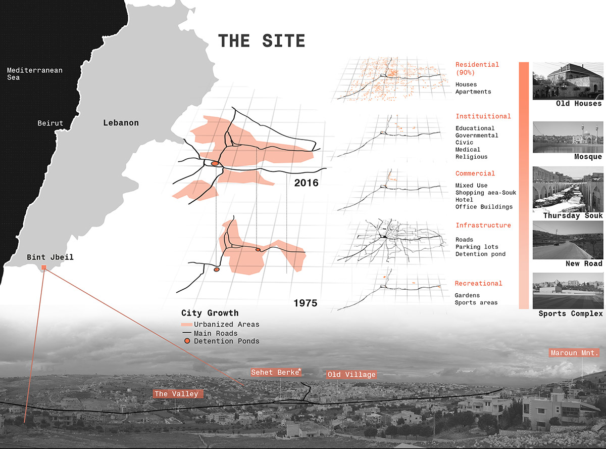
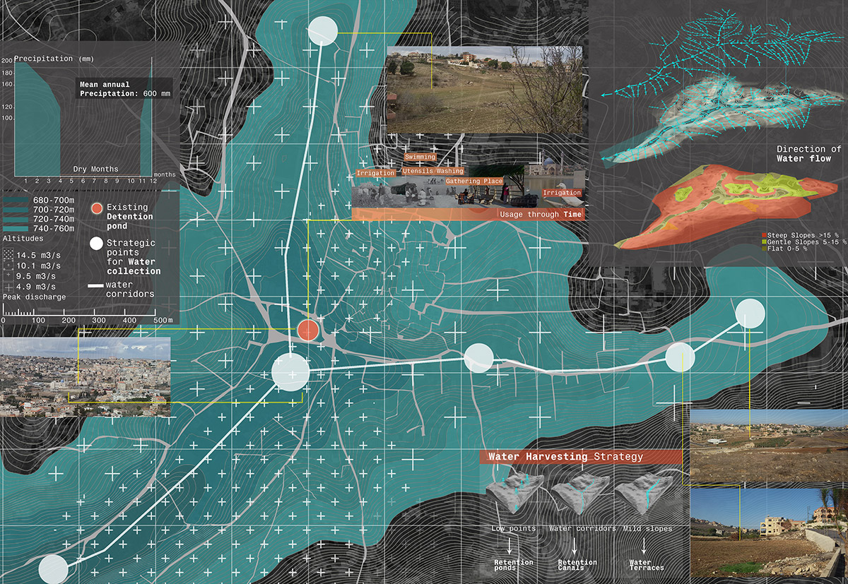
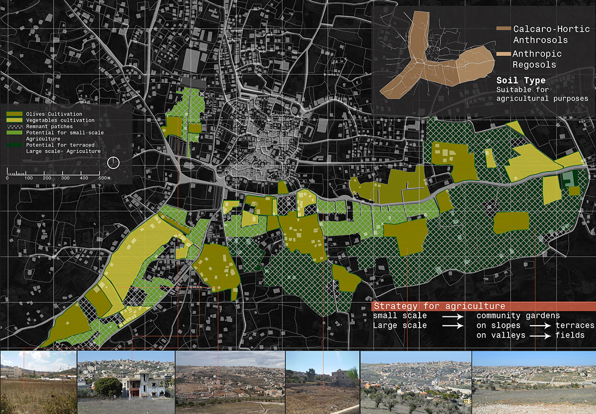
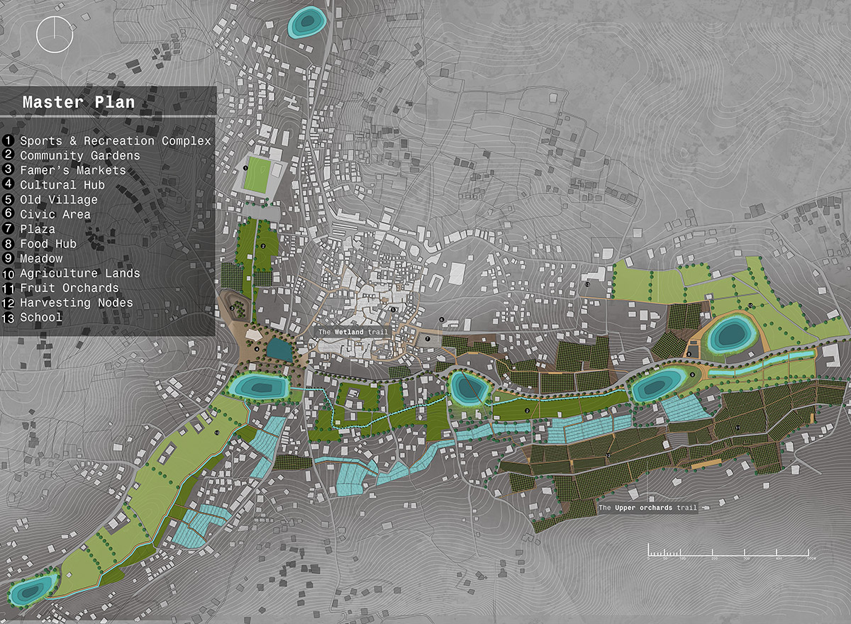
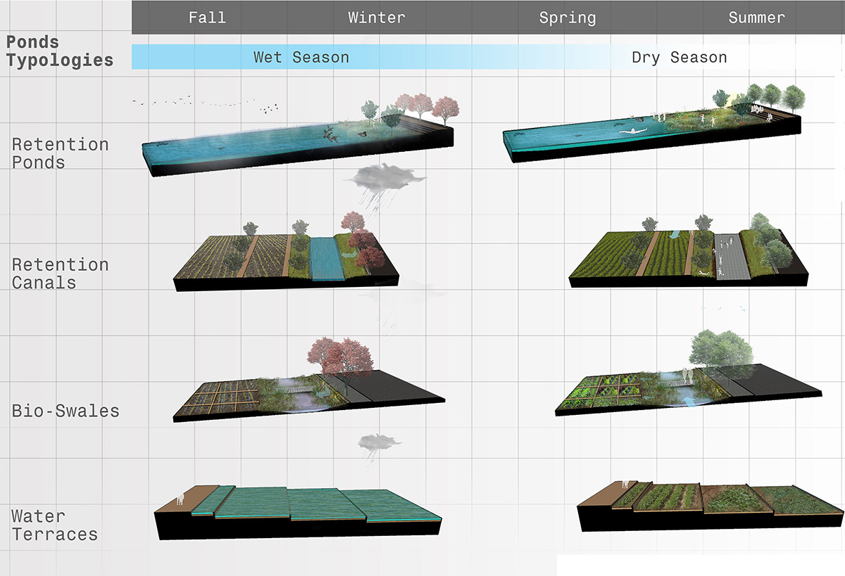
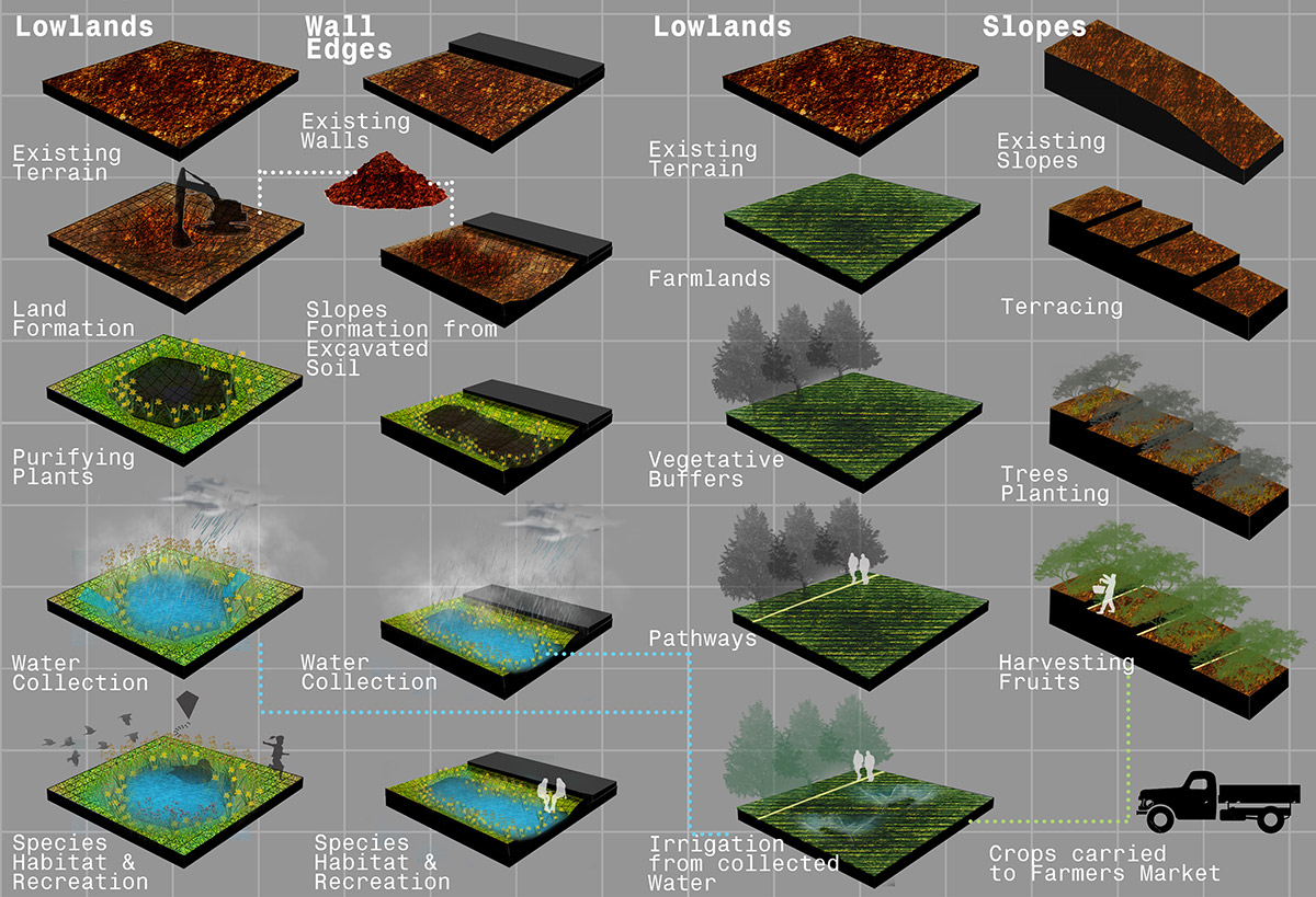
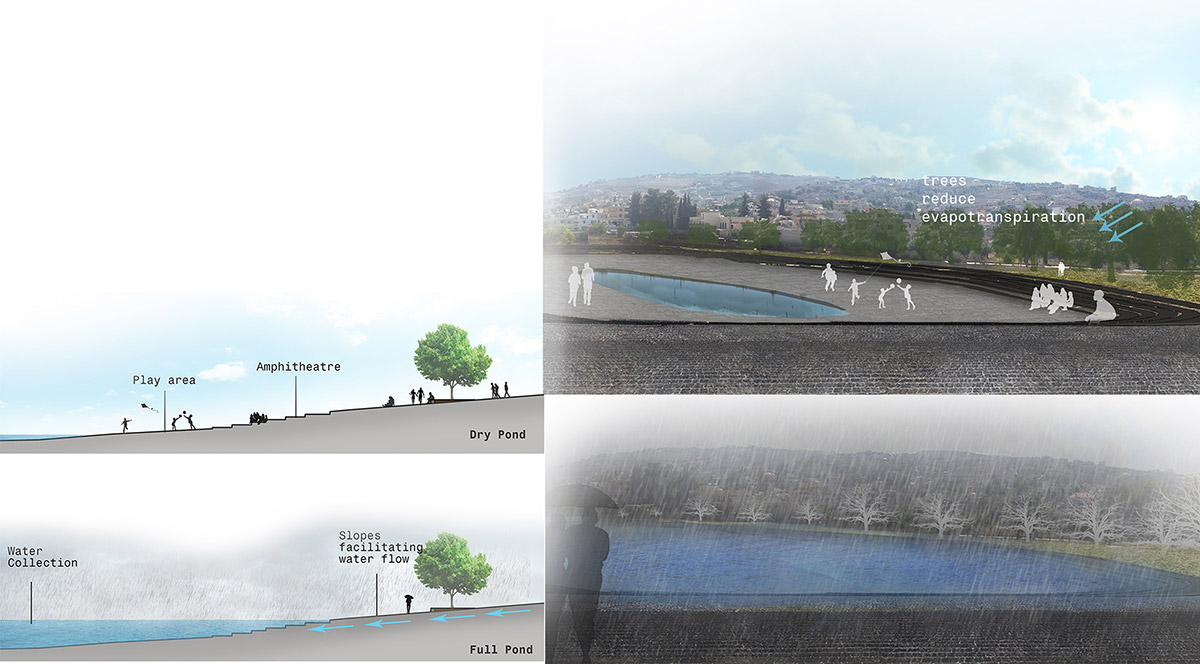
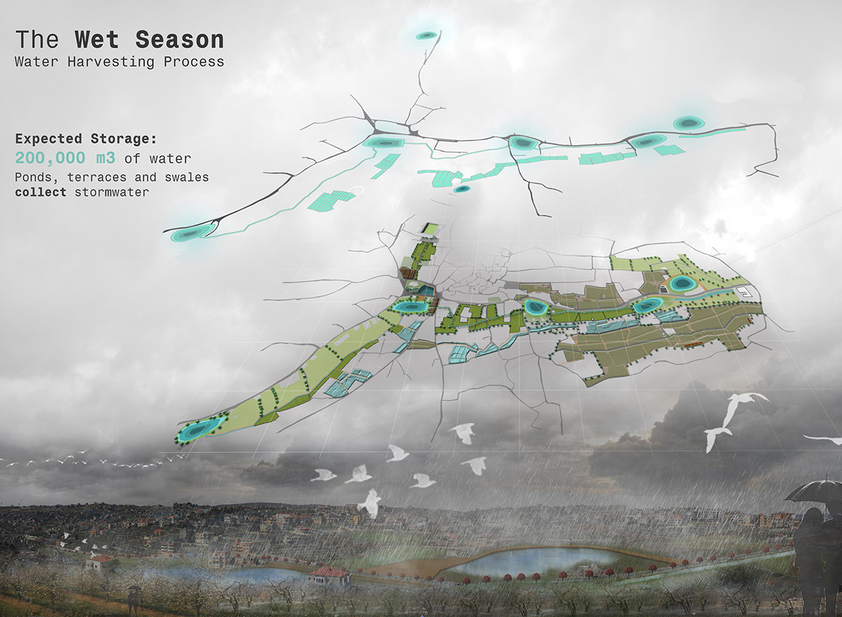
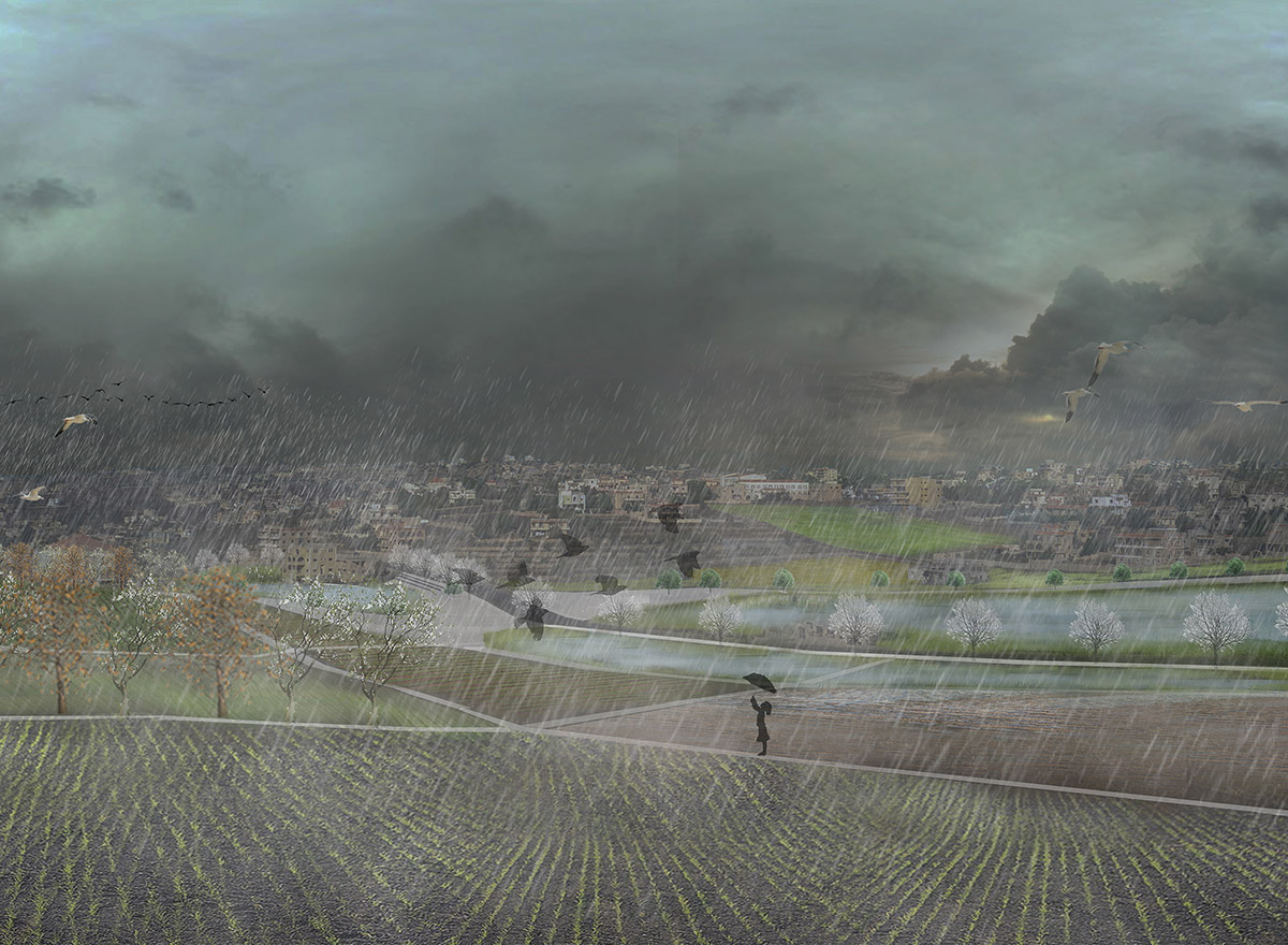
Bint Jbeil is a rural town located in the south of Lebanon. This town has witnessed a growth in its urban fabric but a steep regression in its economic and demographic growth due to an overlap of political instability and the drawbacks of climate change. This overlapping of issues is affecting severely the agricultural economy, the trade market, and also affecting the demography of the village leading to a rise in immigration. Departing from these conditions, the project studies the opportunities present in the village to revitalize it. A remarkable dual opportunity is given by the 235 acres Y-shaped valley, for the amount of rainwater that naturally drains in this area and the presence of an abundant number of vacant lands in it. Therefore, the project aims to turn this Y-shaped valley into a natural landscape that will reactivate the vacant lands of the village by creating a system of water infrastructure of ponds, terraces, and wetlands that will strategically reoccupy the lowlands, harvesting the rainwater that will be reused in renewing the agricultural matrix. This system will be the trigger of the entire transformation of the village and will help improve its economic status.
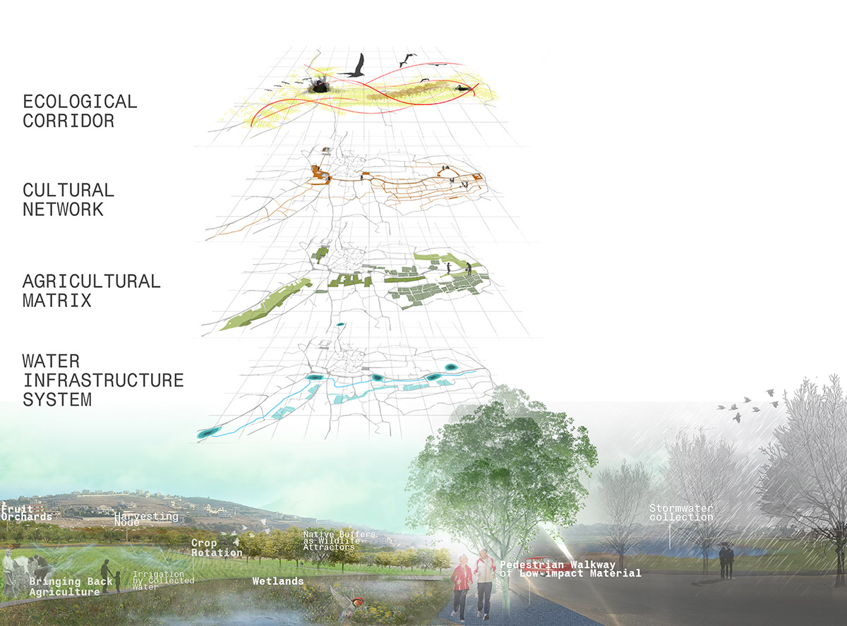
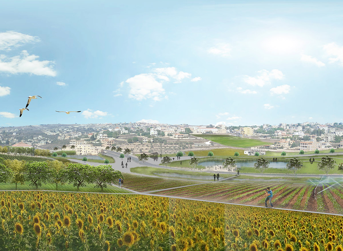
This landscape will not only be a productive one but it is also inscribed in a cultural network where it takes the cultural areas of the city and extends them out to the agriculture matrix and renew the intimate connection of people to the landscape.
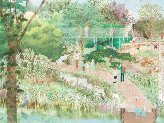
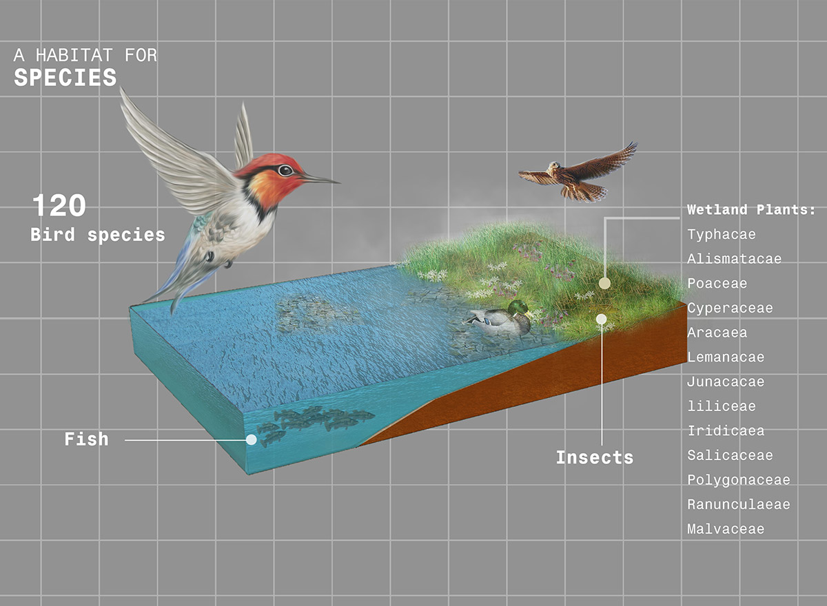
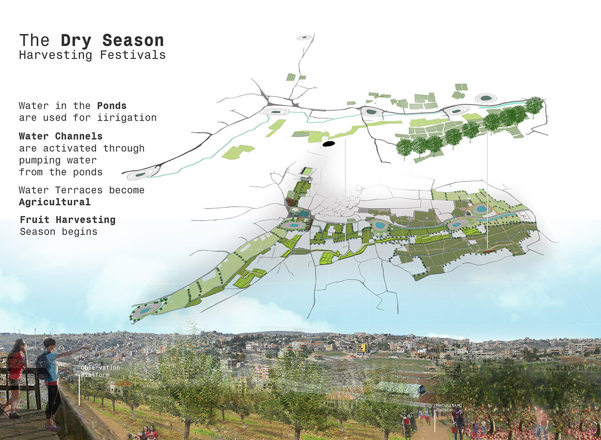
The cultural network will include farmers’ markets, plazas, and harvesting squares thus integrating the cultural calendar with the harvesting season. By this, the villagers will be able to participate in harvesting festivals and celebrate their occasions within the agricultural matrix. The system will also be an ecological corridor and a habitat for wildlife species due to the presence of the wet areas and ponds as well as the native wildlife tree buffers. The wetland areas will be also attracting migrating birds during the migration season.
The Wetlines
Student | Mariam K. Bazzi
University | American University of Beirut
Primary Advisor | Sandra Frem
Secondary Advisors | Nayla Al-Akl and Beata Dreksler