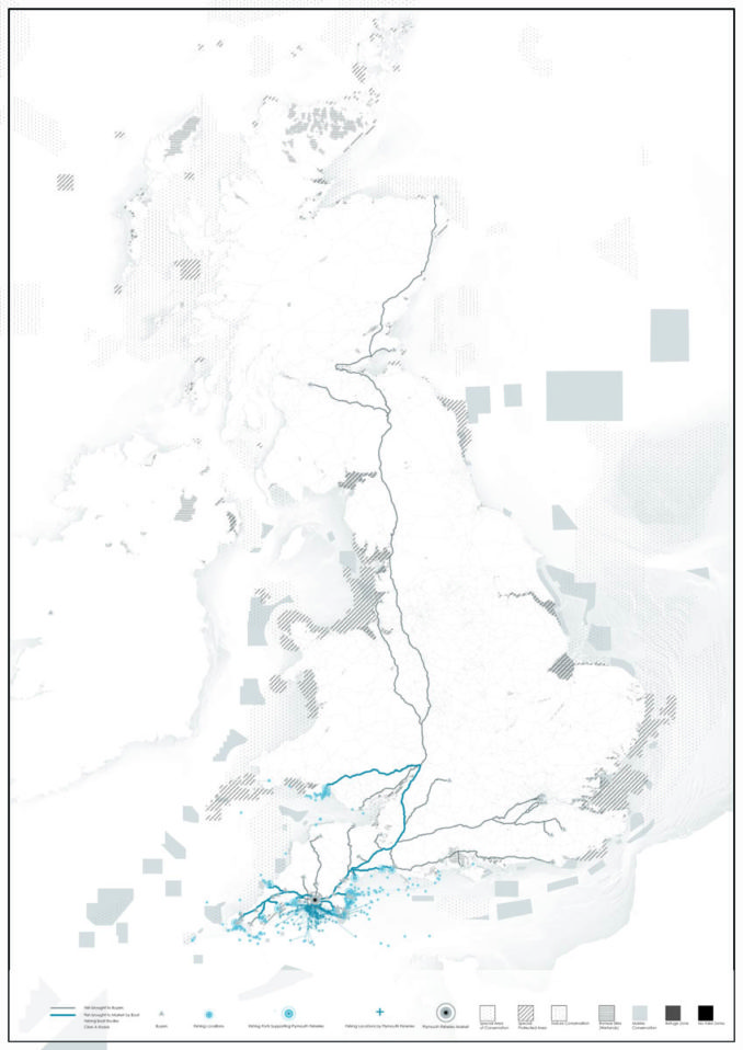
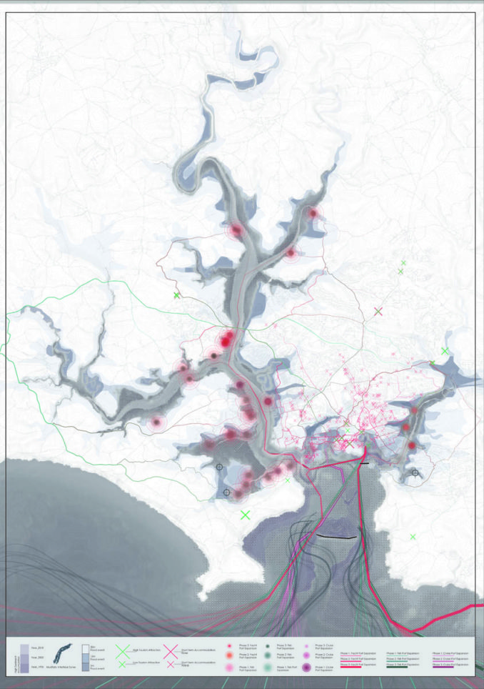
The project studied multiple economic developments along the coastlines of the UK, coastal communities. Many cities have a primary mode of production such as marine tourism, fishing, wind farming, agriculture, etc. Coastal communities develop their economy around the natural resources of their city. However, multiple stakeholders want the local natural resources such as open water for recreation, protected boundaries for specie conservation, or fishing grounds. There’s an economic disproportion of who owns the sea due to the lack of a developed coastal and marine spatial planning. The lack of regulation creates a conflict between the various stakeholders along the coast. In this case, Intertidal Mediations focused on the economic marine tensions in Plymouth, UK.
The project focuses on the Tamar Estuary, located in Plymouth, a coastal community south west of the United Kingdom. Plymouth claims itself as Britain’s Ocean City with historic ports, influential fishing industry, and seasonal aquatic recreation. The city prides on its rich waterfront; however, the city aims to focus its economic development in marine tourism. Plymouth focuses its economic resources by advertising the city’s bay as the country’s first national marine park. However, marine tourism will disrupt the city’s current diverse marine economy.
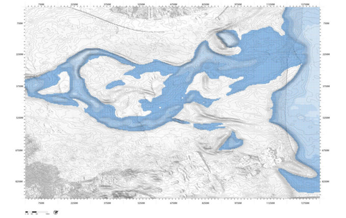
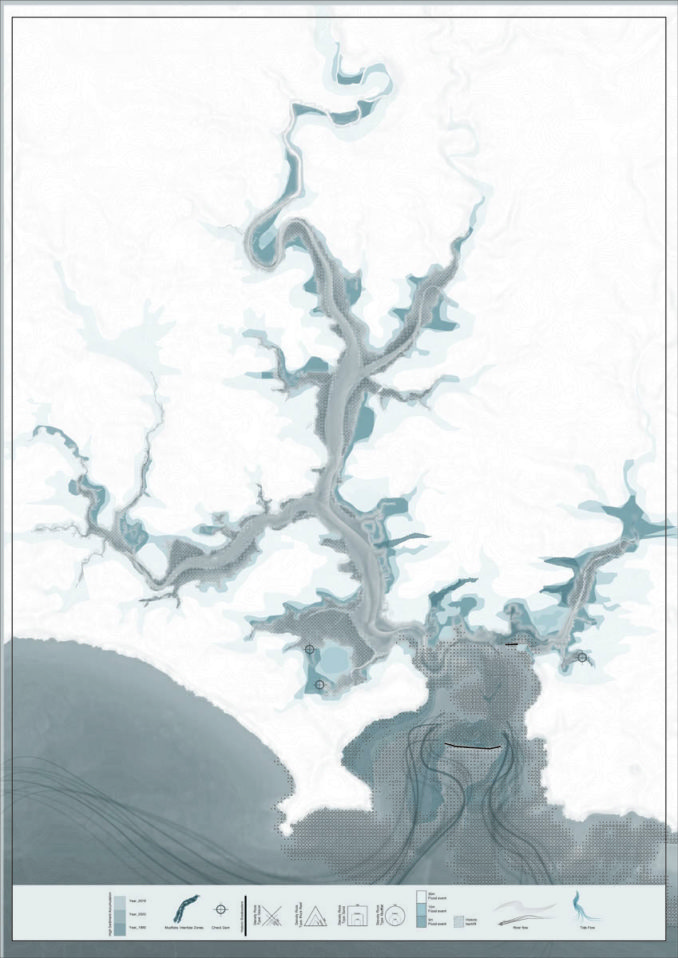
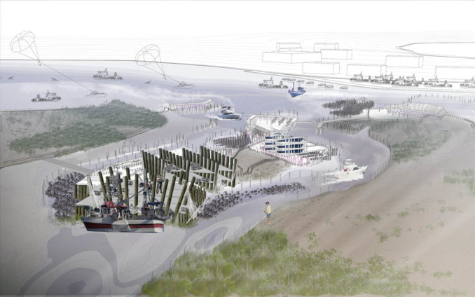
Intertidal mediations map out the regional impact of the city’s existing fishing economy, existing geomorphology, and social impact of the varying stakeholders. Through mapping, the design decision is informed with site conditions, social conflicts, and site opportunities to intervene. Stakeholders’ high demand for sea real estate points to site conditions at the intertidal flats of the Plymouth bay. Intertidal regions of the bay provide varying sea-level heights throughout the day during high and low tides. This helps accommodate fishing communities to dock their boats, conservation zones to protect target spawning grounds, rotating stock mariculture, and seasonal aquatic recreation.
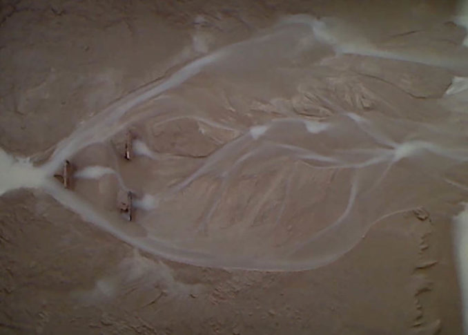
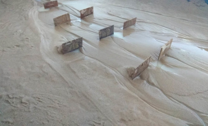
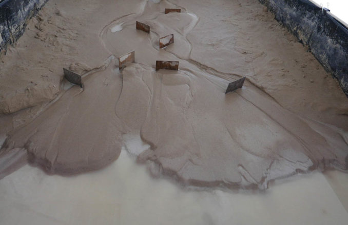
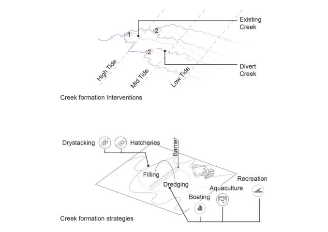
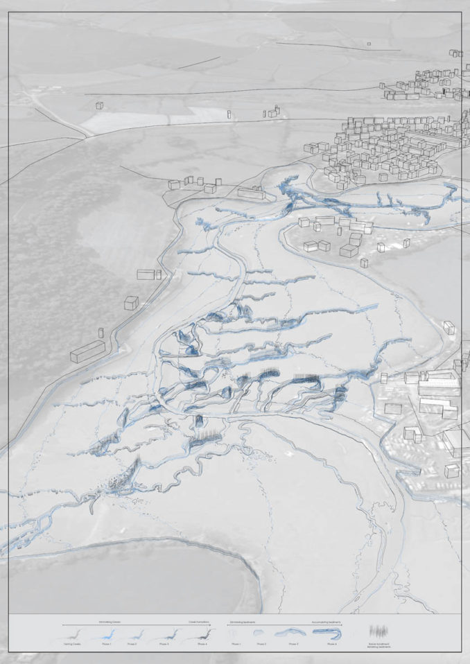
The project tests existing creek formations and interventions to categorize the programmatic needs of each stakeholder. A scaled physical creek was simulated in a tank to test multiple creek formations. The results provide shallow tidal flats for fishers to beach and recreational users to drystack their equipment. Deep tidal flats provide rotating food production and long-term boat stalls. The simulation informs design at the architectural scale to be extrapolated at the multiple scales. Through various scenarios, the project aims to address economic fluctuations, constant tide changes, sediment accumulation and erosion.
Students: Jimmy Ta, Yaxin Zhao, Kai Zhu, Architectural Association Inc.