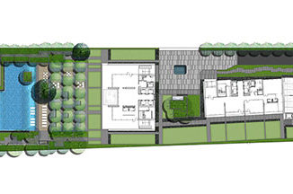
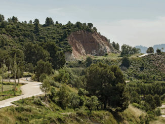
The site is located in the coastal area of the Wenzhou Plain. It is affected by the problem of sea tide, typhoon, and flooding because the terrain is flat and low-lying. On the other side, over the years, along with the increase in population and increase in land demand, the region has started a large-scale land reclamation project, changing the shape of the coastline, invading the ocean, and affecting the ecology of coastal areas. So the project aims to explore a new landscape pattern to adapt urban districts and shore zones in Wenzhou to address climate change and the pressure of land demand.
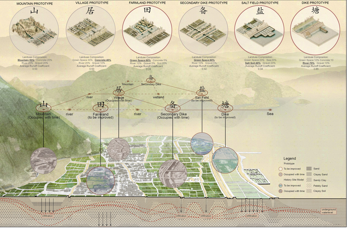
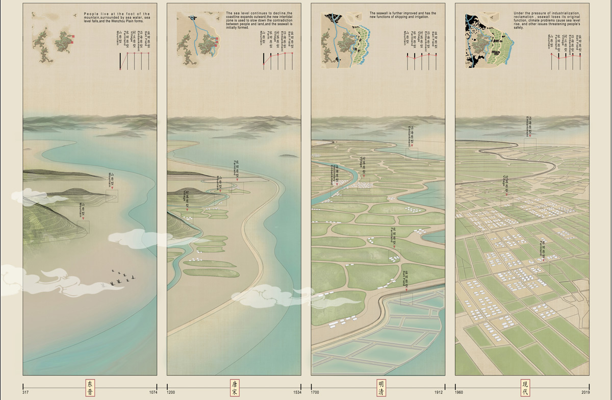
We study from the traditional water system prototype and explore the balance of this system, adapting traditional wisdom for present-day use. The dikes grow along the coastline in different periods from the inside to the outside, from the old to the new. The ancients used polder farmland and sea dike to live. Humans and nature lived in harmony. But in modern times, cities have expanded dramatically, and while the land has gradually expanded outward, the shoreline has also gradually changed from natural to straight. The large-scale coastal land reclamation has dramatically weakened the original relationship between humans and nature.
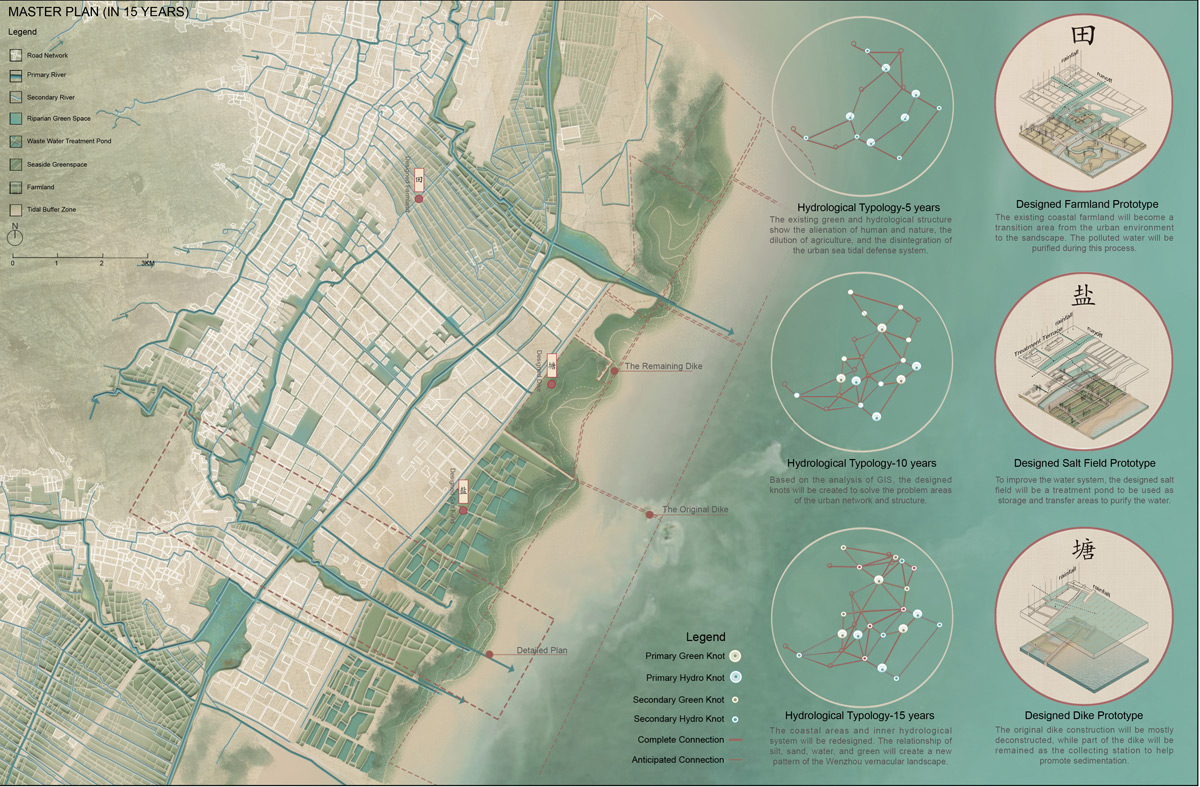
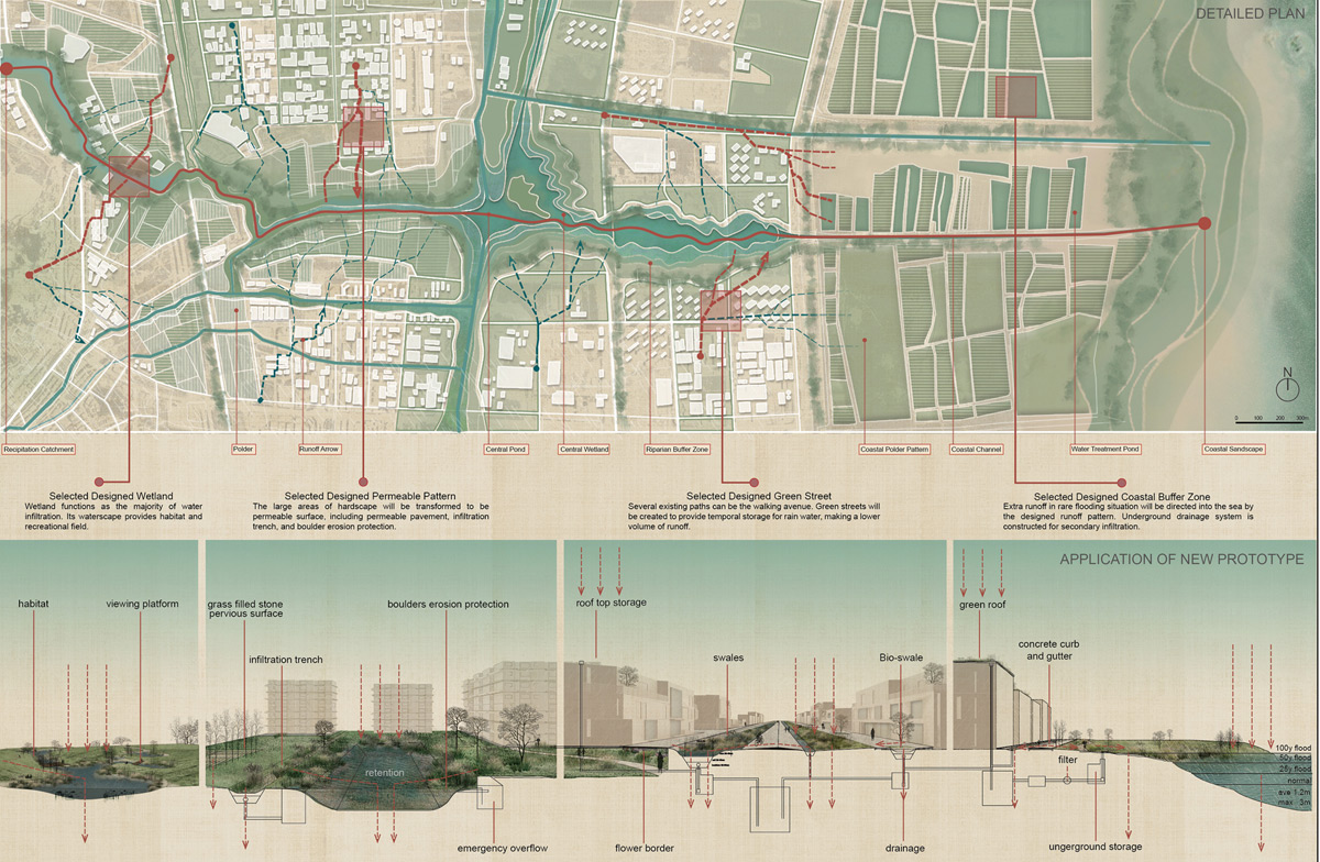
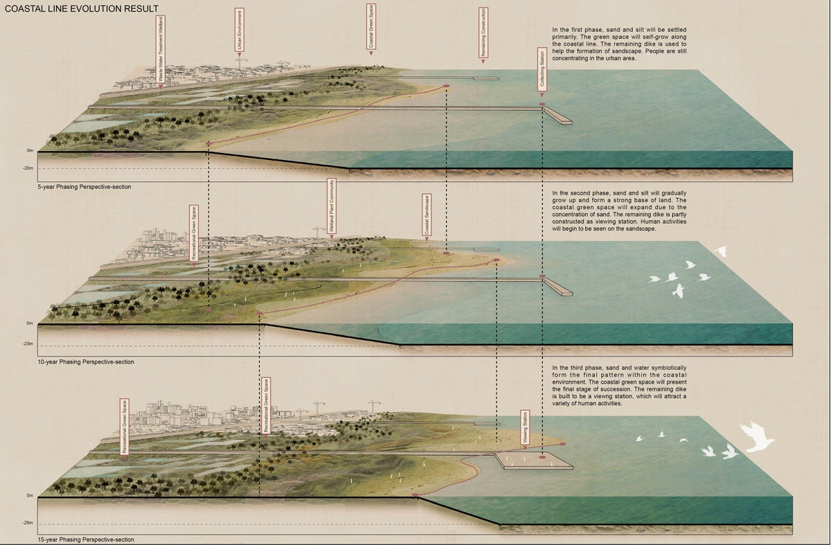
In this regard, we first proposed a landscape pattern model during the heyday, based on site analysis. To figure out how the mountains, settlements, farmland, dikes, coastal areas and salt fields work together. It can also provide a reference for the new pattern planning and prototype construction in the future. Then, we analyzed three types of site textures, which are green space, water network, and road residential area. Based on this, we obtained the topological structure of the three types of site texture of the current site, and then obtained the knots that should be transformed. After reorganizing the topology relationship, we focused on the inner water and outer water. For internal water, we hope to restore the hydrological features accessible from all sides while keeping the current water system as much as possible, and at the same time, widen some main waterways to guide surface runoff based on the main floodwater sinks. For outer water, we refer to the shoreline shaping method of the ancient dike formation process to give the shoreline a spontaneous elasticity and toughness to cope with the invasion of the tides and waves.
Shortlist for 2020 WLA Awards – Student – Analysis & Planning category
Interpretation of Vernacular Landscape
Ying Dong – Beijing University of Civil Engineering and Architecture;
Chengfan Liang – Fujian Agricultural and Forestry University;
XiaoWei He – Beijing Forestry University;