Dordrecht is an “island” in the Rhine-Meuse-Scheldt Delta region of the Netherlands, it is greatly affected by the presence of water. Periodic floods thereafter hindered its development, until 1970 the construction of the Haringvliet Sea Gate has finished the flood destiny.
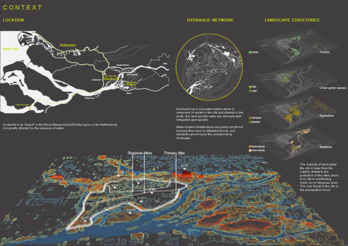
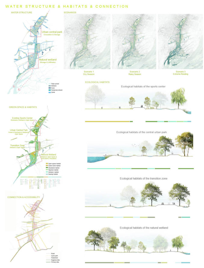
Dordrecht has a nice water rhythm which is composed of canals in the city and streams in the south, the land and the water are obviously well integrated geologically. Yet daily life of residents and water sources maintain a relatively long distance due to the threat of flooding inside the city. Water-related infrastructures are purely functional because they have to withstand floods, and residents cannot enjoy the corresponding landscape.
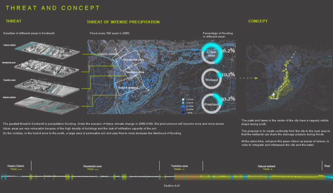
By virtue of dikes and sea gates, the site was protected from floods of the ocean and rivers. Floods caused by precipitation are the biggest threat to Dordrecht.
Under the scenario of future climate change in 2050-2100, this phenomenon will become more and more severe. Urban areas are very fragile: the high density of buildings and low permeability of soil leads to the accumulation of rainwater in the city and increase the difficulty of drainage and water circulation. On the contrary, the urban density is low in the south, and large areas of permeable soil and ample streams flowing into rivers reduce the probability of flooding.
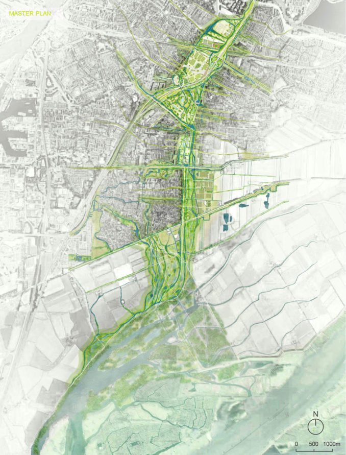
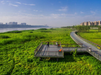
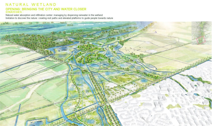
This green ribbon that crosses the city is the project site. The proposal is to establish city-to-rural continuity so that wetlands can share discharge pressure during flood periods. In the meantime, improving this green ribbon as a place of leisure so as to integrate and interweave city and water.
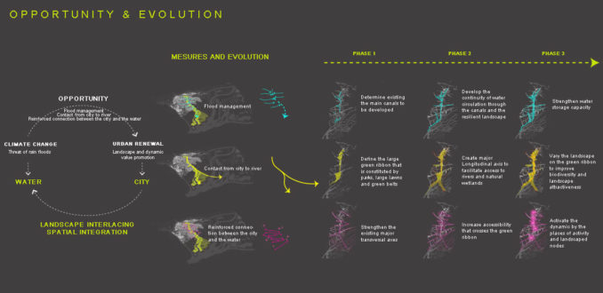
There are three key measures to solve the problem of flooding and the block between city and water source :
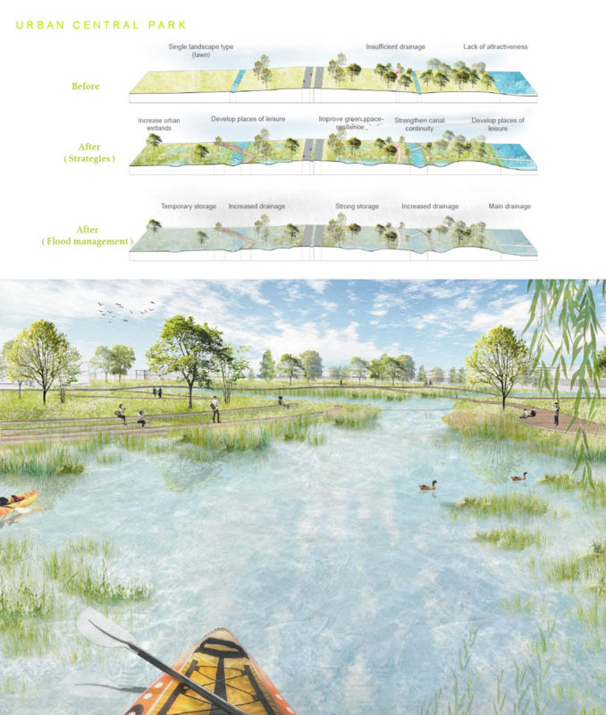
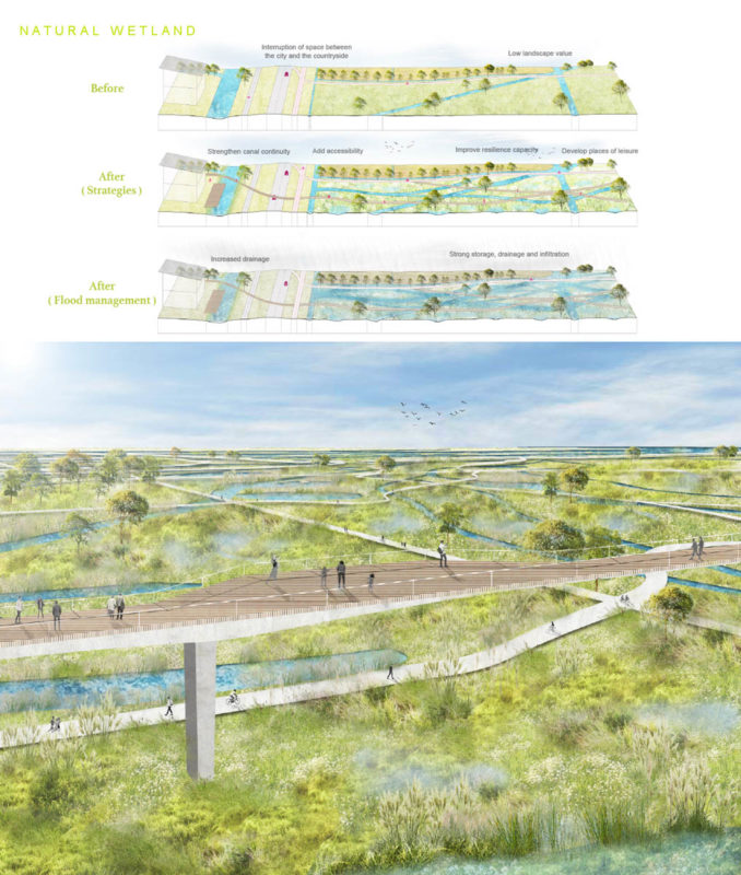
1. Flood management: on the basis of existing canals and streams, enhancing water storage capacity through the resilient landscape and improving the sustainability of the hydraulic circulating system.
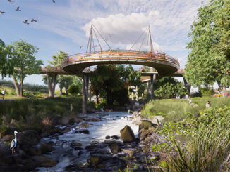
2. Contact from city to river: exploiting the existing parks and lawns on the green ribbon to create the main axis which can establish a contact between the city and the river in the south, and ultimately altering the landscape in order to improve biodiversity and attraction.
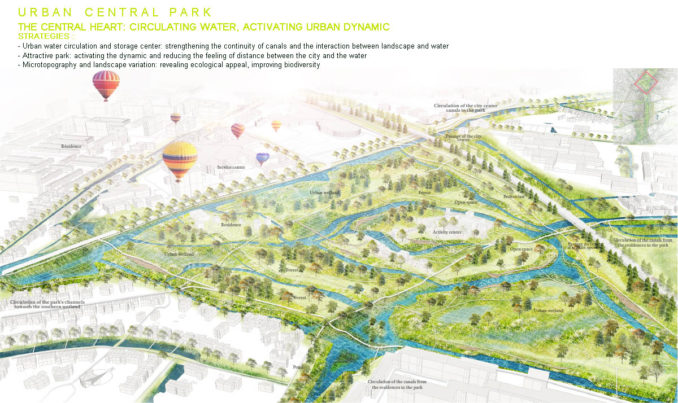
3. Reinforced connection between the city and the water: increasing the accessibility of crossing this green ribbon and activating the vitality through recreation places to bring in the inhabitants. Five landscape nodes among this green ribbon play different roles in flood management and landscape enhancement, which are respectively sport center, central park, the resilient transition area, the territorial mosaic and the natural wetland.
The city and nature interact and evolve together. Climate change is like a magnifying glass, allowing us to reinterpret the territory with a long-term perspective and to seek opportunities in development. As landscape architects, our role is to transform risks into opportunities in order to maximize the value of the territory while minimize the impact.
Student: Shan Jiang, National School of Landscape Architecture of Versailles
Supervisor : Sylvie Salles
Image Credits: Shan Jiang