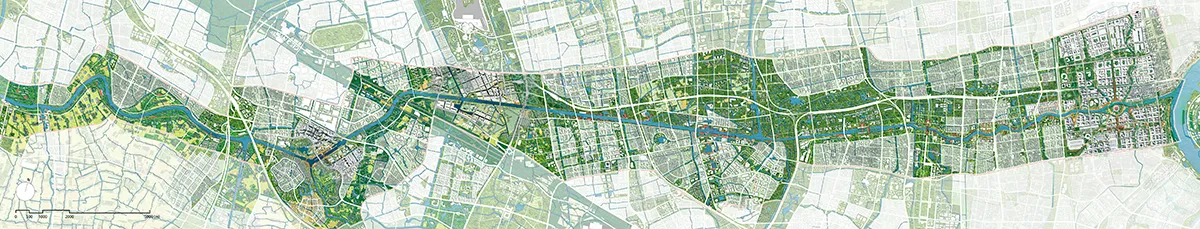
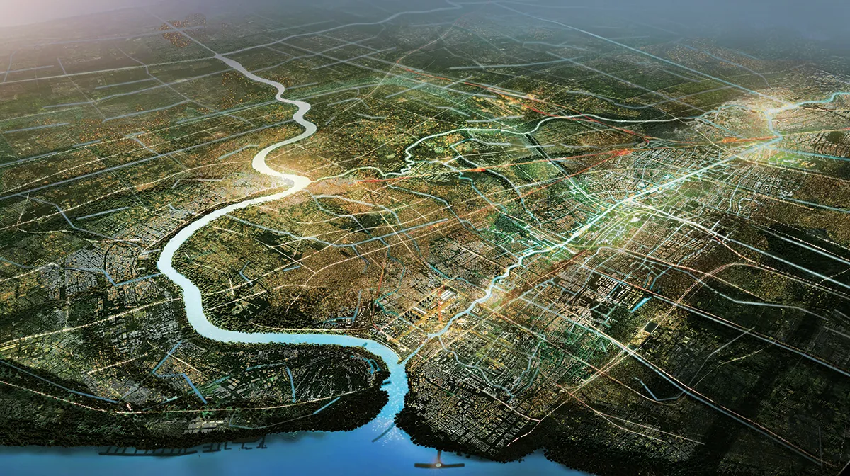
Shanghai Wusong River – Wenzaobang Waterway Area Overall Spatial Design is a landscape masterplan with keynode design for the region along 47km Wusong river in north of Shanghai China. The proposal shows how to bring human development goals together with natural regeneration again. With three main strategies: ‘Ecology raised by river’, ‘Connectivity raised by river’ and ‘Places raised by river’. Wusong River – Wenzaobang shall be transformed from a simple waterway into a blue spine, leading the rejuvenation of northern Shanghai.
The proposal of “North Shanghai raised by a river” comes from the dual meaning behind the indigenous saying “a boy raised by a river”. It reminds us that once humans lived in greater harmony with their environment: the location influenced how a humans lived; a river shaped the culture of a people. Wusong River is the lifeline and teacher of a flourishing metropolitan region. Ecological systems – water and soil – are the base layer for all decision making. Diverse human and non-human habitats along Wusong River are platforms for the development of the whole of Northern Shanghai towards a new era of ecological civilization.
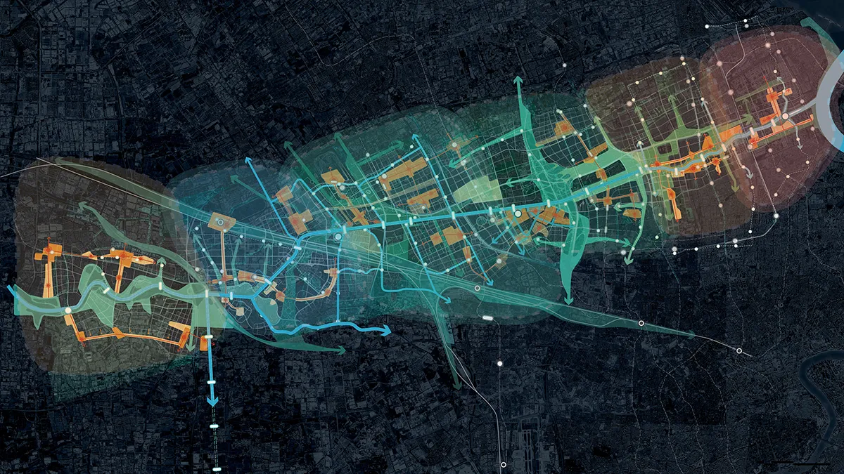
Our analysis and planning for the Wusongjiang River unfolds on three levels: System, Places, and Actions.
System
At the System level, we propose three strategies: Ecology as the foundational strategy, Dynamic strategy to synergize connectivity, and Place-making strategy by water. The project vision Wusongjiang River as a potential link between the freshwater wetland habitat in the Taihu Lake area and the saltwater tidal wetland habitat at the mouth of the Yangtze River. We recognized the potential for new habitats in the hinterland of the riverbank, nurtured by water.

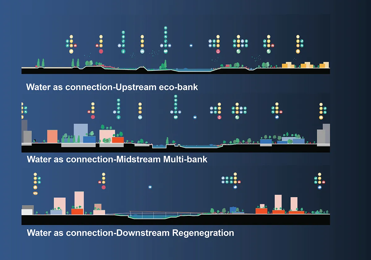
By a new proposed urban to waterfront strategies in different sections, we see waterway itself plus hinterland as strategic habitat corridor for various small animals. We aim to rejuvenate the riverbank in the upper section and optimize ecological regeneration; diversifying the port shoreline in the middle section to seamlessly integrate habitats into the city. Additionally, relocating the Wendong Sluice Gate to the river mouth will eliminate water level differences and enhance ecological embankments.
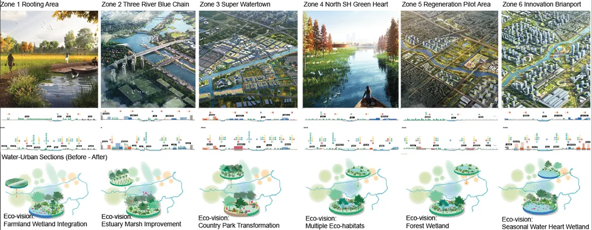
Places –
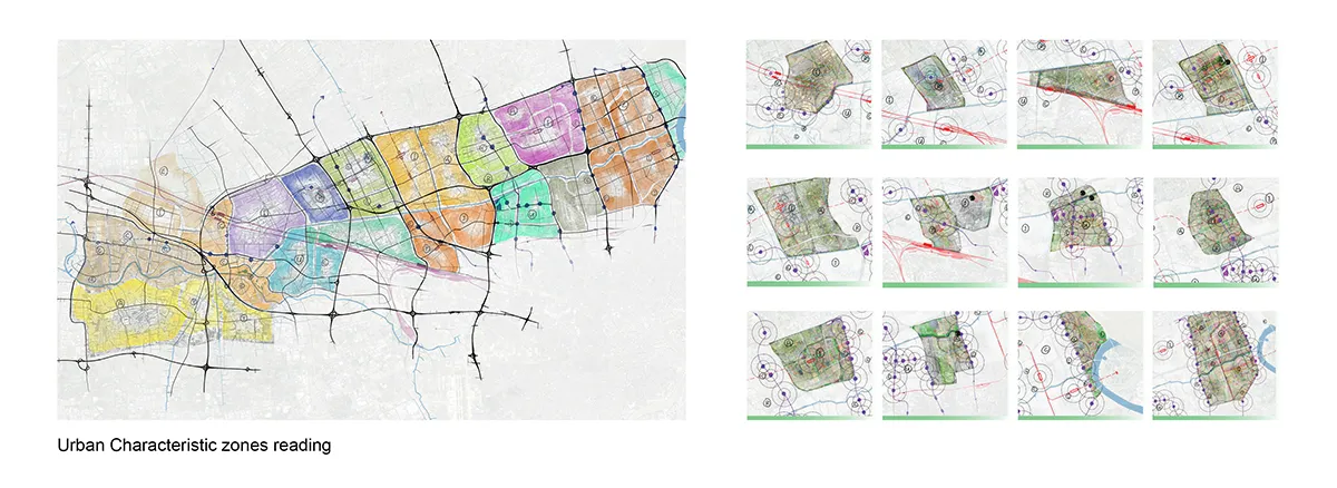
At the level of Place-making, water has always been the central element of northern Shanghai since ancient time. Current north of shanghai read as scattered puzzles. We see Water as Gravity for North Shanghai and create strong development logic for 6 clusters along the 46km zone – from very eco to urban regeneration, each has a water-led place-making framework. We give key-node level analysis and detailed design framework to lead two pilot areas for future development in the area.
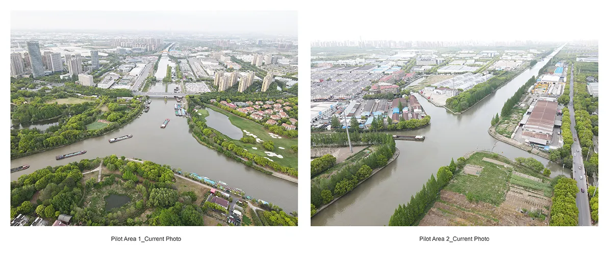
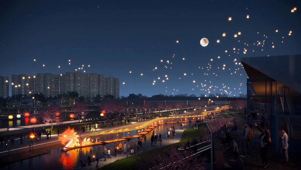
Pilot Area 1: The Three Rivers Blue Chain
Presently, the waterfront is dominated by factories and golf villas. Our proposal sees waterway as an eco-led infrastructure, leads people back to the waterfront in terms of ecology, new-productivities and lifestyle. This approach advocates for a transformative thinking, bridging the ecological corridor and fostering collaborative synergy among industry, academia and exhibition sectors. Central to this vision is ecological synergy, emphasizing the integration of the estuary’s green space system to create a dynamic ecological interaction zone. Additionally, urban-rural synergy is prioritized through the interconnection of industries across the three riverbanks. Strengthening waterfront accessibility links is imperative, necessitating the establishment of diverse transportation networks to enhance connectivity and accessibility.

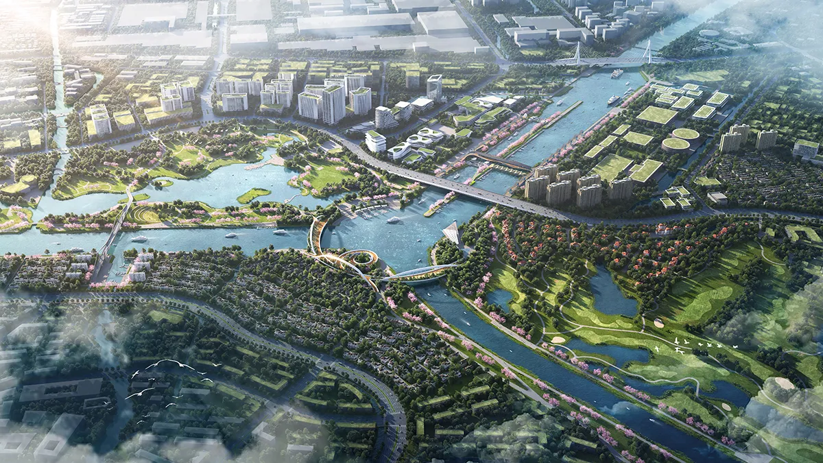
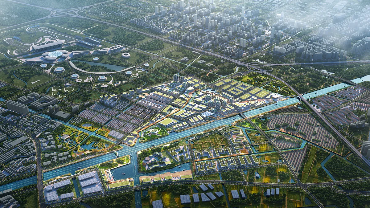
Pilot Area 2: A Super Watertown
Using the Anting Port Area and the Canal Town as demonstration examples of modern water towns. We really want to bring back the water life philosophy in the indigenous living in this area.
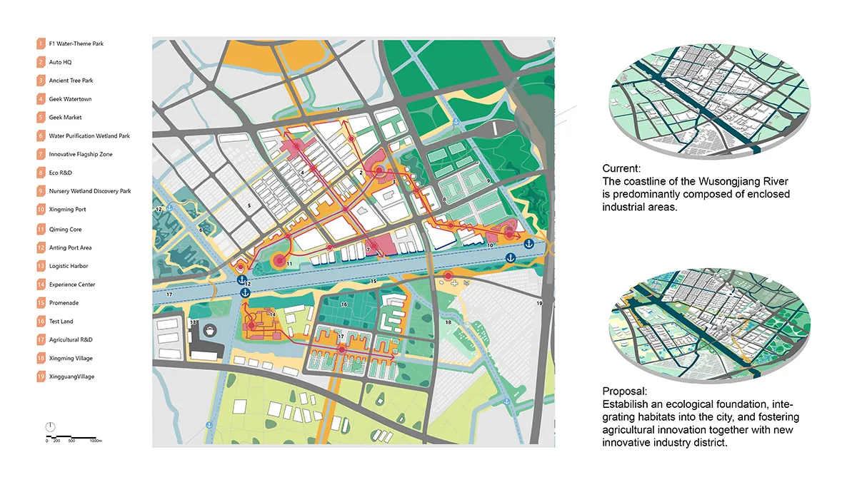
In the prevailing landscape, the Wusong River coastline is largely defined by enclosed industrial zones. Our proposal seeks to redefine this environment by establishing a robust ecological foundation, seamlessly weaving habitats into urban landscapes. This transformative initiative not only encourages agricultural innovation but also spearheads the development of novel industrial districts. The creation of habitats is meticulously orchestrated through a blend of landscape substrates and strategic planting, fostering biodiversity and ecological resilience. Four distinct areas are earmarked for natural restoration efforts, fostering a harmonious coexistence between nature and humanity at the heart of our urban fabric.
Actions
The implementation stage is expected to be finished together with local planning authorities. Operationally in Actions, we advocate the establishment of a ‘Collaborative Navigator’ guiding cross-district and cross-disciplinary collaboration in terms of directional, systematic, and timely development along the waterway by a Raising-City-Plan and Action Toolbox.
Even in times – when considerations and investment beyond human needs are challenging, it is essential to plan for a new balance between human and planetary interests to avoid more extremes. We see Shanghai Wusong River – Wenzaobang Waterway Area Overall Spatial Design as a perfect leading case to deliver on this responsibility.
Shanghai Wusong River – Wenzaobang Waterway Area Overall Spatial Design
Location: Shanghai, China
Designer Credit:
MLA+ B.V.; Shanghai Xian Dai Architectural Design (Group) Co., Ltd ; Hangzhou Landscape Architecture Design Institute Co., Ltd.
Design Team:
MLA+ B.V. -Markus Appenzeller, Jingyue Yan, Chuanzhi Sun, Li Tan, Jun Yang, Martin Probst, Olaf Gerson, Yuzhou Jin, Keyan Tang, Xiaolu Sun;
Shanghai Xian Dai Architectural Design (Group) – Wen Wu, Bin Luo, Nannan Wen, Tao Yan, Lin Zhan, Shizhan Huang, Yawen Deng, Weize Xu, Jingjing Huang, Yuwei Wang;
Hangzhou Landscape Architecture Design Institute – Yonghong Li, Guangqing Zou, Zhibin Shi, Siyu Xiang
Client:
Shanghai Municipal Bureau of Planning and Natural Resources;
Shanghai Municipal Transportation Commission and Shanghai Municipal Water Administration, The People’s Government of Baoshan District Jiading District and Qingpu District of Shanghai and the People’s Government of Kunshan City of Jiangsu Province; the Planning and Natural Resources Bureau of Baoshan District Jiading District; Qingpu District of Shanghai and Kunshan City Natural Resources and Planning Bureau of Jiangsu Province
Image Credits: MLA+ B.V.; Shanghai Xian Dai Architectural Design (Group) Co., Ltd ; Hangzhou Landscape Architecture Design Institute Co., Ltd.
Be the first to comment