Wuhan’s strategic location on the banks of the Yangtze River in central China has led to its sustained success as a trade hub for centuries. Heralded as the “crossroads of nine provinces,” Wuhan continues to build on this legacy of economic vitality and mobility. Boosted by a series of national policies and already revered as one of the world’s fastest growing hubs for technology and innovation, the city is advancing its ambition to be at the vanguard of China’s next wave of progress.
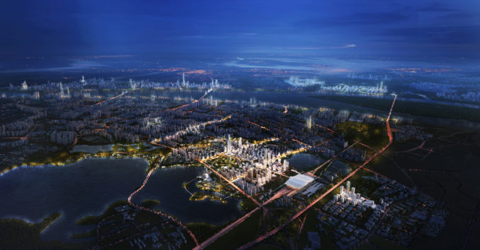
The rapid expansion of China’s High Speed Railway network has been instrumental in driving economic growth throughout the country at both the city and regional scale. Evidence of this initiative’s success is the pairing of the Wuhan High Speed Railway station and the new Yangchun Lake Business District. Designed by Sasaki in collaboration with a diverse interdisciplinary team including Arup, JLL, and the Wuhan Planning Institute, the master plan was recently approved by the city, marking a major step forward as Wuhan embraces a progressive yet realistic vision for the district.
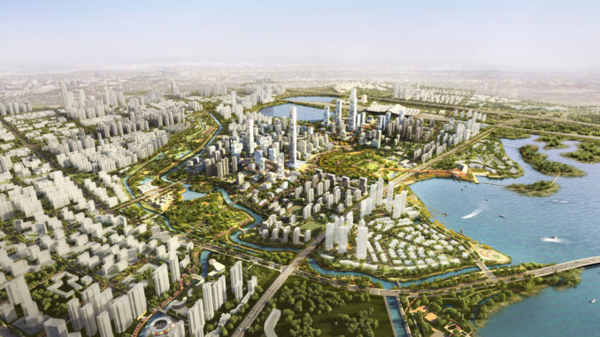
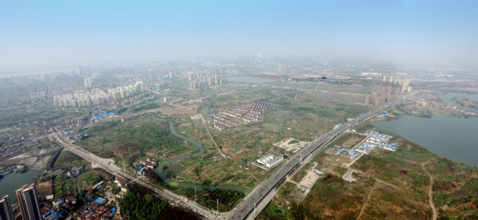
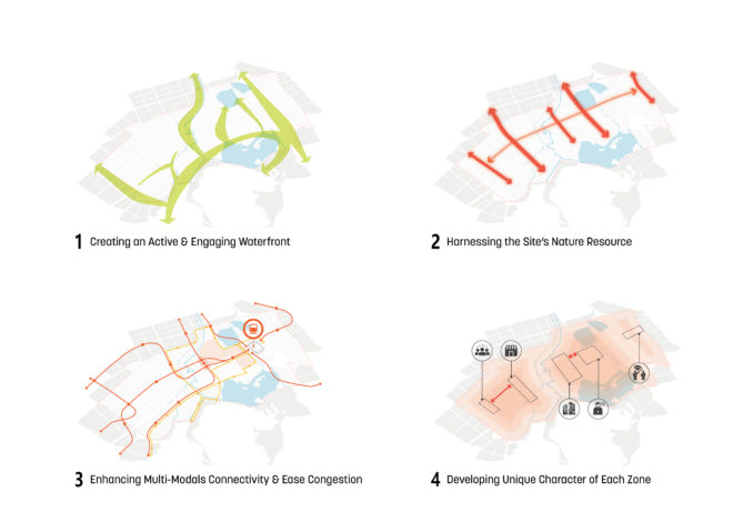
Once on the periphery of the urban core, a recent influx in population to Wuhan led to the rapid densification of the district, but absent a planning vision to accommodate for this growth. Reclamation of the lake’s edge provided necessary land to respond to development pressures but resulted in a detrimental impact on the water quality of Yangchun Lake. Another significant environmental concern was a large solid waste landfill near the waterfront. These existing conditions inspired the Sasaki team to develop a series of five key remediation strategies that respond to these environmental challenges.
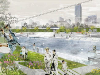
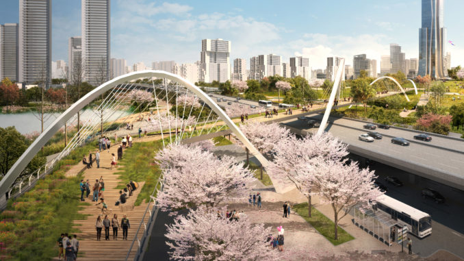
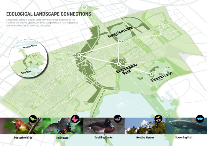
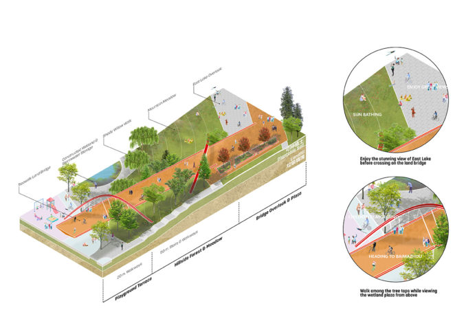
The first strategy was the naturalization of the existing canal network throughout the district. The formerly channelized waterways are restored to mimic natural processes including reestablishing their connection to the floodplain of the lake, managing stormwater to reduce impacts from flooding, improving the riparian habitat, and enhancing connectivity to the lake for both humans and wildlife. Second, a strategy of constructed wetlands along the lake’s edge filters urban runoff while providing critical habitat for a variety of avian, amphibian, aquatic, and terrestrial species.
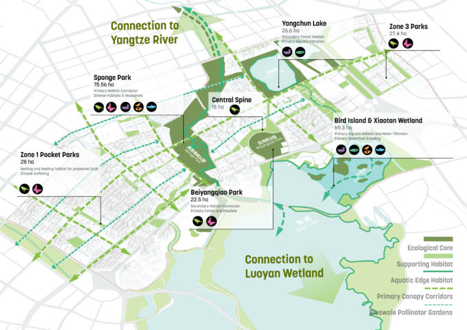
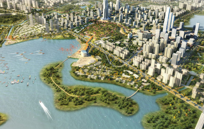
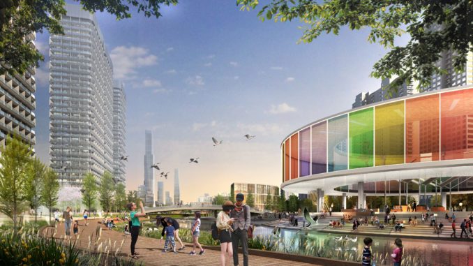
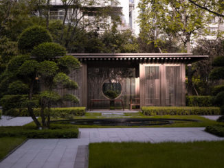
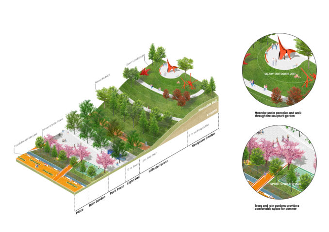
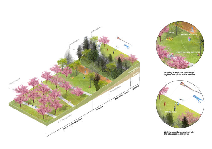
Designed with a series of boardwalks and trails that link to other recreational pedestrian routes throughout the district, the wetland establishes contiguous public access along the once privatized waterfront. The third strategy was the creation of a system of greenways throughout the entire district that follows existing drainage patterns and major roadways. This system provides an urban tree canopy that offers numerous benefits including habitat creation, energy reduction by shading adjacent buildings, and a comfortable microclimate for pedestrians. Fourth, a series of pocket parks are interspersed in each of the district’s neighborhoods, allowing all residents to live within a 10-minute walk of a public landscape.
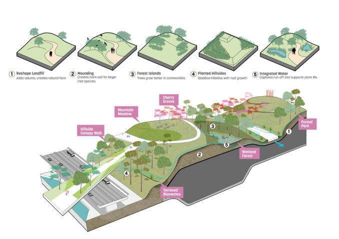
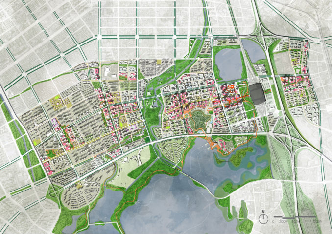
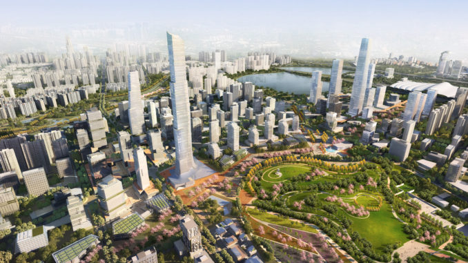
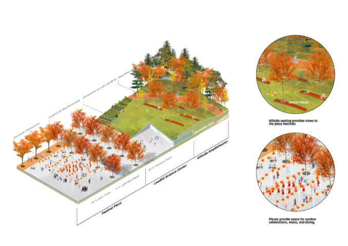
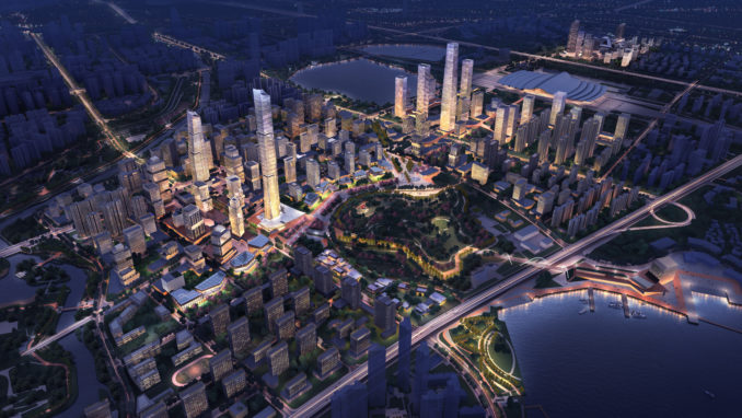
These pocket parks provide daily amenities such as playgrounds and sports fields while also incorporating rain gardens to collect, filter, and replenish groundwater while reducing the impacts of urban flooding. Finally, the fifth strategy was the creation of a new central park. Built upon a former solid waste landfill, the central park repurposes this once noxious use into a vibrant recreational and ecological amenity. When combined, these strategies provide a total of 368 hectares of new open space throughout the district in a variety of typologies that enhance the urban experience.
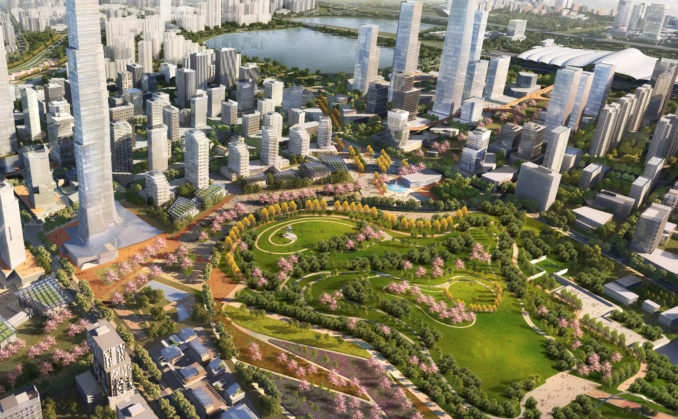
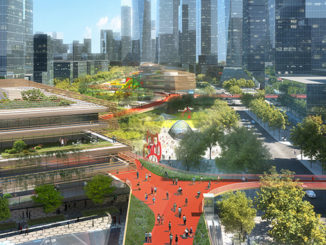
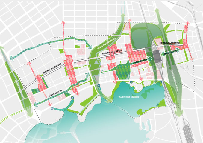
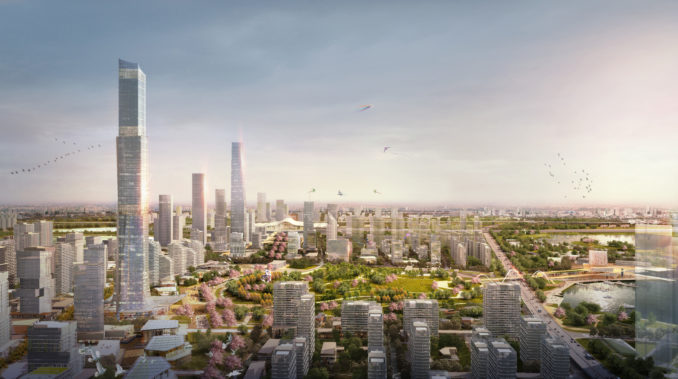
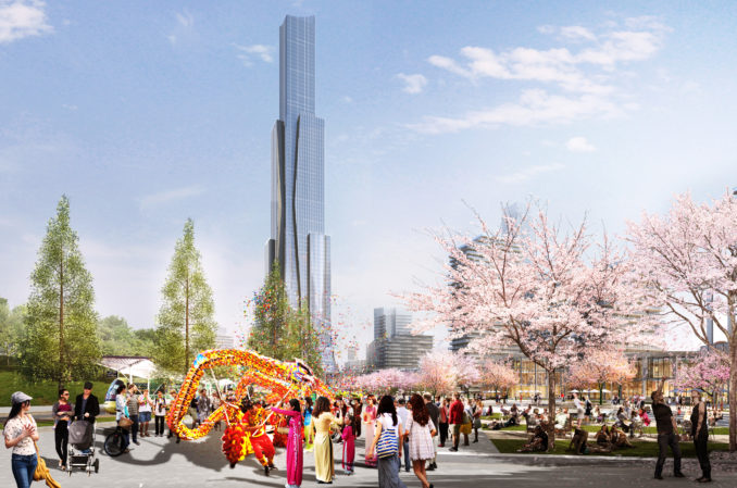
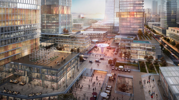
With the environmental improvements and landscape interventions providing the initial armature for the new district, the plan was then organized around a comprehensive pedestrian network to promote walkability and a safer, human-scaled environment that links the district’s parks, plazas, and streetscapes. A series of north-south streets and linear open spaces connect interior landscapes to the lake, providing accessibility and establishing view corridors. Densifying the street grid to create smaller blocks and accommodating autonomous vehicle routes completes the urban design interventions the district. The master plan thoughtfully retained existing neighborhoods to avoid disrupting social networks, while providing guidelines for diversifying land uses within parcels to foster new business opportunities for local residents and allowing for flexibility to accommodate future uses as the district evolves. The result is a landscape-forward urban blueprint that advances an environmentally progressive agenda and defines Wuhan’s next generation of growth.
Wuhan Yangchun Lake Business District
Wuhan, P.R. China
Design Firm: Sasaki
Services: Planning and Urban Design, Landscape Architecture, Architecture
Client name: Wuhan Planning Bureau
Size: 1,800 Hectares (4,448 acres)
Status: Completed 2018