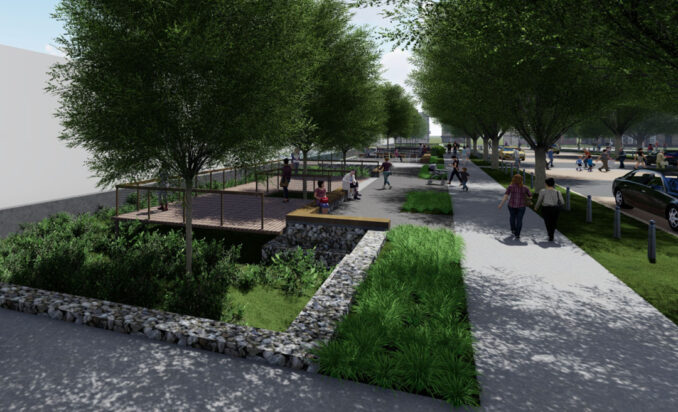
As record-breaking climate change induced flood events become ever more frequent and devastating, cities urgently need new, forward-thinking resilience tactics. In 2022, Washington, DC’s Department of Energy & Environment (DOEE) implemented unprecedented solutions to protect the city’s most vulnerable communities from these extreme flood events.
Washington DC’s Southwest Quadrant is located at the convergence of the Potomac and Anacostia Rivers–and encompasses the Southwest and Buzzard Point neighborhoods. These neighborhoods, bustling with dense development, are home to a population of several thousand residents–including those served by established public housing developments. In 2016, Climate Ready DC determined that the SW Quadrant, among DC’s lowest-lying areas, is particularly susceptible to climate change induced interior flooding, a specific type of extreme flood event that stems from increased rainfall and diminished surface permeability. Interior flooding is projected to have an immense impact on urban areas, as the natural ability of the urban environment to manage and control stormwater is compromised. With these compounding factors in mind, DOEE identified SW as one of two areas poised for a climate resilience pilot program. In 2022, DOEE mobilized an interdisciplinary team of local and international experts, including Ramboll, Design Green, MKSK, Moody Graham, and Karp Strategies to re-imagine Southwest DC’s stormwater and blue-green infrastructure.
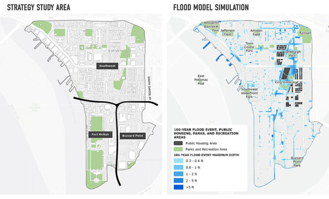
DOEE’s Southwest & Buzzard Point Flood Resilience Strategy (The Strategy) is the first in the nation’s capital–and one of the first worldwide–to give form at a neighborhood scale to the stormwater infrastructure that cities will need to handle extreme flooding events in the future. The project team proposed new prototypes that change the overall strategy and paradigm for stormwater management infrastructure, going beyond DC’s underground network of management pipes and basins. This integrated network of parks and streetscapes will be able to convey volumes of up to five times the current storms. During major flood events, a network of ballfields, amphitheaters, and bioswales will become massive stormwater basins, redirecting a critical amount of storm saturation away from homes, businesses, community facilities, streets, and infrastructure.
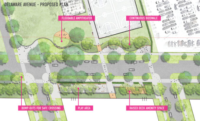
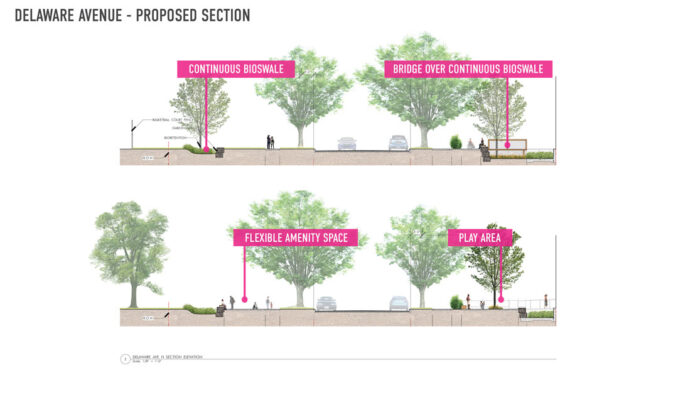
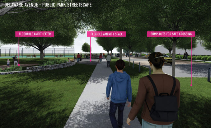
While this state-of-the-art overland network is designed to handle increased saturation during extreme flood events, a series of associated park improvements also enhance their everyday use. The Strategy outlines the creation of venues for community: environmental education and stewardship, spaces for sport and play, and spaces for restoration and passive enjoyment. The project team also called for improving traffic safety while promoting alternative means of transportation. Native planting, trees, and access to green space provide a myriad of real-time health benefits for the associated communities, including improved air quality, stress reduction, and cooler summer temperatures.
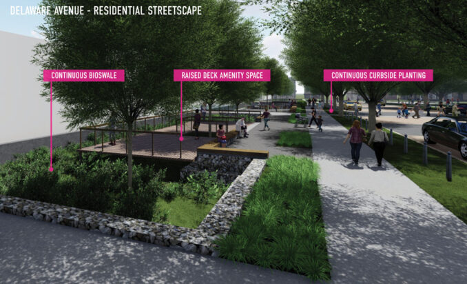
Securing $18M in funding for implementation, DOEE will proceed using a phased approach–prioritizing high-risk areas identified through modeling and further study. Elsewhere, the tactics developed by the project team offer precedents for cities worldwide needing innovative solutions to prepare communities for flood resilience.
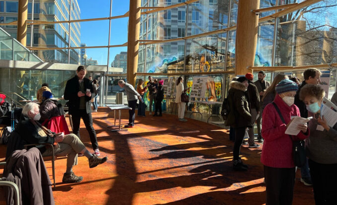
You can access DOEE’s final Strategy documents here.
Learn more about MKSK’s LAB for Climate & Biodiversity Resilience and our commitment to sustainable planning and design methodologies.
Image Credits: MKSK’s LAB for Climate & Biodiversity Resilience unless otherwise captioned.
