GIS (Geographic Information Systems) is important part of the urban planning and urban design process. GIS has often been associated with science, and not so much on design. Geodesign offers to shake up the notion of GIS. Geodesign provides a design framework and supporting technology for design professionals to leverage geographic information, resulting in designs that more closely follow site and natural systems.
Geodesign is a new way of thinking about the design process, utilizing site data with software such as a GIS (Geographic Information System) to create urban or landscape designs.
The Wikipedia’s entry on Geodesign states that ” Geodesign is a set of techniques and enabling technologies for planning built and natural environments in an integrated process, including project conceptualization, analysis, design specification, stakeholder participation and collaboration, design creation, simulation, and evaluation (among other stages). ”
Michael Flaxman, former MIT Professor and CEO of Geodesign Technologies, states that “GeoDesign is a design and planning method which tightly couples the creation of design proposals with impact simulations informed by geographic contexts.”
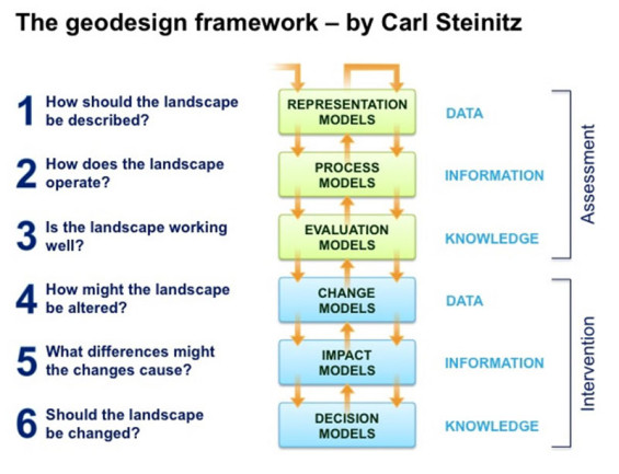
Professor Carl Steinitz, Professor of Landscape Architecture and Planning, Emeritus, brought to the limelight the geodesign framework for landscape architects and designers of the built environment, by posing a series of fundamental questions that as designers of the built environment, should think about and address. Refer to the “Geodesign Framework- by Carl Steinitz” for the summary of questions.
Jack Dangermond, the founder and President of Esri Inc, studied landscape architecture at Harvard’s GSD. He has tapped into his landscape architecture roots and is revolutionizing the concept of geodesign for landscape architecture, architecture, planning and urban design fields. Dangermond claims that, “Geodesign is about integrating geographic knowledge with the spatial design process…..design with nature, or geodesign, is our next evolutionary step.”
Technology wise, think of CAD, BIM, GIS all in one.
Esri offers a suite of software from 2D mapping to 3D modeling as part of the Geodesign solutions, which combines sketching and modeling tools with the power of data, GIS and high quality renderings. The Geodesign Platform includes mainly the following suite of applications:
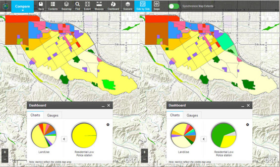
Geoplanner for ArcGIS, which is a web-based, easy to use sketching and mapping tool to design scenarios. It leverages geo-based data and supports all the steps of land-based planning and urban design. This includes sketching and designing scenarios (design alternatives), understanding the impact of your designs, perform site and spatial analysis and compare alternative designs.
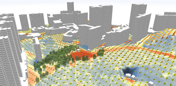
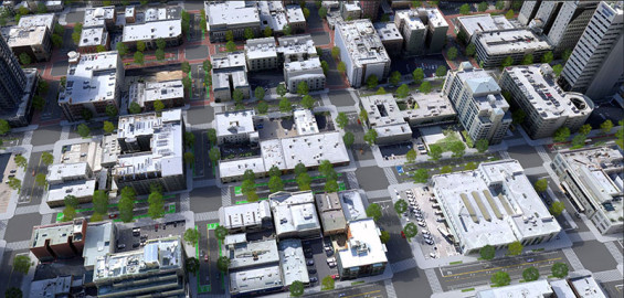
ArcGIS Pro which is a robust desktop application which render and process data faster than ever. The software allows you to design and edit your concepts in 2D and 3D with multiple view ports. You can perform 3d site analysis like wind analysis, shade/ shadow analysis, circulation patterns, density, view-shed analysis. Designers can add realistic trees, buildings and infrastructures quickly.
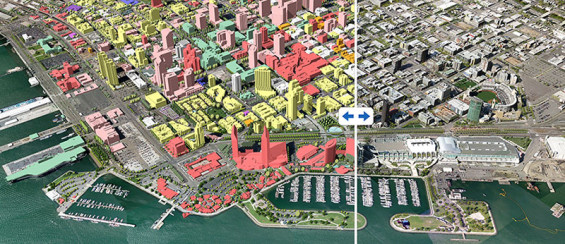
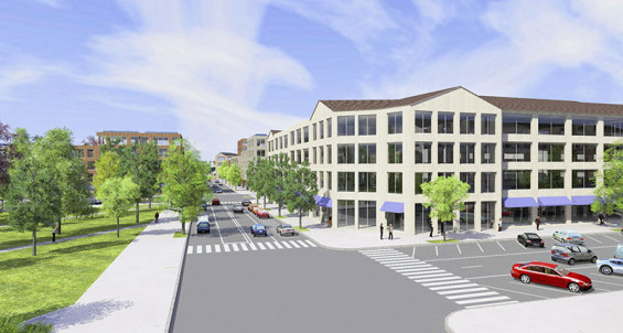
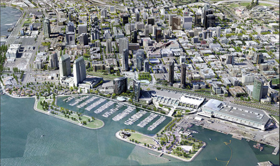
CityEngine which is a 3D modeling software which leverages parametric modeling and geo-based data to create evidence-based city and landscape designs. EngineCity creates high quality renderings. CityEngine allows you to import your urban design proposals within existing built urban context in Cityengine. Using parametric and rule procedures, the landscape architect can create, change and test mass modeling to comply with zoning regulations; test shadow area; create detailed streetscapes and create quality public realm spaces. It offers intuitive and effective tools for façade and landscape texturing, adding landscape elements and various tree species. CityEngine provides perspective correction to capture the right views. CityEngine is integrated with ArcGIS.
All these tools provide real-time feedback on your changing design concepts.
Geodesign combines site and nature “with design by providing designers with robust tools that support rapid evaluation of design alternatives against the impacts of those designs. Geodesign infuses design with a blend of science- and value-based information to help designers, planners, and stakeholders make better-informed decisions….[the geodesign platform] offers geospatial modeling, impact simulations, and real-time feedback to facilitate holistic designs and smart decisions.”
Text | Nadia Amoroso
Images | Courtesy of Nadia Amoroso
Nadia Amoroso is the author of Representing Landscapes: Digital publish recently by Routledge.
Nadia Amoroso is an academic in landscape architecture whose work focuses on the role of visual representation, digital media, urban design and creative mapping. Amoroso is the Director of Amoroso Studio, focusing on landscape and urban design representation and creative cartography. She was the co-founder and Creative Director of DataAppeal™, a data-design visualization and GIS company.