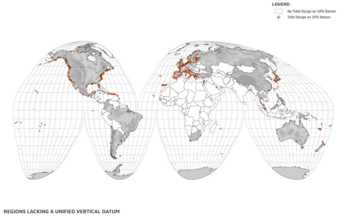
Coastlines are migrating upland faster than at any point in recorded history. As dunes, wetlands and coastal marshes rollback, the need for littoral adaptation and protection increases. In the wake of mounting climate volatility and demands for resilient infrastructure, landscape architects are increasingly called to engage in these valuable and vulnerable coastal zones. Yet vast stretches of the coast across the world lack the basic data for understanding tides, surges, swells and other coastal processes. Landscape architects are thus required to be the authors of such necessary geospatial resources.
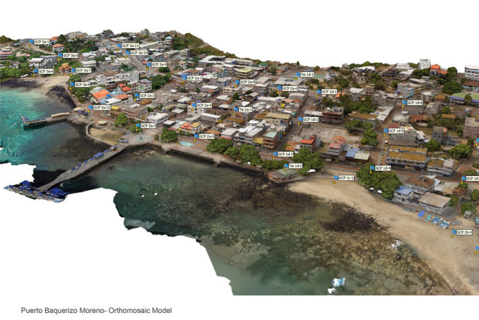
We have been working with students in the Galápagos Islands on projects that relate to the growth of Puerto Baquerizo Moreno on San Cristóbal Island. One of the issues we found was a mismatch between land and water elevations – information that would facilitate reconfiguring this zone to improve the conditions related to the conflicting uses among people and animals, as well as provide the base model for sea-level rise (SLR), storm-surge, and tsunami modeling.
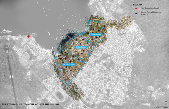
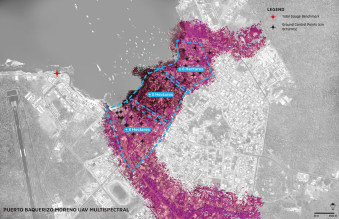
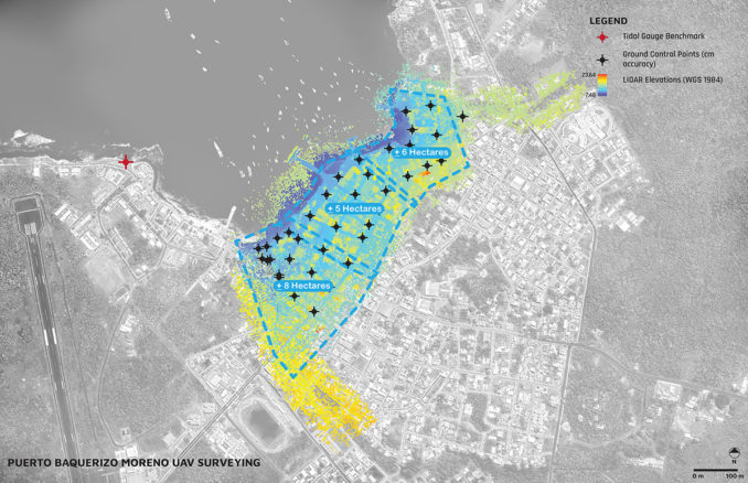
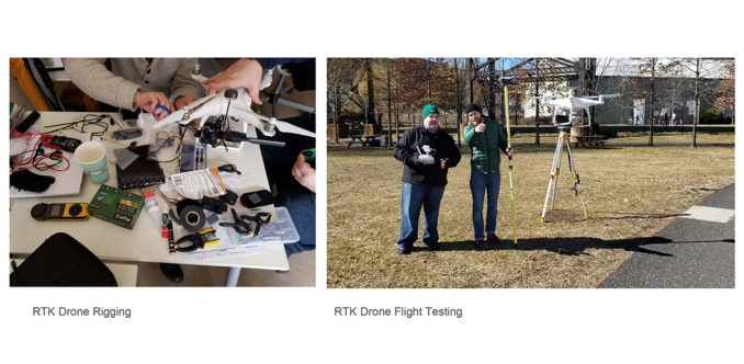
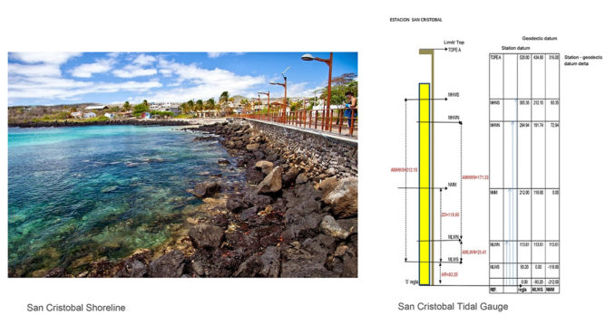
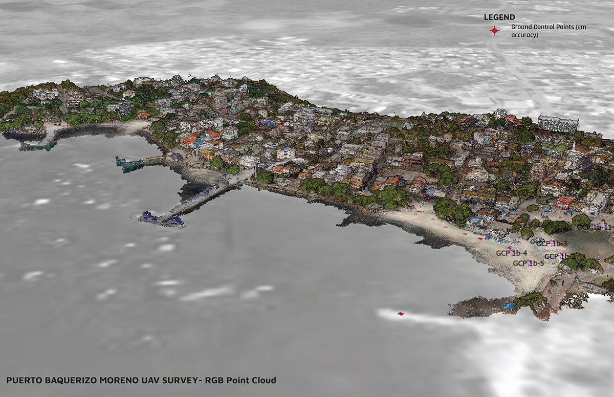
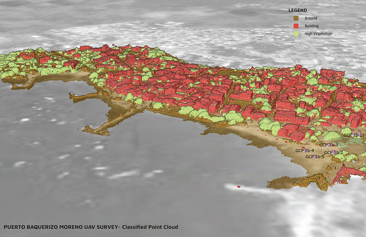
Surprisingly, one of the most scientifically studied sites in the world, the Galápagos Islands, lacks such data. As part of Karen M’Closkey’s 2017 Penn design studio in San Cristóbal Island (Galápagos, Ecuador), we reached out to INOCAR (The Oceanographic Institute of the Navy in Ecuador, similar to the USA’s NOAA) for tidal gauge data. Without a consistent and unified vertical datum, tides cannot be accurately referenced to the land. INOCAR, however, did not have this information. In response, they requested our assistance in the data collection and modeling. Using UAV technology and GNSS/GPS survey equipment, we mapped and modeled Puerto Baquerizo Moreno’s shoreline, including the gauge location. The georeferenced data will enable INOCAR to establish an accurate topo-bathy model and unified vertical datum for the islands’ tidal gauge. The population of Puerto Baquerizo Moreno is projected to double in the next decade; therefore, this information is essential for modeling past and future storm surge, sea-level rise, and tsunami scenarios as it relates to urban growth and coastal resiliency.

Galapagos Shoreline Mapping
Landscape team: Keith VanDerSys, Karen M’Closkey, Michael Luegering, and Michael Tantala
Location: Puerto Baquerizo Moreno, Galapagos, Ecuador
Completion date: July 2019
Image Credit: PEG