Lower Manhattan is the birthplace of New York City, and over the centuries the neighborhood has continued to evolve as part of a transforming and growing city. Today, it remains an iconic global symbol of our city and an exemplar of dynamism and resilience. By the 2040s, however, tidal flooding and more frequent and severe coastal storms will threaten the long-term viability of the Financial District and Seaport neighborhoods. Over the last two years, an interdisciplinary team of planners, engineers, architects, and landscape architects worked in close collaboration with NYCEDC and MOCEJ to develop a strategy for adapting the one-mile stretch of shoreline from the Brooklyn Bridge to The Battery. Released in December 2021 by the NYCEDC and Mayor’s Office of Climate Resiliency (MOCR) the Financial District and Seaport Climate Resilience Master Plan, a blueprint for comprehensive flood defense infrastructure to protect Lower Manhattan from the urgent threat of climate change. The plan, projected to cost $5 to $7 billion, reimagines the shoreline of Lower Manhattan and creates a 21st Century resilient waterfront to withstand severe coastal storms and rising sea levels, which together pose a serious threat to the low-lying Financial District and South Street Seaport neighborhoods where close to a million people work, live, and commute through.
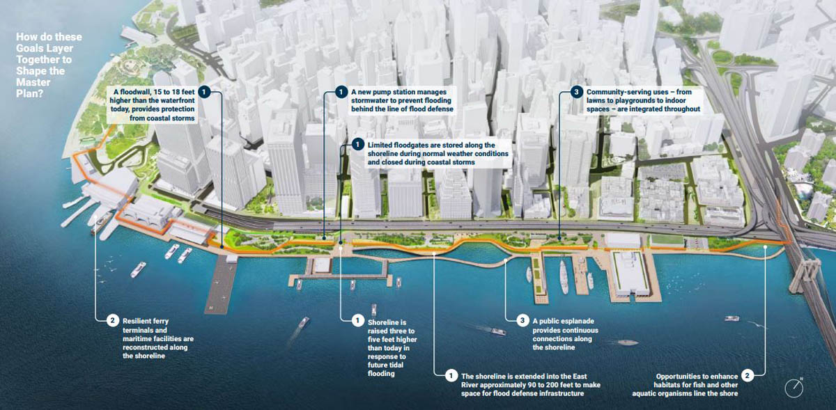
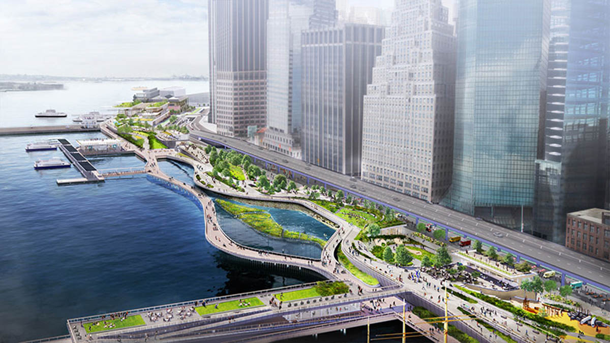
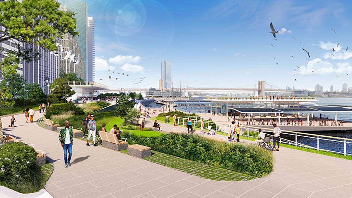
To protect the area, which was hard-hit by Hurricane Sandy in 2012, the master plan features a multilevel waterfront that extends the shoreline of the East River by up to 200 feet from its existing location. The upper level will be elevated by about 15 to 18 feet to protect against severe storms like Sandy, while doubling as public open spaces with sweeping views of the city and harbor. The lower level will be a continuous waterfront esplanade, raised three to five feet to protect against sea level rise while connecting New Yorkers to the water’s edge. When implemented, this innovative design will protect approximately 140 acres and prevent up to $1 billion in annual damages, starting in the 2050s. It will safeguard Lower Manhattan in a time of rising sea levels and more frequent and intense coastal storms.
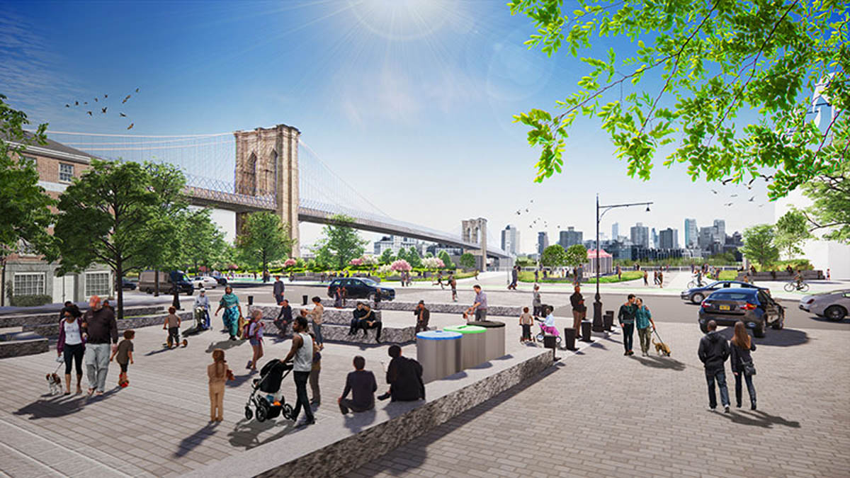
The master plan encompasses almost one mile of waterfront from The Battery to the Brooklyn Bridge. Notable features of the proposed plan include:
- Floodwalls buried in the landscape that create a line of ridges along this waterfront, permanently protecting Lower Manhattan from coastal storms and creating new open spaces with expansive views of the harbor
- Resilient stormwater infrastructure, including a new pump station along with green infrastructure
- Resilient ferry terminals for Staten Island, Governors Island, and NYC Ferries, among other operators
- Universally accessible entrances and pathways, designed to ensure people of all ages and abilities can get to and move around the waterfront
- New public open spaces with playgrounds, plazas, lawns, seating, and cafes
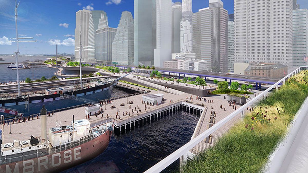
Coves that promote habitat restoration and provide opportunities to learn about the ecology of the East River - Resilient piers for docking historic ships, bolstering the historic character of South Street Seaport
The City has worked closely with the community to shape this plan. Through numerous public meetings and workshops, an online engagement portal, youth outreach with local schools, and other creative forms of engagement, the City incorporated feedback at every step along the way. To maximize outside input, the City also formed the Climate Coalition for Lower Manhattan, a group of local and citywide stakeholders chaired by Elizabeth Yee, Executive Vice President and Chief of Staff at The Rockefeller Foundation, and Tammy Meltzer, Chairperson of Manhattan Community Board 1.
The Financial-District and Seaport Climate Resilience Master Plan is part of the larger Lower Manhattan Coastal Resiliency (LMCR) strategy, backed by over $900 million in City investments to protect Lower Manhattan from flooding. This includes active capital projects in Battery Park City, The Battery, and the Two Bridges neighborhood north of the Brooklyn Bridge. In October, Mayor de Blasio announced $110 million in City funding for Seaport Coastal Resilience, a new project to protect South Street Seaport—the lowest lying and most vulnerable part of the master plan study area—from flooding in the years before the master plan is implemented.
To learn more and download the full report, please visit fidiseaportclimate.nyc.
Financial District & Seaport Climate Resilience Master Plan
Landscape Architect | SCAPE
Architect | One Architecture & Urbanism
Collaborators | AKRF; Arcadis; Matrix New World; Sam Schwartz Engineering; Sive Paget Riesel
Images Credit | Courtesy of NYCEDC and MOCR