Commissioned by the municipality of Groningen, Felixx worked with Goudappel, Stipo and the University of Amsterdam (Marco te Brömmelstroet) on the Design Guide for Public Space – “New Space”. The guide provides a design framework for the future transformation of streets with less space for cars and more space for walking, greenery, sports, playing and social interaction. On December 22nd, 2021, the City Council approved the Guide for reorganizing mobility and public space throughout Groningen.
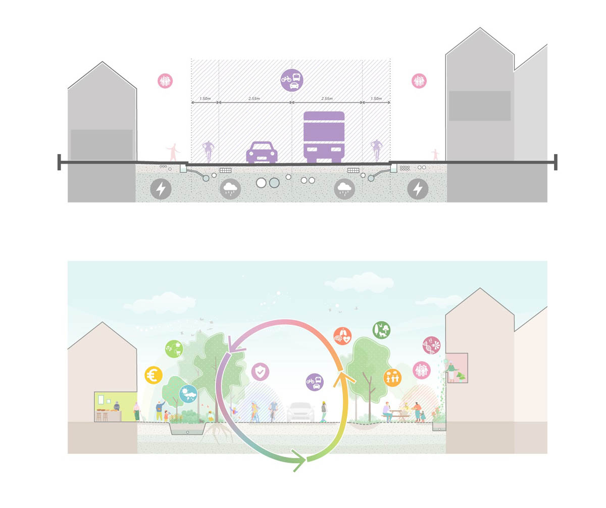
Farewell to the car logic – The 20th century was undoubtedly the century of the car. The pursuit of speed and individual freedom has led to the layout of the city that follows the logic of traffic. As a result, other vital functions became secondary. The effects of climate change together with a growing recognition of the social significance of public space and a greater awareness of the connection between the quality of the urban environment and personal health and wellbeing all increase the pressure on our public space. The transformation of cities to meet the new requirements cannot occur within the space leftover from mobility. In response, the Guide was developed together with the Mobility Vision, ‘Groningen Goed op Weg’, which bids farewell to the car logic.


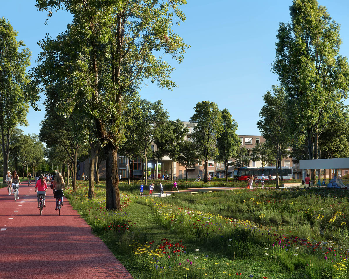
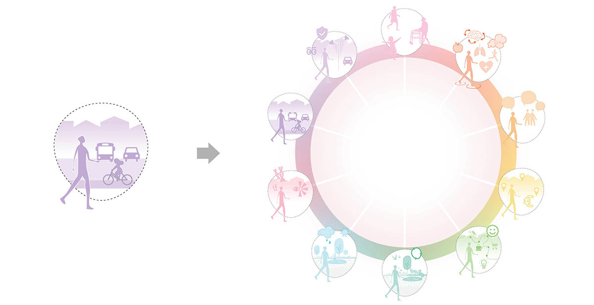
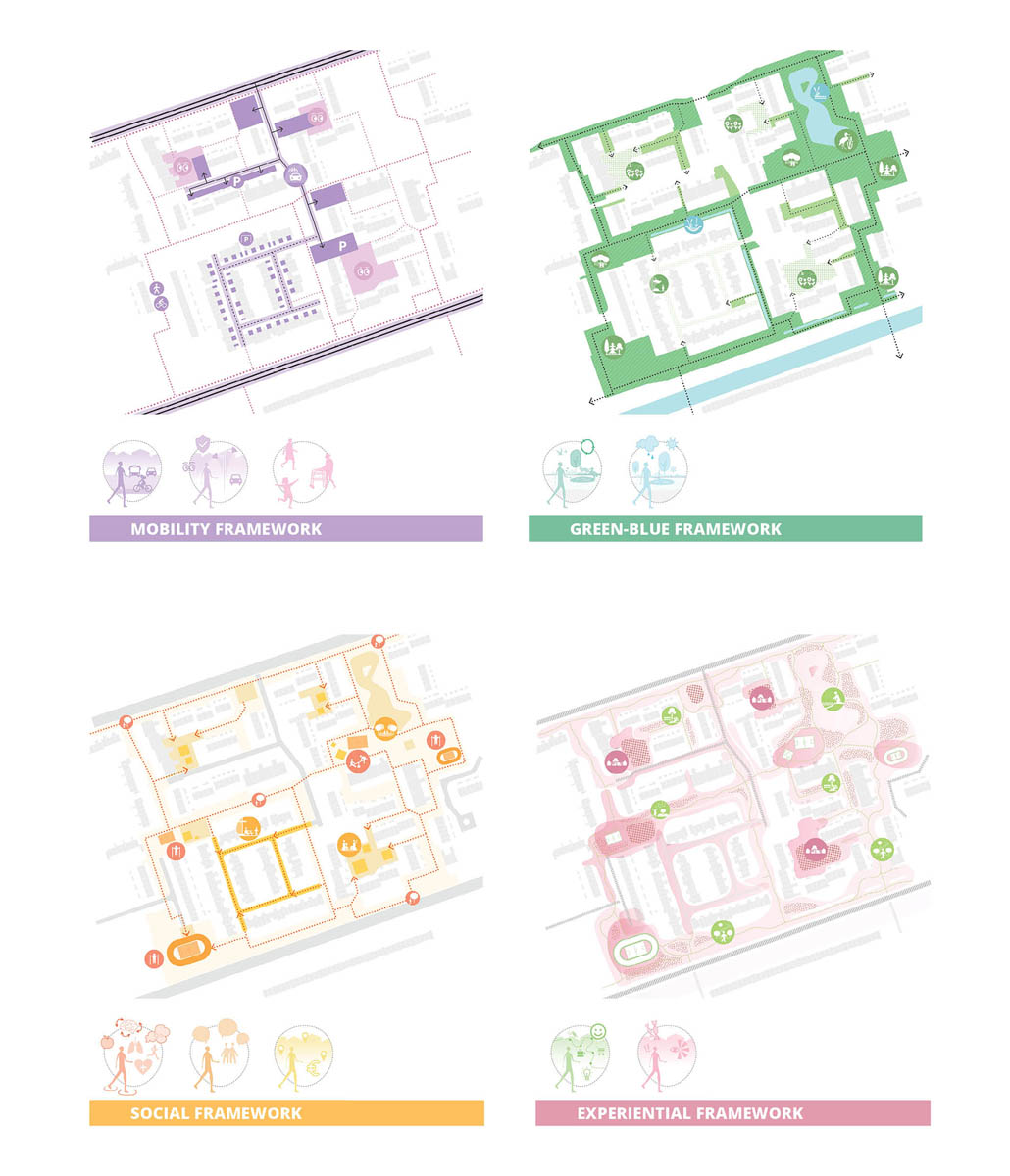
Ten Dimensions – The Guide focuses on the street: the place in the city that brings living and movement together. When mobility no longer dominates, more space can be created for other functions. The guidebook identifies these functions as ‘The ten dimensions of the street’. The ten dimensions integrate policy goals of the municipality and make the streets the domain for their realization:
- Accessibility: the street is for everybody
- Safety: the street is safe for people and traffic
- Perception: the street is more than a route
- Health: the street stimulates movement
- Social: the street is a public domain
- Mobility: the street provides customized accessibility
- Ecology: the street is an ecosystem
- Climate: the street is an urban landscape
- Economy: the street creates value
- Identity: the street has a unique character
“The ten dimensions provide the framework for the redesign of streets as rich ecosystems with diverse functions. Depending on the location and preferences of the residents, the ten dimensions are considered individually and realized in combination. Each street thus becomes a unique piece of Groningen.” – Michiel Van Driessche
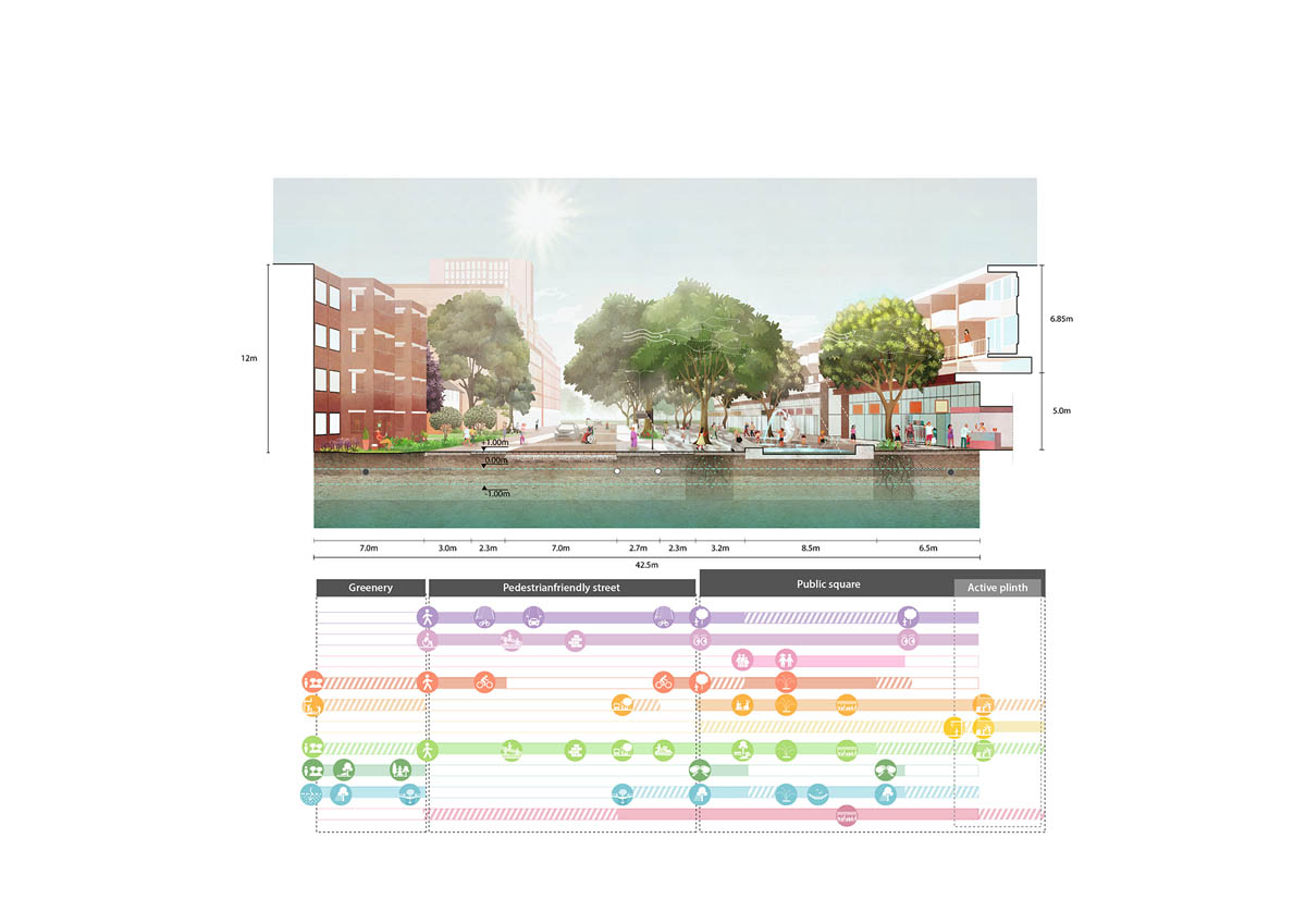
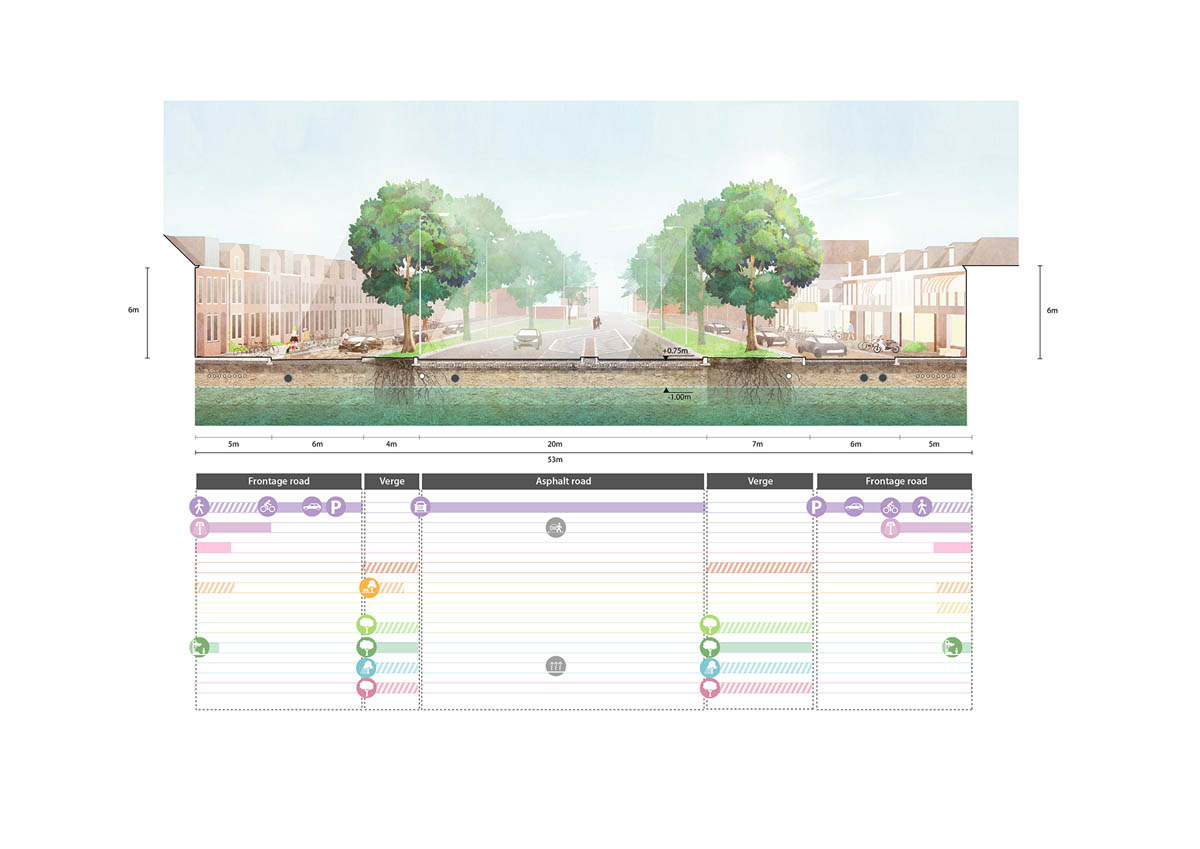
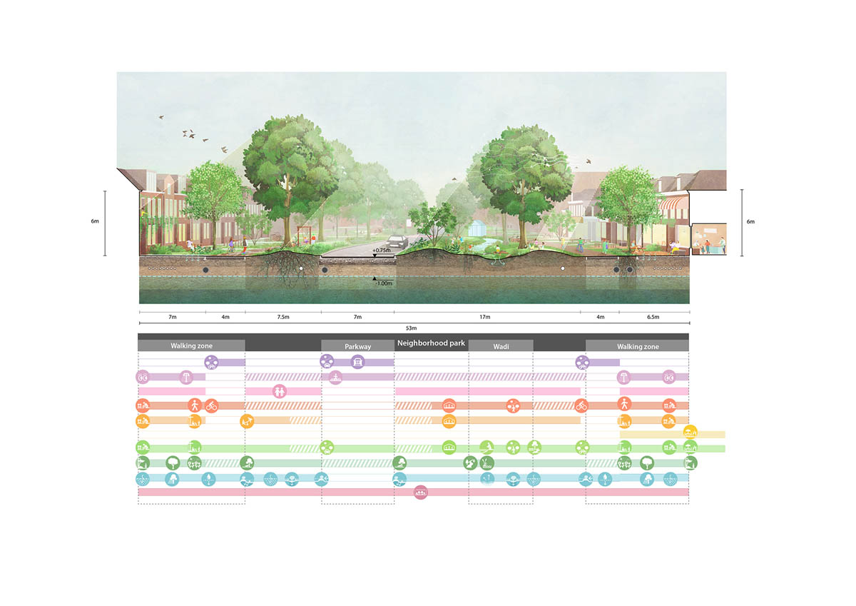
The Guide – The Guide is a tool for designing public space together as ‘a shared space’ for people rather than functional connections. The ten dimensions offer policymakers, designers and residents an operational method:
- at street level, the dimensions are translated into building envelopes and design principles
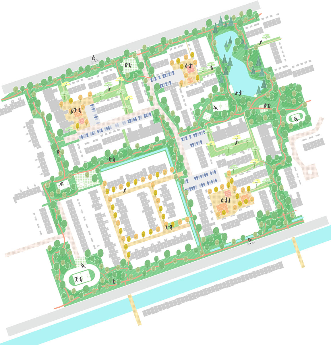
- At the neighborhood level, the dimensions are combined to form frameworks for renewed urban fabric.
- at the scale of Groningen as a whole, the opportunities are shown when the dimensions serve as a basis for large urban landscapes.

From now on, the (re)design of a street will be judged on the extent to which the ten dimensions are realized, not just on their significance within the mobility system. In order to achieve this, during the process, all parties at the table must be equals: cultural historians and ecologists, entrepreneurs and residents, sociologists and designers, mobility experts and health experts. The ten dimensions form the framework for bringing in and weighing their interests, identifying possible conflicts and problems and discovering unknown synergies.
Groningen does it again – The Design Guide for Public Space – “New Space” stems from the coalition agreement Healthy, Green, Happy Groningen, in which reclaiming public space is one of the pillars, and from the environmental vision The Next City. In this vision, increasing the quality of life in Groningen is the central theme. In the 1970s, Groningen already put a stop to the car with its famous traffic circulation plan. The positive impact of this plan helped make Groningen’s city center a car-free zone. With the adoption of the Guide, the municipality is taking the next step towards a future-proof public space.
“In the city of Groningen, the Design Guide for Public Space was adopted just before Christmas. And it is revolutionary. In the future, in Groningen one can still move from one place to another via the street. But the street has been given nine other formal functions, or perhaps it is: given back. “Mobility is no longer normative”, it is said. Traffic is again ten percent of the story.” – Thalia Verkade, NRC, January 6th, 2022.
Design Guide for Public Space
Team
Felixx
Michiel Van Driessche, John de Groot, Elan Redekop van der Meulen, Cherk Ga Leung, Shuangyun Chen
Goudappel
Christiaan Kwantes, Stijn van der Slot
Stipo
Sander van der Ham
University of Amsterdam
Marco te Brömmelstroet
Commissioned by and in collaboration with the Municipality of Groningen.
Images: Courtesy of Felixx