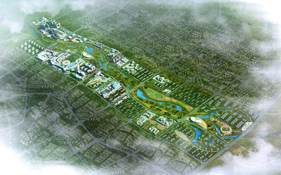
Located in China’s southernmost province of Hainan, the Dingan Riverfront & Urban Redevelopment Plan has been prepared to achieve two major goals for this river front metropolis. The first goal is to bring the existing river to life and to realize its potential usefulness. Currently, the river is an important natural feature which is not being used to its full potential due to fluctuating water levels and poor accessibility.
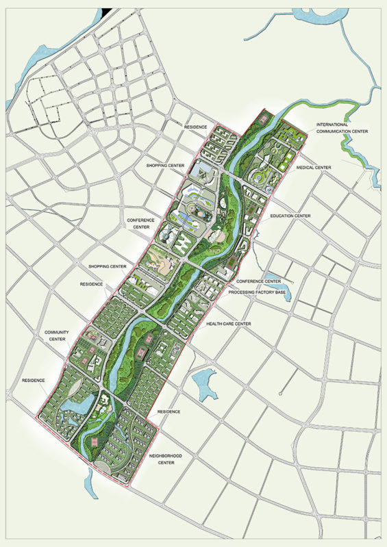
As the second goal, it is important to recognize that urban rivers offer unlimited social and economic benefits to citizens and communities. An urban river is a valuable resource and natural feature which many communities envy. Just as important, it is critical that the land use and development of the lands adjoining the river be considerate of the river and be organized, situated and inclusive of uses which complement and supports each other in a practical and functional manner. In turn, it is vital that the river redevelopment consider the environment and engineering factors affecting any river redevelopment.
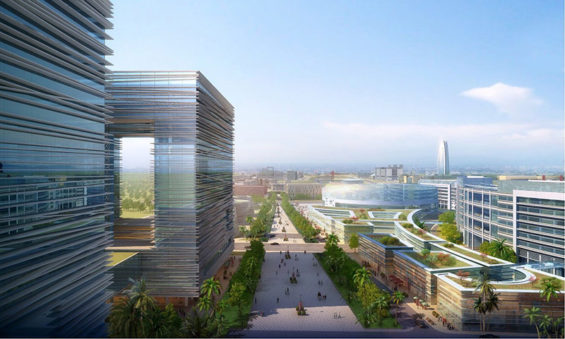
Toward these goals, we are pleased to present to you our concept plan. A Master Plan of River Restoration and Urban Redevelopment. We are confident that this concept, if adopted, will play a major role in improving the quality of life for the Haikou/Dingan community and the Hainan region as a whole.
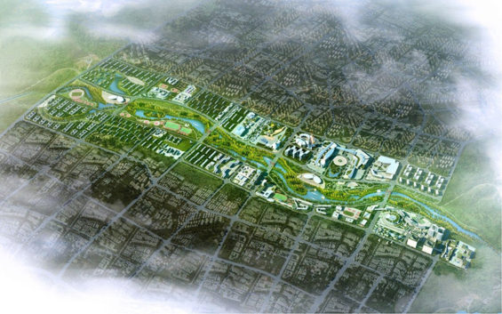
The Plan
Riverfront: The main design element of the plan is the riverfront and to use it to establish connectivity of all the functions and land uses with each other by using the river as the central conduit. All uses and functions enjoin by embracing the riverfront. Currently, however, in its current state, the existing river presents major challenges to improving its usefulness. These challenges include both access and health/safety.
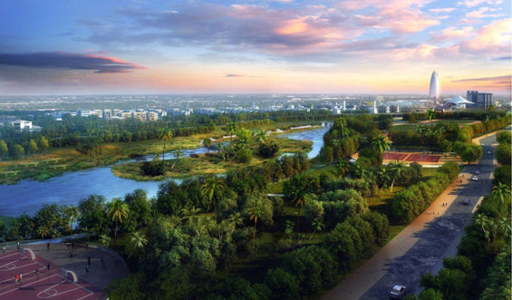
It is our opinion it is impractical to expect improvement to the river use in its current cross section due to the fluctuation in water levels and flow. Because of the fluctuating seasonal influences of water levels in the river, it is our view that the safe and functional use of the river can only be achieved by altering the river cross section with the creation of a elevated flat level river edge. This would involve building a series of walls and filling behind them to create a level levy. This level levy would make the river edge would become more or less equal to the elevation of the urban redevelopment this plan proposes. This concept of improving the cross section and re-elevation of the river edge has multiple benefits for the Haikou community. It will allow easy access to the riverfront without the problem of rising and lowering river water levels. This projection of filled land into the river corridor has a number of benefits we believe is not just important to the improved usefulness and access of the river but critical as an economic engine with our proposed land uses adjoining it.
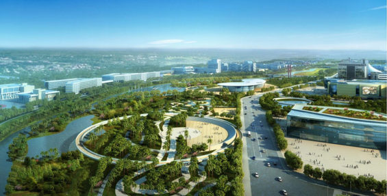
One major benefit of creating a continuous levy wall on both sides of the river is that it allows for the introduction of a level continuous linear park along both sides of the river. By using a continuous wall, the river edge becomes useful and accessible by isolating fluctuating river water levels. Another major benefit is the added recreation land for the community which provides a more safe and functional interface between the urban development and the river itself. In simple terms, it provides an important connection and green belt corridor for the community.
A key component of maximizing the potential of the river front is restoration, preservation and proper management of its ecology. The plan provides for creating a series of flooding forests which will provide vertical greenery and scale to the river plain. Also proposed is the restoration of wetlands within the river corridor which promotes wildlife and flora habitat within the floodplain.
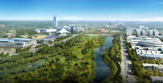
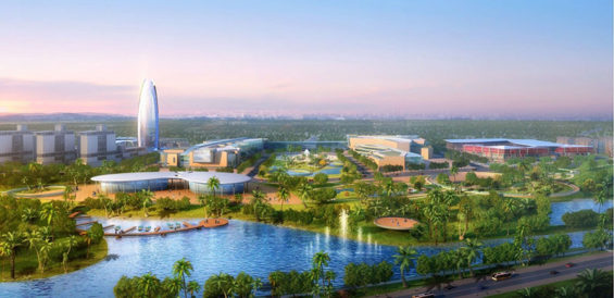
Both of these ecological improvements will contribute to improving and sustaining habitat for wildlife.
A partial list of Park offerings are as follows:
– Amphitheater for Regional Performance Venues with Gardens
– Ecology Park for Public and School Education
– Formal and Informal Sports Fields
– Farmers Market
– Marina for Small Boats
– Restaurants and Cafe
– Promenade with Food and Music Activities
– Laser Show
– Children’s Play Park
– Skate Park
– Pavilions for Picnic and Business Functions
– Canoe and Kayak Launch
– Pond for Model RC Boats
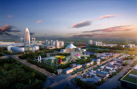
The goal of the Master Plan is to develop economic revitalization, while embracing a balanced vision for the river corridor which responds to the need for further flood protection for the river environment and the need to provide access and use of a great natural resource.
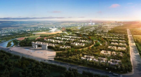
Dingan Riverfront & Urban Redevelopment Master Plan
LOCATION | DingAn, Hainan Province, P.R.C.
DESIGN FIRM | Hua Cheng Bo Yuan Architecture Design & Urban Planning Co., Ltd (Beijing)
PROJECT TEAM |
Robert Finnegan RLA, Foreign Design Director (Florida, USA Landscape Architect Registration No. LA0000428)
Xingguo Lee, Architect
Zhen Su, Designer
Yanyan Shi, Designer
Xinxian Shao, Designer
Images | Totem Design Group
Text | Robert Finnegan RLA
