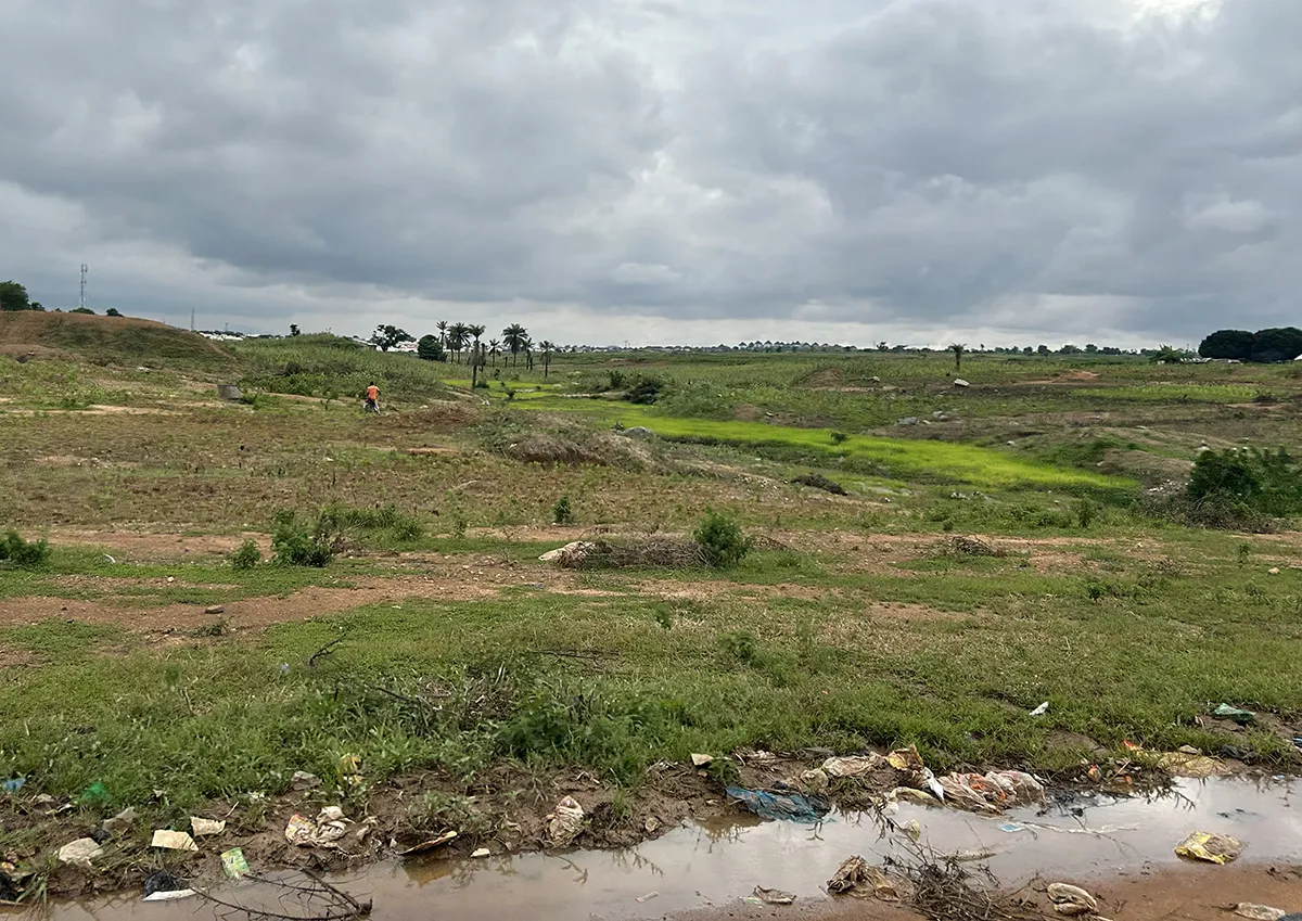
Conceived as a purpose-built capital, Abuja replaced Lagos to promote national integration and to enable more balanced regional development. Envisioned as the country’s “centre of unity,” Abuja has, over the past three decades, expanded rapidly—often outpacing its original master plan. This growth has resulted in a layered urban condition where formal development coexists with informal expansion, placing increasing pressure on infrastructure, ecological systems, and social cohesion.
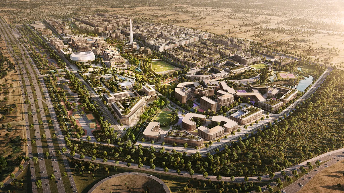
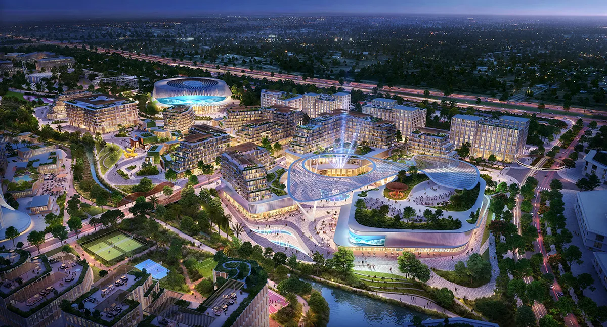
The City Walk master plan, designed by Benoy, marks a new phase in the city’s evolution by positioning landscape as the primary driver for the masterplans organisation. Sited within a Free Trade Zone, the project is envisioned as a mixed-use gateway district, integrating residential, commercial, cultural, and civic programmes within a 250-hectare masterplan.
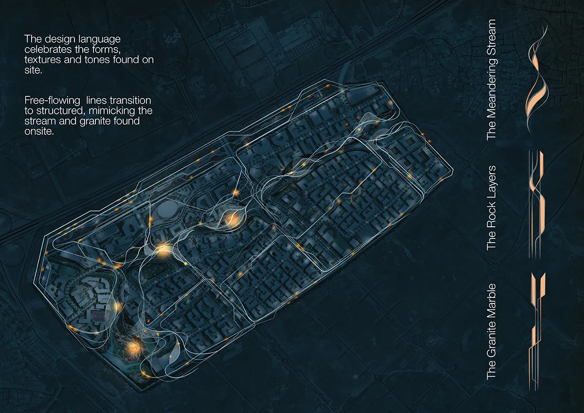
Landscape and hydrology as the site organiser
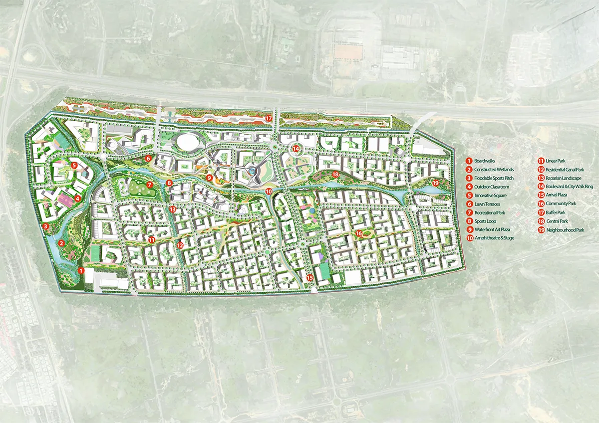
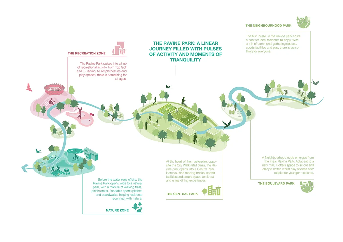
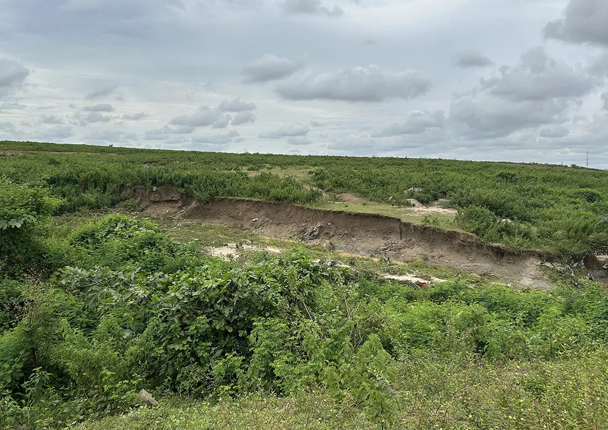
At its core, the masterplan is organised along a strong north–south axis. This framework connects a northern gateway—anchored by landmark destinations including a tower, arena, and cultural venues—to quieter southern residential neighbourhoods and gardens. The Ravine forms the ecological backbone of the scheme, operating as both environmental infrastructure and a social spine. It structures movement, open space, and hydrological systems into a continuous, multifunctional landscape.
Water management and flood resilience are central to the project, particularly within the context of rapidly urbanising regions where conventional drainage systems are often incomplete or under strain. As studio lead Angus Palmer notes:
“Landscape does not recognise project boundaries; it flows beyond them. Our approach was to slow, filter, and contain stormwater—working with water rather than against it—so that it becomes an asset within the site, rather than a problem displaced downstream into areas already vulnerable to flooding and lacking essential drainage infrastructure.”
This philosophy underpins a nature-based approach to hydrology. By mimicking natural water cycles, the design reduces surface runoff, especially during peak flood events, allowing water to infiltrate the ground or be temporarily stored within designated floodable landscapes. These systems transform water from a risk into a resource.
Central to this strategy is the concept of a “Sponge District,” where soft, green infrastructure replaces conventional hard engineering. Swales, wetlands, and open water channels are integrated within the public realm to slow, store, and filter stormwater. Beyond mitigating flood risk, these systems preserve and enhance biodiversity, improve water quality, and contribute to a more resilient urban ecosystem. In this context, landscape operates as the first line of defence—simultaneously as ecological infrastructure and as public spaces.
A design focused on context and place
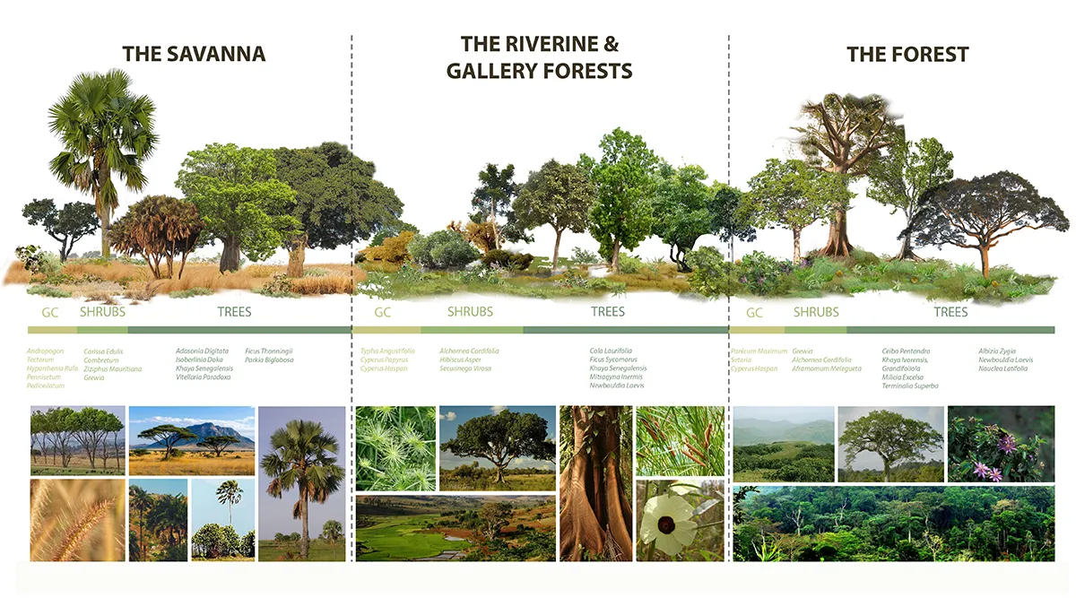
The master plan also prioritises climate-responsive design. Shaded streets, passive cooling, and drought-resilient planting strategies support year-round outdoor comfort. The planting palette is informed by the Guinean Forest–Savanna ecosystem and aligns with broader environmental initiatives such as the Great Green Wall. This approach translates regional anti-desertification strategies into an urban condition, demonstrating how large-scale ecological thinking can inform site-specific design.
Associate Director Miguel Pampulha said,
“The design is rooted in the specific realities of Abuja and its fast-changing urban growth, its wetland and Savanna ecologies, and the social and cultural patterns that shape everyday public life. In this way, the masterplan is not conceived as a generic model, but as a place shaped by local climate, economic opportunity and identity.”
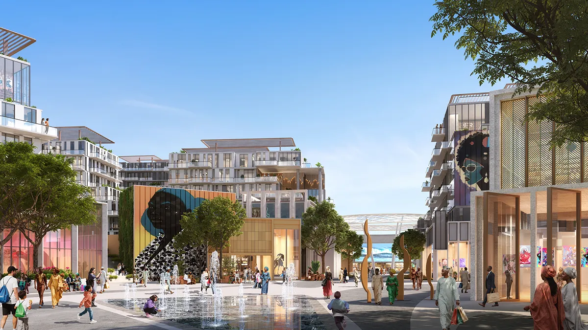
Equally important is the project’s social dimension. City Walk is designed as an inclusive landscape, offering equitable access to green space for a diverse population. Public life is layered within the ecological systems through a network of paths, event spaces, and neighbourhood amenities. The Art District, comprising 12,000 square metres of cultural programming, anchors this public realm, connecting it to retail, leisure, and office uses via a central boulevard and events space.
Material and spatial strategies further reinforce the project’s connection to place. Existing topography and hydrology are preserved and leveraged from, while locally sourced materials minimise environmental impact and construction costs. Buildings are integrated within the landscape, ensuring that natural systems remain legible and dominant.
Synthesizing programmable spaces with urban ecology
The methodology underpinning City Walk reflects a holistic integration of ecology and urbanism: reading natural systems, expanding them into floodable landscapes, embedding sustainable drainage networks, and layering social programmes within this framework.
In rapidly urbanising contexts such as Nigeria, where infrastructure gaps persist, City Walk offers a forward-looking model. By positioning landscape as a primary system rather than an afterthought, it demonstrates how cities can build resilience, support communities, and adapt to climate change through nature-based solutions.
City Walk Abuja Masterplan
Location: Abuja, Nigeria
Designer: Benoy
Image Credits: Benoy