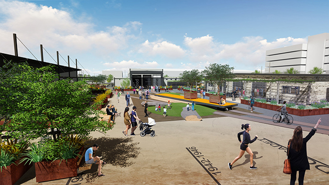
Alameda Point Site A is the first development at the long-languishing former Naval Air Station in Alameda, CA. The mixed-use master plan will a create a new walkable community that is transit-friendly with new jobs, 800 housing units (including 25% affordable), artisan retail, office space, 4 major parks on 15 acres of open space. The 68 acre site is responsive to sea level rise for an island that will be vulnerable in the future. APDW led the design, community engagement and discovery process for the Open Space’s ecological systems, green infrastructure and cultural aspects of the project. The new community is grouped into three districts: Waterfront Park District (open and civic spaces), Urban Park District (retail) and Neighborhood Park District (residential).
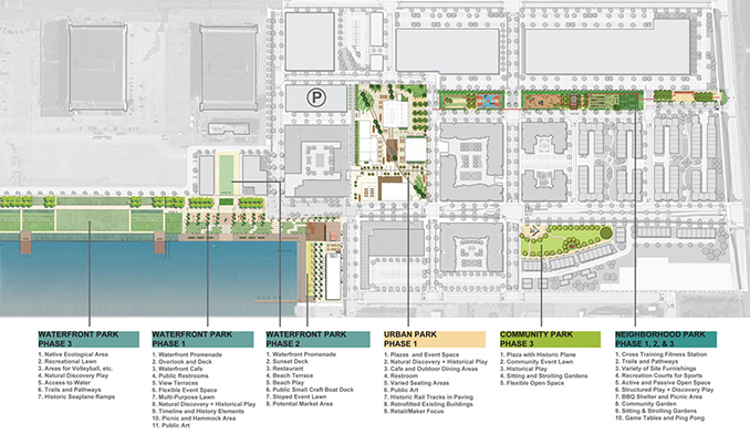
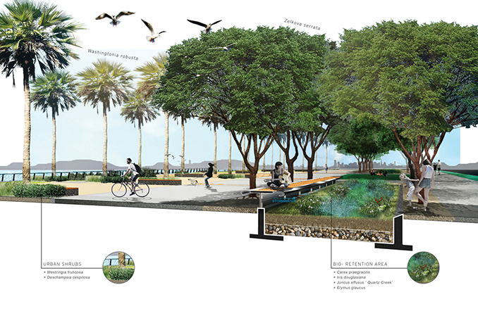
The Alameda Point Site A development plan was endorsed by the Greenbelt Alliance as a “prime example of sustainable, equitable, transit-oriented development”. APDW led the project’s Bay Area Coastal Development review process including designing a series of sea level rise strategies for the project to integrate in its implementation. The master plan was developed to protect the future development from over 56 inches of sea level rise and storm surge to meet high end estimates in the coming decades. Phase One also includes a Ferry Terminal, designed by APDW to be temporary and responsive to the sea level rise.
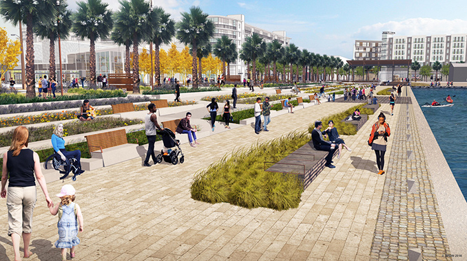
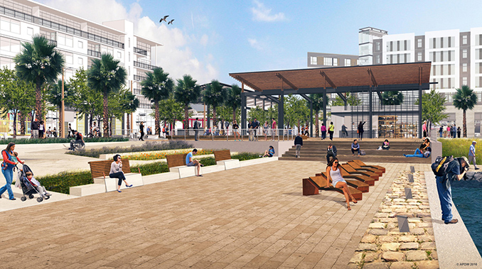
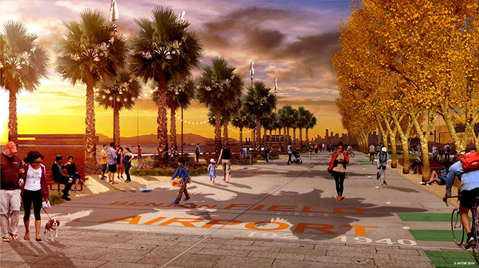
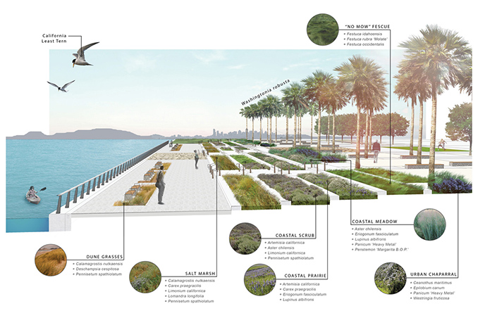
Located on the historic Seaplane Lagoon, the design of the Waterfront Park engages the public as the key open space. The design of the park connects people with the Bay with three distinct areas. The park entry has an open pavilion that houses a café, sheltered seating and restroom facilities with an overlook directed towards the spectacular views of the Bay Bridge and San Francisco beyond. The “Overlook” wood decking will be made of wood salvaged on site. The public approaches Seaplane Lagoon through a series of planted terraces down to a promenade along the water, offering places to sit and enjoy the tremendous views. The Waterfront Park’s terraces are planted with native California plants, mirroring natural systems of the native shoreline to withstand occasional inundation and accommodate the rising tides. The “Taxiway” – located on one of the former service taxiways – aligns with the view corridor to San Francisco and provides flexible space for events and intimate gatherings. It features the cultural historic landscape with salvaged artifacts, public art, markers, and a timeline. Waterfront Park also has a shared pedestrian and bike trail that will connect to the Alameda Bike Trail and the region-wide Bay Trail. Transportation, green infrastructure and trail connectivity along the shoreline were key drivers in the design.
This is the first of three phases of development for the Waterfront Park. Future phases will include a beach, natural habitat, and recreation, a continuation of the Taxiway connecting the future development, sailing center and waterfront restaurant in a reused building.
Urban Park utilizes adaptive reuse of three existing buildings of Block 10 to create a retail community heart. This block preserves an industrial landscape; the existing railroad tracks crisscrossing the center of the block are retained as a character of the place and highlighted with enhanced paving. New “flatbed” rail cars will display specimen trees in boxes to punctuate the space. The intent is to honor the industrial character of this site; the retail architectural enhancements and public open spaces aim to be true to the existing nature. A central area will function as a focal point for events and activities.
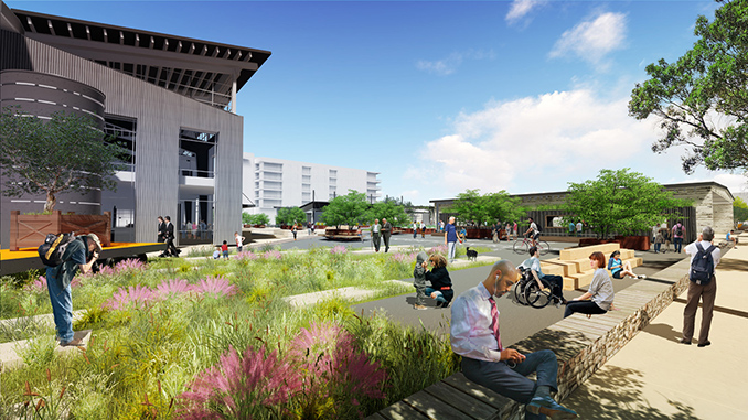
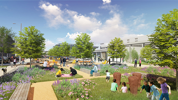
The Neighborhood Parks, a collection of 4 open spaces, support the residents of the new community. Three blocks make up the Linear Park north of the residential blocks and Civic Park with the historic Corsair Airplane Monument is located on the West Atlantic Avenue entry. Neighborhood Park connects the Urban District to the residential blocks, offering a variety of active and passive recreation: cross fitness training station, sports courts, active and discovery play, BBQ and picnic for community gatherings, community gardens, and Dog Park.
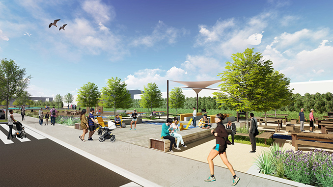
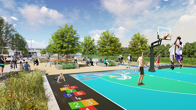
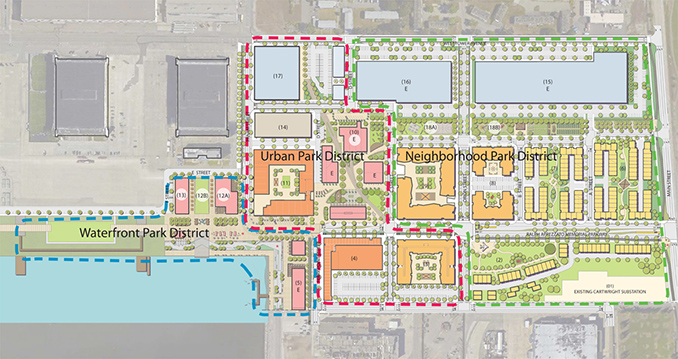
APDW’s design, public outreach, and other design visuals were part of the community and city engagement. APDW’s toolbox for visual communications included creating a set of open space design principles for the team, workshops, blog postings, project tours, 3D modeling, project fly through animations and 3D sea level animations. Some of the community outreach and discovery process included walking and kayak tours of the site to discuss sea level vulnerabilities. April Philips Design Works prepared the perspectives illustrating the activities and design features for the first phase of the Open Spaces.

Alameda Point Site A
Location | Alameda, CA
Design Firm/Landscape Architect | April Philips Design Works (APDW)
Client| Alameda Point Partners
Architects | BAR Architects
BCV Architects
KTGY Architecture and Planning
MBH Architects
Kwan Hemni Architecture and Planning
Civil Engineer | BKF Engineers
Coastal Engineer | Moffat and Nichol
Geotechnical Engineer | Langan
Lighting | HLB
Streetscape Landscape Architect | GLS
Horticulture and Arborist | HortScience
Credit for renderings and graphics | APDW
Credit for Master Plan | BAR and APDW
