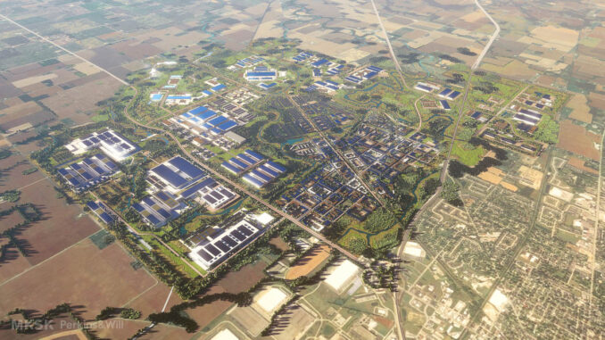
The state of Indiana‘s push to be a leader in attracting the leading technologies of the future is through the 9,000+ acre LEAP Innovation District in the City of Lebanon, strategically situated on Indiana’s I-65 Hard Tech Corridor between Purdue University and the City of Indianapolis.
The LEAP Lebanon Innovation District will become a global example for sustainable industry and development. The district consists of over 9,000 acres and will be a leader in sustainable development in the United States in water management, ecological biodiversity, regenerative development, interconnectedness, decarbonization, 100% electric utilities, and more. The district is centered on a groundbreaking quality of place philosophy that integrates megasite, advanced manufacturing, mixed-use, and corporate opportunities.
MKSK serves as the lead district master planner, working with the Indiana Economic Development Corporation (IEDC) to position this district with a focus on responsible and environmentally conscious approaches to utility management, natural environment restoration, and creating healthy lifestyles for residents and workers alike all while driving the economy of Central Indiana for coming decades.
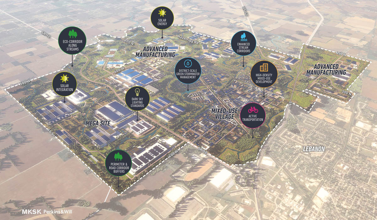
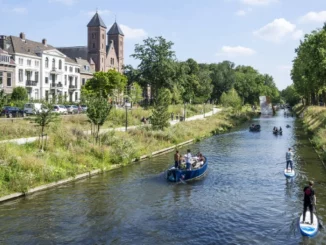
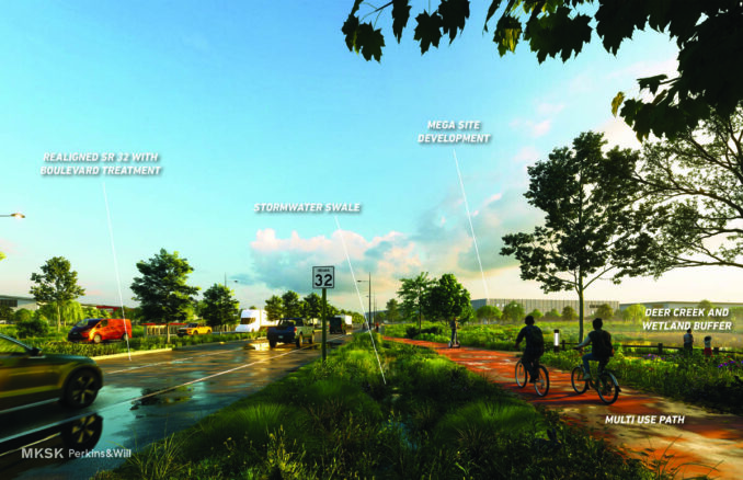
Planning of the Innovation District was shaped by the three existing waterways: Wolf, Deer, and Prairie Creeks. Through a network of new open spaces, these streams will be linked as ‘eco-corridors’, providing wildlife habitat, ecological diversity, and recreational opportunity through a vast new trail system. Utilizing wide buffers that include a system of manufactured wetlands, the district’s eco-corridors, along with new open spaces, vegetated swales, and a network of green alleys, will combine to create a comprehensive and active water management system.
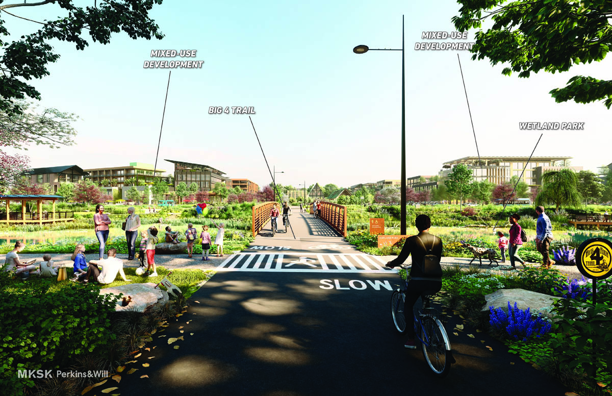
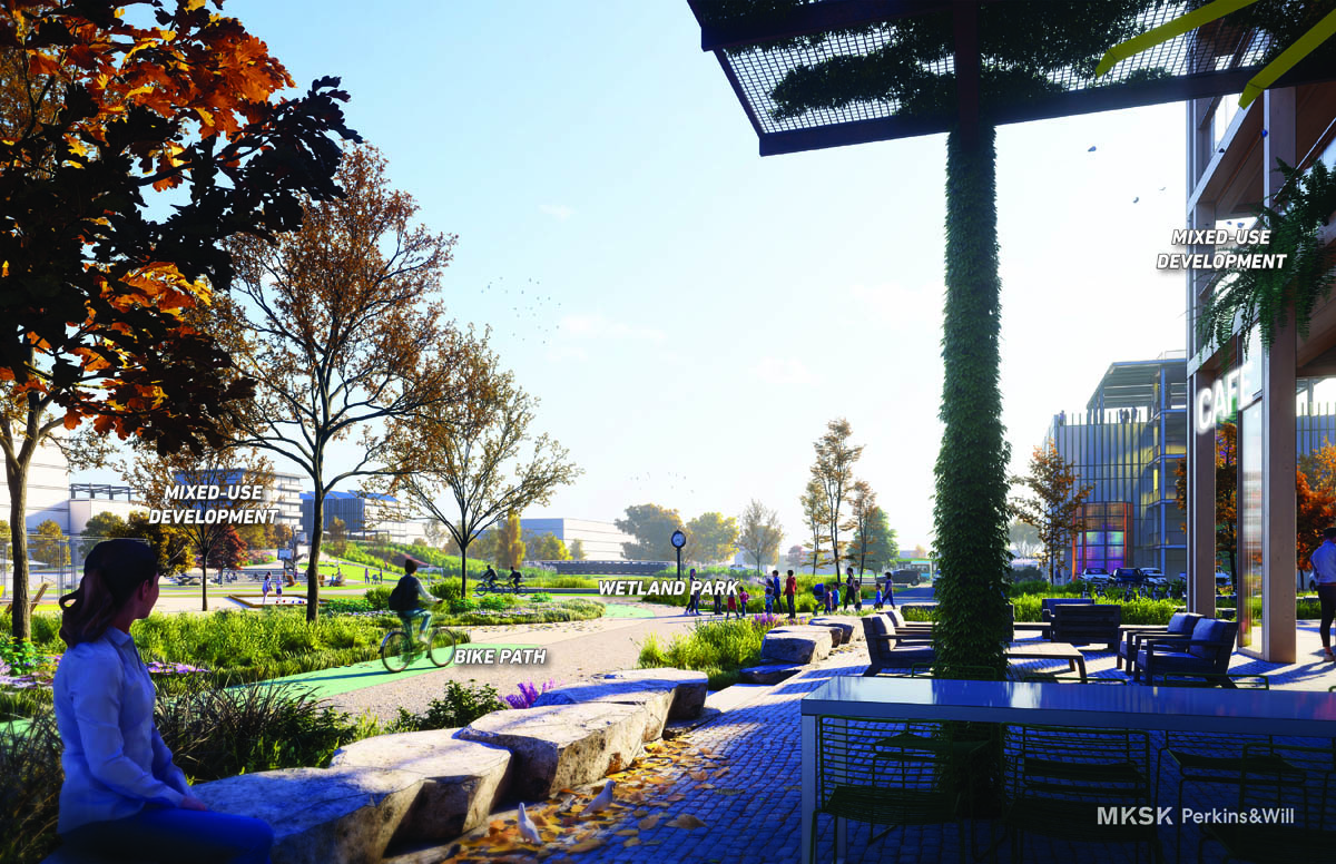
Transportation networks will be built upon major regional highway networks and the existing county road organization. New and reconfigured roads will promote varying land uses; a tighter street grid in the mixed-use village will support walkability and urban development and wider spaced roads that advanced manufacturing and megasites. Integral to streets and roads will be trails which connect to eco-corridors and the existing Big 4 Trail, to provide a complete pedestrian and bicycle network throughout the district.
The district is envisioned to include larger scale advanced manufacturing and megasite industry targeting tomorrow’s technological economy. These uses array across the north, west, and south portions of the district. At the heart of the district, and alongside the Big 4 Trail, is the mixed-use village. Here, a vibrant center will be created through denser development that integrates residential, retail, commercial uses, education, office, hospitality, and other uses. This village will offer future residents and workers a walkable community integrated with active transportation, public art, recreational amenities, and green infrastructure.
Design guidelines establish the importance of and promote environmentally responsible development. Throughout the district, a series of significant perimeter and road buffer standards minimize the visual impact of this development and establish a natural setting comprised of native meadows and tree stands. The design guidelines also limit light pollution and incorporate solar energy into buildings, parking areas, and through standalone installations.
The master plan and supporting design guidelines for the district help realize this sustainable vision for the LEAP District through a series of detailed recommendations and strategies. The master plan and design guidelines were codified in an innovative Planned Unit Development zoning code that focuses on blending innovation with placemaking, best-in-practice stormwater, and sustainable development standards, all while balancing the need to attract economic development and remain business and development friendly.
MKSK is now working with IEDC on implementing site, infrastructure, and wayfinding systems, as well as development attraction efforts.
Project partners include Indiana Economic Development Corporation; Pure Development; City of Lebanon; Perkins&Will; Christopher B. Burke Engineering.