Wetland el Burro suffers of a high contamination status and as most of this structure in Bogotá; it is in its way of disappearing. This thesis is an answer that shows how nature and humans can benefit from each other, when there is an interdisciplinary study and a flexible proposal that continually reevaluate itself and shows Wetlands as important ecosystems on behalf of the development of a sustainable city, but also as a place with the big potential of becoming an environmental classroom for the community and where the citizens can enjoy and learn about nature.
The thesis work was develop throughout different steps, first the general study of the structures of the Wetlands, second the analysis of methodologies that defines the job of a landscape architect and third the design of a project in a Wetland of Bogota. The project balances theory and practice when dealing with Wetlands and involves the community in every step of the process in order to guarantee its success.
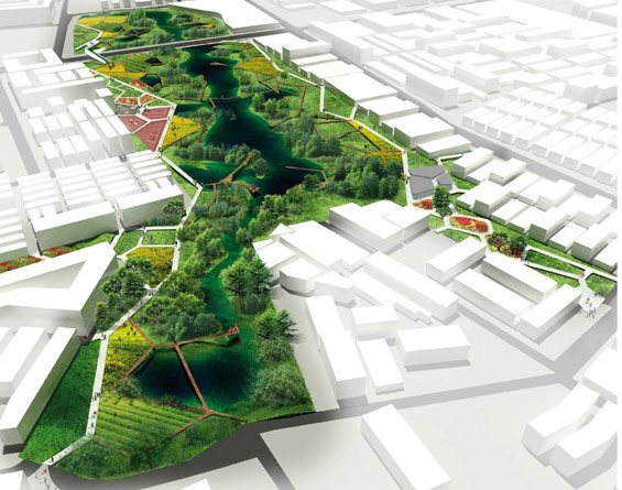
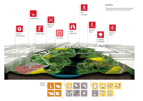
The aim was to raise awareness in the community about the importance of Wetlands and transform them in a Landmark for all the citizens. For this it was necessary the development of a master plan where different activities can interact with each other; as mix layers and a zoning system. And therefore, educational programs with the restoration of native flora and fauna and passive recreational activities can be found.
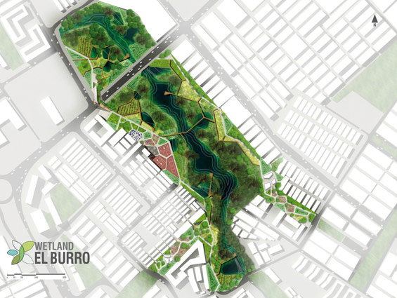
The general Master plan is based on different layers that answer to the needs of the community, the stakeholders and the environment. (Connections, Zoning System, Activities, Communication Process, Restoration and Workshops).
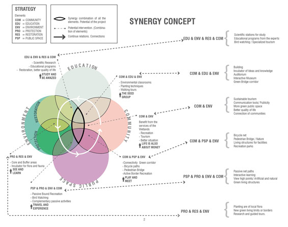
The net of paths allows the user to get closer in some areas but also the nature to continue with the restoration process is divided in different paths according on how close the user can get to certain area.
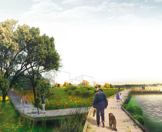
The 1. Combined Active path is the most used by the community and therefore is for pedestrians and bicycles. It is located between the areas of recuperation (the border of the Wetland) and the Active recreation zones. It function is to define the limit of the Wetland.
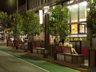
2. Connection Active paths: Its function is to connect the main pedestrian roads with the recreational zones (Sports and skate boarding). These paths have a lighting design, since these areas can be used at night and has also public furniture in the resting points.
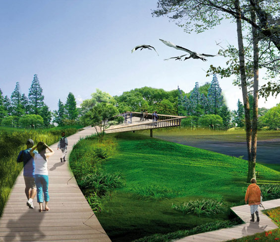
3. Passive Wooden paths: Located within the core and the buffer zones. They have a low impact on the place as they are supported in wooden columns and meant for a passive recreation, bird watching and other complementary activities.
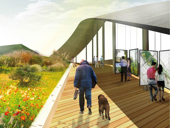
4. Terrace Viewing point: For a breath taking view of the core and buffer areas as well as the main body of water. These places can be closed according to the different mating seasons and cannot be accessed at night.
5. Wooden Resting place: Placed in the zones where the presence of human beings can not disturb the fauna
6. Discovery Paths: Traced paths where the community can walk using Bog Shoes with a Guide
ENTRANCES
The project entrances are where most of the community meet and are suitable for commerce (Cafes and a local market).
The Eco Bridge Structure has two parallel strips. One strip as stepping stone for the birds and a route for the mammals when crossing the street and a Second strip for pedestrians
THE ZONING SYSTEM
The zoning system is developed in order to assure the ecological restoration and the development of Buffer, Core, and management areas.
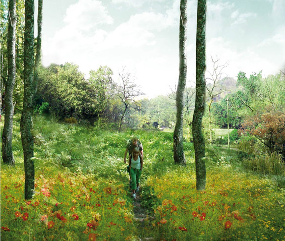
1. Protective Forest: Understood as a green border where reforestation activities take place. Maintaining the existing biodiversity and reintroducing native plants. The community helps with the reforestation and learn the importance of this structure.
2. Planting Area – Incubator
Are zones for the incubation of plants, in this it is expected to start the process of planting and taking care of the trees that will reforest the Wetland. They are also zones where the community can actively participate in process of agriculture, agroforestyand urban gathering. These areas are defined as potential areas for the development of new participatory programs that can bring the community together
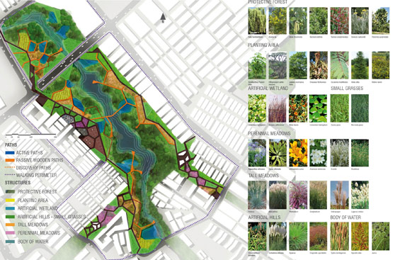
3. Artificial Wetland
Their function is to collect rainy water and become small ecosystems, where native flora and fauna can take place and help with the balance of the Wetland.
4. Perennial meadows and Tall grasses and tall meadows
Are open green spaces that are optimal for relaxation within the recreational zones (In the means of public gardens). In these areas is expected that the community have picnics and general meetings.
5. Artificial Hills
The hills are defined in the areas where it is expected a high level of sound and areas where it is needed to defined a border so the community cannot enter a certain zone. These are place within the core and the buffer.
6. BODY OF WATER
The body of water is the main structure of the Wetland.. In the superficial part of the water, floating plants help with the restoration of the quality of the water through its roots.
PHASES
For the Wetland el Burro it is suggested to have a management process developed in phases thorough time; since it is understood that a process like this one cannot be achieved in a very short time (Rather than a continued process through time). These phases allow the designer team to analyze and determine the effectiveness of the project and the viability of the master plan. 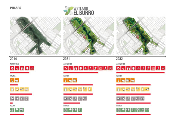
Conclusions
This thesis shows that a project for the community can be developed in a Wetland while the restoration process is taking place. When understanding that the community can be part of this process and that they can help with the protection of the ecosystem as long as they understand its importance. By working on the communication and teaching processes; the community participates in the project and develops a sense of stewardship.
STUDENT PROJECT | “Wetland “El Burro” | Natalia Vergara Forero
Name | Master thesis: “Wetland “El Burro”; Bogota – Colombia. The new area of amusement, ecological restoration and education”
Author | Natalia Vergara Forero
Location | Bogota – Colombia ( Wetland El Burrro)
Design Team | Natalia Vergara Forero
Thesis developed for the IMLA Master of Landscape Architecture 2013
University |
Hochschule Weihenstephan – Triesdorf – University of Applied Sciences GERMANY
Supervisors |
Prof. Ingrid Schegk Hochschule Weihenstephan – Triesdorf – University of Applied Sciences GERMANY
Prof. Sabrina Wilk Hochschule Weihenstephan – Triesdorf – University of Applied Sciences GERMANY