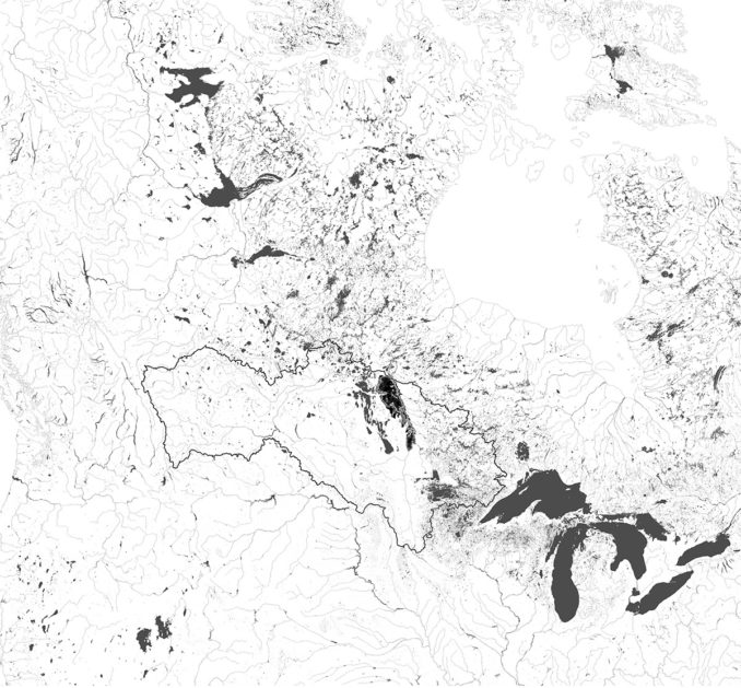
Lake Winnipeg is one of the largest freshwater lakes in the world. It is the remnant of glacial Lake Agassiz, which covered much of North America. The territory of Lake Winnipeg’s watershed covers much of Canada and crosses U.S. borders. The Lake is an integral part of Manitoban heritage, as it is celebrated for the many beaches and cottage communities along its shorelines. Due to heavy nutrient loading and surface runoff within its watershed, it is known as one of the most threatened. In 2013 it was labeled “Most threatened lake of the year” by the Global Nature Fund. This Title in commonly given to lakes in developing countries. Industrial agriculture has resulted in waterway changes and ecosystem service loss. The Lake’s high nutrient content causes mass blooms of Blue- Green Algae. The algae create a toxin dangerous to human and animal health. Since 2008, the Canadian government has given $61.4 million dollars towards efforts of restoring the Lake. Within the last five years, only a one percent decrease in phosphorus levels has been found. The problem does not fall within just one provincial territory, but internationally as well. Since no one entity or government has the responsibility of cleaning Lake Winnipeg the situation continues to worsen.
This thesis will examine how changes in landscape policy and ecological planning can mitigate nutrient loading from the Red River into Lake Winnipeg.

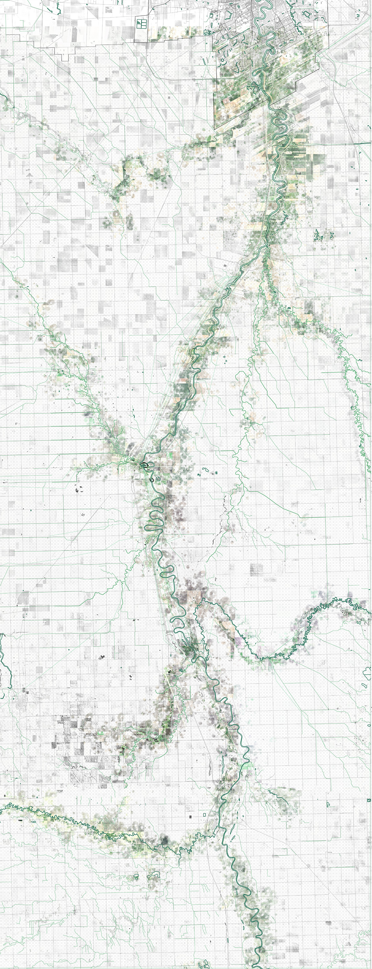
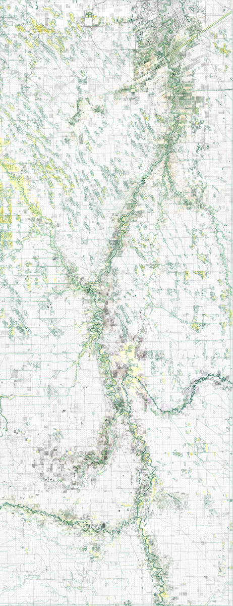
The project will focus on the Red River Drainage Basin, as nearly half of the lakes incoming phosphorus and nitrogen comes from the Red River. It originates at Lake Traverse and is the border of North Dakota and Minnesota. The Red River crosses from the US into Manitoba and goes through the City of Winnipeg, before flowing into the southern basin of Lake Winnipeg (around 600km) The Watershed is composed of nearly all agricultural land, and is based on a 1mile grid.
Outlined are three problems in the watershed that are addressed:
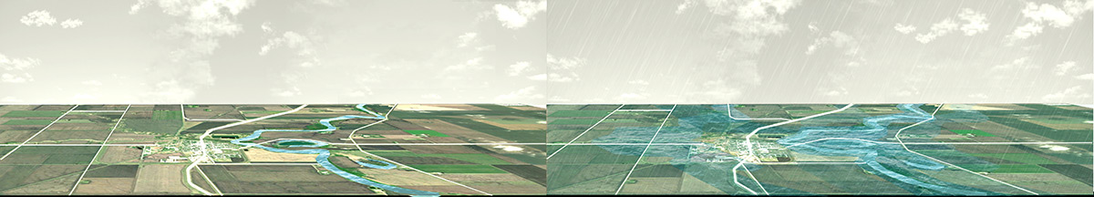
- Major spring flooding and aging infrastructure. Flooding creates a wash effect, which flushes agriculture nutrients and livestock feces in the river.
- Landscape changes as a result of urbanization and industrial use. 99% of the original tall grass prairie and 90% of natural wetlands have been converted for agriculture.
- Understanding and addressing the problem of Lake Winnipeg by multiple governments and not only as problem of the Lake but the entire watershed.
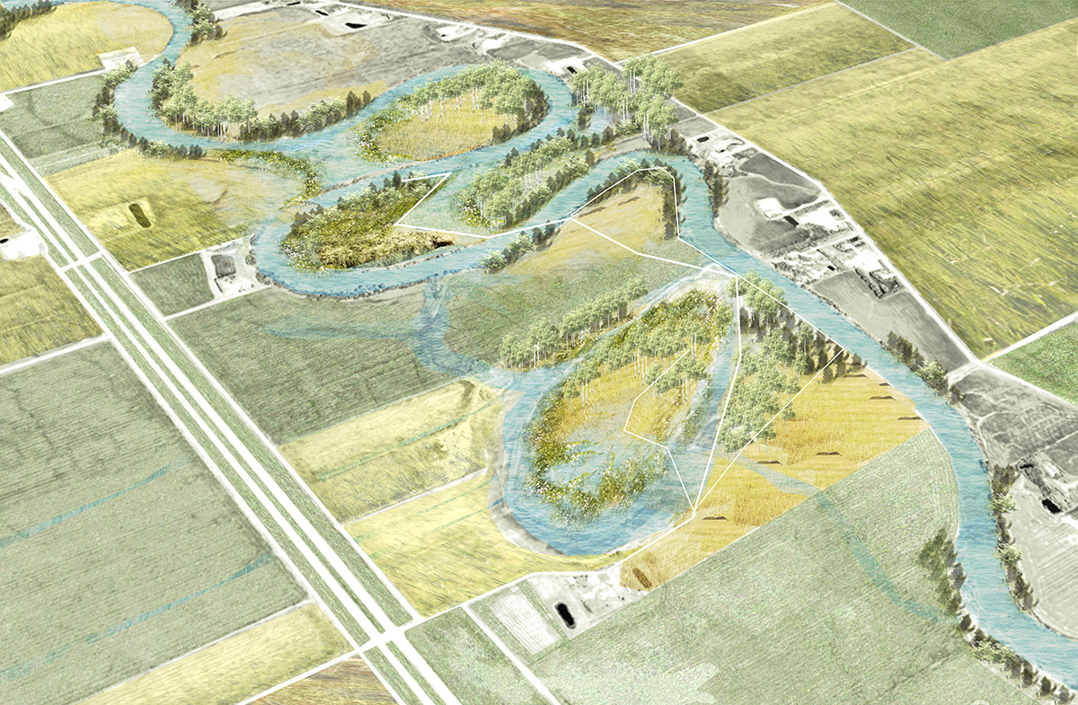
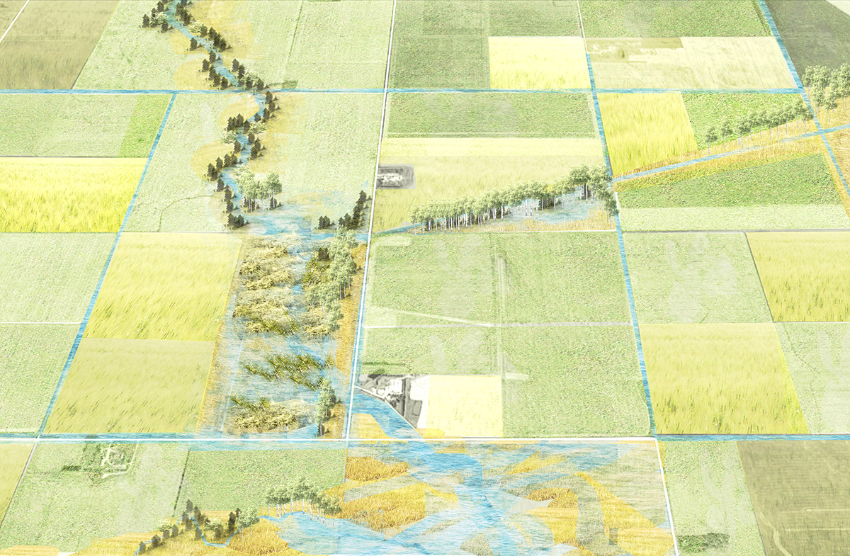
A framework is created to examine how we can implement new rules and landscape policy for waterway adjacencies and landowners to address the issue of nutrient runoff into the River, which eventually drains into Lake Winnipeg. It outlines components such as stakeholders, economy and strategies. The framework would address and convey what it means to protect and restore ecosystems to various groups and people.
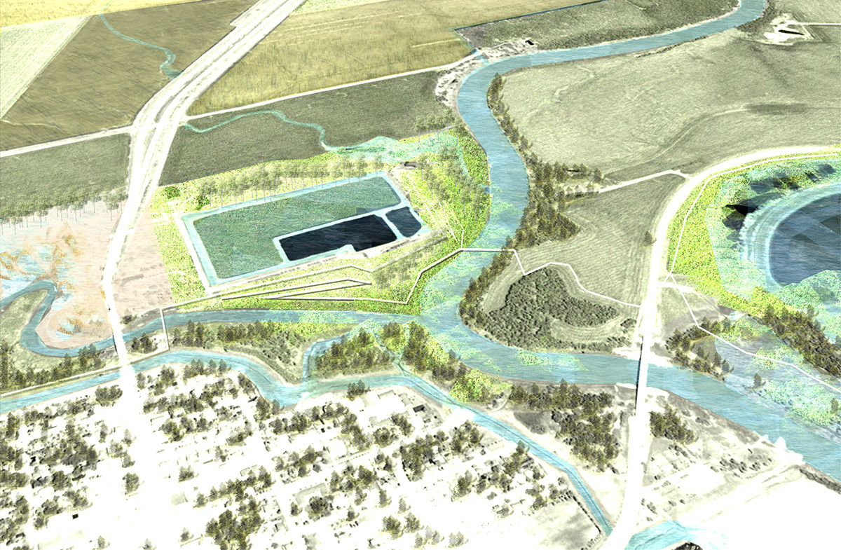
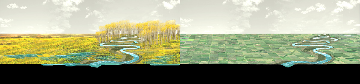
Strategies would include changes in how water travels, where it can collect and how we might start to turn certain agricultural plots offline. This would be based on mapping and analysis where we can identify conditions or opportunities of intervention; such has land prone to flooding or have greater support for ecosystem services. Finally, if we turn off or convert these plots, we can convey how much water and nutrients are detained from flowing into the river, thus reducing nutrient loading into Lake Winnipeg. 1 acre of established prairie produces 24,000lbs of roots, which can intercept up to 53 tons of rainwater or up to 9 inches before runoff.
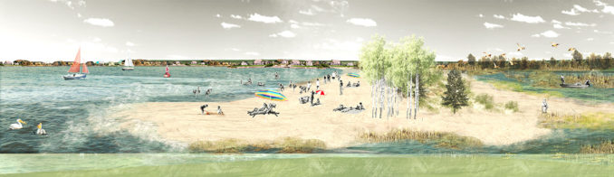
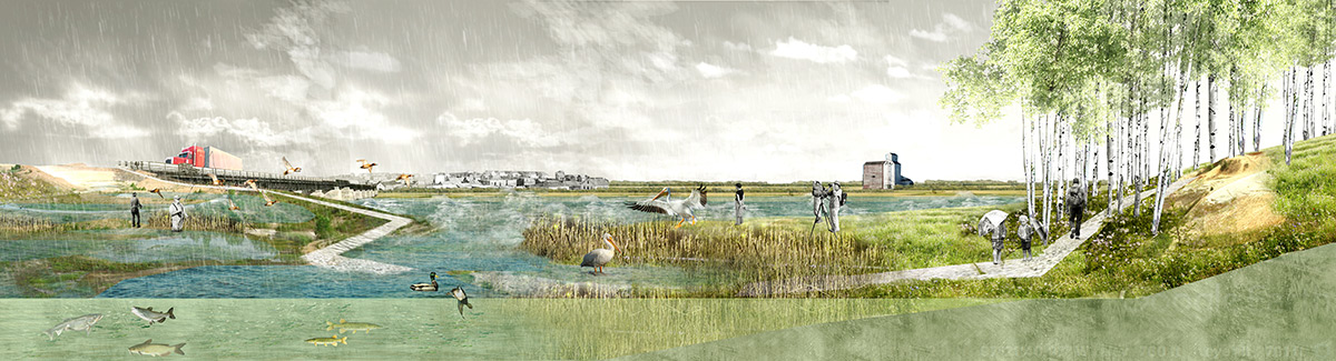
Lake Winnipeg | After
The framework then gives incentive to various levels of government like a sustained economy, more jobs created and a celebrated heritage landscape. Governments can then start to purchase plots or incentive can be given to landowners to obey policy and make landscape and drainage changes to their farming practices. Farmers could receive a sum for the acreage or annual stipend for acreage turned over.

Waters in Peril: Collective Measures for a Dying Lake Winnipeg
Student | Jaysen Ariola – University of Toronto – Master of Landscape Architecture Thesis
Advisor | Pete North
Image Credits | Jaysen Ariola
Winner of the 2019 WLA Awards – Award of Excellence in the Student category