
Boston Children’s Museum, located on the Fort Point Channel, is at growing risk from sea level rise and coastal storms. Following Sasaki’s Waterfront Master Plan in 2021, the Museum tasked Sasaki to continue resiliency planning and identify critical infrastructure needs and key implementation priorities to keep the Museum safe and open for the community.
The Museum’s main Atlas Stores Building dates back to the 1890’s when it was originally part of the Boston Wharf Company’s sprawling network of wool and industrial storage warehouses. It was listed on the National Register of Historic Places in 2004, and is protected as part of the Fort Point Channel Landmark District under the Boston Landmarks Commission. At six stories tall, its brick structure was preserved, while a newer three-story addition was built onto the west side in 2007.
As a contributing structure in a designated historic district, exterior changes like the current flood-resilience waterproofing and new brick cladding required formal Landmarks Commission review to ensure the work preserves the building’s historic character. To ensure preservation of the building, Sasaki’s implementation strategy follows a phased and tailored approach that responds to priority as well as fundraising efforts.
The design will ensure the building’s survival while creating opportunities for education and engagement with its waterfront location.
Preserving for Future Generations
When designing around water, a critical element to define is the Design Flood Elevation (DFE). Sasaki’s design sets the project at 14.5 ft NAVD88, based on the Massachusetts Coast Flood Risk Model (MC–FRM), which projects that the 100-year storm elevation will rise over the next 50 years due to climate change and sea level rise. All flood protection elements throughout the project, including the interior spaces, are designed to this elevation, roughly four and a half feet above the current ground floor of the Museum and Harborwalk. The series of proposed upgrades are moving into the first phase of implementation and are designed to keep floodwater out and allow the building and facility operations to rebound quickly after a storm.
Elevate
The first line of defense is a new elevation for the ground-floor harborwalk, lobby, and adjacent interior spaces. This new elevation will provide passive protection two feet above the current grade, in keeping with the Master Plan guidelines. From there, ramps will connect to Congress Street and the Harborwalk, descending toward the water through a stepped pier landscape that softens the boundary between Fort Point Channel and the Museum.
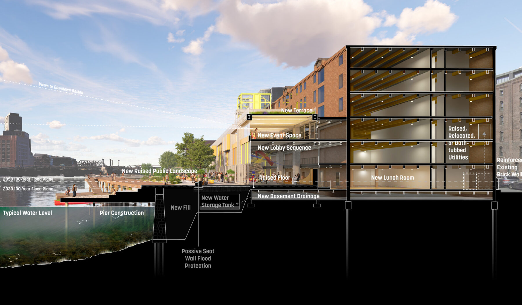
By raising the landscape and floor of the building and adding seatwall protection, a water storage tank, and drainage, the site is prepared for the future 100-year flood plane.
Planted terraces and seatwalls will add a further two and a half feet of passive protection, while deployable flood walls can be raised during storms and high tides to provide up to two additional feet of protection above the seatwalls. This new landscape will double as an educational venue, inviting people of all ages to learn about sea level rise. Alongside the raised floor, critical infrastructure such as mechanical and electrical equipment will be protected in place, either elevated within existing rooms or relocated to rooms on higher floors.
Seal
The design reinforces the Museum’s exterior walls with four and a half feet of added waterproofing membranes above the current ground floor and new flood-proof glazing on the lower levels. This strategy works in tandem with the landscape design, allowing water to move into and around the site while keeping the Museum’s interiors and critical infrastructure dry and secure. Rooms housing critical infrastructure that cannot be elevated will instead be “bathtubbed” from the interior, sealed to keep water out entirely.
In order to protect the historic building, a waterproof layer and a new layer of brick will be added to three sides, extending high enough to protect against a major flood. In the event of a flood, doors and openings will be sealed with flood barriers. At the same time, the City of Boston is installing its own flood barriers in the plaza as a parallel effort. Together, both the Museum’s and the City’s barriers will create a protected dry zone around the building, as well as contribute to the protection of the neighborhood.
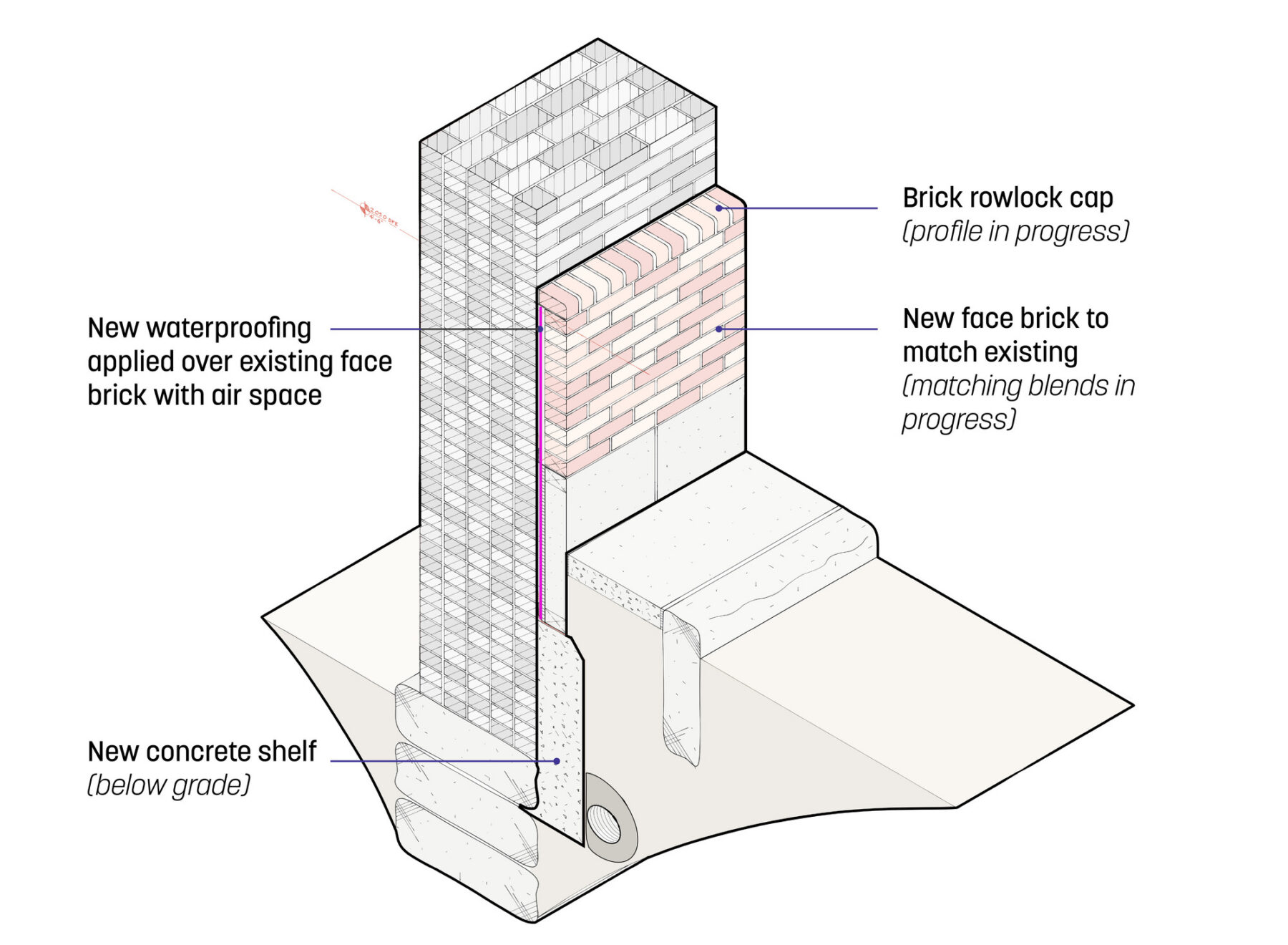
Single Wythe with granite watercourse
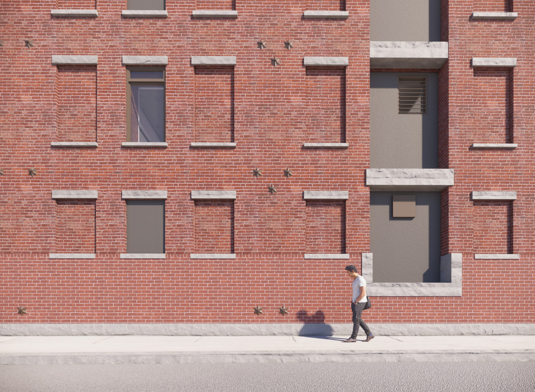
Waterproofing along Sleeper Street
Collect
Stormwater and residual groundwater will be channeled through dedicated collection strategies toward an underground cistern, keeping the site dry and minimizing the risk of water entering the building. By actively pumping water from the cistern back toward the channel, the design ensures that the site, the building, and the surrounding neighborhood remain protected.
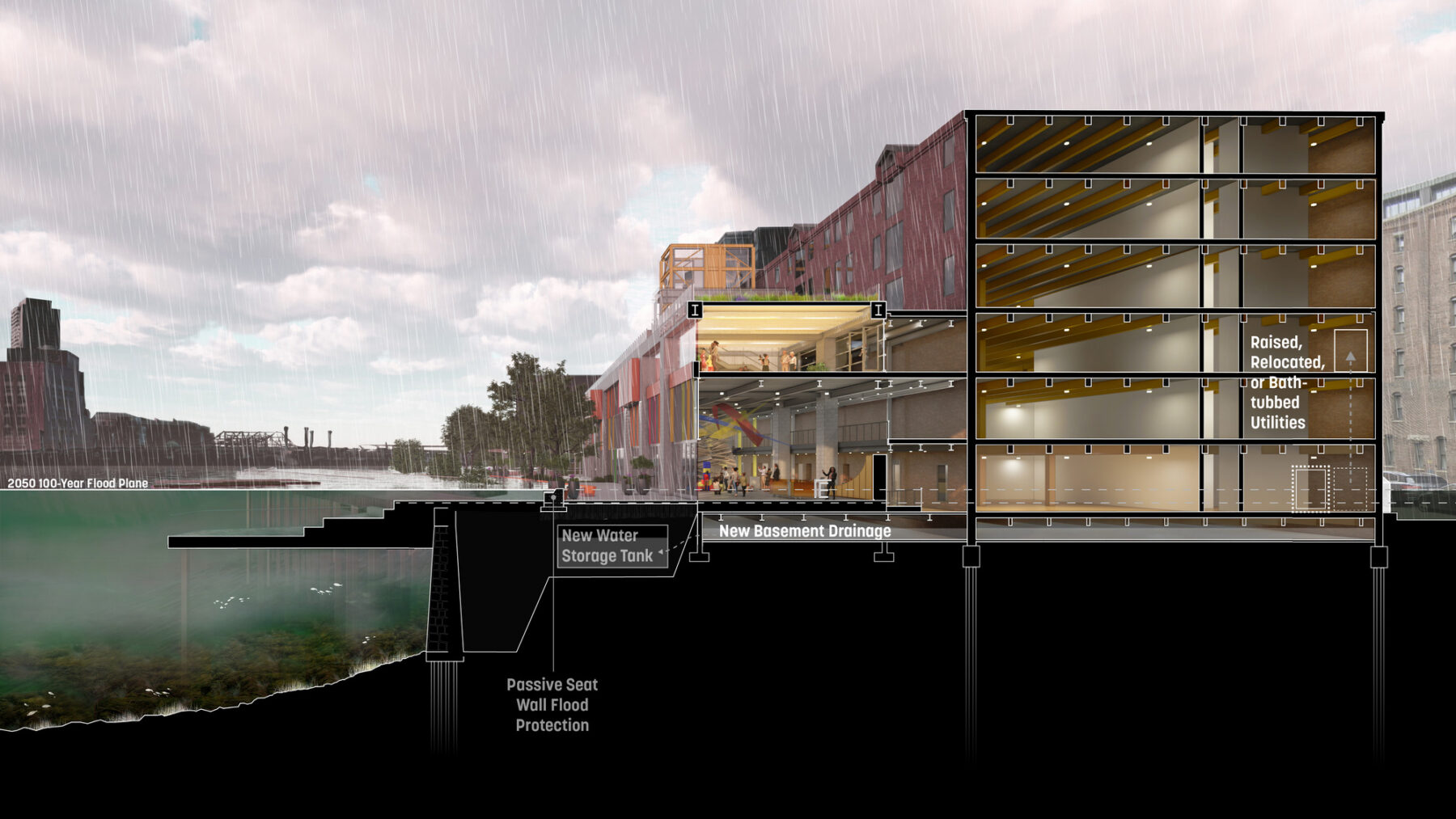
The new raised public landscape is designed for flooding while new building features collect flood water.
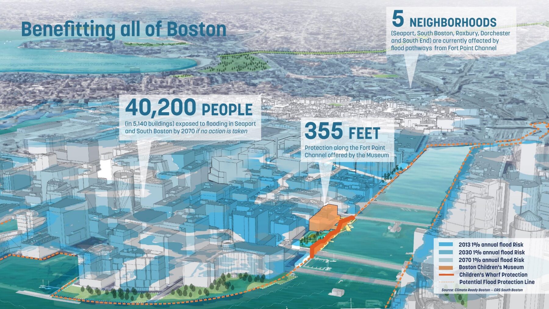
The design connects to a greater part of Boston’s resilience story.
The design also adds a new catch basin, an underground storage tank to collect rainwater during a storm, and a pump that sends the collected water out to the channel through a new outlet built into the seawall. This new outlet is tucked under the existing Harborwalk boardwalk, so it won’t be visible from outside and won’t get in the way of boats or pedestrians. The project has been designed so that the Harborwalk itself, as well as the Museum, will stay open throughout construction.
An Integrated Museum Experience
Following the initial phase of floodproofing implementation, the design will also enhance the Museum’s performance by expanding its reach through new programming and new ways for visitors of all ages to learn what rising sea levels mean for their city.
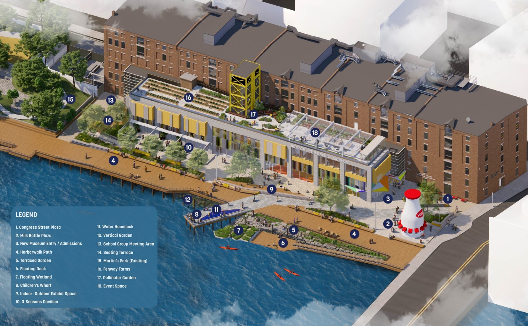
As part of this goal, a reoriented entrance will welcome visitors from Congress Street, past the iconic Hood Milk Bottle landmark, into a larger lobby connected to the lunchroom, a space open to all with room to rest and gather.
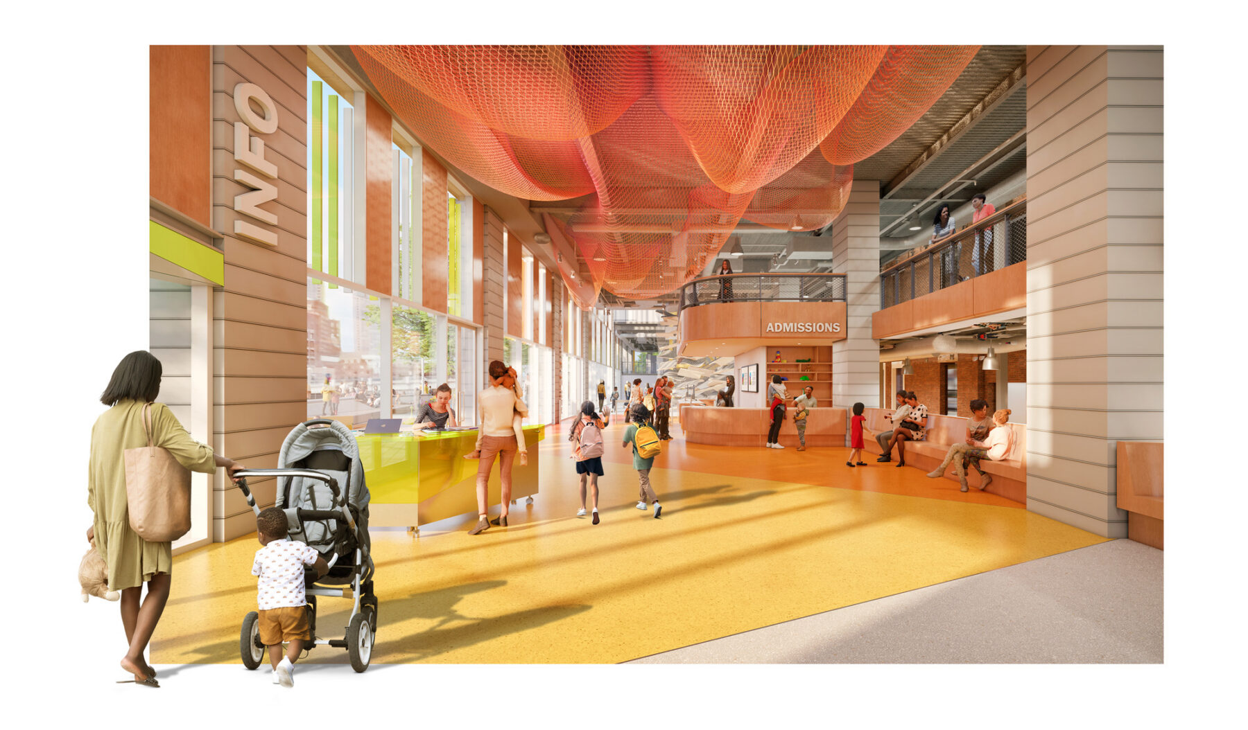
New Entrance and Lobby
Upstairs, two bays will extend south to create a flexible room for events, leading up to a repurposed green roof where the Fenway Farms crates find new life alongside pollinator gardens, sweeping views over Fort Point Channel, and an additional terrace and canopy that will open the Museum to an even broader range of visitors and events.
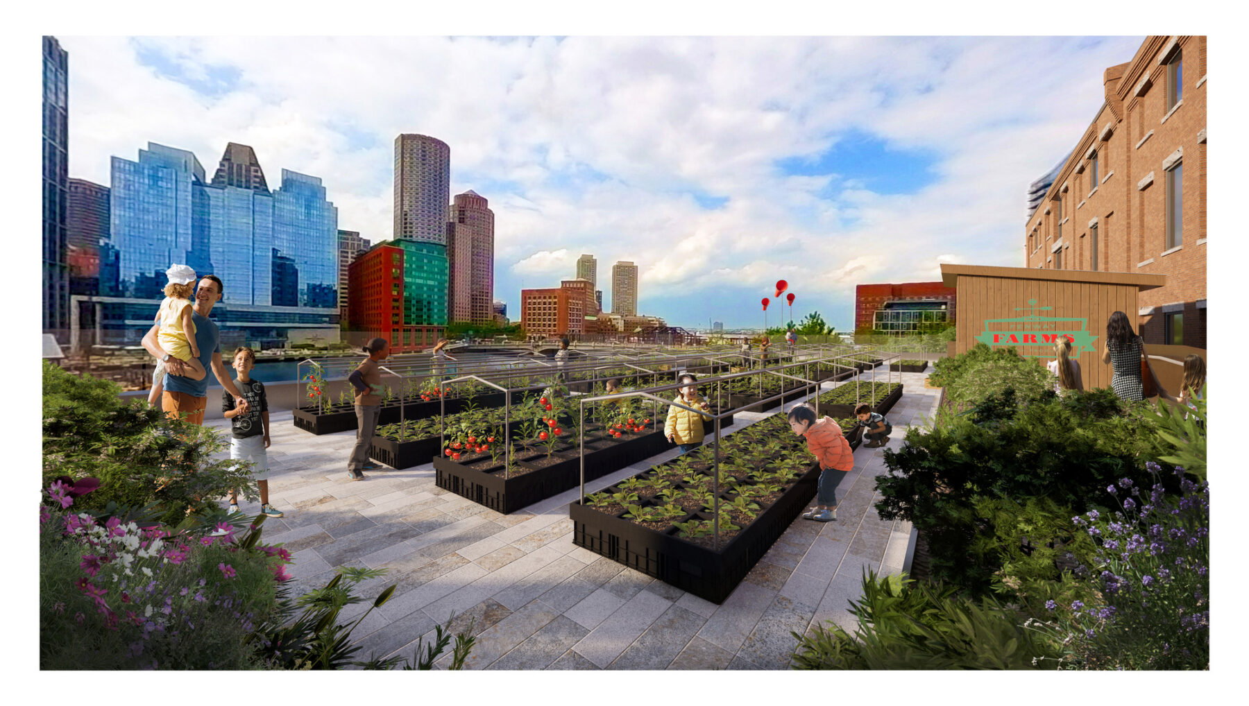
Rooftop Fenway Farms
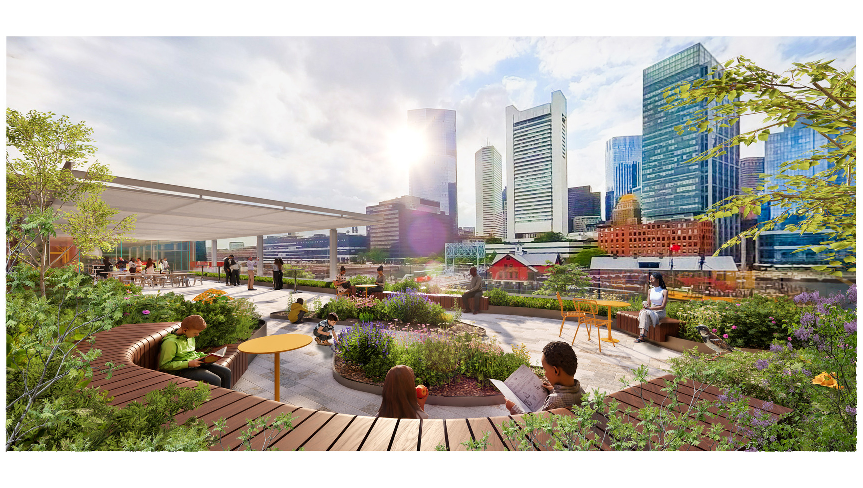
New terrace garden
At the ground floor, a three-season pavilion will extend the visitor experience outward, linking the Harborwalk to the Museum as a true indoor-outdoor extension of its program. A water hammock, a vertical water garden, a terraced garden, and a floating wetland and dock invite children and families to play, learn, and build community along the channel. These new experiences will be anchored by the Children’s Wharf, a signature moment where visitors can experience the water from a new perspective.
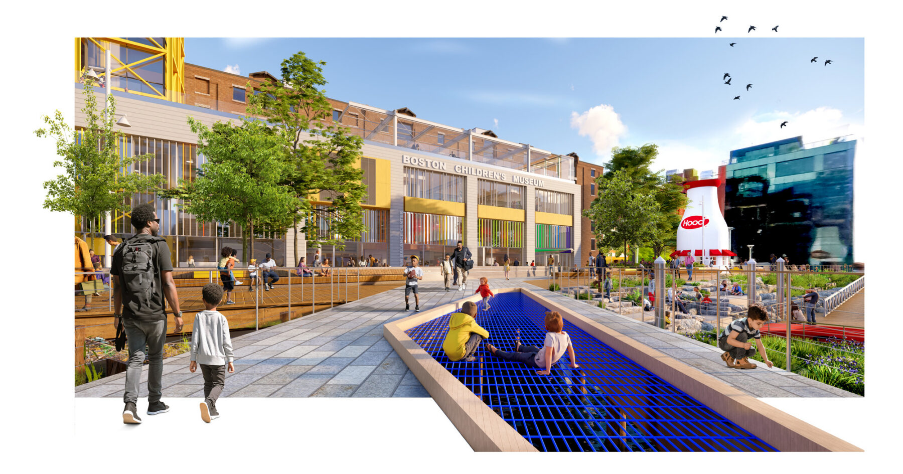
The Children’s Wharf with the water hammock
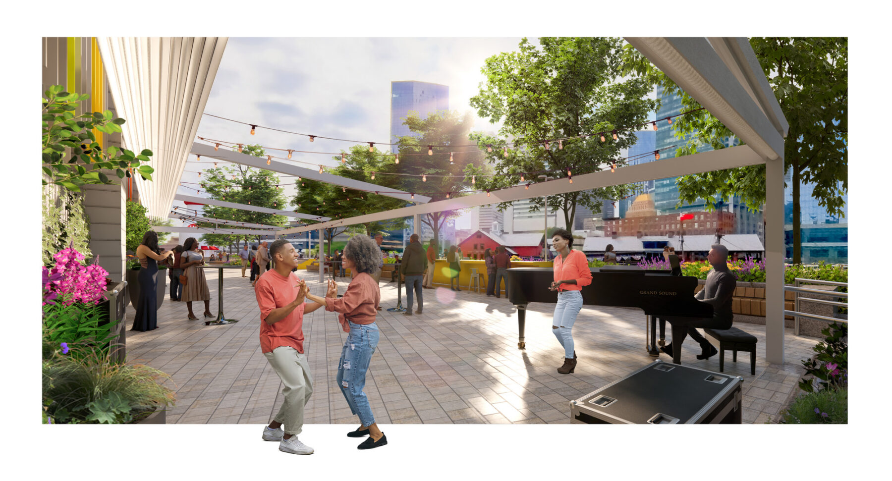
Three-season pavilion
Together, these spaces will ensure the Museum doesn’t just endure rising waters, but it turns them into a place for wonder, play, and discovery.
Exterior waterproofing work began in summer 2026, with additional implementation phases expected to begin in 2027.
Be the first to comment