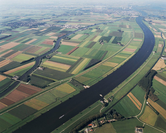
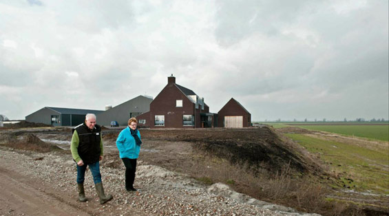
The Overdiepse Polder, located on the south bank of the Bergsche Maas, is one of over 30 ‘Room for the River’ projects. In the polder preventative measures are being taken to enlarge the drainage capacity of the river during high water. So called ‘river widening’. This project is special because inhabitants and entrepreneurs in the polder came up with the solution early on: The Mound Plan.
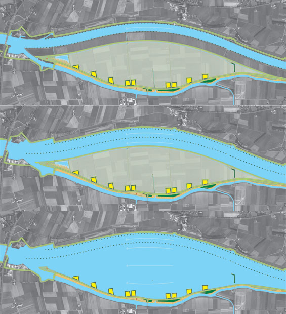
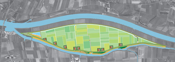
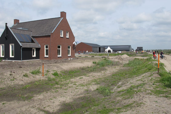
The Overdiepse Polder is located approximately 15 kilometers from Den Bosch. To protect the city and surrounding areas against high water, the decision has been made to ‘de-polder’ the Overdiepse Polder. This is done by lowering the existing dikes and by building new dikes further inland. The Overdiepse Polder will be placed outside the diked-in area, on average this means water will flow into the polder once every 25 years. During high water this allows for a drop in the water level by approximately 27 centimeters. A large portion of the farms can remain in the polder by moving them onto mounds along the new dike. Combining agriculture and water overflow regions, allows farmer’s to remain there in the future.
The landscape design for the Overdiepse Polder Mound Plan is created by Bosch Slabbers, landscape architects, in close collaboration with local governments and other parties in the area. Onix architects, urban planners and designers, executed the aesthetic quality plan for the farms. This aesthetic quality plan defines the parameters for architecture that was ultimately used on the farms and stables.
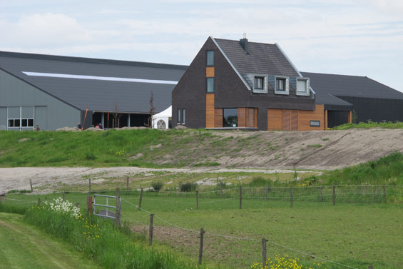
The assignment consists of designing a new mounded-landscape referencing the various examples the Netherlands has traditionally known in this region. The design consists of nine mounds along the north side of the new dike. This series of new farms will make it possible to develop a 21st century ‘farm lane’. Coherent border plantation and a similar shape and size of the mounds ensure a homogenous view across the farmlands. The distance between the mounds is equal. They are placed in a flowing curve, which runs parallel to the curvature of the Bergsche Maas. The result is a coherent row of mounds with an appealing rhythm and line that fits the landscape.
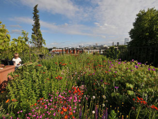
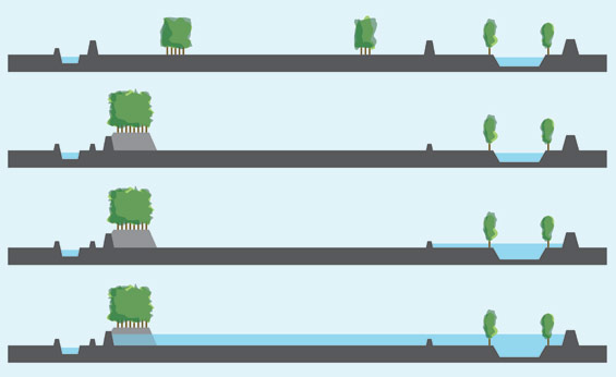
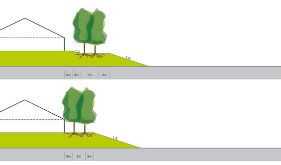
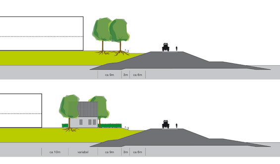
Specific attention is paid to the shape and layout of the mounds. For the mounds are the symbols of the polder, embodying the double purpose of the area: water overflow region and agriculture.
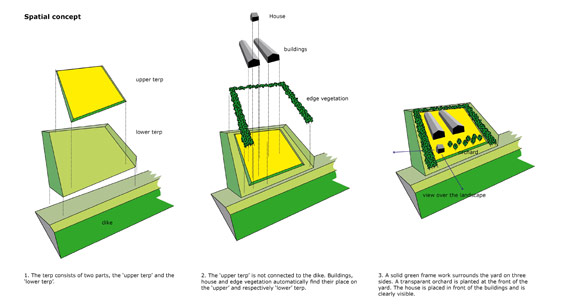
Crucial details are the planting schemes, the positioning of the buildings and the connection of the mound to the dike. A spatial plan is developed for these details that differentiates between the upper and lower mound. This concept is in place for all nine mounds ensuring a transparent coherency.
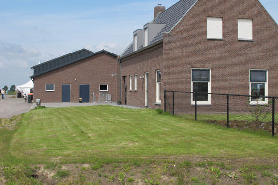
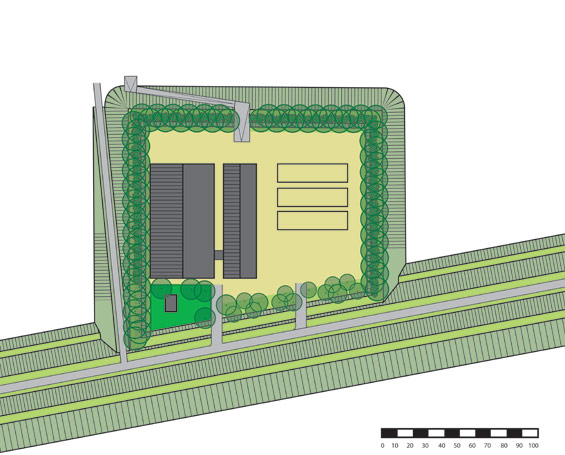
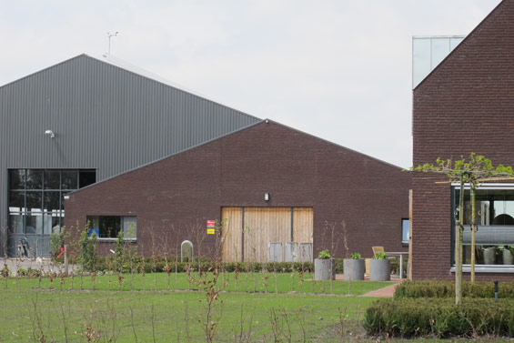
For the architecture of the farms (homestead and stables) a contest was organized, which was won by Onix, architects, urban planners and designers. Based on their contest submission an aesthetic quality plan was drawn up. This aesthetic quality plan defines the parameters for the architecture that was ultimately used on the farms and stables (mostly by local architects). By utilizing the same urban development basis per farm and recurring architectural details (materials and structural relationships between the buildings on the farm) there is a recognizable relationship between the farms, despite the obvious differences in architectural style (traditional vs. modern). For each farm there is an architectural coherency between the homestead, stables and sheds, creating a strong ensemble.
Mound plan | Overdiepse polder The Netherlands | Bosch Slabbers Landscape + Urban design
Landscape architect | Bosch Slabbers Landscape + Urban design | The Netherlands
In collaboration with | Onix architects | The Netherlands
Project | Mound plan Overdiepse polder
Location | Overdiepse polder (between Bergsche Maas and Oude Maasje, municipality of Waalwijk) | The Netherlands
Client | The province of Noord Brabant, municipality of Waalwijk
Design | 2006-2010
Realization | 2011-2015
Image Credit | Bosch Slabbers landscape architects and Onix architects (unless noted otherwise)
Text Credit | Bosch Slabbers landscape architects and Onix architects.