In May 2017, the Bay Area Challenge launched with a regional call to action to bring together local residents, community organizations, public officials and local, national, and international experts to develop innovative solutions that will strengthen our region’s resilience to sea level rise, severe storms, flooding, and earthquakes. Now a year later, the final design concepts have been released to inspire, catalyze action, and push the area along the path to a more resilient future.
Varying in scope and scale, early design ideas imagined in the Collaborative Research Phase have served as a springboard for the Collaborative Design Phase. At each site selected, initial design ideas honed in on addressing ongoing climate issues facing the Bay Area, like sea level rise, severe flooding, and seismic risks, alongside other, sometimes more pressing challenges, including lack of housing, displacement, gentrification, limited access to public land and outdated transportation.
In May 2018 each Team along with their local stakeholders presented their final design concepts and a roadmap toward implementation to the Resilient by Design community and members of the interested public at The Resilient Bay Summit. The projects now have networks of community organizations, city officials, local electeds, designers, engineers, scientists, and other experts that have been activated and inspired to work together to continue to move each project forward. The extraordinary collective effort over the course of the Bay Area Challenge serves as a call to action for the region to continue to work together to build a more resilient Bay Area.
South Bay Sponge (Field Operations Team)
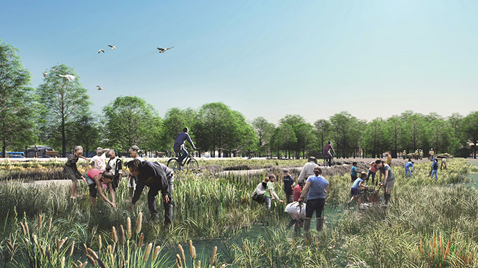
The “Sponge” is a concept for using nature and natural systems as a primary tool for climate adaptation and resiliency in the South Bay, inspired by both the historic function of the region’s inter-tidal marshlands as flood protection, as well as by the remarkable efforts to restore the South Bay Salt Ponds. The potential of a large-scale assemblage of remnant marshlands, newly restored salt ponds and newly constructed wetlands as the core component of a regional flood protection strategy is at once radically innovative, but also resonant with the South Bay landscape today. In addition to addressing climate adaptation, the South Bay Sponge can give the landscapes of the South Bay a powerful and legible identity.
Islais Hyper-Creek (BIG+ONE+Sherwood)
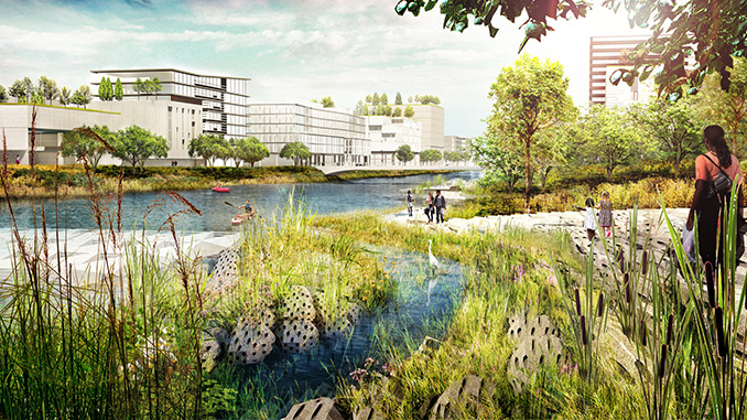
Islais Hyper-Creek is a vision for the area where ecology and industry co-exist in harmony. A large park with a restored tidal creek system and soft shoreline shares the area with maritime functions, light manufacturing, and logistics that have formed the area’s economic backbone for decades. This park plays an important role in building physical and social resilience: it retains, conveys and cleans water, protecting the surrounding neighborhoods while providing amenities and benefits to the community. Present-day industrial functions are consolidated in a smaller area, clustered with complementary programs. This increases their efficiency and provides new economic opportunities. Six proposed pilot projects, developed together with stakeholders and local communities, will kickstart a long-term process toward realizing the overall vision.
Elevate San Rafael (Bionic)
“Elevate San Rafael” is a new paradigm for responding to complex environmental change and simply what needs to be done: occupy higher elevations and raise the quality of life and social connection for everyone. It proposes evolving the city by combining time-tested approaches to coastal adaptation with a moral, financial, and infrastructural agenda for large-scale preparation. This strategic change and redefining the relationship to the bay lends the singular opportunity to elevate all aspects of life. To physically elevate habitation and community bonds and dignity. To elevate ones social and financial position, and policy for urban change. To lift infrastructure to new elevations and purposes, and allow for ecology to persist and expand.
Connect and Collect (Hassell+)
Collect & Connect – Resilient South City is a proposal to create more public green space and continuous public access along South San Francisco’s Colma Creek, aiming to reduce the impacts of flooding, mitigate against sea-level rise vulnerability, restore native flora and fauna, and create more amenity and healthy lifestyle opportunities by connecting a continuous public corridor from Orange Memorial Park to a new public park at the shoreline.
The Grand Bayway (Common Ground)
State Route 37, a low-lying commute route that skirts the northern edge of San Pablo Bay, is both traffic-choked and increasingly flooded due to sea level rise. Sitting atop a precarious levee that confines an immense but compromised marsh complex, Dr. Fraser Shilling of the UC Davis Road Ecology Center has observed, “the highway has the dubious distinction of constricting both traffic and tidal flows.” The project considers a new future for this highway as an elevated scenic byway, creating an iconic “front door” to a vast ecological open space previously known to few. Accessible to cyclists, runners, kayakers, campers, and fishermen, the Grand Bayway will become a Central Park with more 21st century sensibilities for rapidly expanding North Bay communities.

ouR-Home (Home Team)
The ouR-HOME sea level rise response projects are linked to the health and financial well-being of residents that have been traditionally shut out of opportunities to improve health and family wealth. Small lot housing, a community land trust, social impact bonds and community infrastructure combine to lower the cost of entry to home ownership. Green infrastructure proposals to bring the ‘marsh to Main Street’ with a horizontal levee, and plant 20,000 trees to filter air and water, are strategies that can be implemented through existing local job and career programs – benefiting the people in North Richmond.
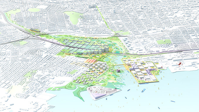
Public Sediment for Alameda Creek
PUBLIC SEDIMENT FOR ALAMEDA CREEK is a proposal to address the challenge of sediment scarcity along the vulnerable urban edges of Fremont, Union City, and Newark. The baylands require sediment to keep pace with sea level rise, yet sediment is trapped upstream in dams and flood control channels. To bring sediment to the baylands, we look upstream to Alameda Creek, the largest local tributary that feeds the Bay. Our proposal aims to redesign this waterbody to create functional systems that sustainably transport sediment, engage people, and provide habitat for anadromous fish.

The Peoples Plan (P+SET)
The Permaculture and Social Equity Team proposed a social design process to build community capacity in leading the challenges of coastal adaptation and resiliency planning. The team was invited to implement their process in Marin City by Shore Up Marin, an environmental justice and resiliency planning organization. Out of the process grew a capacity building program, resulting in an inspiring People’s Plan to authentically reflect the aspirations and intentions of the resident community. An intergenerational cohort expanded existing knowledge for assessing and addressing risks, developing near and long term strategies with a prioritized set of projects to be partially implemented as early as this summer.
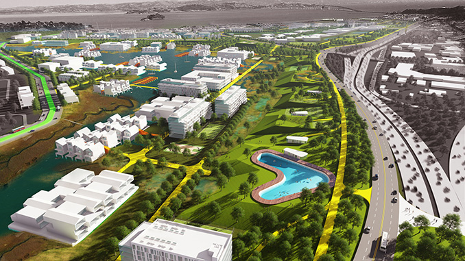
Estuary Commons (ABC)
To protect local neighborhoods and restore native habitats, All Bay Collective is rethinking the shoreline around San Leandro Bay with the creation of Estuary Commons. Through the construction of ponds, landforms, and expanded streams, the communities of Deep East Oakland, Alameda, and San Leandro will not only be able to adapt to sea-level rise and groundwater flooding, but will also have a network of flourishing greenways to enjoy for generations to come. ABC has worked closely with eight community organizations from East Oakland to move the communities from the margins to the center of the design and planning process.
For more information go to Resilient By Design Bay Area Challenge